Wuppertal
| Wuppertal | |
 |
|
 |
|
 Wuppertal
|
|
| Coordinates | |
| Administration | |
| Country | Germany |
|---|---|
| State | North Rhine-Westphalia |
| Admin. region | Düsseldorf |
| District | Urban district |
| Lord Mayor | Peter Jung (CDU) |
| Governing parties | CDU / SPD |
| Basic statistics | |
| Area | 168.41 km2 (65.02 sq mi) |
| Elevation | 100-350 m |
| Population | 351,050 (31 December 2009)[1] |
| - Density | 2,084 /km2 (5,399 /sq mi) |
| Other information | |
| Time zone | CET/CEST (UTC+1/+2) |
| Licence plate | W |
| Postal codes | 42001-42399 |
| Area code | 0202 |
| Website | wuppertal.de |


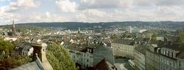
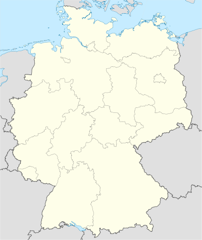
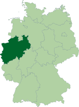
Wuppertal (German pronunciation: [ˈvʊpɐtaːl]) is a city in North Rhine-Westphalia, Germany. It is located on the Wupper river south of the Ruhr area. Population 361,333 (2005).
Two thirds of the total municipal area is green belt: woods, meadows, gardens and fields. From any part of the city it is only a ten-minute walk to one of the public parks or shady woodland path. At the same time it is a major industrial centre including such industries as: textiles, metallurgy, chemicals, medicine (Bayer), electric, rubber, vehicles and printing equipment. One of the most famous pain-killers, Aspirin, was invented in Wuppertal by Bayer.
The Wuppertal Institute for Climate, Environment and Energy is located in this city.
Contents |
History
The city was formed in 1929 by merging Barmen, Elberfeld, Vohwinkel, Ronsdorf, Cronenberg, Langerfeld, and Beyenburg. The name was initially Barmen-Elberfeld, and after 1930 Wuppertal (“Wupper Valley”). The new city was administered within the Prussian Rhine Province.
Uniquely for Germany it is a linear city, owing to the steep hillsides along the river Wupper. Its highest hill is the Lichtscheid which is 351 metres above sea level. The dominating city-centres Elberfeld (historic commercial centre) and Barmen (more industrial) form a united built-up area since 1850. In the following decades, this “Wupper-Town” became the dominating industrial agglomeration of the territories in northwestern Germany. Before the 19th century ended, this conurbation had been surpassed by Cologne, Düsseldorf and the Ruhr area, all with much more favourable topography.
During World War II, it was destroyed to about 40% by the Allies as were many other industrial centres at the time. However, a large number of historic sites have been preserved, such as
- Ölberg (literally “Oil mountain”, the German word for the biblical Mount of Olives), Germany’s largest working class district, protected as a historic monument. The name came about in the 1920s as the surrounding bourgeois residential quarters already had electric light, while this district still used oil lamps.
- Brill, one of Germany’s largest districts of Gründerzeit villas, i. e. bourgeois mansions, built in the second half of the 19th century.
After the war, Wuppertal became a part of the British Zone of Occupation, and subsequently a part of the new state North Rhine-Westphalia in West Germany.
Main sights
In total, Wuppertal possesses over 4,500 buildings classified as national monuments, most dating from styles as Neoclassicism, Eclecticism, Historicism, Art Nouveau/Jugendstil and Bauhaus.
Main sights include:
- Concert hall, a fine masterpiece of turn-of-the-century architecture (Stadthalle),
- Wuppertal Dance Theatre (Tanztheater Wuppertal), headed by Pina Bausch, is world-famous,
- Engels house (Engelshaus), architecturally typical of the region. It houses a permanent display of materials associated with Friedrich Engels and other famous citizens of Wuppertal,
- Wuppertal Zoo, one of the largest, most nicely landscaped zoos in Germany with many rare animals,
- Botanischer Garten Wuppertal, a municipal botanical garden,
- Arboretum Burgholz, an extensive arboretum,
- Von der Heydt Museum, one of the most important galleries in Germany, with works by 19th and 20th century artists. The first of Picasso’s works that ever appeared in public was displayed here.
Schwebebahn

One of the city’s greatest attractions is the suspended monorail (“Wuppertaler Schwebebahn”), which was established in 1901. The tracks are 8 m (26.25 ft) above the streets and 12 m (39.37 ft) above the Wupper river.
Wuppertal in the arts
- The play Die Wupper by Else Lasker-Schüler takes places in Elberfeld.
- The 2000 movie The Princess and the Warrior by Tom Tykwer, was filmed in Wuppertal.
- In the 1974 Wim Wenders film Alice in the Cities, the main characters visit Wuppertal.
- A Lufthansa A340-600 D-AIHM (delivered 2006) is named after the city of Wuppertal. It primarily operates long haul flights from Munich Airport.
Noted people from Wuppertal
- See also the related Category:People from Wuppertal.
- Linda Kisabaka, athlete
- Pina Bausch, choreographer
- Friedrich Bayer, founder of the Friedrich Bayer paint factory that later became Bayer AG
- Arno Breker, sculptor
- Rudolf Carnap, philosopher of science
- Julius Plücker, physicist
- Udo Dirkschneider, singer in heavy-metal band Accept
- Friedrich Engels, philosopher, historian, co-author of the Communist Manifesto (with Karl Marx)
- Hans Knappertsbusch, orchestra conductor
- Else Lasker-Schüler, expressionist poet
- Harald Leipnitz, actor
- Ulrich Leyendecker, composer
- Reimar Lüst, astrophysicist
- Steffen Möller, satirist, soap-opera star and TV celebrity in Poland; the most popular German in Poland
- Tyron Montgomery, Oscar-winning film director
- Simone Osygus, swimmer
- Siegfried Palm, cellist, director of Hochschule für Musik Köln, Intendant of Deutsche Oper Berlin
- Johannes Rau, former Federal President of Germany
- Alice Schwarzer, one of the leaders of the German feminist movement
- Hans Singer, economist
- Rita Süssmuth, former President of the German Parliament
- Horst Tappert, actor
- Helmut Thielicke, theologian
- Tom Tykwer, film director (“Run Lola, Run”, “The Princess and the Warrior”), co-founder of X-Filme syndicate
- Günter Wand, orchestra conductor
- Sulamith Wülfing, artist and illustrator
- Peter Brötzmann and Peter Kowald, noted innovators in modern improvised music
- Christoph Maria Herbst, actor
- Hermann Ebbinghaus, psychologist who studied memory
Sports
The city's football club Wuppertaler SV played in Bundesliga from 1972 until 1975. Today, their team is to be found in the Regionalliga-West.
In 2010, Wuppertal will be the host city of Rink Hockey European Championship.
International relations
Twin towns — Sister cities
Wuppertal is twinned with:
|
|


|
||||||||||||||
|
||||||||||
References
- Notes
- ↑ "Amtliche Bevölkerungszahlen" (in German). Landesbetrieb Information und Technik NRW. 31 December 2009. http://www.it.nrw.de/statistik/a/daten/amtlichebevoelkerungszahlen/index.html.
- ↑ "Partnership towns of the City of Košice" (in Slovak). © 2007-2009 City of Košice Magistrát mesta Košice, Tr. SNP 48/A, 040 11 Košice. http://www.kosice.sk/clanok.asp?file=gov_s_c-00.html. Retrieved 2009-07-12.
