Tashkent
| Tashkent Uzbek: Toshkent, Тошкент Russian: Ташкент Toshqand, Toshkand |
|
|---|---|
 |
|
 Tashkent
|
|
| Coordinates: | |
| Country | |
| Province | Tashkent Province |
| Settled | 5th to 3rd centuries BC |
| Government | |
| - Mayor | Abdukahar Tuhtayev |
| Area | |
| - Total | 334.8 km2 (129.3 sq mi) |
| Population (2008) | |
| - Total | 2,180,000 |
| - Density | 6,511.4/km2 (16,864.3/sq mi) |
| Time zone | (UTC+5) |
| Website | http://tashkent.uz/ |
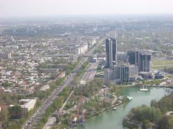
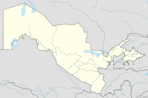
Tashkent (Uzbek: Toshkent, Тошкент; Russian: Ташкент, literally "Stone City") is the capital of Uzbekistan and of the Tashkent Province. The officially registered population of the city in 2008 was 2.1 million.[1] Unofficial sources estimate the actual population may be as much as 4.45 million.[2]
Contents |
History
In pre-Islamic and early Islamic times the town and the province were known as "Chach". The Shahnameh of Ferdowsi also refers to the city as Chach. Later the town came to be known as Chachkand/Chashkand, meaning "Chach City". (Tash in Turkic language means stone. Kand, qand, kent, kad, kath, kud—all meaning a city—are derived from the Persian/Sogdian کنده kanda, meaning a town or a city. They are found in city names like Samarkand, Yarkand, Penjikent etc.).
After the 16th century, the name was steadily changed slightly from Chachkand/Chashkand to Tashkand, which, as "stone city", was more meaningful to the new inhabitants than the old name. The modern spelling of Tashkent reflects Russian orthography.
Tashkent started as an oasis on the Chirchik River, near the foothills of the Golestan Mountains. In ancient times, this area contained Beitian, probably the summer "capital" of the Kangju confederacy.[3]
The principality of Chach, whose main town had a square citadel built around the 5th to 3rd centuries BC, some 8 kilometres (5.0 mi) south of the Syr Darya River. By the 7th century AD, Chach had over 30 towns and a network of over 50 canals, forming a trade center between the Sogdians and Turkic nomads. The region came under the sway of Islam in the early parts of the 8th century.
Hsien-tsang (Xuanzang) mentioned the name of the city as 赭時/柘支 Zhe-shi. The Chinese chronicles Sujshu, Bejshu and Tanshu mention a possession called Shi or Zheshi with a capital with the same name since the V c. AD [Bichurin, 1950. v. II].
Under the Samanid dynasty, the city came to be known as Binkath. However, the Arabs retained the old name of Chach for the surrounding region, pronouncing it al-Shash instead. The modern Turkic name of Tashkent (City of Stone) comes from Kara-Khanid rule in the 10th century.
The city was destroyed by Genghis Khan in 1219, although the great conqueror had found that the Khorezmshah had already sacked the city in 1214. Under the Timurids and subsequent Shaybanid dynasties the city revived, despite occasional attacks by the Uzbeks, Kazakhs, Persians, Mongols, Oirats and Kalmyks.
In 1809, Tashkent was annexed to the Khanate of Kokand. At the time, Tashkent had a population of around 100,000 and was considered the richest city in Central Asia. It prospered greatly through trade to Russia, but chafed under Kokand’s high taxes. The Tashkent clergy also favored the clergy of Bukhara over that of Kokand. However, before the Emir of Bukhara could capitalize on this discontent, the Russian army arrived.
Tsarist Period
In May, 1865, Mikhail Grigorevich Chernyayev (Cherniaev), acting against the direct orders of the tsar, and outnumbered at least 15-1 staged a daring night attack against a city with a wall 25 kilometers (16 mi) long with 11 gates and 30,000 defenders. While a small contingent staged a diversionary attack, the main force penetrated the walls, led by a Russian Orthodox priest armed only with a crucifix. Although defense was stiff, the Russians captured the city after two days of heavy fighting and the loss of only 25 dead as opposed to several thousand of the defenders (including Alimqul, the ruler of the Kokand Khanate). Chernyayev, dubbed the "Lion of Tashkent" by city elders, staged a "hearts-and-minds" campaign to win the population over. He abolished taxes for a year, rode unarmed through the streets and bazaars meeting common people, and appointed himself "Military Governor of Tashkent", recommending to Tsar Alexander II that the city be made an independent khanate under Russian protection.
The Tsar liberally rewarded Chernyayev and his men with medals and bonuses, but regarded the impulsive general as a "loose cannon", and soon replaced him with General Konstantin Petrovich von Kaufman. Far from being granted independence, Tashkent became the capital of the new territory of Russian Turkistan, with Kaufman as first Governor-General. A cantonment and Russian settlement were built across the Ankhor Canal from the old city, and Russian settlers and merchants poured in. Tashkent was a center of espionage in the Great Game rivalry between Russia and the United Kingdom over Central Asia. The Turkestan Military District was established as part of the military reforms of 1874. The Trans-Caspian Railway arrived in 1889, and the railway workers who built it settled in Tashkent as well, bringing with them the seeds of Bolshevik Revolution.
Impact of the Russian revolution
With the fall of the Russian Empire, the provisional government removed all civil restrictions based on religion and nationality, contributing to local enthusiasm for the February Revolution. The Tashkent Soviet of Soldiers' and Workers' Deputies was soon set up, but primarily represented Russian residents, who made up about a fifth of the Tashkent population. Muslim leaders quickly set up the Tashkent Muslim Council (Tashkand Shura-yi-Islamiya) based in the old city. On 10 March 1917, there was a parade with Russian workers marching with red flags, Russian soldiers singing the La Marseillaise and thousands of local Central Asians. Following various speeches, Governor-General Aleksey Kuropatkin closed the vents with words "Long Live a great free Russia".[4] The First Turketan Muslim Conferencene in Tashkent 16–20 April 1917. Like the Muslim Council this was dominated by the Jadid, Muslim reformers. However, a more conservative faction emerged in Tashkent centered around the Ulema. This faction proved more successful during the local elections of July 1917. They formed an alliance with Russian conservatives, while the Soviet became more radical. The Soviet attempt to seize power in September 1917 proved unsuccessful.[5]
In April 1918, Tashkent became the capital of the Turkestan Autonomous Soviet Socialist Republic (Turkestan ASSR). The new regime was threatened by White forces, basmachi, revolts from within, and purges ordered from Moscow. Tashkent fell within the borders of the Uzbek SSR, and became the capital of the Uzbek SSR in 1930, displacing Samarkand.
Soviet period
The city began to industrialize in the 1920s and 1930s, but industry increased tremendously during World War II, with the relocation of factories from western Russia to preserve the Soviet industrial capacity from the invading Nazis. The Russian population increased dramatically as well, with evacuees from the war zones increasing the population to well over a million. The Russians and Ukrainians would eventually comprise more than half of the total residents of Tashkent.[6]
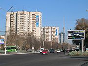
On 26 April 1966, Tashkent was destroyed by a huge earthquake (7.5 on the Richter scale) and over 300,000 were left homeless. Some 78,000 poorly engineered homes were destroyed[7] mainly in the densely packed areas of the old city where traditional adobe housing predominated[8]. The Soviet republics and some other countries such as Finland sent "battalions of fraternal peoples” and urban planners to help rebuild devastated Tashkent. They created a “model Soviet city” of wide shady streets, parks, immense plazas for military parades, fountains, monuments, and acres of apartment blocks. About 100,000 new homes were built by 1970,[7] many of which were filled with the families of the builders. Further development in the following years increased the size of the city with major new developments in the Chilonzar area, north-east and south-east of the city[7].

At the time of the collapse of the Soviet Union in 1991, Tashkent was the fourth largest city in the country and a center of learning in the science and engineering fields.
With the 1966 earthquake and the Soviet redevelopment afterward, very little is left of Tashkent's ancient history, including its significance as a trading point on the historic Silk Road.
Capital of Uzbekistan
At the moment, it is the most cosmopolitan city in Uzbekistan, with large ethnic Russian minority. The city is noted for its tree lined streets, numerous fountains, and pleasant parks. As capital of the nation, it has also been the target of several terrorist attacks since Uzbekistan gained independence, which the government has attributed to Islamic fundamentalists.
Since 1991, the city has changed economically, culturally, and architecturally. The largest statue ever erected for Lenin was replaced with a globe, complete with a geographic map of Uzbekistan over it. Buildings from the Soviet era have been replaced with new, modern buildings. One example is the "Downtown Tashkent" region, which includes the 22-story NBU Bank building, an Intercontinental Hotel, International Business Center, and the Plaza Building.
In 2007, Tashkent was named the cultural capital of the Islamic world[9] as the city is home to numerous historic mosques and religious establishments.
 c1865 |
 1913 |
 1940 |
 1965 |
 1966 Earthquake and subsequent redevelopment |
 1981 |
 2000 |
Geography
| Tashkent | ||||||||||||||||||||||||||||||||||||||||||||||||||||||||||||
|---|---|---|---|---|---|---|---|---|---|---|---|---|---|---|---|---|---|---|---|---|---|---|---|---|---|---|---|---|---|---|---|---|---|---|---|---|---|---|---|---|---|---|---|---|---|---|---|---|---|---|---|---|---|---|---|---|---|---|---|---|
| Climate chart () | ||||||||||||||||||||||||||||||||||||||||||||||||||||||||||||
|
||||||||||||||||||||||||||||||||||||||||||||||||||||||||||||
|
||||||||||||||||||||||||||||||||||||||||||||||||||||||||||||
Tashkent in a well-watered plain to the west of the last Altai mountains on the road between Shymkent and Samarkand. Tashkent sits at the confluence of the Chirchik river and several of its tributaries and is built on deep alluvial deposits up to 15 metres (49 ft). It is a lively tectonic area suffering large numbers of tremors and some earthquakes. One earthquake in 1966 measured 7.5 on the Richter scale. The local time in Tashkent is UTC/GMT +5 hours.
Climate
Tashkent has a continental Mediterranean climate (Köppen climate classification Csa) [11] with long, hot and dry summers from June to September and short but cold winters from December to February. The temperatures in Tashkent can be extremely hot during July and August. With the average annual rainfall ranging from 100 to 200 mm, the country is largely arid and dry. Most precipitation occurs in the months of winter and spring, while the period between July and September is dry.[12][13]
| Climate data for Tashkent | |||||||||||||
|---|---|---|---|---|---|---|---|---|---|---|---|---|---|
| Month | Jan | Feb | Mar | Apr | May | Jun | Jul | Aug | Sep | Oct | Nov | Dec | Year |
| Source: World Meteorological Organisation (UN) [10] | |||||||||||||
Districts

Tashkent is currently divided into the following districts (Uzbek tuman):
- Bektemir
- Chilanzar
- Hamza
- Mirobod
- Mirzo Ulugbek
- Sergeli
- Shaykhontohur
- Sobir Rakhimov
- Uchtepa
- Yakkasaray
- Yunusabad
At the time of the Tsarist take over it had four districts (Uzbek daha):
- Beshyoghoch
- Kukcha
- Shaykhontokhur
- Sebzor
In 1940 it had the following districts (Russian район):
By 1981 they had reorganized into[7]:
- Bektemir
- Akmal-Ikramov (Uchtepa)
- Khamza
- Lenin (Mirobod)
- Kuybishev (Mirzo Ulugbek)
- Sergeli
- Oktober (Shaykhontokhur)
- Sobir Rakhimov
- Chilanzar
- Frunze (Yakkasaray)
- Kirov (Yunusabad)


Main sights
Due to the destruction of most of the ancient city during 1917 revolution and, later, to the 1966 earthquake, little remains of Tashkent's traditional architectural heritage. Tashkent is, however, rich in museums and Soviet-era monuments. They include:
- Kukeldash Madrasah. Dating back to the reign of Abdullah Khan (1557–1598) it is currently being restored by the provincial Religious Board of Mawarannahr Moslems. There is talk of making it into a museum, but it is currently being used as a mosque.
- Chorsu Bazaar, located near the Kukeldash Madrassa. This huge open air bazaar is the center of the old town of Tashkent. Everything imaginable is for sale.
- Telyashayakh Mosque (Khast Imam Mosque). It Contains the Uthman Qur'an, considered to be the oldest extant Qur'an in the world. Dating from 655 and stained with the blood of murdered caliph, Uthman, it was brought by Timur to Samarkand, seized by the Russians as a war trophy and taken to Saint Petersburg. It was returned to Uzbekistan in 1924.[14]
- Yunus Khan Mausoleum. It is a group of three 15th century mausoleums, restored in the 19th century. The biggest is the grave of Yunus Khan, grandfather of Mughal Empire founder Babur.
- Palace of Prince Romanov. During the 19th century Grand Duke Nikolai Konstantinovich, a first cousin of Alexander III of Russia was banished to Tashkent for some shady deals involving the Russian Crown Jewels. His palace still survives in the centre of the city. Once a museum, it has been appropriated by the Ministry of Foreign Affairs.
- Alisher Navoi Opera and Ballet Theatre, built by the same architect who designed Lenin's Tomb in Moscow, Aleksey Shchusev, with Japanese prisoner of war labor in World War II. It hosts Russian ballet and opera.
- Fine Arts Museum of Uzbekistan. It contains a major collection of art from the pre-Russian period, including Sogdian murals, Buddhist statues and Zoroastrian art, along with a more modern collection of 19th and 20th century applied art, such as suzani embroidered hangings. Of more interest is the large collection of paintings "borrowed" from the Hermitage by Grand Duke Romanov to decorate his palace in exile in Tashkent, and never returned. Behind the museum is a small park, containing the neglected graves of the Bolsheviks who died in the Russian Revolution of 1917 and to Ossipov's treachery in 1919, along with first Uzbekistani President Yuldosh Akhunbabayev.
- Museum of Applied Arts. Housed in a traditional house originally commissioned for a wealthy tsarist diplomat, the house itself is the main attraction, rather than its collection of 19th and 20th century applied arts.
- History Museumm the largest museum in the city. It is housed in the ex-Lenin Museum.
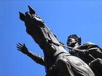
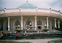
- Amir Timur Museum, housed in a building with brilliant blue dome and ornate interior. It houses exhibits of Timur and of President Islam Karimov. The gardens outside contain a statue of Timur on horseback, surrounded by some of the nicest gardens and fountains in the city.
- Navoi Literary Museum, commemorating Uzbekistan's adopted literary hero, Alisher Navoi, with replica manuscripts, Persian calligraphy and 15th century miniature paintings.
Russian Orthodox church in Amir Temur Square, built in 1898, was demolished in 2009, along with Soviet-time World War II memorial park and Defender of Motherland monument.[15][16][17]
City built environment
- The only metro system in Central Asia. (Astana's and Almaty's are being only in their construction stages.)
- The largest city square (Independence Square) in the former Soviet Union, which once held the tallest statue of Lenin (30 meters tall) in the Soviet Union. Lenin was replaced in 1992 by a globe showing a map of Uzbekistan.
- Government, trade union and private medical and dental facilities.
- Offices of several American and European consulting firms like Ernst & Young Ltd, Deloitte & Touche, PricewaterhouseCoopers and Gravamen Fidelis and Fides LLP.
Education
- Several universities and institutions of higher learning:
- Tashkent Automobile & Road Construction institute[2]
- Tashkent State Technical University[3]
- Tashkent Institute of Architecture and Construction[4]
- International Business School "Kelajak Ilmi"[5]
- Tashkent University of Information Technologies[6]
- Westminster International University in Tashkent[7]
- National University of Uzbekistan [8]
- University of World Economy and Diplomacy
- Tashkent State Economic University
- Tashkent State Institute of Law
- Tashkent Institute of Finance
- State University of Foreign Languages
- Conservatory of Music
- Tashkent State Medicine Academy
- Institute of Oriental Studies.
- Tashkent Islamic University [9]
- Management Development Institute of Singapore in Tashkent [10]
Media
- 9 Uzbek language newspapers, 4 in English and 9 publications in Russian
- Several television and cable television facilities, including Tashkent Tower, the tallest structure in Central Asia
Transportation
- Buses, Trolley Buses, Mini Van Routes, light rail, Taxi, Intercity Distances, Intercity Bus timetable & fares[11]
- Domestic Railway, International Railway Timetable[12]
- Metro system
- Tashkent International Airport is the largest in the country, connecting the city to Asia, Europe and the American continents.
Sport
Tashkent's most prominent football clubs are Pakhtakor Tashkent, and FC Bunyodkor, both of which compete in the Uzbek League.
Cyclist Djamolidine Abdoujaparov and footballer Vassilis Hatzipanagis were born in the city. Tennis player Denis Istomin was born and lives in the city.
Gymnast Alina Kabayeva was also born in Tashkent, as is tennis player, Iroda Tulyaganova.
Footballer Peter Odemwingie was born in Tashkent but plays for the Nigeria national football team.
Twin towns — sister cities
Tashkent is twinned with:
 Seattle, USA
 Tunis, Tunisia
 Istanbul, Turkey
 Karachi, Pakistan
 Berlin, Germany
 Dnipropetrovsk, Ukraine
See also
- Gates of Tashkent
- Tashkent Declaration
References
- ↑ Committee on Statistics of Uzbekistan
- ↑ [1]
- ↑ Pulleyblank, Edwin G. 1963. "The consonantal system of Old Chinese." Asia Major 9 (1963), p. 94.
- ↑ Russian Colonial Society in Tashkent by Jeff Sahadeo, Indiana University Press, 2007, p188
- ↑ The Russian Revolution, 1917 by Rex A. Wade, Cambridge University Press, 2005
- ↑ "Central Asia, 130 years of Russian dominance: a historical overview". Edward Allworth (1994). Duke University Press. p.102. ISBN 0822315211
- ↑ 7.0 7.1 7.2 7.3 Sadikov, A C; Akramob Z. M., Bazarbaev, A., Mirzlaev T.M., Adilov S. R., Baimukhamedov X. N., et al. (in Russian) (72x112). Geographical Atlas of Tashkent (Ташкент Географический Атлас) (2 ed.). Moscow. p. 64.
- ↑ NURTAEV Bakhtiar (1998). "Damage for buildings of different type.". Institute of Geology and Geophysics, Academy of Sciences of Uzbekistan. http://iisee.kenken.go.jp/net/hara/uzbekistan/DamageForBuildings.htm. Retrieved 7 November 2008.
- ↑ "Moscow News – World – Tashkent Touts Islamic University". Mnweekly.ru. 21 June 2007. http://mnweekly.ru/world/20070524/55252222.html. Retrieved 6 May 2009.
- ↑ 10.0 10.1 "World Weather Information Service – Tashkent". World Meteorological Organisation. http://worldweather.wmo.int/032/c00115.htm. Retrieved 2010-04-13.
- ↑ Updated Asian map of the Koppen climate classification system.
- ↑ Tashkent Travel. "Tashkent weather forecast". Tashkent, Uzbekistan. http://www.tashkent-travel.com/weather. Retrieved 11 June 2009.
- ↑ Happy-Tellus.com. "Tashkent, Uzbekistan travel information". Helsinki, Finland: Infocenter International Ltd.. http://www.happytellus.com/tashkent/uzbekistan. Retrieved 11 June 2009.
- ↑ MacWilliams, Ian (January 5, 2006). "Tashkent's hidden Islamic relic". BBC News. http://news.bbc.co.uk/2/hi/asia-pacific/4581684.stm. Retrieved June 8, 2010.
- ↑ uznews.net, Tashkent's central park is history, 25.11.09
- ↑ Army memorial dismantled in Tashkent, 24.11.09
- ↑ Ferghana.ru, МИД России указал послу Узбекистана на обеспокоенность «Наших», 16.01.2010 (Russian)
External links
- Tashkent travel guide from Wikitravel
- Photos of historical monuments and modern buildings in Tashkent
- Recent photos of Tashkent with comments in English
- Disability Information Resource Centre in Tashkent
|
|||||||
|
||||||||