Thun
| Thun | ||||||||||
|---|---|---|---|---|---|---|---|---|---|---|
 |
||||||||||
|
||||||||||
| Population | 42,330 (Dec 2009)[1] | |||||||||
| - Density | 1,960 /km2 (5,076 /sq mi) | |||||||||
| Area | 21.6 km2 (8.3 sq mi) | |||||||||
| Elevation | 560 m (1,837 ft) | |||||||||
| - Highest | 1172 m - Dürrenbergwald | |||||||||
| - Lowest | 552 m - Aar at Lerchenfeld | |||||||||
| Postal code | 3600-3645 | |||||||||
| SFOS number | 0942 | |||||||||
| Mayor | Hans-Ulrich von Allmen (as of 2008) SPS/PSS | |||||||||
| Surrounded by | Amsoldingen, Heiligenschwendi, Heimberg, Hilterfingen, Homberg, Schwendibach, Spiez, Steffisburg, Thierachern, Uetendorf, Zwieselberg | |||||||||
| Website | www.thun.ch SFSO statistics |
|||||||||
 Thun
|
||||||||||
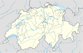
| View map of Thun | ||||||||||
Thun (French: Thoune) is a municipality in the administrative district of Thun in the canton of Bern in Switzerland with about 42,136 inhabitants (near 90,000 in the agglomeration), as of 1 January 2006.
It is located where the River Aar flows out of Lake Thun (Thunersee), 30 km south of Bern. Besides tourism, machine and apparatus engineering, the largest garrison of the country, the food industry and publishing are of economic importance to Thun.
Contents |
History
The area of what is now Thun was inhabited since the Neolithic age (mid-3rd millennium BC). The name of the city derives from the Celtic term Dunum, meaning "fortified city". It fell to Rome in 58 BC, when Roman legions conquered almost all Switzerland, and soon became one of the main centres of Roman administration in the region.
The Romans were driven off from Thun, along with the whole of Switzerland, by the Burgundians around 400 AD. The Aar became the frontier between the Christian Burgundians and the Pagan, German-speaking Alemanni, who lived north. Thun was mentioned for the first time during the 7th century, in the chronicle of Frankish monk Fredgar.
The region of Thun became a part of the Holy Roman Empire in 1033, when Conrad II gained the title of King of Burgundy. The emperors entrusted the Zähringen family, centred in Bern, to subdue the unruly nobles of central Switzerland. Around 1190 Duke Bertold V of Zähringen, built a castle in Thun and expanded the city. After Bertold's death in 1218, his territories went to Ulrich III von Kyburg.
In 1264 Thun received state rights and in 1384 the town was bought by the canton of Bern. Thun was the capital of the Oberland canton of the Helvetic Republic.
In 1819 a Military School was founded in the city, which later developed in the main military school in Switzerland. Thun was connected to the railway network of Switzerland in 1859 and telephone access made available in 1888.
Geography
Thun has an area of 21.6 square kilometers (8.3 sq mi). Of this area, 32.1% is used for agricultural purposes, while 19.7% is forested. Of the rest of the land, 45.6% is settled (buildings or roads) and the remainder (2.5%) is non-productive (rivers, glaciers or mountains).[2]
Demographics
Thun has a population (as of 31 December 2009) of 42,330.[1] As of 2007[update], 11.1% of the population was made up of foreign nationals. Over the last 10 years the population has grown at a rate of 5.6%. Most of the population (as of 2000[update]) speaks German (90.5%), with Italian being second most common ( 1.8%) and Albanian being third ( 1.3%).
In the 2007 election the most popular party was the SVP which received 29.2% of the vote. The next three most popular parties were the SPS (22.1%), the Green Party (14.1%) and the FDP (13.8%).
The age distribution of the population (as of 2000[update]) is children and teenagers (0–19 years old) make up 20.1% of the population, while adults (20–64 years old) make up 60.8% and seniors (over 64 years old) make up 19%. The entire Swiss population is generally well educated. In Thun about 74.9% of the population (between age 25-64) have completed either non-mandatory upper secondary education or additional higher education (either University or a Fachhochschule).
Thun has an unemployment rate of 2.89%. As of 2005[update], there were 210 people employed in the primary economic sector and about 58 businesses involved in this sector. 6012 people are employed in the secondary sector and there are 397 businesses in this sector. 16733 people are employed in the tertiary sector, with 1682 businesses in this sector.[2]

Main sights
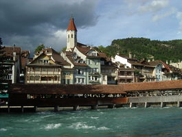
- The Castle (twelfth century) with a history museum. This has several sections about medieval armors and weaponry and rural life.
- The Rathaus (townhall), erected in the 16th century
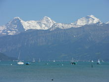
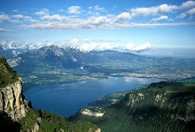
- Lake Thun and the view of the Bernese Alps, including the Niederhorn, Niesen, Stockhorn and Jungfrau peaks.
- The Wocher Panorama, the oldest remaining panorama drawing in the world.
- The Kunstmuseum Thun
- Schloss Schadau
Sports
- Soccer: FC Thun plays in the Swiss Challenge League. Their home ground is the Lachen stadium. On 23 August 2005 FC Thun qualified for the group stages of the UEFA Champions League.
- Orienteering: Thun hosted the 1981 World Orienteering Championships.
- Freestyle Kayak: Thun will host the 2009 ICF Freestyle World Championships.
In fiction
An scene in the spy novel Smiley's People by John le Carré is set here.
Notable residents
- Tanja Frieden, Olympic gold medalist 2006 (Snowboard Cross)
- Niklaus Gerber (1850–1914), Dairy chemist and industrialist
- Simona De Silvestro (Sept. 1, 1988), Race car driver
- Zdravko Kuzmanovic (Sept. 22, 1987), footballer
Twin towns
 Gabrovo, Bulgaria
References
- ↑ 1.0 1.1 Swiss Federal Statistical Office, MS Excel document – Bilanz der ständigen Wohnbevölkerung nach Kantonen, Bezirken und Gemeinden (German) accessed 25 August 2010
- ↑ 2.0 2.1 Swiss Federal Statistical Office accessed 17-Jul-2009
External links
- Thun.ch (German) Official city website
- Tourist information
- City livecam with archive since 2005 (German)
|
|||||||

