Samarkand
| Samarkand Samarqand / Самарқанд |
|||
|---|---|---|---|
 |
|||
|
|||
 Samarkand
|
|||
| Coordinates: | |||
| Country | |||
| Province | Samarqand Province | ||
| Elevation | 702 m (2,303 ft) | ||
| Population (2008) | |||
| - City | 596,300 | ||
| - Urban | 643,970 | ||
| - Metro | 708,000 | ||
| Website | http://www.samarkand.info | ||
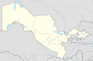
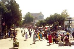
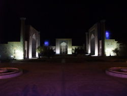
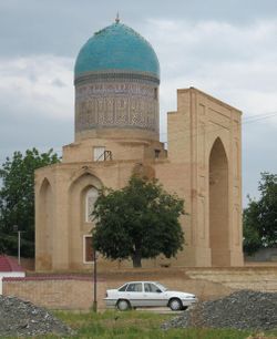
Samarkand (Uzbek: Samarqand; Tajik: Самарқанд; Persian: سمرقند; Russian: Самарканд; literally "Stone Fort" or "Rock Town", in Sogdian)) is the second-largest city in Uzbekistan and the capital of Samarqand Province. The city is most noted for its central position on the Silk Road between China and the West, and for being an Islamic centre for scholarly study. In the 14th century, it became the capital of the empire of Timur (Tamerlane), and is the site of his mausoleum (the Gur-e Amir). The Bibi-Khanym Mosque remains one of the city's most notable landmarks. The Registan was the ancient centre of the city.
In 2001, UNESCO added the 2,750-year-old city to its World Heritage List as Samarkand – Crossroads of Cultures.
Contents |
Etymology
Samarkand derives its name from the Old Persian asmara, "stone", "rock", and Sogdian qand, "fort", "town".[1]. Names in other languages include: , Persian: سمرقند Samarqand (Tajik: Самарқанд), Russian: Самарканд Samarkand, and Turkish: Semerkant.
Population
In 1939 Samarkand had a population of 134,346,[2] and in 2008 an urban population of 596,300, mostly Persian-speaking Tajiks. Along with Bukhara, Samarkand is one of the historical centers of the Tajik people in Central Asia.[3]
History
Samarkand is one of the oldest inhabited cities in the world, prospering from its location on the trade route between China and the Mediterranean (Silk Road). At times Samarkand has been one of the greatest cities of Central Asia.
Early history
Founded circa 700 BC by the Persians, Samarkand has been one of the main centres of Persian civilization from its early days. It was already the capital of the Sogdian satrapy under the Achaemenid dynasty of Persia when Alexander the Great conquered it in 329 BC. The Greeks referred to Samarkand as Maracanda.[4]
| Samarkand – Crossroads of Culture* | |
|---|---|
| UNESCO World Heritage Site | |
| State Party | |
| Type | Cultural |
| Criteria | i, ii, iv |
| Reference | 603 |
| Region** | Asia-Pacific |
| Inscription history | |
| Inscription | 2001 (25th Session) |
| * Name as inscribed on World Heritage List. ** Region as classified by UNESCO. |
|
Although a Persian-speaking region, it was not united politically with Iran most of the times between the disintegration of the Seleucid Empire and the Arab conquest (except at the time of early Sassanids, such as Shapur I[5]). In the 6th century it was within the domain of the Turkic kingdom of the Göktürks.[6]
Medieval history
At the start of the 8th century Samarkand came under Arab control. Under Abbasid rule, the legend goes,[7] the secret of papermaking was obtained from two Chinese prisoners from the Battle of Talas in 751, which led to the first paper mill in the Islamic world being founded in Samarkand. The invention then spread to the rest of the Islamic world, and from there to Europe.
From the 6th to the 13th century it grew larger and more populous than modern Samarkand and was controlled by the Western Turks, Arabs (who converted the area to Islam), Persian Samanids, Kara-Khanid Turks, Seljuk Turks, Kara-Khitan, and Khorezmshah before being sacked by the Mongols under Genghis Khan in 1220 . A small part of the population survived, but Samarkand suffered at least one other Mongol sack by Khan Baraq to get treasure he needed to pay an army with. The town took many decades to recover from these disasters.
In The Travels of Marco Polo, where Polo records his journey along the Silk Road, Samarkand is described as a "a very large and splendid city..." Here also is related the story of a Christian church in Samarkand, which miraculously remained standing after a portion of its central supporting column was removed.
14th century
In 1365, a revolt against Mongol control occurred in Samarkand.[8]
In 1370, Timur the Lame, or Tamerlane, decided to make Samarkand the capital of his empire, which extended from India to Turkey. During the next 35 years he built a new city and populated it with artisans and craftsmen from all of the places he had conquered. Timur gained a reputation as a patron of the arts and Samarkand grew to become the centre of the region of Transoxiana. During this time the city had a population of about 150,000.[9]
15th century
Between 1424 and 1429, the great astronomer Ulugh Beg built the Samarkand Observatory. The sextant was 11 metres long and once rose to the top of the surrounding three storey structure although it was kept underground to protect it from earthquakes. Calibrated along its length, it was the world’s largest 90 degree quadrant at the time.[10] However, the observatory was destroyed by religious fanatics in 1449.[10]
Modern history
In 1499 the Uzbek Turks took control of Samarkand.[9] The Shaybanids emerged as the Uzbek leaders at or about this time.
In the 16th century, the Shaybanids moved their capital to Bukhara and Samarkand went into decline. After an assault by the Persian king, Nadir Shah, the city was abandoned in the 18th century, about 1720 or a few years later.[11]
From 1784, Samarkand was ruled by the emirs of Bukhara.[2]
The city came under Russian rule after the citadel had been taken by a force under Colonel Alexander Abramov in 1868. Shortly thereafter the small Russian garrison of 500 men were themselves besieged. The assault, which was led by Abdul Malik Tura, the rebellious elder son of the Bukharan Emir, and Bek of Shahrisabz, was beaten off with heavy losses. Abramov, now a general, became the first Governor of the Military Okrug which the Russians established along the course of the Zeravshan River, with Samarkand as the administrative centre. The Russian section of the city was built after this point, largely to the west of the old city.
In 1886 the city became the capital of the newly formed Samarkand Oblast of Russian Turkestan and grew in importance still further when the Trans-Caspian railway reached the city in 1888. It became the capital of the Uzbek SSR in 1925 before being replaced by Tashkent in 1930.
Main sights
- The Registan, one of the most relevant examples of Islamic architecture. It consists of three separate buildings:
- Madrasa of Ulugh Beg (1417–1420)
- Sher-Dor Madrasah (Lions Gate) (1619-1635/36).
- Tilya-Kori Madrasah (1647-1659/60).
- Bibi-Khanym Mosque
- Gur-e Amir Mausoleum (1404)
- Observatory of Ulugh Beg (1428–1429)
- Shah-i-Zinda necropolis
- Historical site of Afrasiyab (13th-7th centuries BC)
Climate
| Samarkand | ||||||||||||||||||||||||||||||||||||||||||||||||||||||||||||
|---|---|---|---|---|---|---|---|---|---|---|---|---|---|---|---|---|---|---|---|---|---|---|---|---|---|---|---|---|---|---|---|---|---|---|---|---|---|---|---|---|---|---|---|---|---|---|---|---|---|---|---|---|---|---|---|---|---|---|---|---|
| Climate chart () | ||||||||||||||||||||||||||||||||||||||||||||||||||||||||||||
|
||||||||||||||||||||||||||||||||||||||||||||||||||||||||||||
|
||||||||||||||||||||||||||||||||||||||||||||||||||||||||||||
Samarkand features a semi-arid climate (Köppen climate classification BSk). The climate is sharply continental. Summers are dry and hot, while winters are wet and moderately cold. July and August are the hottest months of the year with temperatures reaching, and exceeding, 40 °C (104 °F). Most of the little annual precipitation is received from December through April.[12]
| Climate data for Samarkand | |||||||||||||
|---|---|---|---|---|---|---|---|---|---|---|---|---|---|
| Month | Jan | Feb | Mar | Apr | May | Jun | Jul | Aug | Sep | Oct | Nov | Dec | Year |
| Average high °C (°F) | 6.1 (43) |
7.9 (46.2) |
13.5 (56.3) |
20.8 (69.4) |
26.4 (79.5) |
32.0 (89.6) |
33.8 (92.8) |
32.2 (90) |
27.9 (82.2) |
21.0 (69.8) |
14.9 (58.8) |
9.2 (48.6) |
20.5 (68.9) |
| Daily mean °C (°F) | 0.6 (33.1) |
2.2 (36) |
7.8 (46) |
14.5 (58.1) |
19.5 (67.1) |
24.5 (76.1) |
26.2 (79.2) |
24.2 (75.6) |
19.3 (66.7) |
12.7 (54.9) |
7.5 (45.5) |
3.3 (37.9) |
13.5 (56.3) |
| Average low °C (°F) | -3.3 (26.1) |
−1.4 (29.5) |
3.2 (37.8) |
8.9 (48) |
12.7 (54.9) |
16.4 (61.5) |
17.8 (64) |
15.9 (60.6) |
11.2 (52.2) |
6.0 (42.8) |
2.0 (35.6) |
−0.9 (30.4) |
7.4 (45.3) |
| Precipitation mm (inches) | 44 (1.73) |
39 (1.54) |
71 (2.8) |
63 (2.48) |
33 (1.3) |
4 (0.16) |
4 (0.16) |
0 (0) |
4 (0.16) |
24 (0.94) |
28 (1.1) |
41 (1.61) |
355 (13.98) |
| Source: Hong Kong Observatory[13] | |||||||||||||
Notable people
- Amoghavajra, an 8th century Buddhist monk who translated Vajrayana scripture, became a powerful figure in the Tang court, and is remembered as one of the three founders of Chinese esoteric Buddhism.
- Qulich Khan Siddiqi (Nawab Khwaja Abid Siddiqi) and Ghazi Uddin Khan Siddiqi, father and grand father of Qamar-ud-din Khan, Asaf Jah I (Nizam I). Nizam I founded the dynasty that ruled Hyderabad (India) for over 200 years.
- Islom Karimov, President of Uzbekistan.
- Malika Kalontarova, folk dancer and People's Artist of USSR (parents were from Samarkand).
Popular culture
Fiction
- Chapters 37 and 38 of Louis Cha's Wuxia novel The Legend of the Condor Heroes briefly portray the Mongolian siege of Samarkand in March 1220.
- Samarcande (1988) is the title of a novel by Amin Maalouf, about Omar Khayyám's life.
- The Amulet of Samarkand is the first book in the Bartimaeus Trilogy written by Jonathan Stroud.
- The Road to Samarcand is one of Patrick O'Brian's early novels (1954) about an American teenage boy, the son of recently deceased missionary parents, who travels from China with a small party on the Silk Road en route to the West.
- In Corto Maltese graphical novels by Hugo Pratt one episode is titled "The Golden House of Samarkand"
- The fictional city of Zanarkand in the Final Fantasy series, used Samarkand as inspiration.[14]
Poetry, drama and film
- Samarkand can appear as an archetype of romantic exoticism, notably in the work by James Elroy Flecker: The Golden Journey to Samarkand (1913).
- In Islamic literature and discussions, Samarkand has taken on a semi-mythological status and is often cited as an ideal of Islamic philosophy and society, a place of justice, fairness, and righteous moderation.
- Nigerian writer Wole Soyinka, winner of the 1986 Nobel Prize in Literature, explores the metaphysical significance of the marketplace in a volume of poetry entitled Samarkand and Other Markets I Have Known, 2002.
- Samarkand has a large featuring in the originally Russian film Day Watch, originally written by Sergei Lukyanenko as part of a Trilogy. Samarkand is the place where the fictional battle for the "Chalk of fate" is experienced.
Non-fiction
- Ibn Battuta the great traveler of the 14th century spent time in Samarkand in the 1330s
- Murder in Samarkand by Craig Murray is a book about the UK Ambassador to Uzbekistan's experiences in this role, until he resigned over human rights abuses in the country in October 2004.
Music
- In 1972, Swedish composer Thorstein Bergman wrote "Om du någonsin kommer fram till Samarkand" ("If you ever reach Samarkand") made notable by Swedish singer Lill Lindfors in 1978.
- In 1977, the Italian singer and composer Roberto Vecchioni issued an LP titled Samarcanda.
- In 2004, violinist Lucia Micarelli released the album Music from a Farther Room, which includes the song "Samarkand".
Sister cities
These cities were major cities of Greater Khorasan:
 Samarqand, Uzbekistan
 Nishapur, Iran
 Bukhara, Uzbekistan
 Balkh, Afghanistan
 Merv, Turkmenistan
 Khiva, Uzbekistan
sister cities
 Cuzco, Peru
 Lahore, Pakistan
 Lviv, Ukraine
 Kairouan, Tunisia
 Istanbul, Turkey
 İzmir, Turkey
 Khujand, Tajikistan

See also
- Samarkand Airport
- Semerkand a monthly religious magazine published in Turkey, named after this city because Samarkand has long been a major centre for Islamic scholars.
References
- ↑ Room, Adrian (2006). Placenames of the World: Origins and Meanings of the Names for 6,600 Countries, Cities, Territories, Natural Features and Historic Sites (2nd edition ed.). London: McFarland. pp. 330. ISBN 0786422483. "Samarkand. City, southeastern Uzbekistan. The city derives its name from that of the former Greek city here of Marakanda, captured by Alexander the Great in 329 B.C.. Its own name derives from the Old Persian asmara, "stone", "rock", and Sogdian kand, "fort", "town"."
- ↑ 2.0 2.1 Columbia-Lippincott Gazeteer. p. 1657
- ↑ D.I. Kertzer/D. Arel, Census and identity, p. 187, Cambridge University Press, 2001
- ↑ Columbia-Lippincott Gazeteer (New York: Comubia University Press, 1972 reprint) p. 1657
- ↑ Guitty Azarpay (1980), Sogdian painting: the pictorial epic in Oriental art, Berkeley : University of California Press, page 16.
- ↑ Encyclopedia Britannica (Chicago: University of Chicago Press, 1984) Vol. 16, p. 204
- ↑ Quraishi, S. "A survey of the development of papermaking in Islamic Countries", Bookbinder, 1989 (3): 29-36.
- ↑ Encyclopedia Britannica, 15th Ed., p. 204
- ↑ 9.0 9.1 Columbia-Lippincott Gazeteer, p. 1657
- ↑ 10.0 10.1 "Samarqand". Raw W Travels. http://www.rayw20.co.uk/SAMARQAND.htm. Retrieved November 1, 2009.
- ↑ Britannica. 15th Ed., p. 204
- ↑ Samarkand.info. "Weather in Samarkand". Samarkand, Uzbekistan. http://www.samarkand.info/html/weather.html. Retrieved 2009-06-11.
- ↑ "Climatological Normals of Samarkand". http://www.hko.gov.hk/wxinfo/climat/world/eng/asia/westasia/samarkand_e.htm. Retrieved 2010-08-03.
- ↑ (2001) in Studio BentStuff: Final Fantasy X Ultimania Ω (in Japanese). DigiCube/Square Enix, 476. ISBN 4-88787-021-3.
External links
- Samarkand - Silk Road Seattle Project, Walter Chapin Simpson Center for the Humanities at the University of Washington
- More than 40 photos of Samarkand by a tourist taken in 2010
- The history of Samarkand, according to Columbia University's Encyclopædia Iranica
|
||||||||||||||||
|
|||||||||||
|
||||||||

