List of National Parks of Canada

This is a list of National Parks of Canada. Canadian National Parks preserve both spectacular and representative areas of the country, located in every one of the nation's 13 provinces and territories. The goal of the national park service is to create a system of protected areas which represent all the distinct natural regions of the country.[1] Parks Canada – the governing and administration body for the system – has developed a plan identifying 39 different regions it aims to represent. As of 2005, Parks Canada reports that the system is more than 60% complete. Canada's parks are managed primarily to protect the ecological integrity of the park, and secondarily to allow the public to explore, learn about and enjoy Canada's natural spaces.[1] As of 2005, feasibility studies have been undertaken for establishing further national parks in three areas: Wolf Lake in Yukon, South Okanagan-Lower Similkameen in British Columbia and the Manitoba Lowlands (north-western Lake Winnipeg).[2]
There are currently 36 National Parks and 6 National Park Reserves (including Kluane National Park and Reserve, which is considered both a National Park and a Reserve). This list also includes the country's four National Marine Conservation Areas (NMCAs), the lone National Landmark, and three future parks.
Contents |
National Parks and National Park Reserves
A National Park Reserve is an area that has been set aside with the intention of becoming a national park, pending the settlement of native land claims. Until then, they are managed as national parks under the National Parks Act.[3]
| Name | Photo | Location | Area | Established |
|---|---|---|---|---|
| Aulavik | Northwest Territories | 12,200 km2 (4,710 sq mi) | 1992 | |
| Auyuittuq | 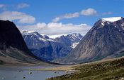 |
Nunavut | 21,471 km2 (8,290 sq mi) | 2001 |
| Banff |  |
Alberta | 6,641 km2 (2,564 sq mi) | 1885 |
| Bruce Peninsula | 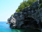 |
Ontario | 154 km2 (59 sq mi) | 1987 |
| Cape Breton Highlands |  |
Nova Scotia | 949 km2 (366 sq mi) | 1936 |
| Elk Island | 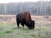 |
Alberta | 194 km2 (75 sq mi) | 1913 |
| Forillon | 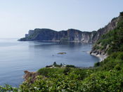 |
Quebec | 244 km2 (94 sq mi) | 1970 |
| Fundy | 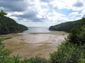 |
New Brunswick | 206 km2 (80 sq mi) | 1948 |
| Georgian Bay Islands | 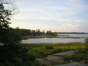 |
Ontario | 13 km2 (5 sq mi) | 1929 |
| Glacier | British Columbia | 1,349 km2 (521 sq mi) | 1886 | |
| Grasslands | Saskatchewan | 907 km2 (350 sq mi) | 1981 | |
| Gros Morne | 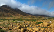 |
Newfoundland | 1,805 km2 (697 sq mi) | 1973 |
| Gulf Islands (Reserve) |
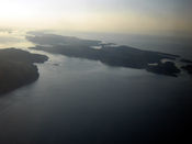 |
British Columbia | 33 km2 (13 sq mi) | 2003 |
| Gwaii Haanas[A] (Reserve) |
 |
British Columbia | 1,495 km2 (577 sq mi) | 1988 |
| Ivvavik[B] | Yukon | 10,168 km2 (3,926 sq mi) | 1984 | |
| Jasper |  |
Alberta | 10,878 km2 (4,200 sq mi) | 1907 |
| Kejimkujik | 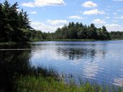 |
Nova Scotia | 404 km2 (156 sq mi) | 1968 |
| Kluane[C] |  |
Yukon | 22,013 km2 (8,499 sq mi) | 1972 |
| Kootenay | 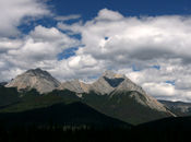 |
British Columbia | 1,406 km2 (543 sq mi) | 1920 |
| Kouchibouguac | New Brunswick | 239 km2 (92 sq mi) | 1969 | |
| La Mauricie | 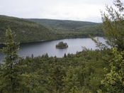 |
Quebec | 536 km2 (207 sq mi) | 1970 |
| Mingan Archipelago (Reserve) |
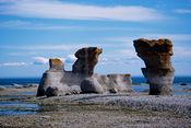 |
Quebec | 151 km2 (58 sq mi) | 1984 |
| Mount Revelstoke | 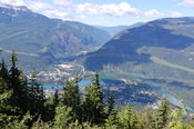 |
British Columbia | 260 km2 (100 sq mi) | 1914 |
| Nahanni (Reserve) |
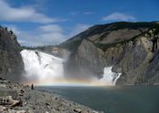 |
Northwest Territories | 30,000 km2 (11,583 sq mi) | 1976 |
| Pacific Rim (Reserve) |
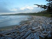 |
British Columbia | 511 km2 (197 sq mi) | 1970 |
| Point Pelee | 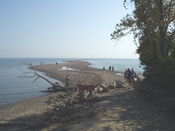 |
Ontario | 15 km2 (6 sq mi) | 1918 |
| Prince Albert | 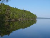 |
Saskatchewan | 3,874 km2 (1,496 sq mi) | 1927 |
| Prince Edward Island | 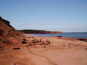 |
Prince Edward Island | 22 km2 (8 sq mi) | 1937 |
| Pukaskwa | 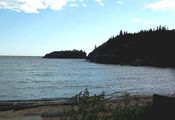 |
Ontario | 1,878 km2 (725 sq mi) | 1978 |
| Quttinirpaaq[E] | 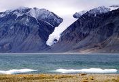 |
Nunavut | 37,775 km2 (14,585 sq mi) | 2001 |
| Riding Mountain[F] | Manitoba | 2,973 km2 (1,148 sq mi) | 1933 | |
| Sirmilik | 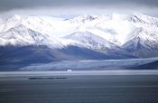 |
Nunavut | 22,200 km2 (8,571 sq mi) | 2001 |
| St. Lawrence Islands | Ontario | 9 km2 (3 sq mi) | 1904 | |
| Terra Nova | 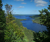 |
Newfoundland | 400 km2 (154 sq mi) | 1957 |
| Torngat Mountains | Labrador | 9,600 km2 (3,707 sq mi) | 2005 | |
| Tuktut Nogait | Northwest Territories | 16,340 km2 (6,309 sq mi) | 1996 | |
| Ukkusiksalik | 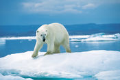 |
Nunavut | 20,500 km2 (7,915 sq mi) | 2003 |
| Vuntut | 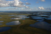 |
Yukon | 4,345 km2 (1,678 sq mi) | 1995 |
| Wapusk | 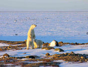 |
Manitoba | 11,475 km2 (4,431 sq mi) | 1996 |
| Waterton Lakes[G] | Alberta | 505 km2 (195 sq mi) | 1895 | |
| Wood Buffalo | 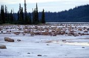 |
Alberta Northwest Territories |
44,807 km2 (17,300 sq mi) | 1922 |
| Yoho | 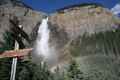 |
British Columbia | 1,313 km2 (507 sq mi) | 1886 |
Future National Parks and National Park Reserves
| Name | Location | Area |
|---|---|---|
| Mealy Mountains National Park Reserve[4] | Labrador | 11,700 km2 (4,517 sq mi) |
| Naats'ihch'oh National Park Reserve[5] | Northwest Territories | 7,600 km2 (2,934 sq mi) |
| Thaydene Nene National Park[6] | Northwest Territories | Approx. 33,000 km2 (12,741 sq mi)[7] |
Abolished National Parks
| Name | Location | Established | Abolished |
|---|---|---|---|
| Buffalo National Park[8] | Alberta | 1909 | 1947 |
| Menissawok National Park[9] | Saskatchewan | 1922 | 1930 |
| Nemiskam National Park[8] | Alberta | 1914 | 1947 |
| Wawaskesy National Park[10] | Alberta | 1922 | 1938 |
National Marine Conservation Areas
National Marine Conservation Areas (NMCAs) are a relatively new addition to the park system. These areas have a different mandate than their terrestrial counterparts. They are designed for sustainable use, although they usually also contain areas designed to protect ecological integrity.[11] The government has announced plans to add five more Marine parks to the system as part of the Marine Conservation Areas Act. The first to be officially announced was Lake Superior National Marine Conservation Area, although a date of opening has not yet been revealed. Other areas under negotiation are the southern Strait of Georgia and Gwaii Haanas in British Columbia and there are discussions to study the feasibility of an area on the southern coast of Newfoundland.[12]
| Name | Photo | Location | Area | Established |
|---|---|---|---|---|
| Fathom Five | Ontario | 112 km2 (43 sq mi) | 1987 | |
| Gwaii Haanas (Reserve) | British Columbia | 1,500 km2 (579 sq mi)[13] | 2010 | |
| Lake Superior | Ontario | 10,000 km2 (3,861 sq mi)[14] | 2007 | |
| Saguenay-St. Lawrence | Quebec | 1,246 km2 (481 sq mi)[15] | 1998 |
National Landmark
In addition to national parks, a National Landmarks program was established in 1978 but has not yet been expanded beyond a single property. Landmarks were intended to protect specific natural features considered "outstanding, exceptional, unique, or rare to this country. These natural features would typically be isolated entities and of scientific interest."[16]
| Name | Photo | Location | Area | Established |
|---|---|---|---|---|
| Pingo | 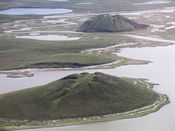 |
Northwest Territories | 16 km2 (6 sq mi) | 1984 |
See also
Provincial parks are administered and funded by the provincial governments, however some provincial parks are categorized as national parks (Category II) under the IUCN's Protected Area Management Categories.
- List of Canadian provincial parks
- List of Alberta provincial parks
- List of British Columbia provincial parks
- List of Ontario Parks (national and provincial)
- List of Quebec national parks (provincial parks in Quebec are called "national" parks by the provincial government)
- List of UNESCO Biosphere Reserves in Canada
- List of national historic sites of Canada.
Notes
- ^ A. South Moresby National Park Reserve was created July 12, 1988, with the signing of the South Moresby Agreement; renamed Gwaii Haanas National Park Reserve and Haida Heritage Site on February 28, 1996. Includes SGaang Gwaii (Anthony Island) World Heritage Site.[17]
- ^ B. Established as Northern Yukon National Park in 1984, renamed Ivvavik National Park in 1992.[18]
- ^ C. Kluane National Park Reserve was established in 1972. Subsequently, a large eastern portion of the Reserve became Kluane National Park.
- ^ D. In 2007, the government announced that 29,000 km2 (11,197 sq mi) of land would be added to Nahanni, making it 33,766 km2 (13,037 sq mi). However, these changes have not been fully implemented yet.[19]
- ^ E. Ellesmere Island National Park Reserve was established in 1988, renamed Quttinirpaaq in 1999 and became a national park in 2000.[20]
- ^ F. Riding Mountain National Park was designated a UNESCO Biosphere Reserve in 1986.[21]
- ^ G. Glacier National Park is part of Waterton-Glacier International Peace Park, a World Heritage Site.
References
- General
- "National Parks of Canada". Parks Canada. http://www.pc.gc.ca/progs/np-pn/recherche-search_e.asp?p=1. Retrieved 2008-04-07.
- "National Marine Conservation Areas of Canada". Parks Canada. http://www.pc.gc.ca/progs/amnc-nmca/recherche-search_e.asp?m=1. Retrieved 2008-04-07.
- "Canada's National Parks and National Park Reserves". The Canadian Encyclopedia. http://www.thecanadianencyclopedia.com/index.cfm?PgNm=TCE&Params=a1ARTa0009259. Retrieved 2008-04-07.
- "Great Canadian Parks Index". Canadian Online Explorer. http://www.greatcanadianparks.com/gc_parks/Canada/parks.html. Retrieved 2008-04-07.
- Specific
- ↑ 1.0 1.1 "National Parks of Canada - Introduction". Parks Canada. http://www.pc.gc.ca/progs/np-pn/intro/index_e.asp. Retrieved 2008-04-07.
- ↑ "National Parks of Canada - Creating New National Parks of Canada". Parks Canada. http://www.pc.gc.ca/progs/np-pn/cnpn-cnnp/index_e.asp. Retrieved 2008-04-07.
- ↑ "Backgrounder - Working toward the creation of Nááts’ihch’oh National Park Reserve". Parks Canada. 2008-04-07. http://www.pc.gc.ca/apps/cp-nr/release_e.asp?bgid=972&andor1=bg. Retrieved 2008-04-07.
- ↑ Boswell, Randy (2010-02-05). "Huge new national park announced for Labrador". Vancouver Sun. http://www.vancouversun.com/travel/Huge+national+park+announced+Labrador/2526849/story.html. Retrieved 2010-02-05.
- ↑ "Canada getting new national park in Northwest Territories". Canadian Press. 2008-04-07. http://canadianpress.google.com/article/ALeqM5hwjWL4jIjBRCXWy4v6yfhBE5VDpw. Retrieved 2008-04-07.
- ↑ "Ottawa, Dene agree to create vast national park". CBC News. 2006-10-14. http://www.cbc.ca/canada/story/2006/10/14/nwt-park.html. Retrieved 2008-04-07.
- ↑ "Nature Canada Applauds Federal Government’s Renewed Commitment to National Park System". Nature Canada. 2006-10-16. http://www.naturecanada.ca/newsroom_oct_17_06_NPs.asp. Retrieved 2008-04-07.
- ↑ 8.0 8.1 Federation of Alberta Naturalists, Fish and Wildlife Historical Society (2005). Fish, Fur & Feathers: Fish and Wildlife Conservation in Alberta 1905-2005. Nature books of Alberta. p. 100. ISBN 0969613474.
- ↑ "Significant events in the history of Parks Canada". Canadian Geographic. http://www.canadiangeographic.ca/Magazine/MA03/Etcetera/parkstimeline.asp. Retrieved 2008-04-07.
- ↑ "Project Update: Arthropods of Canadian Grasslands". University of Alberta. http://www.biology.ualberta.ca/bsc/news17_2/grasslands.htm. Retrieved 2008-04-07.
- ↑ "National Marine Conservation Areas of Canada". Parks Canada. http://www.pc.gc.ca/progs/amnc-nmca/intro/index_e.asp. Retrieved 2008-04-07.
- ↑ Ditchburn, Jennifer (2007-10-24). "PM expected to unveil marine conservation area". Toronto Star. http://www.thestar.com/News/article/270200. Retrieved 2008-04-07.
- ↑ "Minister visits, celebrates marine park's creation". The Queen Charlotte Islands Observer. 2010-06-14. http://www.qciobserver.com/Article.aspx?Id=4496.
- ↑ "Harper announces creation of protected marine park". CBC News. 2007-10-25. http://www.cbc.ca/canada/story/2007/10/25/harper-marine.html. Retrieved 2008-04-07.
- ↑ "Registre des aires protégées du Québec" (PDF). Ministère du Développement durable, de l'Environnement et des Parcs du Québec. http://www.mddep.gouv.qc.ca/biodiversite/aires_protegees/registre/reg-design/05Milieu-marin.pdf. Retrieved 2008-04-27.
- ↑ "Pingo Canadian Landmark - Park Management". Parks Canada. http://www.pc.gc.ca/docs/v-g/pingo/sec6/index_e.asp. Retrieved 2008-04-07.
- ↑ "Gwaii Haanas National Park Reserve and Haida Heritage Site". The Canadian Encyclopedia. http://www.thecanadianencyclopedia.com/index.cfm?PgNm=TCE&Params=A1ARTA0010322. Retrieved 2008-04-07.
- ↑ "Ivvavik National Park". The Canadian Encyclopedia. http://www.thecanadianencyclopedia.com/index.cfm?PgNm=TCE&Params=A1ARTA0010121. Retrieved 2008-04-07.
- ↑ "Tories' expansion of Nahanni park praised". CTV Television Network. 2007-08-08. http://www.ctv.ca/servlet/ArticleNews/story/CTVNews/20070808/harper_arctic_070808/20070808?hub=Canada. Retrieved 2008-04-07.
- ↑ "Quttinirpaaq National Park". The Canadian Encyclopedia. http://www.thecanadianencyclopedia.com/index.cfm?PgNm=TCE&Params=A1ARTA0010119. Retrieved 2008-04-07.
- ↑ "Biosphere Reserve Information - Canada - Riding Mountain". UNESCO. http://www.unesco.org/mabdb/br/brdir/directory/biores.asp?code=CAN+04&mode=all. Retrieved 2008-04-07.
External links
|
||||||||||||||||||||
|
|||||||||||||||||||||||||||||||||||||||||||||||||||||||