Iğdır
| Iğdır | |
|---|---|
 |
|
 Iğdır
|
|
| Coordinates: | |
| Country | |
| Region | Eastern Anatolia |
| Province | Iğdır |
| Area | |
| - City | 1,479 km2 (571 sq mi) |
| Elevation | 850 m (2,789 ft) |
| Population (2009)TÜİK | |
| - Urban | 76,950 |
| Time zone | EET (UTC+2) |
| - Summer (DST) | EEST (UTC+3) |
| Postal code | 76000 |
| Area code(s) | 0476 |
| Licence plate | 76 XX XXX |
| Website | Iğdır Municipality |
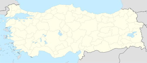
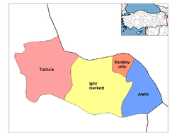
Iğdır (Armenian: Իգդիր, formerly Ծոլակերտ, Tsolakert) is the capital of Iğdır Province in Eastern Anatolia Region, Turkey, and borders Armenia, Nakhchivan and Iran. The border with Armenia is formed by the Aras River. Turkey's highest mountain, Ağrı Dağı, (the Biblical Mount Ararat) is in Iğdır province, but much of the land is a wide plain far below the mountain.
Contents |
Etymology
The area's name came from "Iğdır Bey", the oldest son of Cengiz Alp who was one of six sons of Oghuz Han belonging to internal Oghuz three arrows branch considered to be the 21st of the 24 Oghuz branches.[1] They spread throughout Anatolia and there are towns and villages named Iğdır in Malatya and other parts of Turkey today.[2]
History
Historians believe that Igdir was known during the middle ages with the Armenian name of Tsolakert.[3] In 1555, Igdir became a part of Safavid Persia and remained so until it fell into the hands of the Russians after the Russo-Persian War of 1826-1828 except Ottoman rule between 1578–1605, 1635–1636 and 1722-1746. Still a small village when it was incorporated into the Russian Empire, under Russian rule, two primary schools, one for boys and another for girls, and three churches were opened and 100 Armenian families were allowed to move to Igdir. The town's population rose to 10,000 in 1914. Its population largely busied itself with agriculture and trade.[3]
As the Russian Empire collapsed in 1917, the land came under the control of the newly established Democratic Republic of Armenia. Under the boundaries drawn by US State Department in November 1920, Igdir, as a part of the district of Surmalu in the former Erivan Governorate, was envisaged to remain under Armenian control. But in September 1920, the Turkish forces led by Mustapha Kemal launched a war to eliminate the republic and managed to occupy Igdir.[4] Igdir's majority Armenian population suffered heavily during the Armenian-Turkish War of 1920 and was driven out by way of massacres by Kemal's forces.[5] As Armenia folded away to become a part of Soviet Russia, the Turks' territorial gains were confirmed in the 1921 Treaty of Kars.[3]
Geography
The city of Iğdır sits on a plain at a lower altitude than most of Turkey's eastern provinces. This allows agricultural production including apples, tomatoes, cucumbers, peaches, pears, sugar beet, watermelons and melons. However, the most famous produces of Iğdır are cotton and apricots.
Climate
Iğdır has a relatively moderate Continental climate. The climate is the warmest in this part of Turkey.
| Ortalama Veriler | |||||||||||||
|---|---|---|---|---|---|---|---|---|---|---|---|---|---|
| Months | Jan | Feb | Mar | Apr | May | Jun | Jul | Aug | Sep | Oct | Nov | Dec | |
| Average high °C | 2.6 | 5.6 | 12.8 | 20.1 | 24.3 | 29.4 | 33.7 | 34.4 | 29.1 | 21.2 | 12.6 | 4.9 | |
| Average low °C | -7.3 | -4.9 | 0.1 | 6.5 | 10.5 | 14.3 | 18.3 | 17.7 | 12.2 | 6.1 | 0.2 | -4.2 | |
| Average sunny day | 2.7 | 4.1 | 5.4 | 6.1 | 7.5 | 9.6 | 10.1 | 9.9 | 8.5 | 6.3 | 4.3 | 2.4 | |
| Average rainy day | 5.8 | 6.5 | 7.6 | 11.2 | 15.0 | 10.6 | 5.5 | 4.1 | 4.0 | 8.3 | 6.9 | 6.2 | |
| kaynak: www.meteor.gov.tr | |||||||||||||
Architecture
On the peninsula within a military zone stands Sürmeli castle, a medieval citadel whose surviving walls dating from 1224. The Armenian "Caravanserai of Zor" is another historical structure near Iğdır.[6]
The Genocide Monument

In August 1997, construction started on the "Iğdır Soykırım Anıt-Müzesi" ("Iğdır Genocide Monument and Museum"). Turkish authorities erected the monument to commemorate the massacres and alleged genocide of Turks by Armenians during World War I and the Turkish–Armenian War during the Turkish War of Independence.
Its construction is intended as a counter arguement by the Turks that Armenians also perpetrated massacres against Turks and is seen by some as a part of Turkey's continuing denial of Armenian Genocide. [7]
The Turkish arguement states "The expressed for the erection of this monument and this opinion was stated as follows in the final declaration "Resolved, that a monument of martyrs should be erected in Iğdır and a cemetery for martyrs should be established in Oba Village in order to eternalise the memories of more than one million Turks that fell in Eastern Anatolia and to give a similar answer to those declaring the 24th April as the genocide day and to the monuments erected in many places of the world for the genocide alleged to have been perpetrated against the Armenians."[8]
Historian Tessa Hofmann writes that "on the border to Armenia in the vicinity of Iğdır, a 45 meter high, martial monument was dedicated to the alleged Turkish victims of an Armenian genocide on October 5, 1999, along with a similar museum [were built]."[9]
It was opened on 5 October 1999 by Turkish Minister of State Ramazan Mirzaoğlu. Its height from ground level is 43.5 metres. The monument's design contains symbolism related to Turkish self-identity, history, and legends. The upper structure consists of five upright swords, their points touching to resemble Mount Ararat. On the hilt of the swords are a series of reliefs. Beneath the monument are a series of rooms intended to house a museum. The granite for the monument's swords was brought from China and other materials, such as marble, granite, and ceramics, were brought from other regions of Turkey.[10][11]
Culture
Iğdır's culture is a subculture of the larger Culture of Turkey.
The agricultural production has caused the town to be livelier and wealthier than its neighbours in the generally impoverished eastern Turkey. There are many cafes and restaurants. The best-known dish is an oily meat stew called bozbaş.[12]

Media
Iğdır has 12 local daily and weekly newspapers.[13] The most prominent of these is Yeşil Iğdır which has been published since 1 September 1955.
Economy
The city of Iğdır is located between Kars and Ağrı, and also neighbours with three countries; Armenia, Azerbaijan and Iran. Despite the fact that it has three strategically important neighbours, the border gate to Armenia is closed and there is no direct access to Iran, therefore this situation diminishes economic possibilities.
About 70% percent of Mount Ararat's area lies within Iğdır's borders, however the investments for developing tourism in Mt. Ararat is paid to Ağrı Municipality.
Demographics
Today, Iğdır has a mixed population of Azerbaijanis(who form the majority[14]) Turks and Kurds .[15] The spring festival nevruz which is native to Iran is widely celebrated in Iğdır.

| Iğdır Centrum Population | |||
|---|---|---|---|
| 2007 | 75.927 | ||
| 2000 | 59.880 | ||
| 1997 | 44.334 | ||
| 1990 | 35.858 | ||
| 1985 | 29.460 | ||
| 1980 | 24.352 | ||
| 1975 | 29.542 | ||
| 1970 | 21.420 | ||
Famous people
- Servet Çetin, a Turkish-Azeri soccer player
- Şahin Yakut, a Turkish kickboxer and MMA Fighter
- Avetis Aharonyan, chairman of the Democratic Republic of Armenia
- Drastamat Kanayan, an Armenian politician and general
International relations
Twin towns — Sister cities
Iğdır is twinned with:
 Sharur, Azerbaijan
 Shamakhi, Azerbaijan
References
- ↑ :: Iğdır Belediyesi ::
- ↑ igdir köyü
- ↑ 3.0 3.1 3.2 (Armenian) Anon. «Իգդիր» (Igdir). Soviet Armenian Encyclopedia. vol. iv. Yerevan, Armenian SSR: Armenian Academy of Sciences, 1978, p. 309.
- ↑ Balakian, Peter (2003). The Burning Tigris: The Armenian Genocide and America's Response. New York: HarperCollins. pp. 324–330. ISBN 0-0605-5870-9.
- ↑ Carter, Melville. "The Land Of The Stalking Death: a Journey Through Starving Armenia on an American Relief Train". National Geographic. November 1919. Retrieved July 24, 2009.
- ↑ Caravansarai of Zor. VirtualAni.org.
- ↑ (German) "The Perpetrators Memorialize Themselves: Turks Erect a Memorial for the Victims of Armenian attacks." Süddeutsche Zeitung, December 1, 1999, p. 10.
- ↑ [1]
- ↑ Dr. T. Hofmann, Armenians in Turkey
- ↑ http://www.ermenisorunu.gen.tr/english/massacres/igdir.html IGDIR GENOCIDE MONUMENT AND MUSEUM
- ↑ http://www.igdirkulturturizm.gov.tr/BelgeGoster.aspx?F6E10F8892433CFFAAF6AA849816B2EFC6029A481C6EADF5
- ↑ "Sürmeli Çukurda Iğdır", Ziya Zakir Acar, 2002
- ↑ Her Yönüyle Iğdır", Ziya Zakir Acar, 2004
- ↑ Population policy in Turkey, Erhard Franz,page 293
- ↑ (Turkish) Hürriyet
External links
- Official website of the Iğdır Municipality
- (Turkish) Official website of the Iğdır Province
- (Turkish) Iğdır's News website
|
||||||||||||||||||||||||||||||||||
