Interlaken
| Interlaken | ||||||||||
|---|---|---|---|---|---|---|---|---|---|---|
 |
||||||||||
|
||||||||||
| Population | 5,389 (Dec 2009)[1] | |||||||||
| - Density | 1,225 /km2 (3,172 /sq mi) | |||||||||
| Area | 4.4 km2 (1.7 sq mi) | |||||||||
| Elevation | 568 m (1,864 ft) | |||||||||
| Postal code | 3800 | |||||||||
| SFOS number | 0581 | |||||||||
| Mayor | Urs Graf (Social Democratic Party of Switzerland) | |||||||||
| Surrounded by | Bönigen, Därligen, Matten bei Interlaken, Ringgenberg, Unterseen | |||||||||
| Twin towns | Scottsdale (USA), Ōtsu (Japan), Třeboň (Czech Republic) | |||||||||
| Website | www.interlaken-gemeinde.ch SFSO statistics |
|||||||||
 Interlaken
|
||||||||||
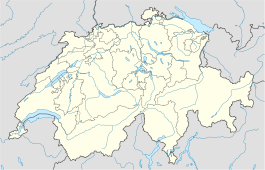
| View map of Interlaken | ||||||||||
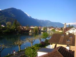
Interlaken is a municipality in the Interlaken-Oberhasli administrative district in the Canton of Bern in Switzerland, a well-known tourist destination in the Bernese Oberland.
Contents |
History
Until 1891 Interlaken was known as Aarmühle.[2] The original importance of the town was as the site of a convent of the Augustinian Canons; the convent was built in 1130 and lasted until 1528. In the past, printing, textiles, and to a smaller extent watchmaking were also of importance, but today tourism is the most significant source of income. Interlaken is one of the oldest tourist resorts in Switzerland, and it remains one of the most popular.
Geography
The Aare River flows through the town. Interlaken is located between Lake Brienz to the east and Lake Thun to the west in the area called Bödeli. The town takes its name from its geographical position between the lakes (in Latin inter lacus).
Interlaken is located at 570 m (1,870 ft) above sea level.
Interlaken has an area, as of 2009[update], of 4.3 square kilometers (1.7 sq mi). Of this area, 1.05 square kilometers (0.4 sq mi) or 24.4% is used for agricultural purposes, while 0.97 square kilometers (0.4 sq mi) or 22.6% is forested. Of the rest of the land, 2.03 square kilometers (0.8 sq mi) or 47.2% is settled (buildings or roads), 0.3 square kilometers (0.1 sq mi) or 7.0% is either rivers or lakes and 0.01 km2 (2.5 acres) or 0.2% is unproductive land.[3]
Of the built up area, industrial buildings made up 5.3% of the total area while housing and buildings made up 21.4% and transportation infrastructure made up 16.0%. while parks, green belts and sports fields made up 4.0%. 20.9% of the total land area is heavily forested and 1.6% is covered with orchards or small clusters of trees. Of the agricultural land, 6.5% is used for growing crops and 16.3% is pastures, while 1.6% is used for orchards or vine crops. All the water in the municipality is in rivers and streams.[3]
Demographics
Interlaken has a population (as of 31 December 2009) of 5,389.[1] As of 2007[update], 24.0% of the population was made up of foreign nationals. Over the last 10 years the population has grown at a rate of 4.5%. Most of the population (as of 2000[update]) speaks German (83.4%), with Portuguese being second most common ( 3.9%) and Italian being third ( 2.8%).
In the 2007 election the most popular party was the SVP which received 29.3% of the vote. The next three most popular parties were the SPS (21.3%), the FDP (18.7%) and the Green Party (11.6%).
The age distribution of the population (as of 2000[update]) is children and teenagers (0–19 years old) make up 19.3% of the population, while adults (20–64 years old) make up 63.1% and seniors (over 64 years old) make up 17.6%. The entire Swiss population is generally well educated. In Interlaken about 69.2% of the population (between age 25-64) have completed either non-mandatory upper secondary education or additional higher education (either University or a Fachhochschule).
Interlaken has an unemployment rate of 3.86%. As of 2005[update], there were 28 people employed in the primary economic sector and about 6 businesses involved in this sector. 742 people are employed in the secondary sector and there are 76 businesses in this sector. 4,935 people are employed in the tertiary sector, with 535 businesses in this sector.[4] The historical population is given in the following table:[2]
| year | population |
|---|---|
| 1764 | 397 |
| 1850 | 1,054 |
| 1900 | 2,962 |
| 1950 | 4,368 |
| 2000 | 5,119 |
Tourism
Interlaken is frequently visited by adventure-seeking backpackers throughout the year. Interlaken is home to numerous backpacker-friendly hostels and companies that provide guided services in skydiving, canyoning, hang gliding, paragliding, and skiing.
The town offers tourists a peaceful base from which to explore the surrounding areas by train or bus. However, the main attraction is probably the magnificent Jungfrau (4,158 m (13,642 ft)) and the nearby Jungfraujoch railway station (3,450 m (11,319 ft)). Many hotels are located along the Höheweg avenue which offer good views of the mountains. Mystery Park, a paranormal-based theme park owned by Erich von Däniken, was closed in 2006 after three years because of financial difficulties but re-opened in 2009[5].
Transportation

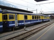
Despite its small size, the town features two railway stations Interlaken Ost and Interlaken West and two funicular railways, the Harderbahn and the Heimwehfluhbahn. Train connections in Interlaken serve the Jungfrau region via the Berner Oberland Bahn, with the narrow-gauge lines of the Zentralbahn extending over the Brünig Pass to Luzern. The main line connects Interlaken with the cities of Spiez, Thun and Bern. There are also regular bus links to the neighbouring town of Thun. Boat services across Lake Brienz to Brienz and across Lake Thun to Spiez and Thun are operated by BLS Lötschbergbahn.
Events
- In September, the Jungfrau Marathon starts in Interlaken.
- The Unspunnenfest is a festival held in Interlaken and the neighbouring communities of Matten and Wilderswil approximately every twelve years. The festival highlights traditional Swiss culture and features competitions of Steinstossen (stone put), Schwingen (wrestling) and yodelling. The last Unspunnenfest was held in September 2006. The next celebration is scheduled for the year 2017.
- On July 15, the Red Bull Air Race World Series was held on the Airport situated near Interlaken.
- During Summer, there is the Greenfield Music Festival on the outskirts of Interlaken.
Weather
| Climate data for Interlaken | |||||||||||||
|---|---|---|---|---|---|---|---|---|---|---|---|---|---|
| Month | Jan | Feb | Mar | Apr | May | Jun | Jul | Aug | Sep | Oct | Nov | Dec | Year |
| Source: MeteoSchweiz [6] | |||||||||||||
See also

- Swiss Alps
- Entrelagos
- Interlagos
References
- ↑ 1.0 1.1 Swiss Federal Statistical Office, MS Excel document – Bilanz der ständigen Wohnbevölkerung nach Kantonen, Bezirken und Gemeinden (German) accessed 25 August 2010
- ↑ 2.0 2.1 Interlaken in German, French and Italian in the online Historical Dictionary of Switzerland.
- ↑ 3.0 3.1 Swiss Federal Statistical Office-Land Use Statistics 2009 data (German) accessed 25 March 2010
- ↑ Swiss Federal Statistical Office accessed 12-Jun-2009
- ↑ [ http://www.mysterypark.ch Mystery Park]
- ↑ "Temperature and Precipitation Average Values-Table, 1961-1990" (in German, French, Italian). Federal Office of Meteorology and Climatology MeteoSwiss. http://www.meteoswiss.admin.ch/web/de/klima/klima_schweiz/tabellen.html. Retrieved 8 May 2009.
External links
- Official website
- Official website of the municipality (German)
- Interlaken (municipality) in German, French and Italian in the online Historical Dictionary of Switzerland.
|
|||||||
