Geraldton
| Geraldton Western Australia |
|
 Windsurfing at Coronation Beach |
|
 Geraldton
|
|
| Population: | 27,420 [1] (42nd) |
| Established: | 1850 |
| Postcode: | 6530 |
| Area: | 189 km² (73.0 sq mi) |
| Time zone: | AWST (UTC+8) |
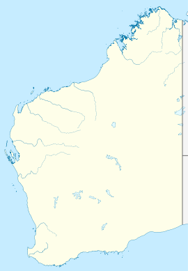
| Location: | 424 km (263 mi) NNW of Perth |
| LGA: | Geraldton-Greenough |
| State District: | Geraldton |
| Federal Division: | Durack |
Geraldton is a city and port in Western Australia located 424 kilometres (263 mi) north of Perth in the Mid West region. At the 2006 census, Geraldton has a population of 27,420,[1] making it the fourth-largest city in Western Australia.
Today the city is an important centre for mining, fishing, wheat, sheep and tourism.
Contents |
History
Though many European maritime explorers encountered or were even wrecked on the Houtman Abrolhos islands 60 kilometres (37 mi) west of Geraldton in the 17th and 18th centuries, there seems to be no evidence that any made landfall near the site of the current town. The first European to explore the area was George Grey in 1839. A decade later the explorer Augustus Gregory travelled through the area. He discovered lead on the Murchison River and the mine which was subsequently established was named Geraldine after the Governor Charles Fitzgerald. The town of Geraldton was gazetted in 1850.
Attractions
The construction of the St Francis Xavier Catholic Cathedral started in 1916 but was not completed until 1938. The cathedral was designed by Monsignor John Hawes who was both an architect and a priest. The lighthouse located on Point Moore was recently repainted and established as another cultural attraction of Geraldton.

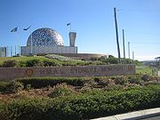
HMAS Sydney was lost off the coast north west of Geraldton in 1941, and there is a memorial overlooking the city designed and build by Joan Walsh-Smith and Charles Smith of Smith Sculptors http://www.smithsculptors.com. After years of searching, the wreck of Sydney, and her opponent, the German auxiliary cruiser Kormoran were discovered north of Geraldton, 150 kilometres (93 mi) from Shark Bay, in March 2008.
Surfing is a popular activity in and around Geraldton. Popular surf spots include Flat Rocks, Back Beach, Greenough, Glenfield and Sunset Beach. Geraldton is also an internationally renowned windsurfing location. The most popular spot is Coronation Beach, located just north of the town. "Coro" is a spectacular port tack jumping site, with flat water on the inside and unhindered Indian Ocean rolling swell offshore. In the late afternoon, the wind swings a little more offshore and starboard tack waveriding becomes possible.
Geraldton is also home to a horse racing industry, which since 1887 hosts the annual Geraldton Gold Cup. The 2007 Geraldton Gold Cup was won by 8-year-old TapDog. The race was historically significant. TapDog became the first horse to win the race three times, his trainer Clive Lauritsen became the first trainer to win the race 6 times, Roy McKay became the first jockey to win the race three times, and owners Peter Day, Jeannette Day, and Hans Hoiskar equalled the most wins by an owner in three. The race also passed the million dollar mark for the first time in tote turnover.
Facilities
The original port has been dredged to a depth of 9.4 m at the berths, which is suitable for ships of 64,000 metric tons deadweight (DWT). In 2009 the Western Australian Government gave the go-ahead for a new deepwater port at Oakajee, about 25 km north of Geraldton. This port will serve the mining industry, especially iron ore.
Geraldton has great dive sites, such as the South Tomi, sunk in 2004. These waters are said to be some of the best in the world, especially in Australia, often having over 40m visibility.
Geraldton is serviced by most mobile phone companies including Telstra, Vodafone and Optus who all provide 3G network services.[2]
The Geraldton-Greenough Regional Library is open seven days a week and provides access to knowledge, information and works of imagination to the community. It also provides free access to the Internet and is a WiFi hotspot.
Education
High Schools
| School | Year Range | Funding |
|---|---|---|
| Geraldton Senior College | 10 – 12 | Public |
| John Wilcock College | 8 – 9 | Public |
| Nagle Catholic College | 7 – 12 | Private |
| Geraldton Grammar School | Kindergarden – 12 | Private |
| Strathalbyn Christian College | Kindergarden – 12 | Private |
One of Geraldton's public high schools, John Willcock College, became the first in Australia to have a laptop programme in 2003, commencing with 60 laptops being provided to Year 8 students. John Willcock College caters for students in Years 8 and 9 with Geraldton Senior College catering for Years 10, 11, and 12. In 1970, Ernie Dingo came to Geraldton where he boarded at John Frewer Hostel for three years whilst attending Geraldton Senior College. Some of the private schools include: Nagle Catholic College, Geraldton Grammar School and Strathalbyn Christian College.
Nearby
North of Geraldton is the town of Northampton, as well as the Hutt River Province, an area which claims to be an independent nation since its self-proclaimed secession from Western Australia in 1969. The Houtman Abrolhos islands are 60 km to the west of Geraldton. They are famous for the 1629 wreck of the Batavia. A stone portico recovered from the wreck has been reconstructed at the local museum, along with other artefacts. Twenty-five kilometres south of Geraldton, near Walkaway, a windfarm was completed in August 2005. It consists of 54 turbines, each producing 1.8 MW and 80 metres high with 40 metre blades.
Australian Defence Satellite Communications Station
The Australian Defence Satellite Communications Station (ADSCS) is located at Kojarena, inland near Geraldton. The ADSCS is part of the US signals intelligence and analysis network ECHELON.[3][4] The station has four satellite tracking dishes which intercept communications from Russian, Chinese, Japanese, Indian and Pakistani regional satellites [5] and international communications satellites (INTELSATs and COMSATs), throughout the Indian Ocean and South-East Asian regions. Staff are drawn from the U.S. National Security Agency and the Australian Defence Signals Directorate, and the site is operated under the UKUSA Agreement.[6]
On 15 February 2007, it was announced that a new US military communications base would be built in Geraldton, after three years of secret negotiations between the US and the Australian Federal Government.[7]
Transport
Geraldton has a public bus service run by TransGeraldton and is connected to Perth with coach services N1, N2 and N3 provided by Transwa. Skywest Airlines provides services from Geraldton Airport; the airport is also used for general aviation.
Media
Radio
Radio services available in Geraldton:
- 6 TTT (97.3FM) - (Community Access Radio Station)
- ABC Midwest & Wheatbelt (6GN 828 AM ) - Part of the ABC Local Radio Network.
- ABC Radio National - (6ABCRN 99.7 FM) - Speciality talk and music.
- Triple J - (6JJJ 98.9 FM ) - Alternative music
- ABC News Radio - (6PNN 101.3 FM) - Rolling News bulletins, news magazine programs and LIVE coverage from Federal Parliament House of Representatives.
- ABC Classic FM - (6ABCFM 94.9 FM) - Classical and Jazz Music.
- WAFM (96.5FM) - Top 40 Music
- The Spirit Network (Radio 6BAY FM 98.1 \ 1512 AM ) - Classic Hits / Adult Contemporary Music format aimed at 35 years + audience.
- Radio Mama- 100.5FM- Indigenous Community station
'
Television
Television services available in Geraldton:
- The Australian Broadcasting Corporation (ABC) - ABC1, ABC2, ABC3, ABC News 24 (digital channels)
- The Special Broadcasting Service (SBS) - SBS One, SBS Two, SBS HD (digital channels)
- WIN Television, a dual affiliate of both the Nine Network and Network Ten.
- GWN Television (Golden West Network), an affiliate of the Seven Network. Previously GTW-11 based on Fifth Street at Wonthella.
The programming schedule is mainly the same as the Seven, Nine and Ten stations in Perth with variations for News bulletins, sport telecasts such as the Australian Football League and National Rugby League, children's and lifestyle programs and infomercials or paid programming.
Both GWN and WIN provide local news services that screen Monday to Friday. GWN News screens at 5.30pm live from Bunbury before Seven News Perth. WIN News screens at 6.30pm following Nine News Perth.
Newspapers
The Geraldton Guardian is the local newspaper for Geraldton and the wider Mid West \ Wheatbelt region.
Newspapers from Perth including The West Australian and The Sunday Times are also available, as well as nationals such as The Australian and The Australian Financial Review.
Magazines
JAM Magazine is a free monthly Midwest lifestyle magazine available in Geraldton and its surrounds.
Yamaji News is a fortnightly Geraldton newspaper presenting the issues and stories affecting Indigenous people in Australia.
Notable residents
- Edith Cowan: First woman elected to the Australian Parliament
- Chris Mainwaring: AFL Footballer with the West Coast Eagles
- Tasma Walton: Actress and wife of talk show host Rove McManus
Climate
Geraldton lies in the transition stages between a Mediterranean and a semi-arid climate. In the wintertime, the temperature is rather mild, averaging around 20 degrees with most of the yearly rainfall in this period. In contrast, summer in Geraldton brings you warm conditions that average 31-32 degrees, with hardly any rainfall.
| Climate data for Geraldton | |||||||||||||
|---|---|---|---|---|---|---|---|---|---|---|---|---|---|
| Month | Jan | Feb | Mar | Apr | May | Jun | Jul | Aug | Sep | Oct | Nov | Dec | Year |
| Record high °C (°F) | 47.7 (117.9) |
47.3 (117.1) |
45.2 (113.4) |
39.4 (102.9) |
36.6 (97.9) |
29.5 (85.1) |
29.0 (84.2) |
31.6 (88.9) |
36.1 (97) |
40.7 (105.3) |
43.8 (110.8) |
46.8 (116.2) |
47.7 (117.9) |
| Average high °C (°F) | 31.6 (88.9) |
32.5 (90.5) |
30.9 (87.6) |
27.6 (81.7) |
24.0 (75.2) |
20.9 (69.6) |
19.5 (67.1) |
20.0 (68) |
22.0 (71.6) |
24.4 (75.9) |
27.1 (80.8) |
29.4 (84.9) |
25.8 (78.4) |
| Average low °C (°F) | 18.3 (64.9) |
19.1 (66.4) |
17.9 (64.2) |
15.4 (59.7) |
12.9 (55.2) |
11.0 (51.8) |
9.5 (49.1) |
8.9 (48) |
9.2 (48.6) |
10.9 (51.6) |
13.8 (56.8) |
16.3 (61.3) |
13.6 (56.5) |
| Record low °C (°F) | 9.4 (48.9) |
10.0 (50) |
8.8 (47.8) |
6.1 (43) |
2.1 (35.8) |
0.5 (32.9) |
-0.4 (31.3) |
1.2 (34.2) |
1.2 (34.2) |
2.4 (36.3) |
3.8 (38.8) |
7.7 (45.9) |
-0.4 (31.3) |
| Precipitation mm (inches) | 5.7 (0.224) |
11.0 (0.433) |
15.9 (0.626) |
24.1 (0.949) |
69.9 (2.752) |
100.4 (3.953) |
92.7 (3.65) |
64.5 (2.539) |
32.5 (1.28) |
19.0 (0.748) |
9.3 (0.366) |
5.4 (0.213) |
448.6 (17.661) |
| Source: [8] | |||||||||||||
Images of Geraldton
|
Bill Sewell Complex |
Windfarm |
 St Francis Xavier Cathedral |
References
- ↑ 1.0 1.1 Australian Bureau of Statistics (25 October 2007). "Geraldton (Urban Centre/Locality)". 2006 Census QuickStats. http://www.censusdata.abs.gov.au/ABSNavigation/prenav/LocationSearch?collection=Census&period=2006&areacode=UCL509400&producttype=QuickStats&breadcrumb=PL&action=401. Retrieved 15 April 2010.
- ↑ Obtained from respective carriers coverage maps.
- ↑ "Tracking down the masters of terror". The Age. 17 March 2003. http://www.theage.com.au/articles/2003/03/16/1047749659596.html. Retrieved 2008-02-22.
- ↑ Adshead, Gary (10 June 2001). "Secret WA spy base". The Sunday Times: p. 20.
- ↑ Interception of satellite communications Ing Manuel Cereijo, May 29, 2006 The Cuban American National Federation archived version
- ↑ "ECHELON Main Stations". World-Information.Org. http://world-information.org/wio/infostructure/100437611746/100438659207/?ic=100446325884. Retrieved 2010-07-06.
- ↑ Brendan Nicholson. US gets military base in Western Australia. The Age, 15 February 2007
- ↑ "Geraldton climate". http://www.bom.gov.au/climate/averages/tables/cw_008051_All.shtml.
External links
- City of Geraldton-Greenough
- the411.com.au - Geraldton Events
- Western Australian Museum - Geraldton
- HMAS Sydney II Memorial Geraldton
- Geraldton Port Authority
- Geraldton-Greenough Regional Library
- Map
|
||||||||||||||
|
||||||||||||||||||||||||||