Cuiabá
| Cuiabá | |||
|---|---|---|---|
| — Municipality — | |||
| The Municipality of Cuiabá | |||
 |
|||
|
|||
| Nickname(s): "Green City" | |||
 |
|||
| Coordinates: | |||
| Country | |||
| Region | Central-West | ||
| State | |||
| Founded | January 1 1727 | ||
| Government | |||
| - Mayor | Wilson Santos (PSDB) | ||
| Area | |||
| - Total | 3,538 km2 (1,366 sq mi) | ||
| Elevation | 165 m (541 ft) | ||
| Population (2000) | |||
| - Total | 542,861 | ||
| - Density | 153.4/km2 (397.3/sq mi) | ||
| Time zone | UTC-4 (UTC-4) | ||
| - Summer (DST) | UTC-3 (UTC-3) | ||
| Postal Code | 78000-000 | ||
| Area code(s) | +55 65 | ||
| HDI (2000) | 0.821 – high | ||
| Website | Cuiabá, Mato Grosso | ||
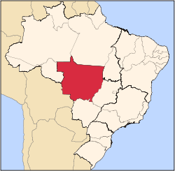
Cuiabá is the capital city of the Brazilian state of Mato Grosso. It is located in the exact centre of South America and is in conurbation with the neighbouring town of Várzea Grande.
The name is of obscure Indian origin, reportedly meaning "arrow-fishing" and alludes to the Bororo custom of using arrows to fish. Another version says that there was an Indian group called Ykuiapá. Others say that a Portuguese man was taking a bath in the river using a kind of plate made with half coconut (named cuia), and the stream took it, and the man said: Cuia ba (something like "the cuia is gone"). The largest pole of tourism, economy, agro industry, trade and culture of the State.
The new Marechal Rondon International Airport connects Cuiabá with many Brazilian cities and also operates some international flights.
The city is home to the Federal University of Mato Grosso.
Contents |
History

Cuiabá was founded on January 1, 1727 by Rodrigo César de Menezes, then the "captain" of the captaincy of São Paulo in the aftermath of the discovery of gold mines. It was given township status in 1818 and became the capital in 1835.
Since the late eighteenth century, until the time of the Paraguay War, the town remained small and in decline. The war, however, brought some infra-structure and a brief period of economic boom, supplying sugar, foodstuffs and timber to the Brazilian troops.
After the war the town was once again forgotten by the rest of the country, to such an extent that the Imperial and later the Republican governments of Brazil used to use it as an exile for troublesome politicians. Isolation allowed it to preserve a lot of the oldest Brazilian ways of life until way into the twentieth century.
Starting from 1930, isolation was broken by road and later by aviation. The town became a city and would grow quite rapidly from 1960 onwards, after the installation of the Brazilian capital in Brasilia.

In the 1970s and 1980s, the pace of growth kept increasing as agriculture became commercialized, using the roads to sell the soybeans and the rice produced abroad. The growth was such that from 1960 to 1980 the small town of 50,000 inhabitants became a behemoth with more than a quarter of a million inhabitants (including surrounding area and towns).
Since 1990, the rate of population growth has decreased, as other towns in the state have begun to attract more immigration than the capital. Tourism has emerged as a source of income and environmental issues have become a concern for the first time.
Geography

.jpg)
| Cuiabá | ||||||||||||||||||||||||||||||||||||||||||||||||||||||||||||
|---|---|---|---|---|---|---|---|---|---|---|---|---|---|---|---|---|---|---|---|---|---|---|---|---|---|---|---|---|---|---|---|---|---|---|---|---|---|---|---|---|---|---|---|---|---|---|---|---|---|---|---|---|---|---|---|---|---|---|---|---|
| Climate chart () | ||||||||||||||||||||||||||||||||||||||||||||||||||||||||||||
|
||||||||||||||||||||||||||||||||||||||||||||||||||||||||||||
|
||||||||||||||||||||||||||||||||||||||||||||||||||||||||||||
Cuiabá borders the towns of Chapada dos Guimarães, Campo Verde, Santo Antônio do Leverger, Várzea Grande, Jangada and Acorizal. It is the place of intersection of many major roads, and waterways, although because of sand banks along the river, it does not support medium or large ships anymore.
The third most important airport of the Brazilian Mid-West region is there, as well as the heart of an important agricultural produce area. It is also the geographic centre of South America and is famous throughout Brazil as the country's hottest metropolis, where temperatures are often above 40°C (104°F).
The town is in the transition zone between three of the most characteristic Brazilian ecosystems: Amazonia, Cerrado and Pantanal. It is also close to the mountain range known as Chapada dos Guimarães (which blocks polar masses and causes the extremely hot weather).
Cuiabá is also known as the Southern gate to the Amazon.
Climate
This climate is tropical climate semi-humid, hot, and notedly seasonal, with a dry winter season from May through September or October. The annual rainfall is 1.500 mm. January is the warmest month, with mean maxima of 32°C (89.6°F) and minima of 24°C (75.2°F) and more rain; July experiences the coldest temperatures, with mean maxima of 31°C (87.8°F) and minima of 17°C (62.6°F) and sun.
Vegetation
Cerrado includes various types of vegetation. It is characterized by extensive savanna formations crossed by gallery forests and stream valleys. Humid fields and "buriti" palm paths are found where the water table is near the surface. Alpine pastures occur at higher altitudes and mesophytic forests on more fertile soils.
The "cerrado" trees have characteristic twisted trunks covered by a thick bark, and leaves which are usually broad and rigid. Many herbaceous plants have extensive roots to store water and nutrients. The plant's thick bark and roots serve as adaptations for the periodic fires which sweep the cerrado landscape. The adaptations protect the plants from destruction and make them capable of sprouting again after the fire.
Economy


The economy of Cuiabá is centralized in commerce, services and industry. Commerce and Services based in Cuiabá are important to the whole State, because population is divided in several small agriculture-centered cities. These people often travel to the capital to get these services and buy goods not sold anywhere else. The industrial sector is represented, basically, by the agro-industry, specially food-processing. Many industries, mainly those that should be maintained far from the populous areas, are installed in the Industrial District of Cuiabá (DIICC), created in 1978. Even though it's located in one of the most agriculture-prone States of Brazil, Cuiabá itself has only small vegetable farms, mainly family or cooperative-based. The city, with a GDP of 4.75 billion reais in 2003, according to the IBGE, is responsible for 21.99% of the total of the State GDP. Greater Cuiabá possesses, currently, four shopping centers registered in the HUGS (Brazilian Association of Shopping Centers), and another 8 commercial galleries.
The GDP for the city was R$ 7,189,521,000 (2006).[1]
The per capita income for the city was R$ 13,244 (2006).[2]
Education

Portuguese is the official national language, and thus the primary language taught in schools. But English is part of the official high school curriculum.
Educational Institutions
- Universidade de Várzea Grande (UNIVAG) (private)
- Universidade Federal de Mato Grosso (UFMT) (Public);
- Universidade de Cuiabá (Unic) (Private);
- Universidade Cândido Rondon (Private);
- and many others (mostly private).
Culture


There is a very rich local culture based on Portuguese, African and Indian influences. Cuiabá has an interesting Indian (native American) influenced cuisine, native dances, craftwork and music. Local dance and music were traditionally connected to the worship of Catholic saints, like Saint Benedict (the city's patron), but today is secular. In August 2007, an important Italian wind orchestra performed the Orchestra Fiati Giovanile Italiana e Coro "I Music Piemonteis" conducted by Ugo Bairo and his choir, conducted by Carmelo Luca Sambataro.
Museums
- Museum Hill of the Box Of water;
- Memorial of Mato Grosso;
- Museum of the Image and Sound of Cuiabá;
- It marries of the Artisan;
- Museum of Rio Cuiabá and Municipal Aquarius;
- Memorial of the Waters;
- Museum of the Education and Teatro Maria of Arruda Müller;
- Museum of Sacred Art of Cuiabá;
- Museu Couto Magalhães;
- Memorial Papa João Paulo II;
- Historical and Geographical institute of Mato Grosso and Museu Barão of Melgaço;
- Institute of the Historical and Environmental Patrimony National–Cuiabá;
- Palace of the Instruction;
- Museum of the History of Mato Grosso;
- Cine Teatro of Cuiabá and Museum of the Movies;
- SESC/Arsenal and Museum of the Swampland.
Carnival
The four-day period before Lent leading up to Ash Wednesday is carnival time in Brazil. As with other capitals in Brazil, there are parties everywhere (os Bailes de Carnaval). Also like many other cities in Brazil, Cuiabá holds its own off-season Carnaval ("Carnaval fora de época", or "micareta"), called Micarecuia.
Sports
Cuiabá is one of 12 cities chosen to host games of the 2014 FIFA World Cup, which take place in Brazil.
International Airport
Marechal Rondon International Airport connects Cuiabá with many Brazilian cities and also operates some international flights. The runway at Marechal Rondon International Airport was opened to traffic in 1956. In February 1975, Infraero took over the airport's administration and began various upgrades to meet the needs of the airport complex. As of 1996, Marechal Rondon Airport, located 10 km (6.21 mi) from the city center, started receiving international flights. Currently it serves more than 900 thousand passengers a year.
Images
 |
 Cuiaba's Skyline. |
.jpg) Americas Garden. |
 The city at night. |
 Street Art in Cuiabá. |
 City Skyline. |
 Sérgio Motta Bridge. |
References
- ↑ (in Portuguese) (PDF) GDP. Cuiabá, Brazil: IBGE. 2006. ISBN 85-240-3919-1. http://www.ibge.gov.br/home/presidencia/noticias/noticia_impressao.php?id_noticia=1288. Retrieved 2009-07-18.
- ↑ (in Portuguese) (PDF) per capita income. Cuiabá, Brazil: IBGE. 2006. ISBN 85-240-3919-1. http://www.ibge.gov.br/home/presidencia/noticias/noticia_impressao.php?id_noticia=1288. Retrieved 2009-07-18.
Distances
From São Paulo - 1690 km (1,050 miles) From Rio de Janeiro - 2090 km (1,298 miles) From Brasília - 1130 km (702 miles)
External links
- (Portuguese) Official Website
- (Portuguese) Local Newspaper Diário de Cuiabá Site
- Cuyaba - Catholic Encyclopedia article on the diocese
 |
Acorizal | Rosário Oeste | Chapada dos Guimarães |  |
| Jangada | Campo Verde | |||
| Várzea Grande | Santo Antônio do Leverger |
|
||||||||||||||||||||||||||||||||||||||
|
||||||||||||||||||||||||||||||||
|
||||||||||||||||||||
|
|||||||||||
|
||||||||||||||||||||||||||||||||||||||||||||||||||||||||||||||||||||||||||||||||||||


.jpg)
