Banjul
| Banjul | |
|---|---|
 |
|
 |
|
 Banjul
|
|
| Coordinates: | |
| Country | The Gambia |
| Division | Banjul |
| Area | |
| - Urban | 35.9 sq mi (93 km2) |
| Population (2003) | |
| - City | 34,828 |
| - Density | 970/sq mi (374.5/km2) |
| - Urban | 357,238 |
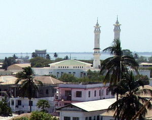
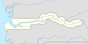
Banjul (formerly Bathurst), officially the City of Banjul, is the capital of The Gambia, and is in the division of the same name. The population of the city proper is only 34,828, with the Greater Banjul Area, which includes the City of Banjul and the Kanifing Municipal Council, at a population of 357,238 (2003 census).[1] Banjul is on St Mary's Island (Banjul Island), where the Gambia River enters the Atlantic Ocean. The island is connected to the mainland — by passenger and vehicle ferries to the north and by bridges to the south.
Contents |
Etymology
Banjul takes it name from the Mandé people who gathered specific fibres on the island which were used in the manufacture of ropes. Bang julo is the mandinka (mande) word for fibre. The mispronounciation led to the word Banjul. Banjul is the Mande word for fibre.
History
In 1816, the British founded Banjul as a trading post and base for suppressing the slave trade. It was first named Bathurst after Henry Bathurst, the secretary of the British Colonial Office, but was changed to Banjul in 1973.[2]
On July 22, 1994 Banjul was the scene of a bloodless military coup d'état in which President Dawda Jawara was overthrown and replaced by the country's current President Yahya Jammeh. To commemorate this event, Arch 22 was built as an entrance portal to the capital. The gate is 35 metres tall and the centre of an open square. It houses a textile museum.
Attractions in the city include the Gambian National Museum, the Albert Market, Banjul State House, Banjul Court House, African Heritage Museum, two cathedrals and several major mosques.[3]
It is the destination of the Plymouth-Banjul Challenge, a charity road rally.
Economy
Banjul is the country's economic and administrative centre and includes the Central Bank of The Gambia. Peanut processing is the country's principal industry, but beeswax, palm wood, palm oil, and skins and hides are also shipped from Banjul's port.[4]
Climate
Banjul has a very warm climate year round. Under the Koppen climate classification, Banjul features a tropical wet and dry climate. The city features a lengthy dry season, spanning from November to June and a relatively short wet season covering the remaining four months. However, during the four months, Banjul tends to see heavy precipitation. August is usually Banjul’s rainiest month, with on average 500 mm of precipitation falling. Temperatures are somewhat constant, though it tends to be slightly cooler during the wet season than the dry season.
| Climate data for Banjul | |||||||||||||
|---|---|---|---|---|---|---|---|---|---|---|---|---|---|
| Month | Jan | Feb | Mar | Apr | May | Jun | Jul | Aug | Sep | Oct | Nov | Dec | Year |
| Source: BBC Weather [5] | |||||||||||||
Transport


Ferries sail from Banjul to Barra. The city is served by the Banjul International Airport. Banjul is on the Trans-West African Coastal Highway connecting it to Dakar and Bissau, and will eventually provide a paved highway link to 11 other nations of ECOWAS.
Banjul International Airport was one of the primary Transoceanic Abort Landing (TAL) sites for the Space Shuttle. It was selected in September 1987, replacing a TAL site at Dakar, Senegal, due to runway deficiencies and geographic hazards there. Banjul was closed as a TAL site in November 2002.
Districts

Banjul Division (Greater Banjul Area) is divided into two districts:
- Banjul
- Kanifing
Sister cities
.svg.png) Ostend (Belgium)[6]
Ostend (Belgium)[6] Grimsby (UK)
 Newark, New Jersey (United States).
 Taipei, (Taiwan) since 1997.
See also
- Divisions of The Gambia
- Districts of The Gambia
References
- ↑ Gambia Divisions
- ↑ History of Banjul
- ↑ Banjul Gambia - Travel Information
- ↑ State Department Information
- ↑ "Average Conditions Banjul, Gambia". BBC Weather. http://www.bbc.co.uk/weather/world/city_guides/results.shtml?tt=TT000230. Retrieved August 16, 2009.
- ↑ Cooperation is established in ICT-infrastructure for the B.C.C. and other projects for capacity building. Ostend-based humanitarian organisation Medios vzw is supporting the Female Surgical Ward of the Royal Victoria Teaching Hospital. (more info on http://stedenband.oostende.be)
External links
|
||||||||||||||||||||||||||||
|
||||||||