Antofagasta
| Antofagasta | |||
|---|---|---|---|
| — Commune — | |||
 |
|||
|
|||
| Nickname(s): La perla del Norte ("Pearl of the North") | |||
| Motto: "Gloria, patria y tesón es tu lema y tu honor" ("Glory, motherland and tenacity is your motto and your honor") |
|||
 |
|||
 Antofagasta
|
|||
| Coordinates: | |||
| Country | Chile | ||
| Region | Antofagasta | ||
| Province | Antofagasta | ||
| Settled | October 22, 1868 | ||
| Capital | Antofagasta | ||
| Government | |||
| - Type | Municipal council | ||
| - Mayor | Marcela Hernando | ||
| Area[1] | |||
| - Commune | 30,718.1 km2 (11,860.3 sq mi) | ||
| Population (2002)[1] | |||
| - Commune | 296,905 | ||
| - Density | 9.7/km2 (25/sq mi) | ||
| - Urban | 0 | ||
| - Rural | 1,113 | ||
| Sex[1] | |||
| - Male | 153,220 | ||
| - Female | 143,685 | ||
| Time zone | CLT (UTC-4) | ||
| - Summer (DST) | CLT (UTC-3) | ||
| Website | http://www.municipalidadantofagasta.cl/ | ||
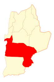
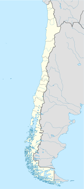
Antofagasta (Spanish pronunciation: [antofaˈɣasta] (![]() listen) or (antofaˈɣaʔta) in the local dialect) is a port city in northern Chile, about 700 miles (1,130 km) north of Santiago. It is the capital of both Antofagasta Province and Antofagasta Region. According to the 2002 census, the city has an urban population of 281,155 and a municipal population of 296,905[1]. The city's name comes from either a Quechua or Aymara word for "town of the great saltpeter bed."
listen) or (antofaˈɣaʔta) in the local dialect) is a port city in northern Chile, about 700 miles (1,130 km) north of Santiago. It is the capital of both Antofagasta Province and Antofagasta Region. According to the 2002 census, the city has an urban population of 281,155 and a municipal population of 296,905[1]. The city's name comes from either a Quechua or Aymara word for "town of the great saltpeter bed."
Contents |
Geography

Antofagasta is a long and narrow city located south of the Mejillones Peninsula and north of the Cerro Coloso, 700 miles (1,130 km) north of Santiago. The city is bordered on the east by steep hills that are part of Chile's Cordillera de la Costa, and on the west by the Pacific Ocean.
Antofagasta lies in the Atacama Desert, which is among the Earth's driest regions. According to The Chilean Geological Magazine, annual rainfall in the city averages less than 4 mm, and there was a period of 40 years when no rain fell. [1]
Mejillones is a small port 65 km to the north, on the northern part of Península de Mejillones. About 90 km north of Antofagasta is Hornitos, a beach that attracts both the tourists and locals. Tocopilla is a coastal city 188 km north of Antofagasta. Calama, the second-largest city in the Antofagasta Region, is 213 km northeast of the regional capital. La Negra is a medium-sized industrial complex approximately 10 km south-east of Antofagasta, on the Pan-American Highway.
History
The first native inhabitants were the Changos, who fished, gathered shellfish, and hunted sea lions. The region was also part of the Incan Empire.
Antofagasta was founded on October 22, 1868 by Bolivian President Mariano Melgarejo to create a port that would provide an outlet for salpeter (nitrate) exports and establish control over an area where Chileans had settled and were smuggling this material. Antofagasta's original name was "la Chimba," though the area was previously known as Peñas Blancas (Spanish for "White Boulders"). It was part of the Litoral Department of Bolivia until February 14, 1879, when it was occupied by Chilean troops. This event marked the beginning of the War of the Pacific. Antofagasta is sometimes referred to as the Captive Province in Bolivia. Different Bolivian administrations have made diplomatic efforts to recover Antofagasta.
Administration

The commune of Antofagasta belongs to 2ª circunscripción (II Region of Antofagasta), which is represented in Senado by the senators Carlos Cantero (RN Renovation) and José Antonio Gómez (PRSD). Of equal way, the commune is part of distrito number 4, which is represented in Cámara de Diputados of Congreso Nacional by the deputies Manuel Rojas (UDI) and Pedro Araya (PDC)
Economy
.jpg)
Antofagasta's economic development has been based on extraction of raw materials. Primary extraction has shifted from guano to potassium nitrate (saltpeter) to copper. Antofagasta was formerly known as the main copper port of Chile, however, in recent years Mejillones have taken the leadership in copper transportation mainly due major infrastructure investment in that area (including a new port called "Megapuerto de Mejillones"). The city's economic mainstay is based on providing housing and services to the mining operations surrounding the city.
Antofagasta's industrial complex is north of the city. The city has a small agricultural zone in Quebrada La Chimba.
Demographics
According to the 2002 census, Antofagasta has a municipal population of 296,905, and a greater conurbation population of 318,779[1], making it the fourth-largest city in Chile. Its inhabitants are primarily Chilean, with significant Croatian and Greek minorities. Because there are several large mines near Antofagasta, temporary migrant workers in the mines form a significant portion of residents.
Transportation
Antofagasta has an airport, Cerro Moreno International Airport, with civilian and military operations. The city also has two seaports: one is a government-owned port near downtown Antofagasta; the other is part of La Escondida copper mine and is located south of the city, near Cerro Coloso.
North of the city, along the seacoast, is a natural monument that features a large rock with a wave-created opening, called La Portada de Antofagasta ("The Doorway to Antofagasta").
Railways
An important railway, Ferrocarril de Antofagasta a Bolivia runs east to Bolivia, used to haul minerals over the high Andes. The history of the railway dates back to 1872 with the grant of a concession by the government of Bolivia to Melbourne Clarke & Co, the territory around Antofagasta being part of Bolivia at this date. The railway was organised as the Antofagasta Nitrate & Railway Company. Construction started in 1873, with the first section opening late in that year, motive power provided by mules. Steam locomotives were introduced in 1876, and by 1879 the railway had extended about 150 km into the interior. War broke out in 1879 between Chile on one side, and Peru and Bolivia on the other. One of the causes of the war was an attempt by the Bolivian government to levy back taxes on the railway.
The line east was 2 foot 6 inch gauge, while the lines in Chile Littoral were meter gauge.
Buses provide transportation within the city. There are several private lines that run on set routes. Buses routes are usually marked on the passenger side of the windshield. Coach-styled buses are available for longer inter-city trips.
Colectivos are also available.
Education
The city has several public and private educational facilities. Two major public universities (Universidad Católica del Norte and Universidad de Antofagasta) operate in the city. Several private universities (Universidad del Mar, Universidad Mayor, and others) have been open since 2002. Previously, the now-defunct Universidad José Santos Ossa was the only private university in Antofagasta.
Although the public schools are distributed almost uniformly throughout the city, private schools operate mainly in the central and southern part of the city, where the wealthiest inhabitants reside.
Gallery
|
Antofagasta is bordered by the Pacific Ocean on the west and steep hills to the east |
 Plaza and cathedral |
 San Jose cathedral |
.jpg) La Portada de Antofagasta |
.jpg) Japanese Park |
 Bus in Antofagasta |
 Mall on Arturo Prat |
 Hotel Antofagasta |
 Antofagasta's coastal edge |
The Port's southern area. |
Antofagasta's airport "Cerro Moreno Airport" |
 Antofagasta's Regional Stadium. |
Mall Plaza Antofagasta |
Mano del Desierto 75 km south of the city |
References
- ↑ 1.0 1.1 1.2 1.3 1.4 (Spanish) "Instituto Nacional de Estadísticas". http://www.ine.cl/canales/chile_estadistico/censos_poblacion_vivienda/censo_pobl_vivi.php. Retrieved 18 April 2010.
![]() This article incorporates text from a publication now in the public domain: Chisholm, Hugh, ed (1911). Encyclopædia Britannica (Eleventh ed.). Cambridge University Press.
This article incorporates text from a publication now in the public domain: Chisholm, Hugh, ed (1911). Encyclopædia Britannica (Eleventh ed.). Cambridge University Press.
|
|||||||||||||
|
|||||

