Zamboanga Sibugay
| Province of Zamboanga Sibugay | |
Provincial seal of Zamboanga Sibugay |
|
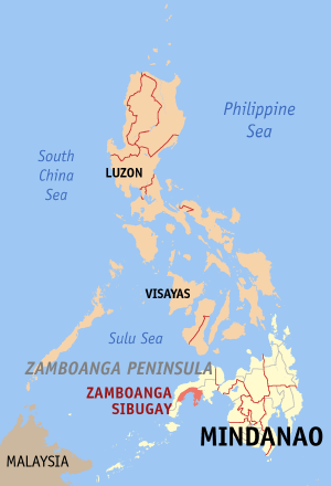 Map of the Philippines with Zamboanga Sibugay highlighted |
|
| Region | Zamboanga Peninsula |
| Capital | Ipil |
| Divisions | |
| - Highly urbanized cities | 0 |
| - Component cities | 0 |
| - Municipalities | 16 |
| - Barangays | 388 |
| - Congressional districts | 2 |
| Population | 29th smallest |
| - Total (2007) | 497,239 |
| - Density | 161 /km² (417 /sq mi) (29th lowest) |
| Area | 44th largest |
| - Total | 3,087.9 km2 (1,192 sq mi) |
| Founded | February 22, 2001 |
| Spoken languages | Cebuano, Chavacano, Tagalog, Spanish and English |
| Governor | George T. Hofer |
Zamboanga Sibugay is a province of the Philippines located in the Zamboanga Peninsula region in Mindanao. Its capital is Ipil and it borders Zamboanga del Norte to the north, Zamboanga del Sur to the east and Zamboanga City to the southwest. To the south lies Sibuguey Bay in the Moro Gulf. Zamboanga Sibugay was created in 2001 when the third district of Zamboanga del Sur split off. Zamboanga Sibugay is the 79th province created in the Philippines.
Contents |
Demographics
As of the 2000 census, Zamboanga Sibugay has a population of 497,239 people, and a population density of 161/km². It is ranked 29th among the provinces of the Philippines in terms of both population and population density. The annual population growth rate is 2.09%.
The major languages spoken in the province are Subanen Cebuano and Ilonggo. Chavacano Tagalog, Ilocano and other ethnic tongues are spoken as well. While English language is widely spoken too.
Economy
The leading industries are in the areas of bakery, rice and corn milling, food processing, and rattan and wood furniture production. New industries include concrete products, garments, wax and candle factory, and other cottage industries.
Major crops produced include rice, corn, coconuts, rubber, fruit trees, vegetables, tobacco, coffee, cacao, and root crops. Livestock and poultry productions are predominantly small-scale backyard operations.Coal mining is also present in some areas of the province.
Geography
Zamboanga Sibugay has an approximate total land area of 3228.3 km² accounting for about 37.82% of the mother province of Zamboanga del Sur. It is geographically located at 123o 04’ 49.75” longitude and at 7o 42’ 14.89” latitude. To the north it intersects the common municipal boundaries of Kalawit, Tampilisan, and Godad in Zamboanga del Norte. In the west, it is bounded by the municipalities of Siraway, Siocon, and Balinguian, and the province of Zamboanga del Norte. On the south it is bounded by Sibuguey Bay. In the east, the municipalities of Bayog and Kumalarang both in the province of Zamboanga del Sur bound it. It is further bounded on the southwest by Zamboanga City.
Political
Zamboanga Sibugay is subdivided into 16 municipalities.
|
|
These municipalities are further subdivided into 389 barangays. The province comprises two (2) congressional district.
Physical
Zamboanga Sibugay has a land area of 3,087.9 km². It is geographically located at 123°04'49"N and 7°42'14"E. It is bounded on the north and west by Zamboanga del Norte; on the east by Zamboanga del Sur; on the south by the Sibuguey Bay; and on the southwest by Zamboanga City.
The climatic condition of the province is moderately normal (climate type III). Annual rainfall varies from 1,599 mm to 3,500 mm. Temperature is relatively warm and constant throughout the year ranging from 22o C to 35o C. The province is situated outside the country's typhoon belt.
History
The area of Zamboanga Sibugay was formerly a part of Zamboanga del Sur. Attempts to divide Zamboanga del Sur into separate provinces date as far back as the 1960s. Several bills were filed in congress, but remained unacted. The new province was finally created by Republic Act No. 8973 on February 22, 2001.
External links
- WOW Philippines - Zamboanga Sibugay
- Ipilenyos Forum Website - Please visit and register to start posting
Online news
|
|||||