Zambales
- For the mountain chain, see Zambales Mountains. For the ethnic group, see Sambal people.
| Province of Zambales | |
Provincial seal of Zambales |
|
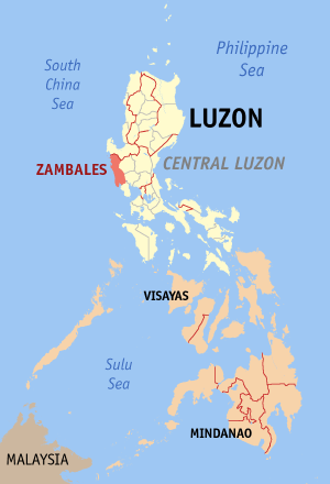 Map of the Philippines with Zambales highlighted |
|
| Region | Central Luzon (Region III) |
| Capital | Iba |
| Divisions | |
| - Highly urbanized cities | 1 |
| - Component cities | 0 |
| - Municipalities | 13 |
| - Barangays | 247 |
| - Congressional districts | 2 |
| Population | 39th largest |
| - Total (2007) | 627,802 |
| - Density | 169 /km² (438 /sq mi) (49th highest) |
| Area | 35th largest |
| - Total | 3,714.4 km2 (1,434 sq mi) |
| Founded | 1578 |
| Spoken languages | Tagalog, Sambal, Ilocano, Kapampangan, Pangasinan, Tina, English |
| Governor | Amor Deloso (Liberal) |
Zambales is a province of the Philippines located in the Central Luzon region. Its capital is Iba. Zambales borders Pangasinan to the north, Tarlac and Pampanga to the east, and Bataan to the south. The province lies between the South China Sea and the Zambales Mountains. With a land area of 3,700 km, Zambales is the second largest among the seven provinces of Central Luzon. It has a population density of 170 people per square kilometer², one of the lowest in the country. The province is noted for its mangoes, which are abundant from January to April.
Zambales is served by the Subic Bay International Airport, which is located in Subic, Zambales and part of Bataan province. Subic Bay Freeport Zone is host to many tourist attractions which include casinos, beach resorts, parks, beachside huts and cottages and historical artifacts.
Contents |
Tourist Attractions
Zambales hosts 173 kilometers of beaches, with coral reefs, dive spots, surfing areas, hotels and day-use beach huts. The province is approximately a 3 to 4 hour drive from Manila, though this can vary greatly with traffic.
The "Fiesta Poon Bato," (literal translation is Feast of the Sacred Stone) held in January, is a religious festival that attracts over half a million people each year. The festival venerates Ina Poon Bato (literal translation is Mother of the Sacred Stone) also known as Nuestra Senora de la Paz y Buen Viaje (Our Lady of Peace and Good Voyage), the oldest known image of the Virgin Mother in Asia. The Barrio of Poon Bato located in the Town of Botolan, that is host to the image and the fiesta, was completely destroyed during the 1991 Mt. Pinatubo eruption. The icon was saved and moved, along with the barrio inhabitants, to nearby Loob Bunga Resettlement Area.
The "Mango Festival" is held in the provincial capital of Iba every April, and the "Domorokdok" (Sambal word for Dance) Festival is held each May in Botolan. These include street dancing, agricultural shows, competitions like sand castle building and "bikini open" beauty pageants.
The Capones Island in Barrio Pundaquit, located in the Town of San Antonio, is home to a Spanish Light House built during the 1800s.
Demographics and culture
- See also: Aeta, Sambal people, Tagalog people, Ilocano people, and Kapampangan people
The Aetas of Mount Pinatubo were the earliest inhabitants of what is now the province of Zambales. They were later displaced by the Sambal, an Austronesian people after whom the province is named. Many Sambal still believe in superstitions and mysteries that have been handed down through the generations.
The Sambal, the Tagalogs, the Ilocanos, and the Kapampangans today constitute the four largest ethnic groups in Zambales; these identities may and do, however, overlap with one another due to intermarriage[1] and other factors. Most of the people of southern Zambales are migrants from different parts of the country owing to the influx of job opportunities brought on by the U.S Subic Naval Base (San Antonio and Subic) during the American regime of the country. Many people found jobs and permanently settled there. The presence of the Americans greatly influenced the inhabitants, from their tastes in food, clothing, and style.
Respect for elders is still importantly observed. Feast days of patron saints are still being practiced in the area, and hospitable Zambaleños are very accommodating when it comes to feasts.
Language
Sambal, Tagalog, and Ilocano are the three main languages of Zambales. Ilocano has 115,337 native speakers, Sambal has 114,637, and Tagalog has 114,637 (plus 24,995 non-native speakers).[2] 119,126 spoke other languages as their mother tongue, such as Kapampangan, including non-Philippine languages such as English.[2] About 75 percent of the population speaks and understands English to varying degrees of fluency, and road signs are written in that language.
Economy
Zambales is a rich source of Nickel & Chromite.
Geography
Climate
Zambales has two pronounced seasons: dry from October to June, and wet from July to September.
Physical
Zambales lies on the western shores of Luzon island, between the Zambales Mountains and the South China Sea. Its shoreline is very ragged, and features many coves and inlets. The mountain range on the eastern part of the province occupies about 60% of its total land area. Subic Bay, in the southernmost part of the province, provides a natural harbor, and was chosen as the location of an American naval base. The peak of Mount Pinatubo lies on the intersection of the boundaries between Zambales, Pampanga, and Tarlac. This volcano, once considered dormant, erupted violently in 1991.
Political
Zambales is subdivided into 13 municipalities and 1 city. Olongapo City is a highly urbanized city and administers itself autonomously from the province. Scarborough Shoal (Panatag Shoal), a Philippine-claimed EEZ is a designated part of the province.
City:
- Olongapo
| Municipality | No. of Barangays |
Area (km²) |
Population (2000) |
Pop. density (per km²) |
||
|---|---|---|---|---|---|---|
| Botolan | ||||||
| Cabangan | ||||||
| Candelaria | 13 | |||||
| Castillejos | ||||||
| Iba | 14 | |||||
| Masinloc | ||||||
| Palauig | ||||||
| San Antonio | 14 | |||||
| San Felipe | ||||||
| San Marcelino | 18 | |||||
| San Narciso | ||||||
| Santa Cruz | ||||||
| Subic | 16 | |||||
History
The area now occupied by Zambales was first explored by the Spanish in 1572, led by Juan de Salcedo. Among the earliest towns founded were Masinloc (1607), Iba (1611), and Santa Cruz (1612). Masinloc became the province's first capital. However, the capital was moved between among the three towns during its history before settling in Iba, due to its strategic location. The first civil governor of Zambales during the American era was the Honorable Potenciano Lesaca from 1901-1903.
The province's name came from the word zambal, which is a Hispanized term for Sambali. Zambal refers to the language spoken by the early Austronesian inhabitants of the place. A contending version states that the name was derived from the word samba, meaning worship, because the Spanish supposedly found the native inhabitants to be highly superstitious; worshiping the spirits of their ancestors.
See also
- Super regions of the Philippines
References
External links
- Official Website of the Provincial Government
- Latest News in Olongapo and Zambales
- Subic Bay Philippines
- [dominicsin45.multiply.com]
- Information on Zambales
|
|||||