Widnes
| Widnes | |
|
|
|
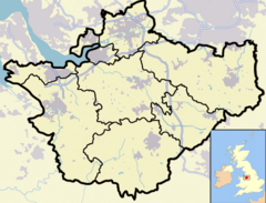 Widnes shown within Cheshire |
|
| Population | 53,410 (2001 Census) |
|---|---|
| OS grid reference | |
| Unitary authority | Halton |
| Ceremonial county | Cheshire |
| Region | North West |
| Constituent country | England |
| Sovereign state | United Kingdom |
| Post town | WIDNES |
| Postcode district | WA8 |
| Dialling code | 0151 |
| Police | Cheshire |
| Fire | Cheshire |
| Ambulance | North West |
| European Parliament | North West England |
| UK Parliament | Halton |
| List of places: UK • England • Cheshire | |

Widnes is an industrial town within the borough of Halton, in the ceremonial county of Cheshire, England, with an urban area population of 57,663 in 2004.[1] It is located on the northern bank of the River Mersey where the estuary narrows to form the Runcorn Gap. Directly to the south across the Mersey is the town of Runcorn. Upstream and 8 miles (13 km) to the east is the town of Warrington, and downstream 16 miles (26 km) to the west is the neighbouring area of Speke, of the city of Liverpool.
Historically part of Lancashire, prior to the Industrial Revolution Widnes consisted of a small number of separate settlements on land which was mainly marsh or moorland. In 1847 the first chemical factory was established and the town rapidly became a major centre of the chemical industry. The demand for labour was met by the immigration of large numbers of workers from Ireland, Poland, Lithuania and Wales. The town continues to be a major manufacturer of chemicals and there has been a degree of diversification of the town's industries.[2]
Widnes lies on the southern route of the Liverpool to Manchester railway line. The main roads passing through the town are the A557 in a north-south direction and the A562 which runs east-west. The Sankey Canal (now disused) terminates in an area of the town known as Spike Island.
Contents |
History
Toponymy
The most usual explanation for the origin of the name Widnes is that it comes from the Danish words vid, meaning wide, and noese, meaning nose and that it refers to the promontory projecting into the River Mersey. However the Widnes promontory is not particularly wide and another possible explanation is the first part derives from the Danish ved, meaning a wood and possibly referring to a tree-covered promontory. Earlier spellings of the name have been Vidnes, Wydnes and Wydness.[3]
Early history
There is little evidence of any early human occupation of the area although a flint arrowhead was discovered at Pex Hill, suggesting there was some human presence in the Stone Age.[3] Roman roads by-passed the area but some Roman coins were found where the Ditton railway station that still stands today.[4] In the 9th century Vikings had invaded the country and Widnes was at the extreme south of the Danelaw. The River Mersey derives its name from the Anglo-Saxon maeres ea, which means boundary river, the boundary being that between the Danelaw and the Saxon kingdom of Mercia.[5] At the beginning of the 20th century it was believed that some earthworks on Cuerdley Marsh had been constructed by the Vikings[6] but an archaeological investigation in the 1930s found nothing to confirm this.[7]
Following the Norman conquest, William the Conqueror granted the Earldom of Lancaster to Roger de Poictou who in turn granted the barony of Widnes to Yorfrid. Yorfrid had no sons and his elder daughter married William FitzNigel, the second Baron of Halton. On Yorfrid's death the barony of Widnes passed to that of Halton.[8] A Norman church was built in Farnworth. Its date of origin is uncertain but it is likely that this was around 1180.[9] In 1507 a grammar school was established in Farnworth with an endowment from Bishop William Smyth.[10] Until the middle of the 19th century the area consisted of the scattered hamlets of Farnworth, Appleton, Ditton, Upton and Woodend. Nearby were the villages of Cronton and Cuerdley.[11]
In the 1750s the Sankey Canal was constructed. This linked the area of St Helens with the River Mersey at Sankey Bridges, near Warrington and was in operation by 1757. It was extended to Fiddler's Ferry in 1762[12] and then in 1833 a further extension to Woodend was opened. In the same year the St Helens and Runcorn Gap Railway was opened. The railway connected St Helens with an area in Woodend which was to become known as Spike Island. The termini of the canal and railway were adjacent and here Widnes Dock, the world's first railway dock, was established.[13] Despite these transport links and the emergence of the chemical industry at nearby Runcorn and elsewhere in the Mersey Valley, the Industrial Revolution did not arrive at Widnes until 14 years later, with the arrival at Spike Island of John Hutchinson.[14]
Coming of the chemical industry

John Hutchinson built his first factory in 1847 on land between the Sankey Canal and the railway making alkali by the Leblanc process.[15] This was an ideal site for the factory because all the raw materials could be transported there by the waterways and railway, and the finished products could similarly be transported anywhere else in the country or overseas. Further chemical factories were soon built nearby by entrepreneurs including John McClelland, William Gossage, Frederic Muspratt, Holbrook Gaskell and Henry Deacon.[2] The town grew rapidly as housing and social provision was made for the factory workers. Soon the villages of Farnworth, Appleton, Ditton and Upton were subsumed within the developing town of Widnes. Woodend became known as West Bank. The substances produced included soap, borax, soda ash, salt cake and bleaching powder. Other industries developed including iron and copper works.[16] The town became heavily polluted with smoke and the by-products of the chemical processes.[17] In 1888 the town was described as "the dirtiest, ugliest and most depressing town in England"[18] and in 1905 as a "poisonous hell-town".[19]
The demand for workers meant that, in addition to people from other areas of the United Kingdom, large numbers of workers came from other countries. Initially these were Irish[20] but from the late 1880s significant numbers arrived from Poland and Lithuania who were fleeing from persecution and poverty in their home countries.[21] Immigrants also came from other areas, in particular Wales.[22] In 1890 the chemical companies making alkali by the Leblanc process combined to form the United Alkali Company. This involved practically all of the chemical industries in Widnes, which was considered to be the principal centre of the new company.[23] However during the 1890s the chemical business in Widnes went into decline as more efficient methods of making alkali were developed elsewhere.[24]
Recent history
During the early decades of the 20th century there was a revival, particularly as the United Alkali Company began to manufacture new products.[25] Improvements were being made to the structure of the town, in particular the opening of the Widnes-Runcorn Transporter Bridge in 1905 which gave the first direct link over the Mersey for road traffic.[26] In 1909 the town became the first in Britain to have a regular covered top double decker bus service.[27]
By 1919 the health of the residents of the town was improving.[28] In the 1920s and 1930s there was further diversification of the chemical industry and the products it manufactured.[29] Slums were being replaced by more and better homes.[30] After World War II more slums were cleared and there was on-going growth and variation in the chemical industry. By the 1950s the town had 45 major chemical factories.[31]
In 1961 the Silver Jubilee Bridge replaced the outdated Transporter Bridge and in recent years many of the old heavy chemical factories have closed to be replaced by more modern factories. There has been reclamation of much of the land previously polluted by the old dirty chemical processes and there have been improvements in the cleanliness and environment of the town.[32]
Governance

From Saxon times Widnes was part of the hundred of West Derby. Modern local government in the town of Widnes commenced with the creation of the Widnes Local Board in 1865, prior to which the town had been part of the administrative district of Prescot.[33] In 1892 the town received a Charter of Incorporation giving it borough status.[34] In 1974, as part of the Local Government Act 1972, Widnes Borough Council was abolished and its territory amalgamated with Runcorn to form the borough of Halton. Rather than being part of the county of Lancashire it is now a part of the ceremonial county of Cheshire. In 1998 the borough of Halton became a unitary authority.[35]
In 1885 Widnes became a parliamentary constituency and elected its first Member of Parliament.[34] Widnes is now in the European parliamentary constituency of North West England. The UK parliamentary constituency is Halton and the current Member of Parliament is Derek Twigg.[36] The local authority is the borough of Halton and the town is divided into nine electoral wards.[37]
Geography
Widnes is situated on the north bank of the River Mersey. The whole town is low-lying with some slightly higher areas in Farnworth and Appleton. To the south of the town a spur projecting into the river forms the West Bank area of Widnes; together with a spur projecting northwards from Runcorn these form Runcorn Gap, a narrowing of the River Mersey. Runcorn Gap is crossed by Runcorn Railway Bridge, carrying the Liverpool branch of the West Coast Main Line, and the Silver Jubilee Bridge, carrying the A533 road which then curves in a westerly direction towards Liverpool becoming the A562. The density of housing is generally high but there are some open green areas, including Victoria Park in Appleton and two golf courses which are geographically near the centre of the urban development. Most of the chemical and other factories are close to the north bank of the River Mersey. [38] A second crossing of the Mersey is planned, to be known as the Mersey Gateway.[39]
Drainage of the Widnes area is into the Mersey via Dutton, Steward's and Bower's Brooks. The bedrock of the area is rock from the Sherwood sandstone group. There are a few outcrops of sandstone but elsewhere the bedrock is covered by drift. Most of this consists of till except near the bank of the Mersey where it is recent alluvium. Large areas are also covered by industrial waste.[40]
When borings were made in the 1870s prior to the building of chemical works a deep gorge measuring around 100 feet (30 m) was found in the bedrock which was filled with glacial deposits. From this it was concluded that before the Ice Age the Mersey had flowed in a more northerly course, and when it was blocked by glacial deposits it had made a new channel through Runcorn Gap.[41]
Being close to the west coast and the Irish Sea, the climate is generally temperate with few extremes of temperature or weather. The mean average temperature in the years 1971 to 2000 was 9.4 to 9.7°C, which was slightly above the average for the United Kingdom[42] as was the average amount of annual sunshine at 1391 to 1470 hours.[43] The average annual rainfall was 741 to 870 mm, which was slightly below the average for the UK.[44] The average number of days in the year when snow is on the ground is 0 to 6, which is low for the United Kingdom.[45] The average number of days of air frost is 2 to 39, which is also low.[46]
Demography
Since the borough of Halton became a unitary authority in 1998, which resulted in its having one level of local government, demographic statistics have been collated for the authority as a whole, rather than separately for the towns of Runcorn and Widnes. While the two towns have different histories and come from different historic counties, their demographic features are similar.
The population of Halton in 2004 was 118,915 and it is the most densely populated district in Cheshire at 14.9 persons per hectare.[1]The change in population during the 20th century is shown in the following table.
| Year | 1901 | 1911 | 1921 | 1931 | 1941 | 1951 | 1961 | 1971 | 1981 | 1991 | 2001 | ||
|---|---|---|---|---|---|---|---|---|---|---|---|---|---|
| Population | 57,755 | 57,062 | 61,039 | 65,309 | 71,835 | 79,026 | 87,168 | 96,150 | 121,861 | 124,915 | 118,215 | ||
| Source: [47] | |||||||||||||
In 2003 Halton had the largest proportion of the population in Cheshire in the age groups under 5, 5 to 15 and 16 to pension age and, at 16.1% the lowest proportion of people at pension age or older. At 1.2% the proportion of non-white ethnic groups in 2001 equalled the lowest in all local authorities in Cheshire. At 11.5 per 1,000 population, the live birth rate in Halton and Warrington, is the highest in the county. At 121 the standardised mortality ratio and at 21.5% the percentage of persons with limiting long-term illness are considerably the highest in Cheshire.[48]
There has been an increase in the number of households from 47,214 in 1991 to 52,501 in 2006. The average household size has reduced from 2.70 in 1991 to 2.44 in 2001. 89.8% of houses had central heating in 2001 compared with 75.8% in 2001. The type of housing has also changed with an increase from 15.5% to 19.2% in detached houses from 1991 to 2001, an increase over the same years in semi-detached houses from 30.0% to 33.0% and a corresponding decrease in terraced houses from 44.0% to 37.5%.[49] The percentage of dwellings in council tax bands A-B is, at 69% the highest in any Cheshire local authority while the percentages in bands E-F (8%) and G-H (1%) are the lowest.[50]
Economy

Widnes continues to be an industrial town and its major industry is still the manufacture of chemicals although there has been some diversification in recent years. In 2006 a new freight park, known as the 3MG Mersey Multimodal Gateway, was opened in the Ditton area of the town. This provides a link for freight arriving by road, air or sea to be transferred to the rail network. It is expected to create up to 5,000 new jobs.[51]
There has been considerable development of shopping areas in the town. The most modern is the Greenoaks Centre, a mall which was opened in 1995. It is adjacent to the long-established Widnes Market which has both a market hall and an open market. Also adjacent is a Morrisons supermarket. Nearby are the Windmill shopping centre which is due to be demolished and renewed with a shopping park, and the Albert Square shopping complex.[52] In the Simms Cross area an ASDA supermarket opened in 2004.[53]
Landmarks

As a town with a relatively short history, Widnes has little if anything of historical interest. However reclamation of chemical factory sites and areas formerly polluted with chemical waste has given opportunities for developments. These include Victoria Promenade at West Bank, alongside the River Mersey, and Spike Island, now cleared of industry, which forms an open recreation area leading to footpaths along the former towpath of the Sankey Canal.[54] Adjacent to Spike Island occupying John Hutchinson's former Tower Building is the Catalyst Science Discovery Centre.[55]
Much of the architecture of the town is undistinguished but there are a number of listed buildings, many of them in the more outlying areas but some are scattered throughout the town. The listed churches are the Anglican churches of St Luke's, Farnworth (and its adjacent bridewell), and St Mary's, West Bank, the Roman Catholic churches of St Michael's, St Marie's and St Bede's, and the two chapels in the cemetery. The railway stations of Widnes North and Hough Green are listed, as are the former town hall and the former power house of the transporter bridge.[56]
Transport
Widnes is on the southern route of the Liverpool to Manchester railway line. There are two stations, Hough Green and Widnes from which services are operated by Northern Rail and East Midlands Trains. Northern Rail operate frequent services to Liverpool and Manchester city centre from Hough Green and Widnes. East Midlands Trains link Widnes station at hourly intervals throughout the day to Liverpool, Manchester, Stockport, Sheffield, Nottingham and Norwich. However passengers to and from London, the Midlands and the South are likely to use Runcorn station and make the short journey across the Silver Jubilee Bridge by bus or taxi.[57]
Three bus companies provide local public transport services: Halton Transport, Arriva and Liverpool Merseypride.[58]
The A562 road passes through Widnes linking Liverpool to the west with Penketh to the east. The A577 road passes though the town linking Runcorn to the south, via the Silver Jubilee Bridge, with the M62 motorway, some 2.5 miles (4 km) to the north.[59]
Widnes is 6 miles (10 km) from Liverpool John Lennon Airport and 25 miles (40 km) from Manchester Airport.

Education
There are nineteen primary schools in the town and three nursery schools. The four secondary schools are Fairfield High School, Saints Peter & Paul Catholic High School, The Bankfield School and Wade Deacon High School. The former colleges, Halton College and Widnes and Runcorn Sixth Form College, merged in 2006 to form the single Riverside College Halton. There are three special schools. Also in Widnes are the Saints Peter and Pauls City Learning Centre in Highfield Road, which is on the same site as Saints Peter & Paul Catholic High School, and Woodview Child Development Centre in Crow Wood Lane.[60] Kingsway Learning Centre offers opportunities for Adult Learning, Basic Skills and Skills for Success.[61]
Performance table
The following table shows the percentage of pupils gaining five GCSE A*–C level grades, including and excluding English and Maths in 2007.[62]
| School | Eligible Pupils | Including English and Maths | Excluding English and Maths |
|---|---|---|---|
| Wade Deacon High School | 220 | 67 | 89 |
| Saints Peter & Paul Catholic High School | 296 | 48 | 61 |
| Fairfield High School | 198 | 37 | 45 |
| The Bankfield School | 178 | 33 | 64 |
| National average | 46.7 | 62 | |
| Halton average | 41.1 | 61.9 |
Religion
The 2001 census showed that of the people living in the borough of Halton, 83.8% declared themselves to be Christian, 8.7% stated that they had "no religion" and for 7.0% their religion was not stated. Those declaring other religions (Buddhism, Hinduism, Jewish, Islam, Sikh and "other religions") amounted to 0.5%.[63]

The Anglican churches are administered by the Diocese of Liverpool.[64] The longest established church is St Luke's, Farnworth. The other Anglican churches are St Mary's in West Bank, St Paul's in Victoria Square, St John's in Greenway Road and St Ambrose in Halton View Road. The Anglicans share the building of St Michael's in Ditchfield Road with Hough Green Methodist Church. The Anglicans also share the building of All Saints in Hough Green Road with the Catholic church of St Basil's.[65]
The Roman Catholic churches in Widnes are part of the Archdiocese of Liverpool.[66] There are eight churches in Widnes, namely St Bede's in Appleton, Our Lady of Perpetual Succour in Mayfield Avenue, St John Fisher in Moorfield Road, St Marie's in Lugsdale Road, St Michael's in St Michael's Road, St Pius X in Sefton Avenue and St Raphael's in Liverpool Road.[65] Owing to a shortage of Catholic Priests and the "Leaving Safe Harbours" project in effect throughout the Archdiocese St Marie's was closed, the last Mass was celebrated on 6th January 2007.[67] The church is a listed building,[68] but it has been placed on the Buildings at Risk list by the campaign group Save Britain’s Heritage[69] and has been identified by The Victorian Society as being one of the ten most endangered Victorian buildings in Britain.[70]
Trinity Methodist Church is in Peelhouse Lane and there are Methodist churches in Farnworth and Halebank.[65] There is a Baptist [71] church in Deacon Road and Evangelical Christian churches at The Foundry[72] in Lugsdale Road and in Ditton. The Jehovah's Witnesses have a Kingdom Hall in Moorfield Road and The Widnes National Spiritualist Church is in Lacey Road.[65]
Sports
The major sporting body in the town is Widnes Vikings Rugby League Football Club who play in the Co-operative National League 1 and were winners of the Northern Rail Cup in 2007.[73] Their home ground is Stobart Stadium Halton in Lowerhouse Lane, which is owned and run by Halton Borough Council. In addition to being a sporting ground it has facilities for conferences and banqueting.[74] In October 2007 the club was defeated in the National League One Grand Final. Following this, and because of the club's financial situation, its board decided to put it into administration.[75] It was subsequently purchased by Steve O'Connor, a local businessman.[76]
In Heath Road is a rugby union club, Widnes Rugby Union Football Club (otherwise known as 'the wids'), an amateur sports club which is managed and administered by volunteers. The players are all club members and pay subscriptions. The club welcomes and encourages the development of rugby within all sections of the local community by promoting links with local schools, local authorities and the Rugby Football Union constituency body.[77]
Widnes Cricket Club have their ground in Beaconsfield Road. Moorfield Sports & Social Club in Moorfield Road hosts sports including Football, rugby league, cricket and bowls. There is a Widnes Ladies Hockey Club and in Highfield Road is a private golf club.[78] Other sports facilities are available.[79]
Culture
The Queens Hall, which was a converted Methodist chapel, was in use as a theatre and concert hall until the opening of The Brindley in Runcorn. It is now closed and its future is uncertain. It is hoped that it will be possible to open another converted chapel nearby, the Queens Hall Studio, as a performance venue.[80] Widnes does not have a cinema at present but one is planned as part of the Widnes Waterfront development, which also promises an ice rink and a bowling centre.[81]
There is a tradition that the song Homeward Bound was written by Paul Simon on a Widnes station.[82] However a quote from Paul Simon reads as follows: "If you know Widnes, then you'll understand how I was desperately trying to get back to London as quickly as possible. Homeward Bound came out of that feeling."[83] Other reports suggest he was seen onto the train at Widnes by his hosts, so perhaps the town was the inspiration for the song rather than its birthplace.
Community facilities
The main library in Victoria Square has been refurbished.[84] In addition to the normal services provided by a library, this library holds a large collection of material relating to railways.[85] There is a branch library in the Ditton area of the town.[86]
Victoria Park is in the Appleton area of the town and has a number of attractions, including a cafeteria and refreshment kiosk, a bandstand, model boating lake, tennis and basketball courts, a skateboarding facility, glasshouses with a pets' corner and a butterfly house.[87] Hough Green Park is in the Ditton area of the town.[88] Crow Wood Park is in the eastern part of Widnes[89] and Sunnybank is a large area of open ground also in the eastern part of the town.[90] There are a number of nature reserves. Pickerings Pasture is an area of wildflower meadows overlooking the River Mersey which was built on the site of a former household and industrial landfill.[91] The other nature reserves in the town are Clincton Wood[92] and Hale Road Woodlands.[93]
Kingsway Leisure Centre has a swimming pool and a gym in addition to a sports hall.[94] There are a number of football,[95] cricket[96] and rugby league[97] clubs in the town. St Michael’s Golf Course was a municipal golf course which was built on reclaimed industrial waste land but high levels of arsenic have been found in the soil and at present it is closed.[98] There is a private golf club in Highfield Road.[99]
There is no hospital in Widnes. For acute medical care patients go to Warrington Hospital which is administered by the North Cheshire Hospitals NHS Trust[100] or to Whiston Hospital which is administered by the St Helens & Knowsley NHS Trust.[101] Primary care services are provided by the Halton and St Helens Primary Care Trust. This is in a state of change following the recent merger of the Halton and the St Helens Primary Care Trusts. General practitioner services are provided in health centres and in separate medical practices. There are dental practices providing a mixture of National Health Service and private dental care.[102]
Notable people
Three men born in or near the village of Farnworth achieved prominent positions in the Anglican church. They were William Smyth (c.1460–1514) who became Bishop of Coventry and Lichfield, then Bishop of Lincoln and who built the grammar school in the village, Richard Barnes (1532–1587) who became Bishop of Carlisle, then Bishop of Durham, and Richard Bancroft (1544–1610) who became Bishop of London and then Archbishop of Canterbury.[9]

During the late 19th century a number of prominent chemists and industrialists lived in Widnes. Amongst these was Ludwig Mond, co-founder of Brunner Mond & Company. He lived in The Hollies, Farnworth and there his two sons were born, both of whom became notable. Sir Robert Mond (1867–1938) became a chemist and archaeologist and his younger brother Alfred Mond, 1st Baron Melchett (1868–1930) became an industrialist, financier and politician.[103]
Charles Glover Barkla (1877–1944) who was born in Widnes was the winner of the 1917 Nobel prize in physics.[104] Born in the village of Farnworth was Roy Chadwick (1893–1947), the designer of the Avro Lancaster bomber. Thomas Mottershead (1893–1917), also born in Widnes, joined the Royal Flying Corps in World War I. He was awarded the Victoria Cross and the Distinguished Conduct Medal posthumously for his gallantry.[105] Another Widnes man, Thomas Wilkinson (1898–1942) of the Royal Naval Reserve, was awarded the Victoria Cross posthumously in World War II.[106]
Jack Ashley (b. 1922) was born in Widnes and was a local councillor there. He was then a Member of Parliament for Stoke-on-Trent for many years. He became a Companion of Honour in 1975 and was invested as a Privy Councillor in 1979. In 1992 he was made a life peer as Baron Ashley of Stoke, of Widnes in the County of Cheshire.[107] Gordon Oakes (1931–2005) who was born and educated in Widnes became a local Member of Parliament and a government minister.[108]
Andrew Higginson (b. 1977) is a professional snooker player from Widnes.[109] Melanie Chisholm (b. 1974), was born and went to school in Widnes, is a former Spice Girl who is known as Melanie C or Sporty Spice.[110] Kim Cattrall (b. 1956), actress and star of Sex and the City, was born in Widnes. When Cattrall was less than a year old, her family moved to Canada. [111]
See also
- Listed buildings in Widnes, Cheshire
References
Notes
- ↑ 1.0 1.1 "Halton Population". Halton Borough Council. Retrieved on 2007-04-25.
- ↑ 2.0 2.1 Hardie, pp. 25-41.
- ↑ 3.0 3.1 Poole, p. 5.
- ↑ Diggle. p. 2.
- ↑ Whimperley, p. 11.
- ↑ Poole, pp. 5-6, 226-227.
- ↑ Whimperley, p. 12.
- ↑ Poole, pp. 7-8.
- ↑ 9.0 9.1 Foster, Alan, A History of Farnworth Church, its Parish and Village, 1981.
- ↑ Poole, p. 107.
- ↑ Diggle, pp. 12-15.
- ↑ Whimperley, p. 73.
- ↑ Diggle, pp. 17-19.
- ↑ Diggle, p20
- ↑ Greatbatch, M. L. and Mercer, P. J., Spike Island, Halton Borough Council.
- ↑ Whimperley, p. 132.
- ↑ Whimperley, p. 107.
- ↑ Daily News quoted by Diggle, p. 71.
- ↑ Daily Mail quoted in Diggle, p. 105.
- ↑ Morris, p. 73ff.
- ↑ Morris, pp. 114, 125.
- ↑ Morris, p. 157ff.
- ↑ Hardie, p. 149.
- ↑ Diggle, pp. 83-84.
- ↑ Diggle, p. 106.
- ↑ Diggle, pp. 111-112.
- ↑ Ian, Allan (1995). British Buses Before 1945. Ian Allan Publishing. pp. p.61. ISBN 0711022798.
- ↑ Diggle, p. 138.
- ↑ Diggle, p. 146.
- ↑ Diggle, pp. 151-152
- ↑ Diggle, pp. 171-172.
- ↑ Whimperley, pp.176-188.
- ↑ Whimperley, pp. 199-121.
- ↑ 34.0 34.1 Whimperley, p. 125.
- ↑ Whimperley, p. 180.
- ↑ "MPs". Halton Borough Council. Retrieved on 2007-04-25.
- ↑ "Local Democracy". Halton Borough Council. Retrieved on 2007-04-25.
- ↑ Ordnance Survey, Explorer 275 map
- ↑ "The Mersey Gateway". New Mersey Gateway. Retrieved on 2007-03-26.
- ↑ "Contaminated Land: Strategy for Inspection" (PDF) 37–38. Halton Borough Council (2003-09-04). Retrieved on 2007-04-25.
- ↑ Poole, pp. 1-5.
- ↑ "Mean Temperature: Annual Average 1971–2000". Met Office. Retrieved on 2007-03-30.
- ↑ "Sunshine Duration: Annual Average 1971–2000". Met Office. Retrieved on 2007-03-30.
- ↑ "Rainfall Amount: Annual Average 1971–2000". Met Office. Retrieved on 2007-03-30.
- ↑ "Days of Snow Lying: Annual Average 1971–2000". Met Office. Retrieved on 2007-03-30.
- ↑ "Days of Air Frost: Annual Average 1971–2000". Met Office. Retrieved on 2007-03-30.
- ↑ "Halton UA: Total Population". A Vision of Britain through Time. Retrieved on 2007-04-07.
- ↑ National Statistics:Region in Figures, North West Winter 2004/05, pp24, 26, accessed 4 April 2007
- ↑ "Halton Unitary in Figures". Halton Borough Council. Retrieved on 2007-04-04.
- ↑ Phillpotts, Greg; Dan Cohen (Eds.) (2005). "Region in Figures: North West" (PDF) 106. Office for National Statistics. Retrieved on 2007-04-07.
- ↑ "New freight park". Halton Borough Council. Retrieved on 2008-09-18.
- ↑ "Greenoaks". Halton Borough Council. Retrieved on 2007-04-26.
- ↑ "Johanna's gran-d opening of new Asda". Guardian Series. Newsquest Media Group (2004-08-11). Retrieved on 2007-04-26.
- ↑ "Waterfront sites and promenades in Halton". Halton Borough Council. Retrieved on 2007-04-26.
- ↑ "Catalyst Science Discovery Centre". Catalyst. Retrieved on 2007-04-25.
- ↑ "Listed buildings in Halton". Halton Borough Council. Retrieved on 2007-04-25.
- ↑ "Rail Information". Halton Borough Council. Retrieved on 2007-04-26.
- ↑ "Bus information". Halton Borough Council. Retrieved on 2007-04-26.
- ↑ Ordnance Survey, Explorer 275 map
- ↑ "Education and Learning". Halton Borough Council. Retrieved on 2007-04-26.
- ↑ "Kingsway Learning Centre". Halton Borough Council. Retrieved on 2007-04-26.
- ↑ "Secondary School achievement and attainment tables 2007: LA Halton". Department for Children, Schools and Families. Retrieved on 2008-02-07.
- ↑ "Religion, Census 2001: Key Statistics for the rural and urban area classification 2004". National Statistics. Retrieved on 2007-04-02.
- ↑ "The Diocese of Liverpool". Diocese of Liverpool. Retrieved on 2007-04-26.
- ↑ 65.0 65.1 65.2 65.3 "Churches in Widnes". Halton Borough Council. Retrieved on 2007-04-26.
- ↑ "The Archdiocese of Liverpool". Archdiocese of Liverpool. Retrieved on 2007-04-26.
- ↑ Short, Adrian (2007-02-15). "Parishioners told closure is permanent". Runcorn & Widnes Weekly News. Trinity Mirror North West & North Wales Limited. Retrieved on 2007-09-28.
- ↑ "St Marie's Roman Catholic Church". Halton Borough Council. Retrieved on 2008-09-21.
- ↑ Miller, Vikki (2008-06-21). "Record number of churches face demolition". Telegraph.co.uk. Telegraph Media Group. Retrieved on 2008-06-24.
- ↑ Wynne-Jones, Jonathan (2008-09-21), "Catholic church 'neglecting' heritage", Sunday Telegraph: 16, http://www.telegraph.co.uk/news/uknews/3022100/Catholic-Church-closures-attacked-by-Victorian-Society.html
- ↑ "Widnes Baptist Church". Widnes Baptist Church. Retrieved on 2007-11-05.
- ↑ "Church @ The Foundry". The Foundry. Retrieved on 2007-04-26.
- ↑ "Widnes Vikings". Widnes Vikings RLFC. Retrieved on 2007-09-26. The name "Vikings" is an association with the supposed presence of Vikings in Cuerdley (see Early history).
- ↑ "Halton Stadium". Halton Borough Council. Retrieved on 2007-04-27.
- ↑ Turner, Alex (2007-10-09). "Vikings board puts club into administration". Widnes Weekly News. Trinity Mirror North West & North Wales Limited.. Retrieved on 2007-10-11.
- ↑ "Businessman Steve O’Connor is new owner of Widnes Vikings". Widnes Vikings RLFC. Retrieved on 2007-11-10.
- ↑ "Widnes RUFC". Widnes Rugby Union Football Club. Retrieved on 2008-05-13.
- ↑ "Widnes Golf Club". Widnes Golf Club. Retrieved on 2007-04-27.
- ↑ "Sports in Halton". Halton Borough Council. Retrieved on 2007-04-27.
- ↑ "Chance to breathe new life into Studio". Halton Borough Council. Retrieved on 2007-04-26.
- ↑ "Widnes Waterfront Economic Development Zone". Halton Borough Council. Retrieved on 2007-04-26.
- ↑ "Information about Widnes". Event Transport Accommodation. Retrieved on 2007-04-26.
- ↑ "Homeward Bound". Simon and Garfunkel Homepage. Retrieved on 2007-04-26.
- ↑ "Widnes Library". Halton Borough Council. Retrieved on 2007-04-26.
- ↑ "Cornucopia: Railway collection". Museums, Libraries and Archives Council. Retrieved on 2007-04-26.
- ↑ "Ditton Library". Halton Borough Council. Retrieved on 2007-04-26.
- ↑ "Victoria Park". Halton Borough Council. Retrieved on 2007-04-26.
- ↑ "Hough Green Park". Halton Borough Council. Retrieved on 2007-04-26.
- ↑ "Crow Wood Park". Halton Borough Council. Retrieved on 2007-04-26.
- ↑ "Sunnybank". Halton Borough Council. Retrieved on 2007-04-26.
- ↑ "Pickerings Pasture". Halton Borough Council. Retrieved on 2007-04-26.
- ↑ "Clincton Wood". Halton Borough Council. Retrieved on 2007-04-26.
- ↑ "Hale Road Woodlands". Halton Borough Council. Retrieved on 2007-04-26.
- ↑ "Kingsway Leisure Centre". Halton Borough Council. Retrieved on 2007-04-26.
- ↑ "Football". Halton Borough Council. Retrieved on 2007-04-26.
- ↑ "Cricket". Halton Borough Council. Retrieved on 2007-04-26.
- ↑ "Rugby League". Halton Borough Council. Retrieved on 2007-04-26.
- ↑ "St Michael’s Golf Course". Halton Borough Council. Retrieved on 2007-04-26.
- ↑ "Widnes Golf Club". Halton Borough Council. Retrieved on 2007-04-26.
- ↑ "Warrington Hospital". North Cheshire Hospitals NHS Trust. Retrieved on 2007-04-26.
- ↑ "Whiston Hospital". St Helens and Knowsley Hospitals NHS Trust. Retrieved on 2007-04-26.
- ↑ "Halton & St. Helens Primary Care Trust". Healthcare Commission. Retrieved on 2007-09-29.
- ↑ Greenaway, Frank, 'Mond family (per. 1867-1973)', Oxford Dictionary of National Biography, Oxford University Press, 2004; [1] accessed 9 March 2007.
- ↑ Falconer, Isobel, 'Barkla, Charles Glover (1877–1944)’, Oxford Dictionary of National Biography, Oxford University Press, 2004 [2] Accessed 28 April 2007
- ↑ "Sgt Thomas Mottershead VC". Halton Royal British Legion. Retrieved on 2007-04-28.
- ↑ "British and Dominion Navies - Victoria Cross at Sea, 1940-1945". Naval History.net. Retrieved on 2007-04-28.
- ↑ "Jack Ashley, Baron Ashley of Stoke". Second Site. Retrieved on 2007-04-28.
- ↑ Davies, Bryan (2005-08-22). "Gordon Oakes: Labour frontbencher of the 1970s". Obituary. Guardian News and Media Limited. Retrieved on 2007-04-28.
- ↑ "Euro Player Profile: Andrew Higginson". European Billiards & Snooker Association. Retrieved on 2007-04-28.
- ↑ "Melanie Chisholm Picture, Profile, Gossip, and News". CelebrityWonder.com. Retrieved on 2007-04-28.
- ↑ "Kim Cattrall". TheCelebrityCafe.com. Retrieved on 2007-10-07.
Bibliography used for notes
- Poole, Charles (1906). Old Widnes and its Neighbourhood. Widnes: Swale.
- Hardie, D. W. F. (1950). A History of the Chemical Industry in Widnes. London: Imperial Chemical Industries Limited.
- Diggle, Rev. G. E. (1961). A History of Widnes. Widnes: Corporation of Widnes.
- Whimperley, Arthur (1991). Widnes Through the Ages. Halton: Halton Borough Council.
- Morris, Jean M. (2005). Into the Crucible. Countryvise Limited. ISBN 1 901231 61 5.
Further bibliography
- The Bridging of Runcorn Gap. Halton: Halton Borough Council. 1978.
- Cowan, C. A. (1990). Crossing the Runcorn Gap, Vol. 1: Runcorn Ferry and Hale Ford. Halton: Halton Borough Council.
- Cowan, C. A. (1992). Crossing the Runcorn Gap, Vol. 2: Early Bridging Proposals. Halton: Halton Borough Council.
- Cowan, C. A. (1990). Crossing the Runcorn Gap, Vol. 3: Runcorn Railway Bridge. Halton: Halton Borough Council.
External links
- Debate on the Second Crossing (2004 - HMSO)
- Widnes World (local newspaper)
- H2G2 article on Widnes
- Runcorn Round Table
|
|||||||||||
|
|||||||||||||||||