Whittier, California
| City of Whittier, California | |
 |
|
| Coordinates: | |
| Country | United States |
|---|---|
| State | California |
| County | Los Angeles |
| Government | |
| - Mayor | Joe Vinatieri |
| Area | |
| - Total | 14.8 sq mi (37.9 km²) |
| - Land | 14.8 sq mi (37.9 km²) |
| - Water | 0.0 sq mi (0 km²) |
| Elevation | 367 ft (112 m) |
| Population (2000) | |
| - Total | 83,680 |
| - Density | 3,098.1/sq mi (1,196.2/km²) |
| Time zone | PST (UTC-8) |
| - Summer (DST) | PDT (UTC-7) |
| ZIP codes | 90601-90606 |
| Area code(s) | 562/626 |
| FIPS code | 06-85292 |
| GNIS feature ID | 1652813 |
| Website: http://www.cityofwhittier.org/ | |
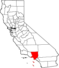
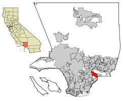
Whittier is a city in Los Angeles County, California about 12 miles (19 km) southeast of Los Angeles. As of the 2000 census, the city had a total population of 83,680. It is the home of Whittier College. Like nearby Montebello, the city is considered both part of the Gateway Cities or the Southeast area of Los Angeles County.
The city's population as a whole has grown since its founding days but has experienced rapid growth particularly starting in the 1990s. It has increased from 77,807 in 1990 to 83,680 in 2000 and is projected to grow to 90,041 in 2010.
- 90,041 2010 Projection
- 86,671 2005 Estimate
- 83,680 2000 Census
- 77,807 1990 Census
Contents |
Geography

Whittier is located at (33.5756, -118.128).[1]
According to the United States Census Bureau, the city has a total area of 37.9 km² (14.8 mi²), all land.
Whittier is bordered by the community of Hacienda Heights to the northeast, City of Industry to the north, and several other unincorporated communities in the San Gabriel Valley mostly along its northern sections. Pico Rivera lies at the west, La Habra Heights to the east, La Habra to the southeast and Santa Fe Springs to the south.
History
The roots of Whittier can be traced to a Spanish soldier, Manuel Nieto, who in 1784 received a Spanish land grant of 300,000 acres (1,200 km²), Rancho Los Nietos, as a reward for his military service and to encourage settlement in California. Nieto's area was reduced in 1790 because of a dispute with the Mission San Gabriel, but he still laid claim to 167,000 acres (680 km2) stretching from the hills north of Whittier, Fullerton and Brea, south to the Pacific ocean, and from today's Los Angeles River, east to the Santa Ana River. Nieto constructed a dwelling for his family near the present town of Whittier, stocked the land with cattle and horses, and cultivated corn. Upon his death in 1804, his children inherited his property.
After the Mexican-American war, Jacob F. Gerkens, a German immigrant who paid $234 to the U.S. government to acquire 160 acres (0.6 km2) of land under the Homestead Act, built a cabin on the land which is today known as the Jonathan Bailey House. The land had several owners before a group of Quakers bought the land, which had since been expanded to 1,259 acres (5 km2), with the purpose of founding a Quaker community. The area soon became known as a thriving citrus ranching region, with "Quaker Brand" fruit being shipped all over the United States. Soon after, walnut trees were planted, and Whittier became the largest walnut grower in California.

Whittier became a charter law city and was incorporated in 1898. Like many other southern California communities, Whittier experienced a population increase after World War II.
Origin of name
In the founding days of Whittier, when it was a small isolated town, Jonathan Bailey and his wife, Rebecca, were among the first residents. They followed the Quaker religion, and held religious meetings on their porch. As the city grew, the citizens named it after John Greenleaf Whittier, a respected Quaker poet. Whittier wrote a dedication poem, and is honored today with statues and a small exhibit at the Whittier museum; a statue of him sits in the park, and another representing his poem The Barefoot Boy resides by the City Hall. Consequently, the college there is called Whittier College, and the mascot, appropriately, is "The Poet." Whittier never set foot there, but the city still bears his name and is rooted in the Quaker tradition.
Quaker history in Whittier
The first Quaker Meeting, "First Friends Church" still stands on Philadelphia Street in Uptown Whittier, though its original structure was condemned after the Whittier Narrows earthquake in 1987. First Friends is a 'programmed' Quaker meeting and is similar to other churches in the Christian mainstream. A more traditional 'unprogrammed' Quaker Meeting group known as the Whitleaf Meeting meets in the Mendenhall Building on the Whittier College campus every Saturday morning. Many are members of both meetings.
The Mendenhall Building at Whittier College was donated by Leona May Mendenhall in honor of her husband, Oscar Mendenhall. The Mendenhalls were among the founding families of Whittier. Oscar's brother, Samuel Mendenhall, helped bring in the water system and post office. The Mendenhalls were large growers for Sunkist oranges and Blue Diamond walnuts.
Whittier Narrows earthquake
On Oct. 1, 1987, at 7:42 a.m., the Whittier Narrows earthquake struck, the epicenter six miles (10 km) north by northwest of Whittier. The seismic event, which registered 5.9 on the Richter scale, resulted in eight casualties and massive damage to uptown Whittier's historic buildings. In the years following the earthquake, the city's deteriorating uptown business district, which suffered substantial damage in the earthquake, became the focus of renewed development, which has met with opposition from many Whittier citizens. Out of the rubble of the earthquake the Whittier Conservancy was formed in 1987 in an effort to stop the demolition of many historic buildings and residences after the disaster. The city also created a Historic Resources Commission to oversee the approval of historic designations and Mills Act proposal.
Demographics

As of the census[2] of 2000, there were 83,680 people, 28,271 households, and 20,468 families residing in the city. The population density was 2,208.4/km² (5,719.4/mi²). There were 28,977 housing units at an average density of 764.7/km² (1,980.5/mi²). The racial makeup of the city was 63.2% White, 1.2% African American, 1.3% Native American, 3.3% Asian, 0.2% Pacific Islander, 25.8% from other races, and 5.0% from two or more races. Hispanic or Latino of any race were 55.9% of the population. [1]
There were 28,271 households out of which 37.8% had children under the age of 18 living with them, 52.5% were married couples living together, 14.3% had a female householder with no husband present, and 27.6% were non-families. 22.4% of all households were made up of individuals and 9.4% had someone living alone who was 65 years of age or older. The average household size was 2.88 and the average family size was 3.38.
In the city the population was spread out with 28.3% under the age of 18, 10.0% from 18 to 24, 30.6% from 25 to 44, 18.6% from 45 to 64, and 12.5% who were 65 years of age or older. The median age was 33 years. For every 100 females there were 94.6 males. For every 100 females age 18 and over, there were 90.1 males.
The median income for a household in the city was $49,256, and the median income for a family was $55,726. Males had a median income of $40,394 versus $34,223 for females. The per capita income for the city was $21,409. About 7.8% of families and 10.5% of the population were below the poverty line, including 13.7% of those under age 18 and 8.0% of those age 65 or over.
Politics
In the state legislature Whittier is located in the 30th Senate District, represented by Democrat Ronald S. Calderon, and in the 58th and 60th Assembly Districts, represented by Democrat Charles M. Calderon and Republican Bob Huff respectively. Federally, Whittier is located in California's 38th, 39th, and 42nd congressional districts, which have Cook PVIs of D +20, D +13, and R +10 respectively[3] and are represented by Democrats Grace Napolitano and Linda Sánchez and Republican Gary Miller respectively.
Business
Whittier's Redevelopment Agency has numerous projects underway to revitalize the community. This includes a $7 million dollar project near historic Hoover Hotel.
The Whittwood Town Center (formerly the Whittwood Mall) anchored by JC Penney, Target, Sears, Vons, and Mervyn's has made way for Red Robin and Black Angus. The city still waits to attract more well known businesses and open new residential town homes with the revival of its Uptown district.
In addition, the agency is working on developing a 480-acre (1.9 km2) project area near Whittier Blvd. The master plan was adopted in June 2005 by the City Council.
Nelles Land Controversy

In 2006, the City Council lost a bid for the now-closed Fred C. Nelles Youth Correctional Facility. The city and the state disagreed on the price of the Nelles property and the state put it up for bid, eventually selecting Meruelo Maddux Properties of Los Angeles. However, before the company could purchase the property, the State of California unlisted the property and it was designated as one of a handful of potential sites for a new men's prison. Plans for this were part of Governor Arnold Schwarzenegger's master plan to build more prisons across California. State correction officials recently have said they will abide with the wishes of Whittier in regard to Nelles. However, Robert Sillen, the federal receiver in charge of prison health care, has placed Nelles on a list of seven sites that could be used for a new regional or mental health prison hospital. Currently the location is used as a backlot for television and motion picture filming. Due to a federal court ruling, the federal government has taken over the issue of whether a prison will be built at Nelles. It has yet to make a decision. The federal government is considering whether to construct an inmate medical facility on the site of Nelles due to the inadequate healthcare provided to prison inmates in California.
Whittwood Mall
Built in 1960 as competition to The Quad at Whittier. The mall was originally an open-air plaza, a design favored by customers of the mid-20th century.
A J.C. Penney was added to the east end of the center in 1972. Then, in early 1979, Whittwood Mall was given a complete overhaul. Largely because of growing public favor toward outdoor shopping "communities," the mall faced a downhill struggle during the mid-1990s. The mall remodeled the exterior in early 1991. Krikorian Theatres built a 10-screen premium movie theatre on the back lot in the late '80s. This was sold a few years later to Regal Cinemas, who closed the theatre by the late '90s.
In 1996, The Broadway was bought out by Federated Department Stores. It was closed and immediately sold to Sears in 1996.
In 2004, the original Whittwood Mall closed, although the center's department stores remained open. With the exception of the major stores, the mall's buildings were torn down. The mall was replaced by "big box" retailers, most notably a Target. Today the site has been re-named the Whittwood Town Center.
Transportation
There are a variety of bus routes operating within the city with Foothill Transit, Montebello Bus Lines and the Norwalk Transit being the leading bus lines used within the city. Other bus routes operating in the city include the Metro,The Sunshine Shuttle starting at Beaty Ave all the way through The Whitwood Town Center, Line 121 Whitwood starting at Aviation Station (Metrorail Green Line) and ending at the Whittwood Town Center. The city also has a variety of freeways with the San Gabriel River Freeway (I-605) running right along the northern end of the city. State Route 72 runs via Whittier Boulevard and forms part of El Camino Real.
Education


The city of Whittier is served by the Whittier Union High School District, East Whittier City School District, Whittier City School District, Lowell Joint School District and the Fullerton Joint Union High School District.
Five high schools, California High School, La Serna High School, Pioneer High School, Santa Fe High School, and Whittier High School comprise the Whittier Union High School District. There is one alternative continuation high school Whittier Adult School, formerly known as Sierra Vista High School, and Frontier High School. Whittier Adult School belongs to the Whittier Union High School District. Rio Hondo College, which lies just outside the city serves Whittier. The city also has three Catholic elementary schools K-8
- St. Bruno's Parish School
- St. Mary of the Assumption School
- St. Gregory the Great School
All three schools are operated by the Roman Catholic Archdiocese of Los Angeles with one (St. Mary of the Assumption School) being one of the largest Catholic elementary schools in Los Angeles County.
Media
The local newspaper is the Whittier Daily News. Other area papers include the San Gabriel Valley Tribune, a sister paper of the Whittier Daily News, Los Angeles Times and the Orange County Register.
Historical landmarks & entertainment locations
Places


- Rose Hills Memorial Park, considered to be one of the largest cemeteries in the world, is located just outside the city limits.
- The Principia Discordia was revealed to its authors in the city's local bowling alley
- Whittier is home to the following California Historical Landmarks 1:
- Pio Pico State Historic Park, California Historical Landmark No. 127: The Casa de Governor Pío Pico/Home of Governor Pío Pico, home of the last Mexican Governor of California.
- California Historical Landmark No. 646: Grave of George Caralambo, (Greek George):
- California Historical Landmark No. 681: Paradox Hybrid Walnut Tree:
- California Historical Landmark No. 947: Reform School for Juvenile Offenders (Fred C. Nelles School — Closed May 27, 2004 and currently being redeveloped for business and residential use)
- Whittier Museum - 6755 Newlin Ave, Whittier 90601. Open to the public Saturdays and Sundays from 1 to 4 p.m. and is free of charge
- Whittier is the home to the following places listed in the National Register of Historic Places:
- Pio Pico House, 6003 Pioneer Blvd.
- Hoover Hotel, 7035 Greenleaf Ave.
- National Bank of Whittier Building, 13002 E. Philadelphia
- Southern Pacific Railroad Depot, 7333 Greenleaf Ave.
- Standard Oil Building, 7257 Bright Ave.
- Jonathan Bailey House, 13421 E. Camilla St.
- Orin Jordan House, 8310 S. Comstock Ave.
Film and television locations
- Various movies and television shows have been filmed in the city including:
- Back to the Future/Back to the Future Part II - Films starring Michael J. Fox. Whittier High School was used as the setting for Hill Valley High School.
- Hocus Pocus - Film starring Bette Midler, Sarah Jessica Parker, Thora Birch and Vinessa Shaw. Parts were filmed in Uptown Whittier.
- Father of the Bride Part II - Film starring Steve Martin. Parts were filmed in uptown Whittier.
- The Wonder Years - Television series starring Fred Savage. The parade scene in the last episode was filmed in uptown Whittier.
- The Next Best Thing- Film starring Madonna and Rupert Everett was filmed in the Whittier Hills.
- Matilda - Film starring Danny DeVito was filmed in East Whittier.
- Bringing Down the House- Film starring Queen Latifah and Steve Martin was filmed at the Friendly Hills Country Club, in East Whittier.
- Terminator 3 (2003) - Film starring Arnold Schwarzenegger. Various parts were shot in Whittier including in Rose Hills Memorial Park.
- Blow - Film starring Johnny Depp and Penelope Cruz. Scenes were filmed at the Fred C. Nelles boys' correctional facility, which closed in January 2004, and in a residential neighborhood.
- Masters of the Universe - Film starring Dolph Lundgren. Most of the movie was filmed in Whittier.
- Walk, Don't Run - Film Directed by Henry Winkler. All of this movie was filmed at Whittier High School in 1980.
- Ali - directed by Michael Mann, portions of which were filmed at a residence in the historic neighborhood near the uptown village.
- South of Nowhere - filmed Whittier Adult School, formerly known as Sierra Vista High School, and Frontier High School.
- The Oh in Ohio - Film starring Parker Posey and Paul Rudd. Various scenes were shot in the city.
- Big Fat Liar (2002)- Film starring Frankie Muniz, Amanda Bynes, and Paul Giamatti. One major scene was shot at a house on Greenleaf Ave in Uptown Whittier.
- Disturbia (film) (2007)- Film starring Shia LaBeouf, Carrie Anne Moss, and Amanda Walsh. Was shot on Painter Ave, the deli scenes were filmed at "Our Cleaners" on Comstock Ave. in uptown Whittier.
- Moonlight - Television series starring Alex O'Loughlin and Sophia Myles. Exteriors of a state execution facility were filmed at the Fred C. Nelles correctional facility, the facility name being clearly shown in multiple shots.
- What Just Happened? (2008) - Film starring Robert De Niro, Bruce Willis, Sean Penn and Robin Wright Penn. Scenes were filmed in Rose Hills Memorial Park.
- Crime and Punishment in Suburbia (2000) Film starring Monica Keena, Ellen Barkin and James DeBello. Interior shots of a 1950's coffee shop were filmed in a local bowling alley. The corner of Painter and Telegraph Rd can be seen through the windows showing a Sizzler restaurant and adjacent gas station.
John Greenleaf Whittier's dedication poem
Although John Greenleaf Whittier never visited the city, he did write a poem in honor of it:
"My Name I Give To Thee"
Dear Town, for whom the flowers are born,
Stars shine, and happy songbirds sing,
What can my evening give to thy morn,
My Winter to Thy Spring?
A life not void of pure intent
With small desert of praise or blame;
The Love I felt, the Good I meant,
I leave Thee with My Name.
Notable residents
Entertainment
- Antagonist, Metal band signed to Prosthetic Records
- Pete Dee Davison, Musician (The Adicts)
- Brendon Baerg, Actor (Yes, Dear)
- Andrea Barber, Actress (Full House)
- Caprice Bourret, Supermodel
- Joy Enriquez, Singer/Actress (7th Heaven)
- Stacy Ferguson (a.k.a. Fergie), Singer (Black Eyed Peas)
- Kathy Hilton, Actress/Socialite/Mother of Paris and Nicky Hilton
- William Garwood, American stage and film actor and director of the early silent era in the 1910s
- Vic "the Brick" Jacobs - Co-host of The Loose Cannons" radio program on KLAC Radio
- Adrienne Janic Co-host of Overhaulin, model and Fanta Girl
- Long Gone John, Founder of Sympathy for the Record Industry
- Mark Kostabi, Composer and artist
- John Alan Lasseter, Academy Award-winning animator and Chief Creative Officer at Pixar and Walt Disney Animation Studios
- Roger Lodge, Actor (Host of Blind Date)
- Alex Lopez, drummer for Suicide Silence signed to Century Media Records
- Martika, Singer
- John Mayer, Singer/Songwriter realeased two major albumns Room for Squares and Heavier Things
- Tim Minear, Screenwriter/Director
- Lorna Patterson, Actress
- Merle Pertile, Playboy Playmate (January 1962)
- Vaneza Leza Pitynski, Actress (The Brothers Garcia)
- Chuck Prophet, Musician (Solo artist and founder of the band Green On Red)
- Ron Shelton, Director (Bull Durham, White Men Can't Jump, Hollywood Homicide)
- Eric Stoltz, Actor (Memphis Belle, Jerry Maguire, Pulp Fiction)
- Geoff Stults, Actor (7th Heaven)
- Lauren Tewes, Actress (The Love Boat)
- Tina Yothers, Actress (Family Ties)
- Tom Waits, Actor, singer-songwriter
Arts and literature
- Horace Bristol, Photographer, Life Magazine
- Daniel Colegrove, Photographer
- Firoozeh Dumas, Author
- M.F.K. Fisher, Author
- Dave Freeman, Author
- Mark Kostabi, Painter, who left Whittier to be discovered in New York.
- Carol Lay, Artist
- Thom Mayne, Pritzker Prize-winning architect
- Craig McCracken, Animator
- Tim Miller, Performance Artist (Member of the NEA Four)
- Cherríe Moraga, Poet, Essayist, Playwright
- Joe Ranft - Animator, storyboard artist
- Nicole Stansbury, Author
- X-8, Artist/Publisher
- Diane Wakoski, Poet
Government
- George Allen, Former United States Senator (Virginia)
- Louis Caldera, Former United States Secretary of the Army
- Ronald B. Cameron, Congressman
- James Ferguson, Air Force General
- Jacob F. Gerkens - First Chief of the LAPD
- Gabriel Green, Write-in United States presidential candidate
- Lou Henry Hoover, Wife of President Herbert Hoover
- Richard Nixon, 37th President of the United States Played football at Whittier High School and Whittier College
- Pat Nixon, Wife of President Richard Nixon
- Pío Pico, Last Mexican Governor of Alta California
Miscellaneous
- Milo Burcham, Aviator/Test Pilot
- Tricia Nixon Cox - Daughter of President Nixon
- Francis A. Nixon, Father of President Richard Nixon
- Kerry Thornley, Founder of Discordianism
Sports
- Greg Hancock - Speedway champion, one of the best speedway riders in the World
- Shirley Babashoff, Olympic Gold Medalist (Swimming)
- Chet Brewer, Former Negro League Baseball Player
- Chuck Cary, Former Professional Baseball Player
- Bob Chandler, Former Professional Football Player
- Andy Etchebarren, Former Professional Baseball Player (Last man to bat against Sandy Koufax)
- Nomar Garciaparra, Professional Baseball Player
- Michael Garciaparra, Baseball Player
- Oscar de la Hoya, Boxer
- Payton Jordan, Head coach of the 1968 United States Olympic track and field
- Mark Kotsay, Professional Baseball Player
- Dan Owens, Former Professional Football Player
- Jamie Quirk, Former Professional Baseball Player
- Ante Razov, Professional Soccer Player
- Anthony Reyes, Professional Baseball Player
- Kim Rhode, Olympic Gold Medalist (Double trap and skeet shooter)
- Mark Sanchez, College Football Quarterback, USC
- Adam Snyder - San Francisco 49ers
- Jenny Topping - Olympic Gold Medalist (Softball)
- Jim Zorn, Former Professional Football Player
- Eddie Zosky, Former Professional Baseball Player
See also
- South Whittier, California (an unincorporated area south of the city limits)
- Los Angeles
- Whittier Narrows earthquake
References
- ↑ "US Gazetteer files: 2000 and 1990". United States Census Bureau (2005-05-03). Retrieved on 2008-01-31.
- ↑ "American FactFinder". United States Census Bureau. Retrieved on 2008-01-31.
- ↑ "Will Gerrymandered Districts Stem the Wave of Voter Unrest?". Campaign Legal Center Blog. Retrieved on 2008-02-10.
External links
- Whittier, California is at coordinates
|
|||||||||||||||||