Whitstable
| Whitstable | |
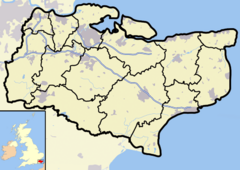 Whitstable shown within Kent |
|
| Population | 30,195 (2001 Census) |
|---|---|
| OS grid reference | |
| District | City of Canterbury |
| Shire county | Kent |
| Region | South East |
| Constituent country | England |
| Sovereign state | United Kingdom |
| Post town | WHITSTABLE |
| Postcode district | CT5 |
| Dialling code | 01227 |
| Police | Kent |
| Fire | Kent |
| Ambulance | South East Coast |
| European Parliament | South East England |
| UK Parliament | Canterbury |
| List of places: UK • England • Kent | |
Whitstable (pronounced /ˈʍɪtstəbəl/) is a seaside town in northeast Kent, southeast England. It is 8 kilometres (5 mi) north of the city of Canterbury and 3 kilometres (2 mi) west of the seaside town of Herne Bay. It is part of the Canterbury Local Authority district and has a population of about 30,000.
Known as the "Pearl of Kent", Whitstable is famous for its oysters, which have been collected in the area since at least Roman times. The town itself dates back to before the writing of the Domesday Book. Whitstable's distinctive character and ambience is popular with tourists, and its maritime heritage is celebrated with the annual Oyster Festival in July. After a period of decline, the oyster fishery industry is now thriving again, and freshly caught shellfish are available throughout the year at several seafood restaurants and pubs in the town.
In 1830, one of the earliest passenger railway services was opened by the Canterbury and Whitstable Railway Company and, in 1832, the company opened Whitstable harbour and extended the line to enable passage to London from the port. The railway has since closed but the harbour still plays an important role in the town's economy.
Contents |
History
Archaeological finds indicate that the Whitstable area was inhabited during the Palaeolithic era, the Bronze Age and the Iron Age.[1] Oysters were harvested in the area in Roman times,[2] and charters indicate that there were Saxon settlements where salt production and coastal trade occurred.[1] The town was first recorded in the Domesday Book of 1086, under the name Witenestaple, meaning "the meeting place of the white post", which referred to a local landmark. At that time, Witenestaple was an administrative area which stretched from the coast to the village of Blean, 3 kilometres (2 mi) north of Canterbury. The area contained three manors at Seasalter, Northwood and Swalecliffe. The Seasalter and Swalecliffe manors were owned by the church, and the manor at Northwood was run by noblemen on behalf of the king. Fisheries were located at the Seasalter manor, saltworks were at the Northwood manor, and pigs were farmed at the forest in Blean.[3] By 1226, the name of the area had evolved into Whitstaple.[4] Around 1300, saltworks were opened at the Seasalter manor, and, in 1325, a sea wall was built there to prevent coastal flooding.[3]

By 1413, the three manors had combined, forming the Whitstaple manor, and had been sold to a religious foundation in Essex.[3] In the 1500s, the manor was seized by King Henry VIII during his suppression of the church, and was given back to the nobility. In 1574, a Royal Patent was granted to the manor owner for the fishing of its oyster beds.[2] In the same year, the lands at Tankerton were incorporated into the manor. A copperas works was established at Tankerton in 1588 which operated until about 1830.[5] By 1610, the name Whitstaple had become Whitstable.[4]
Around the mid-1700s, goods and passengers began to be transported by ship between London and Whitstable, and a toll road was built to the cathedral city of Canterbury. These improvements in transport led to the town's development as a seaside resort; the first advertisements for bathing machines at Whitstable appeared in 1768. In 1790, the manor was sold to private landowners. The rights to harvest the oyster beds were bought in 1793 by the newly established Oyster Company of Free Fishers and Dredgers.[6]

On 3 May 1830, the world's first steam-hauled passenger and freight railway service was opened by the Canterbury and Whitstable Railway Company. The line ran from Westgate in Canterbury to Whitstable town centre. The six-mile (10 km) railway was designed by William James and built at a cost of £83,000. The railway line's initials, C&WR, and Whitstable's shellfish industry eventually led to its nickname: 'The Crab And Winkle Railway'. At first, trains were pulled along on ropes by steam-driven stationary winding engines up the inclined planes and by a locomotive for the rest of the journey. The winding engines were located at Tyler Hill and Clowes Wood. The locomotive used was the Invicta, an 0-4-0 inclined cylinder tender locomotive built by Robert Stephenson of Newcastle for £635, which pulled three carriages.[7][8]

Whitstable harbour was opened by the railway company in 1832, and the rail line was extended, enabling goods to be directly transferred from ships onto the trains. The harbour provided shelter for around 20 sailing ships of up to 150 tons, and had sidings for around 80 rail wagons. A dock was built for transferring freight between sea-going and river vessels. Whitstable harbour's main trade was importing Northumberland coal, which was then taken to Canterbury or transported by the South Eastern Railway to Croydon and Reigate.[7][8]
In 1834, the world's first season tickets were issued for the C&WR line. They were sold to Canterbury residents travelling to Whitstable beach during the summer season.[7] Until its demolition in 1970, Whitstable was home to the world's oldest railway bridge.
In 1840, the Invicta locomotive was retired and replaced by horses until a third winding engine was built at South Street. The Invicta was kept for scrap, but in 1898 work began on its restoration. The restoration continued intermittently, until it was finally completed in 1977 in York by the National Railway Museum. The locomotive was returned to Canterbury on 3 May 1980 to celebrate the 150th anniversary of the line. It is now displayed at the Canterbury Museum.[7][8]
In 1845, the Canterbury and Whitstable Railway Company was bought by the South Eastern Railway, who then introduced steam locomotives capable of operating along the entire length of the railway. These locomotives were coke-fired, so two ovens were built near the harbour to convert coal into coke. Coke production continued until 1880 when coal-fired locomotives took over. The ovens and their chimneys were demolished in 1892.[7][8] On 16 November 1869, 71 buildings in the town were destroyed by a fire started at a shop near the harbour.[9]
The Sea Cadet Corps traces its origin to the town. In about 1856, the Naval Lads' Brigade was started in Whitstable by the Reverend Henry Barton. In 1904, it was renamed the Sea Cadet Corps.[10]
In 1936, a plant to manufacture tarmacadam was built beside Whitstable Harbour, on the site of the old coke works, but after World War II, the harbour gradually fell into decay. In 1958, Whitstable Urban District Council purchased and repaired the harbour with the intention of rejuvenating the town's economy. The ownership of the harbour passed to Canterbury City Council in 1974.[11] By the early 20th century, the Oyster Company of Free Fishers and Dredgers had become the Whitstable Oyster Fishery Company. Oyster production drastically declined between the 1940s and 1970s due to pollution, disease, bad weather and underinvestment. However, since the 1970s there has been a gradual improvement.[2]
The Crab and Winkle Line finally closed in 1953. About 40% of the line was reopened as a footpath and cycleway under the stewardship of a local charity, the Crab and Winkle Line Trust. Plans exist to extend the path along the old line into the centre of Whitstable and out to the harbour.[7]
Governance
As at 2009, the Member of Parliament for the constituency of Canterbury, covering Canterbury and Whitstable, is the Conservative Julian Brazier, who has been the MP since 1987. At the 2005 general election, in Canterbury the Conservatives won a majority of 7,471 and 44.4% of the vote. Labour won 28.7% of the vote, Liberal Democrats 21.1%, Green Party 3.2%, United Kingdom Independence Party 2.0% and an independent candidate 0.7%.[12]
Whitstable, along with Herne Bay and Canterbury, is in the City of Canterbury local government district. The town comprises the five electoral wards of Tankerton, Seasalter, Chestfield and Swalecliffe, Gorrell and Harbour. These wards have of the 50 seats on the Canterbury City Council. Following the 2007 local elections, 10 of those seats were held by the Conservatives and two by the Labour Party.[13]
Geography
Whitstable is located at (51.3607, 1.0257) on the northeast Kent coast. The town lies to the east of the outlet of The Swale into the Thames Estuary. The town is 3 kilometres (2 mi) west of the seaside town of Herne Bay, 8 kilometres (5 mi) northeast of the town of Faversham and 8 kilometres (5 mi) north of the city of Canterbury; several small villages lie in between. The suburbs/villages of Tankerton, Swalecliffe and Chestfield are at the eastern end of the town, Seasalter at the west, and South Street at the south. Chestfield has its own parish council. An area of protected woodland and grassland called Duncan Down lies to the southeast.
| Destinations from WHITSTABLE | |||||||||||
| Thames Estuary (sea) | Thames Estuary (sea) |
Thames Estuary (sea) | |||||||||
| The Swale (sea) |
|
Herne Bay (town) | |||||||||
| Graveney with Goodnestone (civil parish) | Blean (civil parish) |
Chestfield (civil parish) | |||||||||

The geology of the town consists mainly of London Clay (which covers most of North Kent).[14] The western part of the town is built on low-lying marshland resulting from The Swale outflow, and sea walls are in place to prevent coastal flooding. The land in the east is higher, with slopes down to the coast at Tankerton.[15] The whole of the north east Kent coast has been designated a Site of Special Scientific Interest.[16]
Climate
In East Kent, the warmest time of the year is July and August, when maximum temperatures average around 21 °C (70 °F). The coolest time of the year is January and February, when minimum temperatures average around 1 °C (39 °F).[17] East Kent's average maximum and minimum temperatures are around 1/2 °C higher than the national average.[18] Whitstable is sometimes warmer than other parts of Kent due to it being backed by the North Downs to the south.[19]
East Kent's average annual rainfall is about 728 mm (29 in); October to January being the wettest months.[17] The national average annual rainfall is about 838 mm (33 in).[18] A recent drought caused Mid Kent Water to impose a hosepipe ban between August 2005[20] and February 2007.[21]
These are average temperature and rainfall figures taken between 1971 and 2000 at the Met Office weather station in Wye, around 29 kilometres (18 mi) southwest of Whitstable:
| Month | Jan | Feb | Mar | Apr | May | Jun | Jul | Aug | Sep | Oct | Nov | Dec | Year |
|---|---|---|---|---|---|---|---|---|---|---|---|---|---|
| Average high °C (°F) | 7.1 (45) |
7.2 (45) |
9.9 (50) |
12.1 (54) |
15.9 (61) |
18.7 (66) |
21.3 (70) |
21.6 (71) |
18.4 (65) |
14.5 (58) |
10.3 (51) |
8.0 (46) |
13.8 (57) |
| Average low °C (°F) | 1.5 (35) |
1.3 (34) |
2.8 (37) |
4.3 (40) |
7.3 (45) |
9.9 (50) |
12.2 (54) |
12.2 (54) |
10.1 (50) |
7.2 (45) |
3.9 (39) |
2.6 (37) |
6.3 (43) |
| Precipitation mm (inches) | 72.0 (2.83) |
44.7 (1.76) |
53.5 (2.11) |
50.8 (2) |
45.3 (1.78) |
51.8 (2.04) |
47.1 (1.85) |
55.9 (2.2) |
65.3 (2.57) |
85.4 (3.36) |
78.7 (3.1) |
77.3 (3.04) |
727.9 (28.66) |
| Source: Met Office[22] 2008-01-09 | |||||||||||||
Transport Links

Whitstable railway station is on the Chatham Main Line, which runs between Ramsgate in East Kent and London Victoria. Other stations on this line include Broadstairs, Margate, Herne Bay, Faversham, Gillingham, Rochester and Bromley South.[23] Whitstable is around 1 hour and 20 minutes from London by fast-service train. A National Express coach service runs between London Victoria and Ramsgate.[24] Trains run to London's Cannon Street station, provided primarily for business commuting.
There is a Stagecoach bus service running every twenty minutes to neighbouring Herne Bay and Canterbury, where many Whitstable residents go to work and shop.[25] The A299 road, known as the Thanet Way, runs between Ramsgate and Faversham via Herne Bay and Whitstable, and merges with the M2 motorway at Faversham.
Demography
| Whitstable Compared | |||
|---|---|---|---|
| 2001 UK Census | Whitstable | Canterbury District | England |
| Total population | 30,195 | 135,278 | 49,138,831 |
| Foreign born | 4.5% | 5.1% | 9.2% |
| White | 98% | 97% | 91% |
| Asian | 0.6% | 1.6% | 4.6% |
| Black | 0.2% | 0.5% | 2.3% |
| Christian | 74% | 73% | 72% |
| Muslim | 0.3% | 0.6% | 3.1% |
| Hindu | 0.1% | 0.4% | 1.1% |
| No religion | 16% | 17% | 15% |
| Over 65 years old | 23% | 19% | 16% |
| Unemployed | 2.5% | 2.7% | 3.3% |
As of the 2001 UK census, Whitstable area electoral wards had a population of 30,195 and a population density of 10.3 persons per hectare.[26]
The ethnicity of the town was 98.2% white, 0.8% mixed race, 0.2% Chinese, 0.4% other Asian, 0.2% black and 0.2% other. The place of birth of residents was 95.5% United Kingdom, 0.6% Republic of Ireland, 1.2% other Western European countries, and 2.7% elsewhere. Religion was recorded as 74.8% Christian, 0.3% Muslim, 0.3% Buddhist, 0.2% Jewish, 0.1% Hindu and 0.1% Sikh. 15.8% were recorded as having no religion, 0.4% had an alternative religion and 8.1% did not state their religion.[26]
The age distribution was 5% aged 0–4 years, 14% aged 5–15 years, 4% aged 16–19 years, 28% aged 20–44 years, 26% aged 45–64 years and 23% aged 65 years and over. The town has a high percentage of residents over 65, compared with the national average of 16%.[26] As a seaside town, Whitstable is a popular retirement destination.
Of the town's 13,155 households, 49.0% were married couples, 7.8% were cohabiting couples and 8.0% were lone parents. 30.7% of households were individuals and 18.0% had someone living alone at pensionable age. 26.4% of households included children aged under 16, or a person aged 16 to 18 who was in full-time education.[26]
Economy
According to the 2001 UK census, the economic activity of residents in the town aged 16–74 was 35.6% in full-time employment, 13.4% in part-time employment, 10.4% self-employed, 2.5% unemployed, 2.4% students with jobs, 3.4% students without jobs, 18.8% retired, 6.7% looking after home or family, 4.5% permanently sick or disabled and 2.3% economically inactive for other reasons. The percentage of retired people was significantly higher than the national figure of 13.5%. The unemployment rate of 2.5% was lower than the national rate of 3.3%. 12% of the town's residents aged 16–74 had a higher education qualification or the equivalent, compared to 20% nationwide.[26]
The main activities at the harbour are fishing, fish processing, cargo handling and boat storage.[27] The harbour area is the site for other industries such as tarmac manufacturing and a maintenance port for an offshore windfarm.[28] Business parks located on the outskirts of the town provide premises for large retailers, offices and light industries.[29]
The town's distinctive character and ambience has led to a strong tourist industry, which is promoted each year by the Oyster Festival. As of early 2007, Canterbury City Council were planning to boost tourism by building retail developments in addition to the existing shopping centre.[30]
The 2001 UK census reported the industry of employment of residents of Whitstable as 18% retail, 13% health and social work, 12% manufacturing, 11% education, 10% real estate, 9% construction, 7% transport and communications, 5% public administration, 5% hotels and restaurants, 4% finance, 1% agriculture and 5% other community, social or personal services. Compared to national figures, the town had a relatively high number of workers in the construction, education, and health/social care industries and a relatively low number in manufacturing, finance, and real estate.[26] Many residents commute to work outside the town; as of the 2001 census, there were 13,260 employed residents, but only 9,725 jobs within the town.[26]
The high level of employees in teaching is possibly due to the town's proximity to Canterbury, which has three higher education establishments.[31] The elderly population of the town has led to many health and social care jobs at local care homes and at the Whitstable and Tankerton Hospital.[32] As of the 2001 census, 1.3% of the town's population resided in a medical or care establishment, compared to the national average of only 0.8%.[26]
Education
Whitstable's secondary school is The Community College Whitstable. It is a secondary modern school which changed its named from Sir William Nottidge School in 1998. In 2005, 10% of its pupils gained at least five GCSEs at grades A*–C, ranking it 115th out of Kent's 120 secondary schools.[33] Many students living in Whitstable commute to schools in other nearby towns, especially to the grammar schools in Faversham and Canterbury.
The town's public primary schools are Whitstable Junior School, Whitstable and Seasalter Church Of England Junior School, Westmeads Infant School, Swalecliffe Community Primary School, St Mary's Catholic Primary School, St Alphege CofE Primary School, Joy Lane Junior School and Joy Lane Infant School.[34] The voluntary controlled church schools are owned by the church, but like the other schools, are administered by Kent County Council.[35]
Canterbury College @ Whitstable is a branch of Canterbury College in Whitstable town centre which provides a range of short information technology courses to adults.[36] Whitstable Adult Education Centre runs adult learning courses.[37]
The Community College Whitstable will be starting their school rebuild as part of the Building Schools for the Future program as part of the Governments plan to rebuild all secondary schools in the United Kingdom within the next ten years. The first phase of the new building works at The Community College Whitstable will be starting in the summer of 2008 and phased completions from mid-2009. The main focus for the Building Schools for the Future programme is to build new schools, not rebuild old schools. IT will be the main focus of the rebuild. The rebuild will not only rebuild the schools, but rebuild the curriculum to prepare students for the 21st Century.
The Community College Whitstable has an Investors in People award, and have also recently gained Specialist Maths and Computing Status. Since 2005 The Community College Whitstable has had two state of the art buildings built. One was to replace the ageing Science and Technology buildings and the other to offer a vocational curriculum to GCSE and 6th Form Students, from The Community College Whitstable and other schools in the area. The 'CoVE' is called the Centre of Vocational Excellence.
However despite the school's awards and recent investment it has still attracted controversy. In September 2007 The Community College Whitstable was the subject of a news report over school uniform policy.[38] The school's headteacher Mrs Helena Sullivan-Tighe had decided to enforce the school uniform policy more rigidly. One day in September pupils at the school were inspected as they arrived for the school day and close attention was given in particular to footwear. The end result was that around 40 pupils were found to be wearing unsuitable footwear and they were removed from the learning environment and placed into isolation. In some cases parents of the children were not informed and only heard about the incident when their children returned home. The incident was called Gestapo-like and made the local news mainly because many of the isolated pupils had in fact been wearing plain black trainers sold in local stores as back-to-school shoes. A statement from Mrs Sullivan-Tighe was subsequently reported in local newspapers which confirmed the incident and in which it was revealed that the school had hurriedly purchased around 30 pairs of shoes so that most of the affected pupils could be returned to the learning environment without further interruption of their state education. The report also indicated that at least one pupil had remained in isolation for 3 days.
Culture
Events and venues
Each July, Whitstable celebrates the Oyster Festival. The nine day festival traditionally starts with an opening parade on the nearest Saturday to St James' Day. The parade, starts with the official "Landing of the Catch", followed by the procession of the oysters in a horse-drawn dray through the town, stopping to deliver the catch to local restaurants, cafes and public houses. The rest of the festival consists of entertainment for both adults and children, with local art on display around the town, and many establishments offering local fish dishes.[39]
May Day is celebrated with the annual Jack-in-the-Green parade, with traditional English dancing throughout the town, a fair at Whitstable Castle and a maypole dance by local schoolchildren overlooking the sea.
The Whitstable Museum and Gallery displays artifacts and portraits relating to the town's seafaring traditions, with special features on oysters, diving and shipping. In 2001, the Museum was awarded the international Nautiek Award for services to diving history.[40] The town’s seafood industry can be explored at the Oyster and Fishery Exhibition.
The town's main theatre is the Playhouse which is owned by theatrical group, the Lindley Players. The theatre is hired out to other groups such as the amateur Phoenix Theatre Group and the professional Playtime Theatre Company. Several amateur music and choral groups have been formed by local residents.[41] The town's only cinema was called the Imperial Oyster, which has been closed to make way for a more profitable cafe.[42]
Attractions and landmarks

The town has shingle/sandy beaches flanking the harbour, where sunbathing, swimming and water sports are popular. A notable feature of Whitstable is The Street, a natural strip of shingle bank which runs out to sea at right angles to the coast, for a distance of about half a mile. Located to the east of the harbour, it is revealed only at low tide, when it is possible to walk out along it.[43] A view of The Street can be seen on the hilltop lawns of Tankerton Slopes.[44] The Slopes are home to the largest population in England of the rare Hog’s Fennel.[45]
Off the coast of Whitstable is a windfarm, consisting of 30 wind turbines, each 140 metres (459 ft) high, providing enough electricity to power 70,000 households.[46] A now-redundant offshore World War II sea fort is visible from the town's coast.[47] Sailing trips are available from the harbour to the windfarm, the sea fort and a seal watching spot in the Thames Estuary.[48]
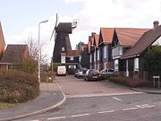
A traditional windmill on Borstal Hill, built in 1815, is used as a motel. It is a well known landmark in the area.
Island Wall, the closest street to the seafront, has numerous buildings dating from the mid-19th century including the Neptune and Wall Tavern pubs, and the Dollar Row cottages, which were built from the proceeds of a salvage operation on a ship carrying silver dollars.[49] The street is home to the Favourite, one of the few remaining Whitstable oyster yawls.[50] Built in 1824, it is now managed by the Favourite Trust, a charitable trust who undertake fund raising to maintain the historical vessel.[51]
The town is criss-crossed by numerous small alleys, once used by fishermen to reach the beach. Many of these are now registered as public rights of way and are still in frequent use. Squeeze Gut Alley, through which most people have to walk sideways due to its narrowness, is one of the more notable, .[52]
Sports

The town is a popular destination for watersport enthusiasts. Established in 1904, the Whitstable Yacht Club is one of the oldest yacht clubs in England and takes part in local and national competitions throughout the year.[53] Each year, the town hosts the International Waterski Championships.[54]
In May 2007, Whitstable Town Football Club, based at the Belmont ground, won promotion from the Kent League to the Isthmian League Division One South.[55] Whitstable Rugby Football Club 1st XV also won promotion in 2007, to the London League. The club has a 2nd XV team which play in the East Kent League 2.[56]
Whitstable has a council-owned swimming pool and sports centre with facilities for badminton, short tennis, 5-a-side football, volleyball, cricket and tennis.[57] A 10-pin bowling centre is located next door to the swimming pool. There is also an outdoor basketball court at the Rec near the swimming pool.
Local Media
The four local newspapers are the Kent Messenger Group owned Whitstable Bagette and KM Extra, and the Northcliffe Media-owned Whitstable Times and Canterbury Adscene. The Whitstable Gazette and Whitstable Times provide news related only to the town, and KM Extra and Canterbury Adscene provide news on the wider Canterbury district.[58][59] The local radio station in the Canterbury area is kmfm for Canterbury, Whitstable and Herne Bay. It was previously known as CTFM, until it was taken over by the Kent Messenger Group in September 1997.[60]
Popular culture
Whitstable is one of the settings for Sarah Waters' 1998 novel Tipping the Velvet and its 2002 BBC drama adaptation.[61] The Old Neptune Pub in the town was used as a filming location for the 2006 movie Venus, for which the actor Peter O'Toole earned an Academy Award nomination.[62][63]
At age 10, after the death of his parents, the playwright and novelist W. Somerset Maugham was sent to live with his uncle in Whitstable.[64] His novel Cakes and Ale (1930) is set in the fictional town of Blackstable. It is likely that he based this town on Whitstable, as the names and description of places around Blackstable, including The Duke of Cumberland Inn and Joy Lane, are identical to places around Whitstable.[65]
Peter Cushing, best known for his roles in horror movies made by Hammer Films, bought a house in the town in 1959. He initially used it as a weekend home, but lived there permanently after his retirement.[66]
Twin Towns
Whitstable has formed cultural links with the following towns:[67]
 Dainville, France
 Borken, Germany
 Říčany, Czech Republic
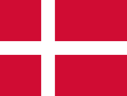 Albertslund, Denmark
 Mölndal, Sweden
[68]== References ==
- ↑ 1.0 1.1 "Up to 1000AD". Canterbury City Council. Retrieved on 2007-05-20.
- ↑ 2.0 2.1 2.2 "Whitstable Oyster Company". Whitstable Oyster Fishery Company. Retrieved on 2007-03-29.
- ↑ 3.0 3.1 3.2 "1000 - 1500". Canterbury City Council. Retrieved on 2007-03-29.
- ↑ 4.0 4.1 "Kent place names". bbc.co.uk. Retrieved on 2007-03-29.
- ↑ "1500 - 1700". Canterbury City Council. Retrieved on 2007-03-29.
- ↑ "1700 - 1800". Canterbury City Council. Retrieved on 2007-03-29.
- ↑ 7.0 7.1 7.2 7.3 7.4 7.5 "The Past". Crabandwinkle.org. Retrieved on 2007-04-20.
- ↑ 8.0 8.1 8.2 8.3 "Whitstable Harbour History". Whitstablescene.co.uk. Retrieved on 2007-04-20.
- ↑ Goodsall, Robert (1938). Whitstable, Seasalter and Swalecliffe.
- ↑ "Whitstable Sea Cadets". Canterbury City Council. Retrieved on 2007-04-21.
- ↑ "South Quay public consultation". Canterbury City Council. Retrieved on 2007-04-21.
- ↑ "Canterbury". Guardian.co.uk. Retrieved on 2007-03-29.
- ↑ "Members of the Council". Canterbury City Council. Retrieved on 2007-03-29.
- ↑ Woodward, Horrace B (1904). Stanford's Geological Atlas.
- ↑ "Kent". Encyclopedia.jrank.org. Retrieved on 2007-04-21.
- ↑ "Geological Sites Map". Natureonthemap.org.uk. Retrieved on 2007-04-24.
- ↑ 17.0 17.1 "Wye 1971-2000 averages". Met Office. Retrieved on 2007-03-29.
- ↑ 18.0 18.1 "England 1971-2000 averages". Met Office. Retrieved on 2007-03-29.
- ↑ "Kent weather exposed". BBC Kent. Retrieved on 2007-03-29.
- ↑ "Mid Kent Water Impose Further Water Restrictions". Mid Kent Water. Retrieved on 2007-03-29.
- ↑ "Mid Kent Water Lifts Ban". HosePipeBan.org.uk (2007-02-27). Retrieved on 2007-03-29.
- ↑ "Wye 1971-2000 averages". UK government. Retrieved on January 9, 2008.
- ↑ "Timetable". National Rail Enquiries. Retrieved on 2007-03-29.
- ↑ "Timetable". National Express. Retrieved on 2007-03-29.
- ↑ "Route 36" (PDF). Stagecoach. Retrieved on 2007-03-29.
- ↑ 26.0 26.1 26.2 26.3 26.4 26.5 26.6 26.7 "Neighbourhood Statistics". Statistics.gov.uk. Retrieved on 2007-03-29.
- ↑ "Whitstable Harbour Annual Report 2006-07" (PDF). Canterbury City Council. Retrieved on 2007-04-23.
- ↑ "Whitstable Harbour". Canterbury City Council. Retrieved on 2007-04-23.
- ↑ "Whitstable Enterprise Centre". Canterbury City Council. Retrieved on 2007-04-23.
- ↑ "Whitstable planning strategy". Canterbury City Council. Retrieved on 2007-04-21.
- ↑ "Boosting our local economy". Canterbury City Council. Retrieved on 2007-04-21.
- ↑ "Whitstable and Tankerton Hospital". NHS. Retrieved on 2007-04-21.
- ↑ "Schools in Kent". BBC (2005-10-19). Retrieved on 2007-04-24.
- ↑ "UK Schools and Colleges Database". Schoolswebdirectory.co.uk. Retrieved on 2007-03-29.
- ↑ "Schools and the Church of England". Church of England. Retrieved on 2007-03-29.
- ↑ "UK Online". Canterbury College. Retrieved on 2007-04-22.
- ↑ "Adult and community education". Kent County Council. Retrieved on 2007-03-29.
- ↑ "School's Uniform Rules Criticised". Meridian News (2007-10-05). Retrieved on 2007-10-05.
- ↑ "Whitstable and the Oyster Festival history". Whitstable and the Oyster Festival. Retrieved on 2007-04-21.
- ↑ "Whitstable museum and art gallery". Canterbury City Council. Retrieved on 2007-04-21.
- ↑ "Clubs and Societies". inWhitstable.com. Retrieved on 2007-04-21.
- ↑ "Local cinemas". BBC. Retrieved on 2007-04-21.
- ↑ "Top 10 beaches in the UK". SHE magazine. Retrieved on 2007-04-19.
- ↑ "Tankerton Slopes". Canterbury City Council. Retrieved on 2007-04-21.
- ↑ "Whitstable". MaritimeHeritageTrail.co.uk. Retrieved on 2007-04-21.
- ↑ "Kentish Flats Offshore Wind Farm". Vattenfall. Retrieved on 2007-04-19.
- ↑ "The Maunsell Sea Forts". Whitstablescene.co.uk. Retrieved on 2007-04-19.
- ↑ "Bayblast Marine". VisitCanterbury.co.uk. Retrieved on 2007-04-21.
- ↑ "Diver's trail". Canterbury City Council. Retrieved on 2007-04-19.
- ↑ "Favourite Oyster Yawl". National Historic Ships. Retrieved on 2007-04-24.
- ↑ "Favourite Trust". Favourite Trust. Retrieved on 2007-04-24.
- ↑ "Whitstable Alleyways". SeeWhitstable.com (2006). Retrieved on 2007-04-24.
- ↑ "Whitstable Yacht Club". Whitstable Yacht Club. Retrieved on 2007-04-21.
- ↑ "Canterbury Guide to Places to Stay". Resort-guide.co.uk (2005). Retrieved on 2007-04-19.
- ↑ "Whitstable Town FC". Whitstable Town FC. Retrieved on 2007-04-19.
- ↑ "Whitstable Rugby Football Club". Whitstable Rugby Football Club. Retrieved on 2007-04-21.
- ↑ "Whitstable Sports Centre". Active Life Ltd. Retrieved on 2007-04-21.
- ↑ "KM Publications". Kent Online. Retrieved on 2007-04-14.
- ↑ "Regionals". Trinity Mirror. Retrieved on 2007-04-14.
- ↑ "kmfm". MediaUK.com. Retrieved on 2007-04-14.
- ↑ "Tipping the Velvet". Powell's Books. Retrieved on 2007-04-19.
- ↑ "Venus and Whitstable". Kent Film Office. Retrieved on 2007-04-19.
- ↑ "Peter O'Toole, A winner in waiting". TheIrishWorld.com. Retrieved on 2007-06-05.
- ↑ "Somerset Maugham". Spartacus.schoolnet.co.uk. Retrieved on 2007-04-21.
- ↑ "Sea for sadness and solitude". The Telegraph (2002-04-24). Retrieved on 2007-04-19.
- ↑ "Peter Cushing". Canterbury City Council. Retrieved on 2007-05-29.
- ↑ "Whitstable". Canterbury City Council. Retrieved on 2006-05-11.
- ↑ http://www.mediauk.com:80/magazines/344359/the-whitstable-imp
External links
- See Whitstable
- Simply Whitstable - discussion, photos and history
- Alternative tour of town
- Town history
- OysterTown - includes town history and genealogy info
- Whitstable Oyster Festival
- Favourite Oyster Yawl
- Whitstable Sea Cadets
- Whitstable Yacht Club
- Whitstable Town Football Club
- Whitstable Cricket Club
- Swalecliffe Village's Website
- The Community College Whitstable
- The Whitstable IMP- Free local monthly magazine
|
||||||||
|
||||||||||||||||||||