West Yorkshire
| West Yorkshire | |
|---|---|
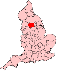 Shown within England |
|
| Geography | |
| Status | Metropolitan county & Ceremonial county |
| Origin | 1974 (Local Government Act 1972) |
| Region | Yorkshire and the Humber |
| Area - Total |
Ranked 29th 2,029 km² (783 sq mi) |
| Admin HQ | Leeds |
| ONS code | 2F |
| NUTS 3 | UKE4 |
| Demography | |
| Population - Total (2005) - Density |
Ranked 4th 2,161,200 1,044/km² (2,704/sq mi) |
| Ethnicity | 88.6% White 8.7% S.Asian |
| Politics | |
| No county council since 1986. | |
| Executive | |
| Members of Parliament |
|
| Metropolitan Boroughs | |

|
|
West Yorkshire is a metropolitan county within the Yorkshire and the Humber region of England with a population of 2.2 million. West Yorkshire came into existence as a metropolitan county in 1974 after the passage of the Local Government Act 1972.[1]
West Yorkshire, which is landlocked, consists of five metropolitan boroughs (City of Bradford, Calderdale, Kirklees, City of Leeds and City of Wakefield) and shares borders with the counties of Derbyshire (to the south), Greater Manchester (to the south-west), Lancashire (to the north-west), North Yorkshire (to the north and east) and South Yorkshire (to the south-east).
West Yorkshire County Council was abolished in 1986, and so its districts (the metropolitan boroughs) are now effectively unitary authorities. However, the metropolitan county, which covers an area of 2,029 square kilometres (783 sq mi), continues to exist in law, and as a geographic frame of reference.[2][3][4]
West Yorkshire encompasses the West Yorkshire Urban Area, which is the most built-up and biggest urban area within the historic county boundaries of Yorkshire.
Contents |
Divisions and environs
West Yorkshire is divided into five local government districts; they are the City of Bradford, Calderdale, Kirklees, the City of Leeds and the City of Wakefield.
| District | Area km2 | Population | Population density |
|---|---|---|---|
| City of Bradford | 366.42 | 493,100 | 1,346 |
| Calderdale | 363.92 | 198,500 | 545 |
| Kirklees | 408.60 | 398,200 | 975 |
| City of Leeds | 551.72 | 750,200 | 1,360 |
| City of Wakefield | 338.61 | 321,200 | 949 |
History
It was formed as a metropolitan county in 1974, by the Local Government Act 1972, and corresponds roughly to the core of the historic West Riding of Yorkshire and the county boroughs of Bradford, Dewsbury, Halifax Huddersfield, Leeds, and Wakefield. The Wakefield district's industrial heritage is significantly different from most of the rest of the county in that coal-mining was a large employer whilst textiles was not a particularly large industry (except in Ossett, where the two industries were both important).
West Yorkshire Metropolitan County Council inherited the use of West Riding County Hall at Wakefield, opened in 1898, from the West Riding County Council in 1974. Since 1987 it has been the headquarters of Wakefield City Council.[5]
It initially had a two-tier structure of local government with a strategic-level county council and five districts providing most services.[6] In 1986, throughout England the metropolitan county councils were abolished. The functions of the county council were devolved to the boroughs; joint-boards covering fire, police and public transport; and to other special joint arrangements.[7] Organisations such as West Yorkshire Police Authority and West Yorkshire Passenger Transport Executive continue to operate on this basis.
Although the county council was abolished, West Yorkshire continues to form a metropolitan and ceremonial county with a Lord Lieutenant of West Yorkshire and a High Sheriff.
Geography
The county borders, going anticlockwise from the west: Lancashire, Greater Manchester, Derbyshire, South Yorkshire and North Yorkshire. It lies almost entirely on rocks of carboniferous age which form the southern Pennine fringes in the west[8] and the Yorkshire coalfield further eastwards.[9] In the extreme east of the metropolitan county there are younger deposits of magnesian limestone.[10] The Bradford and Calderdale areas are dominated by the scenery of the eastern slopes of the Pennines, dropping from upland in the west down to the east, and dissected by numerous steep-sided valleys. There is a close conjunction of large scale industry, urban areas and transport routes with open countryside. The dense network of roads, canals and railways and urban development, confined by valleys creates dramatic interplay of views between settlements and the surrounding hillsides.
The carboniferous rocks of the Yorkshire coalfield further east have produced a rolling landscape with hills, escarpments and broad valleys. In this landscape there is widespread evidence of both current and former industrial activity. There are numerous derelict or converted mine buildings and recently landscaped former spoil heaps. The scenery is a mixture of built up areas, industrial land with some dereliction, and farmed open country. Ribbon developments along transport routes including canal, road and rail are prominent features of the area although some remnants of the pre industrial landscape and semi-natural vegetation still survive. However, many areas are affected by urban fringe pressures creating fragmented and downgraded landscapes and ever present are urban influences from major cities, smaller industrial towns and former mining villages.
In the magnesian limestone belt to the east of the Leeds and Wakefield areas is an elevated ridge with smoothly rolling scenery, dissected by dry valleys. Here, there is a large number of country houses and estates with parkland, estate woodlands, plantations and game coverts.
The rivers Aire and Calder drain the area, flowing from west to east.
Politics
In Parliament, all but two of West Yorkshire's M.P.s are Labour. At local level, the councils are generally divided, apart from the Wakefield district, which has long been one of the safest Labour councils in the country.
There are currently plans for a tram system in West Yorkshire, but those for a Leeds Supertram were rejected by the government in 2005.
Economy
This is a chart of regional gross value added for West Yorkshire at current basic prices with figures in millions of British Pounds Sterling.[11]
| Year | Regional Gross Value Added[12] | Agriculture[13] | Industry[14] | Services[15] |
|---|---|---|---|---|
| 1995 | 21,302 | 132 | 7,740 | 13,429 |
| 2000 | 27,679 | 80 | 8,284 | 19,314 |
| 2003 | 31,995 | 91 | 8,705 | 23,199 |
Cities, towns and villages
- See also: List of civil parishes in West Yorkshire
The table below outlines many of the county's settlements, and is formatted according to their metropolitan borough.
| Metropolitan county | Metropolitan borough | Centre of administration | Other places | |
|---|---|---|---|---|
| West Yorkshire | City of Bradford | Bradford | Addingham, Baildon, Bingley, Burley-in-Wharfedale, Cottingley, Crossflatts, Cullingworth, Denholme, East and West Morton, Esholt, Gilstead, Harden, Haworth, Ilkley, Keighley, Menston, Oakworth, Oxenhope, Queensbury, Riddlesden, Saltaire, Sandy Lane, Shipley, Silsden, Stanbury, Steeton, Thornbury, Thornton, Tong, Wilsden | |
| Calderdale | Halifax | Bailiff Bridge, Boothtown, Brighouse, Copley, Cragg Vale, Elland, Greetland, Hebden Bridge, Heptonstall, Hipperholme, Mytholmroyd, Norwood Green, Rastrick, Ripponden, Shibden, Sowerby Bridge, Todmorden | ||
| Kirklees | Huddersfield | Almondbury, Batley, Birkby, Birkenshaw, Birstall, Cleckheaton, Denby Dale, Dewsbury, Emley, Golcar, Gomersal, Hartshead, Hartshead Moor, Heckmondwike, Holmfirth, Honley, Kirkburton, Linthwaite, Liversedge, Marsden, Meltham, Mirfield, New Mill, Norristhorpe, Roberttown, Scammonden, Shelley, Shepley, Skelmanthorpe, Slaithwaite, Thornhill | ||
| City of Leeds | Leeds | Allerton Bywater, Beeston, Boston Spa, Collingham, Garforth, Guiseley, Harewood, Horsforth, Kippax, Kirkstall, Ledsham, Ledston, Methley, Morley, New Farnley, Otley, Oulton, Pool-in-Wharfedale, Pudsey, Rothwell, Scarcroft, Scholes, Swillington, Walton (Leeds), Wetherby, Yeadon | ||
| City of Wakefield | Wakefield | Ackworth, Alverthorpe, Castleford, Crigglestone, Crofton, Fairburn Ings, Ferrybridge, Fitzwilliam, Hemsworth, Horbury, Knottingley, Newmillerdam, Nostell, Ossett, Pontefract, Sandal, Stanley, Walton (Wakefield), West Bretton | ||
Places of interest
Historic environment
|
|
|
Museums
- Brontë Parsonage Museum, Haworth
- Colne Valley Museum
- Colour Museum[1], Bradford
- Leeds City Museum
- National Coal Mining Museum for England (Netherton)
- National Media Museum, Bradford
- Pennine Farm Museum, Ripponden
- Pontefract Museum
- Royal Armouries museum, Leeds
- Tolson Museum, Dalton (Huddersfield)
- Wakefield Museum, Wakefield
- West Yorkshire Folk Museum, Shibden Hall
- Yorkshire Sculpture Park, West Bretton
Natural environment
- Emley Moor, site of the tallest self-supporting structure in the UK (a TV mast)
- Harewood Estate - Leeds Country Way public footpath runs through the estate, beautiful landscaped gardens and home to Red Kites amongst many other birds
- New Swillington Ings Nature Reserve
- Otley Chevin - extensive wooded parkland on high ground with extensive views North over Wharfedale and South as far as the Peak District
- RSPB Fairburn Ings - wetland centre for birds
- Seckar Woods LNR, a Local Nature Reserve
- Walton Hall, West Yorkshire, home of naturalist Charles Waterton and the world's first nature reserve
Waterways
- Scammonden Reservoir, Deanhead Reservoir - both in the moors near Ripponden
- River Aire, River Calder, River Hebble, River Spen, River Worth
- Aire and Calder Navigation
- Calder and Hebble Navigation
- Huddersfield Broad Canal
- Huddersfield Narrow Canal, Standedge Tunnel
- Leeds and Liverpool Canal
- Knottingley & Goole Canal
- Rochdale Canal
See also
- The Kingdom of Elmet
- West Yorkshire Urban Area
- West Yorkshire Metropolitan Ambulance Service
- West Yorkshire Regiment (The Prince of Wales's Own)
References
- ↑ Arnold-Baker, C., Local Government Act 1972, (1973)
- ↑ Office of National Statistics - Gazetteer of the old and new geographies of the United Kingdom, p. 48. Retrieved 14 December 2006.
- ↑ Metropolitan Counties and Districts, Beginners' Guide to UK Geography, Office for National Statistics, 17 September 2004. Retrieved 11 January 2007.
- ↑ Yorkshire and Humber Counties, The Boundary Commission for England. Retrieved 14 February 2007.
- ↑ Wakefield City Council (20 November 2004). "County Hall".
- ↑ Redcliffe-Maud & Wood, B., English Local Government Reformed, (1974)
- ↑ Kingdom, J., Local Government and Politics in Britain, (1991)
- ↑ "Yorkshire Southern Pennine Fringe". www.countryside.gov.uk. Retrieved on 2008-10-06.
- ↑ "Nottinghamshire, Derbyshire and Yorkshire Coalfield". www.countryside.gov.uk. Retrieved on 2008-10-06.
- ↑ "Southern Magnesian Limestone". www.countryside.gov.uk. Retrieved on 2008-10-06.
- ↑ "Regional Gross Value Added" (PDF) pp. 240–253. Office for National Statistics (2005-12-21). Retrieved on 2008-10-06.
- ↑ Components may not sum to totals due to rounding
- ↑ includes hunting and forestry
- ↑ includes energy and construction
- ↑ includes financial intermediation services indirectly measured
|
||||||||||||||
|
||||||||||||||||||||
|
|||||
|
|||||