Weser River
| Weser | |
|---|---|
 |
|
| Origin | Fulda and Werra |
| Mouth | North Sea |
| Basin countries | Germany |
| Length | 452 km |
| Source elevation | 117 m |
| Avg. discharge | 327 m³/s |
| Basin area | 46,306 km² |

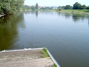
The Weser (IPA: [ˈveːzɐ]) is a river in north-western Germany. Formed at Hann. Münden by the tributary (confluence) of the Fulda and Werra, it flows through Lower Saxony, then reaching the historic (Hanseatic League) port city of Bremen before emptying into the North Sea 50 km further north at Bremerhaven, which is also a seaport. On the opposite (west) bank is the town of Nordenham at the foot of the Butjadingen Peninsula; thus, the mouth of the river is located in Lower Saxony. The Weser has an overall length of 452 km. Together with its Werra tributary, which originates in Thuringia, its length is 744 km.
Contents |
Etymology
Linguistically, the name of both rivers, Weser and Werra, goes back to the same source, the differentiation being caused by the old linguistic border between Upper und Lower German, which touched the region of Hannoversch Münden.
The name Weser is linked to other rivers such as the Wear in England and the Vistula in Poland, all of which are ultimately derived from the root *weis- "to flow", which gave Old English/Old Frisian wāse "mud, ooze", Old Norse veisa "slime, stagnant pool", Dutch waas "lawn", Old Saxon waso "wet ground, mire", and Old High German wasal "rain".
Course
The Weser river is the longest German river to reach the sea the course of which lies entirely within the national territory.
The top section of its course leads through a hilly region called the Weserbergland. It extends from the confluence of the Fulda and the Werra to the Porta Westfalica, where it runs through a gorge between two mountain chains, the Wiehengebirge in the west and the Weserbergland in the east.
Between Minden and the North Sea, it has largely been canalised, permitting ships of up to 1,200 tons to navigate it. Eight hydroelectric dams are located along its length. Further downstream, it is linked to the Dortmund-Ems Canal via the Küstenkanal, and another canal links it at Bremerhaven to the Elbe River. A large reservoir on the Eder river, the main tributary of the Fulda, is used to regulate water levels on the Weser so as to ensure adequate depth for shipping throughout the year. The dam, built in 1914, was bombed and destroyed by British planes in February 1943, causing massive destruction and approximately 70 deaths downstream, but was rebuilt within four months. Today, the Edersee reservoir is a major summer resort area and provides substantial hydroelectricity.

The Weser enters the North Sea in the southernmost part of the German Bight. In the North Sea it splits up into two arms representing the ancient riverbed at the end of the last ice age. These sea-arms are called Alte Weser (old Weser) and Neue Weser (new Weser). They represent the major waterways for ships heading for the harbors of Bremerhaven, Nordenham and Bremen. The northernmost point of the Weser is marked by the Alte Weser lighthouse. This lighthouse replaced the historic and famous Roter Sand lighthouse in 1964.
Tributaries
The largest tributary of the Weser is the Aller, which joins south of Bremen. The tributaries of the Weser and the Werra (from source to mouth) are:
Left
- Ulster
- Fulda, with Eder
- Diemel
- Große Aue
- Hunte
Right
- Nesse
- Aller
- Lesum (Wümme)
Notable towns
Towns along the Weser, from the confluence of Werra and Fulda to the mouth, include: Hann. Münden, Beverungen, Höxter, Holzminden, Bodenwerder, Hameln, Hessisch Oldendorf, Rinteln, Vlotho, Bad Oeynhausen, Porta Westfalica, Minden, Petershagen, Nienburg, Achim, Bremen, Brake, Nordenham, Bremerhaven.