Wellington
| Wellington Te Whanga-nui-a-Tara (in Māori[1]) |
|
| — main urban area — | |
 |
|
| Nickname(s): Wellywood, the Windy City | |
 |
|
| Coordinates: | |
| Country | |
|---|---|
| Region | Wellington |
| Territorial authorities | Wellington City Lower Hutt City Upper Hutt City Porirua City |
| Area [2] | |
| - main urban area | 290 km² (112 sq mi) |
| Lowest elevation | 0 m (0 ft) |
| Population (June 2008 estimate)[3][4] | |
| - Density | 620.9/km² (1,608.1/sq mi) |
| - Urban | 381,900 |
| Time zone | NZST (UTC+12) |
| - Summer (DST) | NZDT (UTC+13) |
| Postcode(s) | 6000 group, and 5000 and 5300 series |
| Area code(s) | 04 (local) +64 4 (from overseas) |
| Local iwi | Ngāti Poneke, Ngāti Tama, Te Āti Awa |
| Website: http://www.wellingtonnz.com/ | |

Wellington is the capital of New Zealand, situated at the southwestern tip of the North Island between Cook Strait and the Rimutaka Range. The Wellington Urban Area is the major population centre of the southern North Island and ranks as New Zealand's third most populous urban area with around 381,900 residents. There are around 473,700 residents in the Wellington Region.
Wellington's suburbs lie across four cities. Wellington City, on the peninsula between Cook Strait and Wellington Harbour, contains the central business district and about half of Wellington's population. Porirua City is situated on Porirua Harbour to the north and is notable for its large Māori and Pacific Island communities. Lower Hutt City and Upper Hutt City are suburban areas to the northeast, together known as the Hutt Valley. Although each of the four cities also contains a rural hinterland, almost all of the population is within the urban area.
Contents |
Name
Wellington was named in honour of Arthur Wellesley, the first Duke of Wellington and victor of the Battle of Waterloo. The Duke's title comes from the town of Wellington in the English county of Somerset.
In Māori, Wellington goes by three names. Te Whanga-nui-a-Tara refers to Wellington Harbour and means "the great harbour of Tara".[1] Pōneke is a transliteration of Port Nick, short for Port Nicholson (the city's central marae, the community supporting it and its kapa haka have the pseudo-tribal name of Ngāti Pōneke).[5] Te Upoko-o-te-Ika-a-Māui, meaning The Head of the Fish of Māui (often shortened to Te Upoko-o-te-Ika), a traditional name for the southernmost part of the North Island, derives from the legend of the fishing up of the island by the demigod Māui.
Wellington also goes by a number of nicknames including The Harbour Capital, Wellywood and (now rarely) the Windy City .
Importance
Wellington is New Zealand's political centre, housing Parliament and the head offices of all Government Ministries and Departments, plus the bulk of the foreign diplomatic missions that are based in New Zealand.
Wellington's compact city centre supports an arts scene, café culture and nightlife much larger than most cities of a similar size. It is a centre of New Zealand's film and theatre industry. Te Papa Tongarewa (the Museum of New Zealand), the New Zealand Symphony Orchestra, the Royal New Zealand Ballet, Museum of Wellington City & Sea and the biennial New Zealand International Arts Festival are all sited there.
Wellington has the 12th best quality of living in the world, according to a 2007 study by consulting company Mercer. Of cities with English as the primary language, Wellington ranked fourth.[6] Only Auckland of New Zealand cities rated higher as it was ranked fifth in the world in 2006 and 2007.
Settlement
- See also: New Zealand Company
Legend recounts that Kupe discovered and explored the district in about the tenth century.
European settlement began with the arrival of an advance party of the New Zealand Company on the ship Tory, on 20 September 1839, followed by 150 settlers on the Aurora on 22 January 1840. The settlers constructed their first homes at Petone (which they called Britannia for a time) on the flat area at the mouth of the Hutt River. When that proved swampy and flood-prone they transplanted the plans, which had been drawn without regard for the hilly terrain.
Earthquakes
- See also: Earthquakes in New Zealand

Wellington suffered serious damage in a series of earthquakes in 1848[7] and from another earthquake in 1855. The 1855 Wairarapa earthquake occurred on a fault line to the north and east of Wellington. It ranks as probably the most powerful earthquake in recorded New Zealand history[8], with an estimated magnitude of at least 8.2 on the Richter scale. It caused vertical movements of two to three metres over a large area, including raising an area of land out of the harbour and turning it into a tidal swamp. Much of this land was subsequently reclaimed and is now part of Wellington's central business district. For this reason the street named Lambton Quay now runs 100 to 200 metres (325 to 650 ft) from the harbour. Plaques set into the footpath along Lambton Quay mark the shoreline in 1840 and thus indicate the extent of the uplift and of subsequent reclamation.
The area has high seismic activity even by New Zealand standards, with a major fault line running through the centre of the city, and several others nearby. Several hundred more minor fault lines have been identified within the urban area. The inhabitants, particularly those in high-rise buildings, typically notice several earthquakes every year. For many years after the 1855 earthquake, the majority of buildings constructed in Wellington were made entirely from wood. The 1996-restored Government Buildings,[9] near Parliament is the largest wooden office building in the Southern Hemisphere. While masonry and structural steel have subsequently been used in building construction, especially for office buildings, timber framing remains the primary structural component of almost all residential construction. Residents also place their hopes of survival in good building regulations, which gradually became more stringent in the course of the twentieth century.
New Zealand's capital


In 1865, Wellington became the capital of New Zealand, replacing Auckland, where William Hobson had established his capital in 1841. Parliament first sat in Wellington on 7 July 1862, but the city did not become the official capital for some time. In November 1863 the Premier Alfred Domett moved a resolution before Parliament (in Auckland) that "... it has become necessary that the seat of government ... should be transferred to some suitable locality in Cook Strait." Apparently there was concern that the southern regions, where the gold fields were located, would form a separate colony. Commissioners from Australia (chosen for their neutral status) pronounced the opinion that Wellington was suitable because of its harbour and central location. Parliament officially sat in Wellington for the first time on 26 July 1865. The population of Wellington was then 4,900.[10]
Wellington is the seat of New Zealand's highest court, the Supreme Court of New Zealand. The historic former High Court building is to be enlarged and restored for the court's use.
Government House, the official residence of the Governor-General, is in Newtown, opposite the Basin Reserve.
Location and geography
Wellington stands at the south-western tip of the North Island on Cook Strait, the passage that separates the North and South Islands. On a clear day the snowcapped Kaikoura Ranges are visible to the south across the strait. To the north stretch the golden beaches of the Kapiti Coast. On the east the Rimutaka Range divides Wellington from the broad plains of the Wairarapa, a wine region of national acclaim.
Wellington is the southernmost national capital city in the world, with a latitude of about 41°S. It is also the most remote capital in the World (i.e. the furthest from any other capital). It is more densely populated than most other settlements in New Zealand, due to the small amount of building space available between the harbour and the surrounding hills. Wellington has very few suitable areas in which to expand and this has resulted in the development of the surrounding cities in the greater urban area. Because of its location in the roaring forties latitudes and its exposure to omnipresent winds coming through Cook Strait, the city is known to Kiwis as "Windy Wellington".
More than most cities, life in Wellington is dominated by its central business district (CBD). Approximately 62,000 people work in the CBD, only 4,000 fewer than work in Auckland's CBD, despite that city having three times Wellington's population. Wellington's cultural and nightlife venues concentrate in Courtenay Place and surroundings located in the southern part of the CBD, making the inner city suburb of Te Aro the largest entertainment destination in New Zealand.
Wellington has a median income well above the average in New Zealand[11] and a much higher proportion of people with tertiary qualifications than the national average.[12]
Wellington has a reputation for its picturesque natural harbour and green hillsides adorned with tiered suburbs of colonial villas. The CBD is sited close to Lambton Harbour, an arm of Wellington Harbour. Wellington Harbour lies along an active geological fault, which is clearly evident on its straight western coast. The land to the west of this rises abruptly, meaning that many of Wellington's suburbs sit high above the centre of the city.
There is a network of bush walks and reserves maintained by the Wellington City Council and local volunteers. The Wellington region has 500 square kilometres (190 sq mi) of regional parks and forests.
In the east is the Miramar Peninsula, connected to the rest of the city by a low-lying isthmus at Rongotai, the site of Wellington International Airport. The narrow entrance to Wellington is directly to the east of the Miramar Peninsula, and contains the dangerous shallows of Barrett Reef, where many ships have been wrecked (most famously the inter-island ferry Wahine in 1968).
On the hill west of the city centre are Victoria University and Wellington Botanic Garden. Both can be reached by a funicular railway, the Wellington Cable Car.
Wellington Harbour has three islands: Matiu/Somes Island, Makaro/Ward Island and Mokopuna Island. Only Matiu/Somes Island is large enough for settlement. It has been used as a quarantine station for people and animals and as an internment camp during the First and Second World Wars. It is now a conservation island, providing refuge for endangered species, much like Kapiti Island further up the coast. There is access during daylight hours by the Dominion Post Ferry.
Architecture

Wellington contains a variety of architectural styles dating back from the past 150 years; from nineteenth century wooden cottages, such as the Katherine Mansfield Birthplace in Thorndon, some streamlined Art Deco structures such as the old Wellington Free Ambulance headquarters and the City Gallery, and the curves and vibrant colours of post-modern architecture in the CBD.
The oldest building in Wellington is the Colonial Cottage in Mount Cook [13]. The tallest building in the city is the Majestic Centre on Willis Street at 116 metres high[14], the second tallest being the structural expressionist BNZ Tower at 103 metres [15]. Futuna Chapel is located in Karori, was the first bicultural building in New Zealand, and is thus considered one of the most significant New Zealand buildings of the twentieth century.

Old Saint Paul's is an example of 19th-century Gothic Revival architecture adapted to colonial conditions and materials, as is Saint Mary of the Angels. The Museum of Wellington City & Sea building, the Bond Store is in the Second French Empire style, and the Wellington Harbour Board Wharf Office Building is in a late English Classical style. There are several restored theatre buildings, the St. James Theatre, the Opera House and the Embassy Theatre.
Civic Square is surrounded by the Town Hall and council offices, the Michael Fowler Centre, the Wellington Central Library, the City-to-Sea bridge, and the City Gallery.
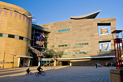
Being the capital, there are many memorable government buildings in Wellington. Both the National Library of New Zealand, located on Molesworth Street, and the Te Puni Kōkiri building on Lambton Quay are aesthetically unique . The circular-conical Executive Wing of New Zealand Parliament Buildings, located on the corner of Lambton Quay and Molesworth Street, was constructed in the mid-60s and is commonly referred to as the Beehive. Across the road from the Beehive is the largest wooden building in the Southern Hemisphere[16], part of the old Government Buildings which now houses part of Victoria University of Wellington's Law Faculty. The Museum of New Zealand Te Papa Tongarewa is located on the waterfront.
As tastes and trends in architecture have come into and fallen out of fashion, many memorable buildings have been lost.
Wellington also contains many iconic sculptures and structures. Elijah Wood mentioned that he urinated from the Bucket Fountain in Cuba Street in an interview with Jay Leno[17].
Climate
The city averages 2025 hours (or about 169 days) of sunshine per year.[18]
| Month | Jan | Feb | Mar | Apr | May | Jun | Jul | Aug | Sep | Oct | Nov | Dec | Year |
|---|---|---|---|---|---|---|---|---|---|---|---|---|---|
| Average high °C | 20.3 | 20.6 | 19 | 16.7 | 14.2 | 12 | 11.4 | 12 | 13.5 | 15 | 16.6 | 18.5 | 15.8 |
| Average low °C | 13.4 | 13.6 | 12.6 | 10.9 | 8.8 | 6.9 | 6.3 | 6.5 | 7.7 | 9 | 10.3 | 12.2 | 9.9 |
| Precipitation mm | 72 | 62 | 92 | 100 | 117 | 147 | 136 | 123 | 100 | 115 | 99 | 86 | 1,249 |
| Average high °F | 69 | 69 | 66 | 62 | 58 | 54 | 53 | 54 | 56 | 59 | 62 | 65 | 60 |
| Average low °F | 56 | 56 | 55 | 52 | 48 | 44 | 43 | 44 | 46 | 48 | 51 | 54 | 50 |
| Precipitation inches | 2.83 | 2.44 | 3.62 | 3.94 | 4.61 | 5.79 | 5.35 | 4.84 | 3.94 | 4.53 | 3.9 | 3.39 | 49.17 |
| Source: NIWA[19] Oct 2007 | |||||||||||||
Energy
The energy needs of Wellington are increasing, and one new source is the wind. Project West Wind was granted resource consent for 66 turbines, which is estimated to generate approximately 140MW[20] . Meridian Energy's Project West Wind is located a few kilometres west of Wellington's CBD, located on Meridian's Quartz Hill and Terawhiti Station.
Demographics
The urban area of Wellington stretches across the city council areas of Wellington, Lower Hutt, Upper Hutt and Porirua. As of 2008 the four cities have a total population of 385,600 (June 2008 estimate),[4] and the Wellington Urban Area contains 99% of that population. The remaining areas are largely mountainous and sparsely farmed or parkland and are outside the urban area boundary.
Demographic statistics from the 2006 census are not readily available for the Wellington Urban Area, so the following demographic statistics detailed in this section are for the four city council areas:
Age distribution
| Area | Under 20 | 20–39 | 40–59 | 60–79 | 80 and over |
|---|---|---|---|---|---|
| Wellington City | 25% | 37% | 26% | 10% | 2% |
| Lower Hutt City | 30% | 27% | 27% | 12% | 3% |
| Upper Hutt City | 30% | 25% | 28% | 14% | 3% |
| Porirua City | 34% | 27% | 26% | 10% | 1% |
| Four cities | 28% | 32% | 27% | 11% | 2% |
| New Zealand | 29% | 27% | 27% | 14% | 3% |
The relative lack of older people in Wellington is less marked when the neighbouring Kapiti Coast District is included. Nearly 7% of Kapiti Coast residents are over 80. Overall, Wellington's age structure closely matches the national distribution.
Arts and culture
Film
Wellington is the centre of the nation's film industry. Peter Jackson famous for The Lord of the Rings, Richard Taylor, and a growing team of creative professionals have turned the eastern suburb of Miramar into one of the world's most acclaimed film-making infrastructures. Directors like Jane Campion and Vincent Ward have managed to reach the world's screens with their independent spirit. Emerging Kiwi film-makers, like Robert Sarkies, Taika Waititi, Costa Botes and Jennifer Bush-Daumec [1], are extending the Wellington-based lineage and cinematic scope.
Museums and cultural institutions
Wellington is home to Te Papa Tongarewa (the Museum of New Zealand), the Museum of Wellington City & Sea, the Katherine Mansfield Birthplace Museum, Colonial Cottage, the New Zealand Cricket Museum, the Cable Car Museum, Old Saint Paul's, and the Wellington Law school (largest wooden building in the southern hemisphere) and the Wellington City Art Gallery.
Food
Wellington's cafe culture is extremely strong. The city has more cafes per capita than New York City.[21]
Festivals
Wellington has become home to a myriad of high-profile events and cultural celebrations, including the biennial New Zealand International Arts Festival, biennial Wellington Jazz Festival, and major events such as World of Wearable Art, Cuba Street Carnival, New Zealand Fringe Festival, New Zealand International Comedy Festival (also hosted in Auckland), Summer City, The Wellington Folk Festival (in Wainuiomata), New Zealand Affordable Art Show, The New Zealand Sevens Weekend and Parade ,Out in the Square and numerous film festivals.
Music
The local music scene has, over the years produced bands such as The Warratahs, The Phoenix Foundation, Shihad, Fly My Pretties, Fat Freddy's Drop, The Black Seeds, Fur Patrol, Flight Of The Conchords and Connan and the Mockasins. The New Zealand School of Music was established in 2005 through a merger of the conservatory and theory programmes at Massey University and Victoria University of Wellington. New Zealand Symphony Orchestra, Nevine String Quartet and Chamber Music New Zealand are based in Wellington.
Performing arts
Wellington is home to the New Zealand Symphony Orchestra, City Gallery, the Royal New Zealand Ballet, St James' Theatre, Downstage Theatre, Bats Theatre, the Arts Foundation of New Zealand and the New Zealand International Arts Festival; the Wellington Performing Arts Centre is also an important local source for theatre.
Wellington is also home to groups that perform Improvised Theatre and Improvisational comedy, including Wellington Improvisation Troupe (WIT), The Improvisors and youth group, Joe Improv. Poet Bill Manhire, director of the International Institute of Modern Letters, has turned the Creative Writing Programme at Victoria University of Wellington into a forge of new literary activity. Te Whaea, New Zealand's university-level school of dance and drama, and tertiary institutions such as The Learning Connexion, offer training and creative development.
Arts

From 1936 Wellington was home to the National Art Gallery of New Zealand up until 1992 when it was amalgamated into Museum of New Zealand Te Papa Tongarewa. Wellington is also home to the New Zealand Academy of Fine Arts. The city's new arts centre, Toi Poneke, serves as a nexus of creative projects, collaborations, and multi-disciplinary production. Arts Programmes and Services Manager Eric Vaughn Holowacz and a small team based in the Abel Smith Street facility have produced ambitious new initiatives such as Opening Notes, Drive by Art, the annual Artsplash Festival, and new public art projects. The city is also home to experimental arts publication White Fungus Magazine.
Transport
- See also: Public transport in Wellington
Wellington is served to the north by both State Highway 1 in the west, and State Highway 2 in the east, meeting at the Ngauranga Interchange north of the city centre, where State Highway 1 takes the traffic into the city, and further to the airport. Road access into the capital is lower in grade that most other cities in New Zealand - between Wellington and the Kapiti Coast, State Highway 1 travels along the Centennial Highway, an narrow accident-prone section of road, and between Wellington and Wairarapa, State Highway 2 must transverse the Rimutaka Ranges on a similar narrow accident-prone road. Wellington does have two short motorways: the Johnsonville-Porirua Motorway and the Wellington Urban Motorway, which in combination with a small non-motorway section in the Ngauranga Gorge, connect Porirua with Wellington City.
Bus transport in Wellington is supplied by several different operators under the control of Metlink Wellington. Buses serve almost every part of Wellington City, with most of them connecting with each other along the "Golden Mile", a section running from Wellington Railway Station to Courtenay Place.

Wellington lies at the southern end of the North Island Main Trunk Railway (NIMT) and the Wairarapa Line, with both lines converging at Wellington Railway Station at the northern end of central Wellington. Two long-distance services leave from Wellington Railway Station: the Capital Connection, which allows commuters to travel between Wellington and Palmerston North, and The Overlander, which connect Wellington to Auckland.
Four electrified suburban lines radiate out of Wellington Railway Station to the outer suburbs - the Johnsonville Line travels north to the northern Wellington City suburbs, ending at Johnsonville; the Paraparaumu Line travels along the NIMT to Porirua and to Paraparaumu on the Kapiti Coast; the Melling Line travels to the Lower Hutt City centre via Petone, and the Hutt Valley Line travels along the Wairarapa Line via Waterloo and Taita to Upper Hutt. A diesel-hauled carriage service, known as the Wairarapa Connection, connects several times daily to Masterton in the Wairarapa, via the 8.8-kilometre (5.5 mi) long Rimutaka Tunnel.
Wellington is the northern terminus of Cook Strait ferries connecting to Picton in the South Island, with services provided by both state-owned Interislander and private Bluebridge. Local ferries connect Wellington City with Eastbourne and Petone.
Wellington International Airport is the city's major airport, and lies 6 kilometres (3.7 mi) south-east of the city. The airport is serviced by flights from across New Zealand, and several flights to Australia and the Pacific Islands. Flights to other international destinations require a transfer at another airport, as many larger aircraft cannot use Wellington's short (1,936-metre/6,350-foot) runway.
Sport

Wellington is the home to:
- The Hurricanes - Super 14 rugby team representing the Lower North Island, primarily based in Wellington
- Wellington Lions - Air New Zealand Cup rugby team
- Wellington Phoenix FC - Football club playing in the Australian A-League, the only professional Football club in New Zealand.
- Team Wellington - Wellington's franchise in the New Zealand Football Championship
- Central Pulse - netball franchise representing the Lower North Island in the ANZ Championship, primarily based in Wellington
- Wellington Firebirds and Wellington Blaze - men's and women's cricket teams
- Wellington Saints - The National Basketball League basketball team
Sporting events hosted in Wellington include:
- the Wellington Sevens - a round of the IRB Sevens World Series. Held at the Westpac Stadium over a weekend every February, this rugby sevens tournament contributes $6.8 million to the local economy each year.
- the World Mountain Running Championships in 2005.
- a Wellington 500 street race for touring cars, between 1985 and 1996
Gallery


Notable Wellingtonians

(Alphabetically by surname)
- Ivan Bootham - novelist, short story writer, poet and composer
- John Campbell - broadcaster and news journalist
- Jane Campion - Oscar winning film-maker
- Jemaine Clement - musician, member of Flight of the Conchords
- Robin Cooke, Baron Cooke of Thorndon (dec) - barrister and jurist
- Russell Coutts - professional sailor
- Russell Crowe - Oscar-winning actor
- Rod Drury - technology entrepreneur
- Lauris Edmond (dec) - poet
- Brooke Fraser - multi-platinum selling singer
- Patricia Grace - writer
- Ben Hana (Blanket man) - Vagrant
- Peter Jackson - Oscar-winning film-maker
- Lloyd Jones - award winning writer
- Raybon Kan - comedian
- Elizabeth Knox - celebrated author
- Ben Lummis - singer, 2004 New Zealand Idol winner
- Alan MacDiarmid (dec) - scientist
- Katherine Mansfield (dec) - writer
- Jack Marshall (dec) - former Prime Minister
- Bret McKenzie - musician, member of Flight of the Conchords
- Melissa Moon - two time world mountain running champion
- Sam Morgan - founder of online auction site TradeMe
- Anna Paquin - Oscar-winning actress
- William Hayward Pickering (dec) - electrical engineer, former head of the Jet Propulsion Laboratory in California
- Antonia Prebble - actress
- John Psathas - composer
- Christopher Pugsley - writer
- Wynton Rufer - footballer
- Jonathan Sarfati - chess master and author, raised in Wellington
- Tom Scott - cartoonist, political commentator
- Richard Taylor - head of film prop and special effects company Weta Workshop. Multiple Oscar winner.
- Jon Toogood - singer and guitarist for the rock band Shihad
- Tana Umaga - former captain of the All Blacks
- Karl Urban - actor
- Rosita Vai - singer, 2005 New Zealand Idol winner
- Peter Vincent - entrepreneur, founder/CEO of Vincent Aviation, NZ's only 100% Kiwi owned international airline
- Fran Walsh - Oscar-winning screenwriter
See also
- Helengrad
- Courtenay Place
- Civic Square
- Wellywood
- Public transport in Wellington
- The Bucket Fountain
- Cuba Street
- Lambton Quay
- Te Aro
References
- ↑ 1.0 1.1 "Te Āti Awa ki Te Whanganui-a-Tara" (in Māori). Te Ara Encyclopedia of New Zealand., orthographic conventions sourced from "Māori Language Commission".
- ↑ "About Wellington - Facts & Figures". Wellington City Council. Retrieved on 2008-08-05.
- ↑ "Wellington City Council Annual Plan 2007-2008". Retrieved on 2008-08-05.
- ↑ 4.0 4.1 "Subnational Population Estimates: At 30 June 2008". Statistics New Zealand (23 October 2008). Retrieved on 2008-10-28.
- ↑ "Poneke". New Zealand Department of Conservation.
- ↑ "Mercer 2007 World-wide quality of living survey".
- ↑ The 1848 Marlborough earthquake - Te Ara Encyclopedia of New Zealand
- ↑ The 1855 Wairarapa earthquake - Te Ara Encyclopedia of New Zealand
- ↑ Historic Places Trust
- ↑ Phillip Temple: Wellington Yesterday
- ↑ "Living in Wellington". Career Services (1 May 2007).
- ↑ "Wellington Facts & Figures - Census Summaries - 2006 - Occupation & Qualifications". Statistics New Zealand.
- ↑ http://www.colonialcottagemuseum.co.nz/home.html Colonial Cottage
- ↑ SkyScraper City archive (accessed September 22, 2006)
- ↑ http://www.emporis.com/en/wm/bu/?id=stateinsurancetower-wellington-newzealand Emporis.com
- ↑ http://www.doc.govt.nz/templates/page.aspx?id=34143 Department of Conservation
- ↑ http://tbhl.theonering.net/tbhlnews/news-archive-12-2003.html The Bastards have Landed: The Peter Jackson Fanclub
- ↑ "Mean Monthly Sunshine (hours)". National Institute of Water and Atmospheric Research.
- ↑ "NIWA Climate Data 1971-2000".
- ↑ "Makara Wind Farm".
- ↑ "Living and working in Wellington".
External links
- Greater Wellington Regional Council
- Official NZ Tourism website for Wellington
- Wellington City Council
- Wellington in Te Ara the Encyclopedia of New Zealand
- Wellington travel guide from Wikitravel
|
||||||||||||||||||||||||||
|
|||||
|
|||||