Wayne County, New York
| Wayne County, New York | |
| Map | |
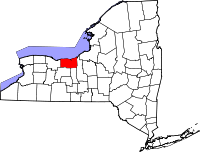 Location in the state of New York |
|
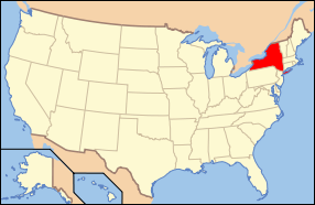 New York's location in the U.S. |
|
| Statistics | |
| Founded | 1823 |
|---|---|
| Seat | Lyons |
| Area - Total - Land - Water |
1,384 sq mi (3,585 km²) 604 sq mi (1,564 km²) 780 sq mi (2,020 km²), |
| Population - (2000) - Density |
93,765 155/sq mi (60/km²) |
| Website: www.co.wayne.ny.us | |
Wayne County is a county located in the U.S. State of New York. It is part of the Rochester, NY Metropolitan Statistical Area and lies on the south shore of Lake Ontario, forming part of the northern border of the United States with Canada. The name honors General Anthony Wayne, a Revolutionary War hero and American statesman.
Its location during the early westward expansion of the United States, on an international border and in a fertile farming region, has contributed to a rich cultural and economic history. Two world religions sprung from within its borders, and its inhabitants played important roles in Abolitionism in the years leading up to the Civil War. Nineteenth century War of 1812 skirmishes, Great Lakes sailing ship commerce and Erie Canal barge traffic have since yielded to contemporary recognition as one of the world's most productive fruit growing regions.
Contents
|
History
Prior to the arrival of Europeans, the land Wayne County encompasses was originally part of the Iroquois Confederacy, which had existed from around August 31, 1142.[1] When counties were established in New York State in 1683, it became part of Albany County. This was an enormous county, including the northern part of New York State and all of the present State of Vermont, extending (in theory) westward to the Pacific Ocean. In 1804, after numerous acts of subdividing, Seneca County was formed by the splitting of Cayuga County, which, in turn, was reduced in size by combining portions of Seneca and the remainder of Cayuga County to form Tompkins County in 1817.
On April 11 1823, Wayne County was formed by combining portions of Seneca and Ontario Counties.
Westward expansion
The first non-Native American settlers of the region located along the Ganargua River, just west of present-day Palmyra. In 1788 the area became part of the Phelps and Gorham Purchase, a 6,000,000 acre (24,000 km²) tract of land sold to Oliver Phelps and Nathaniel Gorham by the Commonwealth of Massachusetts. Sir William Pulteney, a British baronet and English land speculator. Pulteney and his partners in the Pulteney Association purchased a 1,000,000 acres (4,000 km²) of the former Phelps and Gorham Purchase in 1790.[2]
The first westward road was one coming from near Utica to Geneva, and, with the building of the Cayuga Bridge in 1800, was the road chosen by nearly all of the westward travelers. This highway left the Wayne region somewhat isolated and settlers desiring to locate there came by way of streams and lakes lying to the north of the road. It was only a few years after that the "new road" came west, passing through the county, opening up the fertile Ganargua lands to easier settlement.[3]
The first permanent settlement was started by John Swift and Col. John Jenkins in March 1789, about two miles from Palmyra. In May of that year a small colony made up of the Stansell and Leatherby families located at the junction of Ganargwa and the Canandaigua Outlet, calling the place Lyons, from a "fancied likeness of that city's location on the Rhone".[3]
While Phelps and Gorham sold some land to settlers, they were unable to make payments on their land and much of the land in the Phelps Gorham purchase either reverted to Massachusetts and was resold or conveyed directly to Robert Morris, a major financier of the Revolutionary War and signer of The Declaration of Independence. In 1792, he in turn sold approximately 1,200,000 acres (4,900 km²) to The Pulteney Association owned by Sir William Pulteney and two other minor partners. The Pulteney Purchase, or the Genesee Tract as it was also known, comprised all of the present-day counties of Ontario, Steuben and Yates, as well as portions of Allegheny, Livingston, Monroe, Schuyler and Wayne. After Pulteney's death in 1805 the land was known as the Pulteney Estate.[4]
Sir William Pulteney selected Charles Williamson as land agent to develop the purchased 1,200,000 acres (4,900 km²). In 1792, Williamson, a Scotsman came to the unsettled wilderness in upstate New York to develop the land by building roads, selecting sites for towns, dividing land into lots, and building gristmills, taverns, stores and houses.[4] Williamson selected Sodus Bay on Lake Ontario as the point for a future commercial center, with the idea that the lake and the Saint Lawrence River would be the outlet for the products of the region. In 1794 he had roads built from Palmyra to Phelpstown (present-day Phelps). Sodus was surveyed by Joseph Colt in lots of a quarter acre (1,000 m²), a hotel was built, and $20,000 dollars was expended in the first two years in improvements. Sodus quickly passed from having an uncertain future to the head of the towns of the region.[3]
Great Lakes commerce
Until the opening of the Erie Canal in 1823, Pultneyville, New York, at the mouth of Salmon Creek, was Wayne County's only port. From about 1811 through the 1890s (when the customs office closed), shipping in this small hamlet extended to the Atlantic Ocean and the world via the Saint Lawrence River. During the early years of the 19th century, activity in Pultneyville focused on agricultural commerce from the surrounding region (as far south as Canandaigua) and the maritime trade on the Great Lakes. In 1865, it was home to nearly 30 lake captains, and many sailors from both Pultneyville and Sodus Bay crewed on whalers around the world.[5] In 1874 the first railroad appeared when the Lake Shore Railroad line opened and the center of trade moved three miles south to Williamson and Pultneyville's significance as a commerce center sharply declined.[6]
Religion: Wayne County and the Second Great Awakening

Wayne County played host to key events in the development of significant American religions during the country's Second Great Awakening period of the early 19th century. Palmyra became the birthplace of The Church of Jesus Christ of Latter-day Saints in the 1820s. The Fox Sisters heard rappings from a dead peddler in Hydesville and spawned a movement that eventually garnered a million followers at its peak,[7] and Sodus Bay contained a significant, albeit short-lived, community of Shakers about the same time.[8]
Spiritualism and the Fox sisters
Spiritualists often set March 31, 1848 as the beginning of their movement. On that date, Kate and Margaret Fox, of Hydesville, reported that they had made contact with the spirit of a murdered peddler. What made this an extraordinary event was that the spirit communicated through audible rapping noises, rather than simply appearing to a person in a trance. The evidence of the senses appealed to practical Americans, and the Fox sisters became a sensation. Demonstrations of mediumship (seances and automatic writing, for example) proved to be a profitable business, and soon became popular forms of entertainment and spiritual catharsis. The Foxes earned a living this way, as did many others.[9]
Joseph Smith, Hill Cumorah and Mormonism

Illustration by Charles William Carter, 1886
Hill Cumorah in Palmyra is where Smith discovered the Golden Plates which contained the writings of the Book of Mormon.
On the west side of this hill, not far from the top, under a stone of considerable size, lay the plates of the Book of Mormon, deposited in a stone box.
– Joseph Smith, Jr.
Smith visited the hill each year on the fall equinox (September 22, 22) between 1823 and 1827 and claimed to be instructed by the angel Moroni. Smith said he was finally was sufficiently instructed to take the Mormon record on September 22, 1827. It is not absolutely known if no one else saw the actual plates until June 15, 1829, but those who did on that date testified that they saw and they bore record of the validity of Joseph Smith as a Prophet and The Book of Mormon as a true ancient American record. Martin Harris, David Whitmer and Oliver Cowdery testified that it was indeed from God. All three later apostatized from the Church but none ever denied the truthfulness of their testimonies. The powerful witness accounts can be found in the preface to the Book of Mormon.
The hill (which was then unnamed) was only a few miles from Joseph Smith's home on the main road toward Canandaigua from Palmyra to Manchester and is not far from Carangrie Creek and the Clyde River. According to geologists, the hill, a drumlin, was formed during the retreat of the last Ice Age glaciers and it rises approximately 110 feet above the surrounding valley floor.
Smith and his Mormon followers soon trekked westward, Smith was shot by a mob in Carthrage jail Illinois. Brigham Young was eventually sustained as Prophet, Seer and Revalator just as in times of old. After much hardship they found Salt Lake City, Utah and The Church of Jesus Christ of Latter-day Saints. The Hill Cumorah Pageant is held annually in Palmyra by the church and attracted over 100,000 attendees during its 2001 performances.[10] The church reported a worldwide membership of over 12.5 million in 2005.[11]
War of 1812
Two small skirmishes were fought in the county during the War of 1812: one in Sodus in June 1813[12] and the other in Williamson, a year later. In May 1814 British troops under the command of Sir James Yeo landed in the Williamson hamlet of Pultneyville. Yeo's fleet had already successfully raided Oswego to the east and unsuccessfully attacked Rochester to the west before attempting to obtain stores from Pultneyville. An agreement with the hamlet's residents was made, permitting the invaders to seize supplies without resistance. A dispute broke out, however, and weapons fire began on both sides, including cannon bombardment from Lake Ontario. A few citizens were killed or wounded and two were taken prisoner as the British fled.[13]
Civil War and Underground Railroad

During the American Civil War Wayne County inhabitants were active in support of the Underground Railroad due to the area's proximity to slave-free Canada.[14][15][16] Wayne County also raised companies for multiple volunteer Union regiments, including the 33rd New York Volunteer Infantry Regiment, the 111th New York Volunteer Infantry Regiment, and the 9th New York Heavy Artillery Regiment.
Erie Canal
The Erie Canal transits the southern edge of the county. The villages of Lyons, Newark, and Palmyra all became homes to canal locks when the Albany to Rochester section of the canal opened on September 10, 1823. On that day these communities became part of a direct water-link between the eastern seaboard metropolises of New York City and Baltimore and America's expanding western frontier.
Hoffman Essays
Wayne County high school seniors are offered the opportunity to win a scholarship by The Augustus L. and Jennie D. Hoffman Foundation Scholarship Essay Program. Established in 1954 to encourage the study of local history, students research and write essays on some aspect of Wayne County history or civic affairs. Between its inception and 2007 over 600 essays have been submitted.[17]
Nuclear Power
On June 1, 1970, the Robert E. Ginna Nuclear Power Plant started commercial operation on the shores of Lake Ontario, just over the Monroe County line in the Town of Ontario.
Historical societies
In addition to the county historical society, there are a number of other historical preservation organizations. Most of these are town or village based.
|
|
Law/Government and Politics
The county is governed by a Board of Supervisors, composed of the town supervisors from each of the county's fifteen towns. The board's chairman is selected from amongst the supervisors. The 2007 county budget was $154 million.[18]
The county seat is the village of Lyons and bi-weekly board meetings are held in the Wayne County Court House in the village.
Law enforcement in Wayne County is a shared responsibility of the New York State Police, Troop E, the Wayne County Sheriff's Office, and various town and village police departments.
The Wayne Supreme & County Court (7th Judicial District) sits in Lyons and hears felony cases as well as a few civil cases; the Wayne County Drug Treatment Court also provides an opportunity for recovering drug addicts to work with each other and improve their lifestyles.[19] Vehicle and traffic matters, small claims, evictions, civil matters and criminal offenses in Wayne County are heard in locally-funded town and village courts (collectively known as the Justice Courts).[20]
Education
Wayne County does not have a single unified school district to deliver K-12 education, but multiple central school districts. Each district is governed by a locally-elected board of education, run by a hired superintendent, and funded largely through property taxes, as well as state and federal aid. These districts include:
- Palmyra-Macedon Central School District
- Wayne Central School District
- Gananda Central School District
- Newark Central School District
- Marion Central School District
- Williamson Central School District
- Lyons Central School District
- North Rose-Wolcott Central School District
- Red Creek Central School District
- Sodus Central School District
- Clyde-Savannah Central School District
As with all educational activities in New York State, Wayne County's school systems are ultimately answerable to the New York State Board of Regents and the New York State Education Department, as well as their local communities. These districts also participate in the Wayne Finger Lakes Board of Cooperative Educational Services (BOCES), a state-established organization which shares common educational resources and has its own elected board and superintendent.
Wayne County also has several private, parochial/religiously-based schools, including:
- St. Michael School, Newark
- East Palmyra Christian School
- Heritage Baptist Christian School, Palmyra
Wayne County is not home to any regionally-accredited institutions of higher learning, but has a satellite campus of Finger Lakes Community College in Newark to serve the associate degree-level learner and has access to many excellent public and private colleges and universities in immediately adjacent counties (such as SUNY Brockport, SUNY Oswego, University of Rochester, and Hobart and William Smith Colleges, to name just a few).
Geography
Wayne County is in the western part of New York State, east of Rochester and northwest of Syracuse, on the south shore of Lake Ontario. Sodus Bay is located on the north shoreline of the county. Wayne is bounded by five other New York counties: the northern boundary is Lake Ontario with Canada on the opposite shore; the western boundary is Monroe County; and the eastern boundary is Cayuga County; the south boundary is shared with Ontario and Seneca Counties.
According to the U.S. Census Bureau, the county has a total area of 1,384 square miles (3,585 km²), of which, 604 square miles (1,565 km²) of it is land and 780 square miles (2,020 km²) of it (56.35%) is water.
The Clinton Formation, a band of red hematite across the county, led to a thriving iron industry during the 19th century. Furnaces were located in the Towns of Ontario and Wolcott.
Adjacent Counties
- Lake Ontario and Canada - north
- Cayuga County, New York - east
- Seneca County, New York - southeast
- Ontario County, New York - southwest
- Monroe County, New York - west
Major Highways
 New York State Route 14
 New York State Route 21
 New York State Route 31
 New York State Route 88
 New York State Route 89
 New York State Route 104
 New York State Route 414
Towns and villages (incorporated communities)
The county is completely rural and has no cities. Its largest political subdivision (incorporated communities) is the town, followed by the village. There are the 15 towns and nine villages.
|
|
|
Unincorporated communities
Wayne county has a number of unincorporated communities. Most are considered hamlets.
|
|
|
|
Notable Festivals and Parades
Wayne County is home to several festivals and parades, most from late spring through early fall due to the Upstate New York climate. Some of the more notable include:
- Apple Blossom Festival (Williamson, third week in May)
- Hill Cumorah Pageant (Palmyra and Manchester, Ontario County, third week in July)
- Rose Parade (Newark, third weekend in July)
- Wayne County Fair (Palmyra, second week in August)
- Lumberjack Festival (Macedon Center, second weekend in September)
- Canaltown Days (Palmyra, third weekend in September)
Also, many of Wayne County's volunteer fire departments host "firemen's carnivals" throughout the summer, with parades, rides, food, fireworks, and attractions which become a centerpiece of the summer social circuit.
Demographics
In 2005 the county's estimated population was 93,609, a slight drop from the decennial count in 2000 (93,765), and a 5 percent increase from the official count in 1990.[21] Families made up 70 percent of the households in Wayne County in 2005. This figure includes both married-couple families (59 percent) and other families (12 percent). Non-family households made up 30 percent of all households. Most of these households were people living alone, but some were composed of people living in households in which no one was related to the householder. Source: American Community Survey, 2005
As of the census[22] of 2000, there were 93,765 people, 34,908 households, and 25,063 families residing in the county. The population density was 155 people per square mile (60/km²). There were 38,767 housing units and the average population density was 25/km² (64/sq mi).[23]
There were 34,908 households out of which 36.10% had children under the age of 18 living with them, 56.70% were married couples living together, 10.30% had a female householder with no husband present, and 28.20% were non-families. 22.40% of all households were made up of individuals and 9.30% had someone living alone who was 65 years of age or older. The average household size was 2.64 and the average family size was 3.08.
In the county the population was spread out with 27.40% under the age of 18, 6.80% from 18 to 24, 30.10% from 25 to 44, 23.50% from 45 to 64, and 12.20% who were 65 years of age or older. The median age was 37 years. For every 100 females there were 98.10 males. For every 100 females age 18 and over, there were 95.50 males.
The median income for a household in the county was $44,157, and the median income for a family was $51,495. Males had a median income of $36,825 versus $26,470 for females. The per capita income for the county was $19,258. About 6.00% of families and 8.60% of the population were below the poverty line, including 10.70% of those under age 18 and 9.40% of those age 65 or over.
Racial/ethnic makeup
The racial makeup of the county was 93.80% White, 3.25% African American, 0.26% Native American, 0.47% Asian, 0.01% Pacific Islander, 0.87% from other races, and 1.34% from two or more races. Hispanic or Latino of any race were 2.41% of the population. 18.0% were of German, 12.8% Italian, 12.6% English, 11.6% Dutch, 11.4% Irish and 8.9% American ancestry according to Census 2000. 95.7% spoke English and 2.2% Spanish as their first language.
See also
References
Citations
- ↑ Barbara, Mann; Jerry L. Fields (1997). "A Sign in the Sky: Dating the League of the Haudenosaunee". American Indian Culture and Research Journal (American Indian Studies Center) 21 (2).
- ↑ McKelvey, Blake (1927). "Historic Aspects of the Phelps and Gorham Treaty of July 4-8, 1788". Rochester, New York: Rochester Public Library. Retrieved on 2007-01-07.
- ↑ 3.0 3.1 3.2 Sullivan, James (1927). "The History of New York State". Lewis Historical Publishing Company, Inc.. Retrieved on 2007-01-06.
- ↑ 4.0 4.1 "Williamson". Pultneyville Historical Society (2003-2006). Retrieved on 2007-01-07.
- ↑ Roemer, Lillian (Spring 1996). The Whale Hunters of Pultneyville. Rochester, New York: Rochester Public Library. pp. p. 5.
- ↑ The first train from Oswego to Charlotte, Rochester's port, ran on January 1, 1875. McKelvey, Blake (October 1968). Railroads in Rochester's History. Rochester, New York: Rochester Public Library. pp. p. 13.
- ↑ Stuart, Nancy Rubin (2005). The Reluctant Spiritualist. Harcourt Books.
- ↑ Martin, John H. (Fall 2005). "Saints, Sinners and Reformers". The Crooked Lake Review. Retrieved on 2007-01-07.
- ↑ Carroll 1997; Braude 2001
- ↑ "A History Lesson", The Rochester Democrat and Chronicle (July 8, 2001). Retrieved on 2007-02-15.
- ↑ Statistical Report 2005, The Church of Jesus Christ of Latter-day Saints.
- ↑ Marsh, Ruth; Dorothy S. Truesdale (October 1942). War on Lake Ontario: 1812–1815. Rochester, New York: Rochester Public Library. pp. p. 11.
- ↑ Marsh, Ruth; Dorothy S. Truesdale (October 1942). War on Lake Ontario: 1812–1815. Rochester, New York: Rochester Public Library. pp. p. 18.
- ↑ (1955). "The Underground Railroad". The Hoffman Foundation Scholarship Essay Program. Retrieved on 2007-02-14.
- ↑ (1970). "The Road North". The Hoffman Foundation Scholarship Essay Program. Retrieved on 2007-02-14.
- ↑ (1977). "Williamson's Contribution to Three Great Movements". The Hoffman Foundation Scholarship Essay Program. Retrieved on 2007-02-14.
- ↑ "The Hoffman Foundation Scholarship Essay Program". Wayne County, NY: Office of the County Historian. Retrieved on 2007-01-07.
- ↑ "Wayne County, New York: County Budget". Wayne County, New York (December 16, 2006). Retrieved on 2007-01-06.
- ↑ "7th Judicial District Wayne County, N.Y.". New York State Unified Court System. Retrieved on 2008-11-28.
- ↑ "Town & Village Courts". New York State Unified Court System. Retrieved on 2008-11-28.
- ↑ "U.S. Census Bureau, 2005 Population Estimates, Census 2000, 1990 Census". U.S. Census Bureau. Retrieved on 2007-01-07.
- ↑ "American FactFinder". United States Census Bureau. Retrieved on 2008-01-31.
- ↑ "U.S. Census (2000) - Fact Sheet (Wayne County, NY)". U.S. Census Bureau. Retrieved on 2007-01-07.
Sources
"The Hoffman Foundation Scholarship Essay Program". Wayne County, NY: Office of the County Historian. Retrieved on 2007-01-07.
External links
- Wayne County, NY official site
- Wayne County, NY Tourism site
- Wayne County at the Open Directory Project
- Early history of Wayne County
|
|||||||||||||||||
|