Warren County, Illinois
| Warren County, Illinois | |
| Map | |
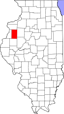 Location in the state of Illinois |
|
 Illinois's location in the U.S. |
|
| Statistics | |
| Founded | 1825 |
|---|---|
| Seat | Monmouth |
| Area - Total - Land - Water |
543 sq mi (1,406 km²) 542 sq mi (1,404 km²) 1 sq mi (3 km²), 0.12% |
| Population - (2000) - Density |
18,735 34/sq mi (13/km²) |
| Website: www.warrencountyil.com | |
Warren County is a county located in the U.S. state of Illinois. As of 2000, the population was 18,735. Its county seat is Monmouth, Illinois[1].
Warren County is part of the Galesburg Micropolitan Statistical Area.
Contents |
History
Warren County was organized in 1825 out of Pike County. Pike County, consisted of all portions of state North and West of the Illinois River before 1825. Henderson County was formed in 1841 from the western area of Warren County. Warren County was named for Dr. Joseph Warren, killed at the Battle of Bunker Hill in 1775. He is believed to have been the first officer to fall in the Revolutionary War.
Geography
According to the U.S. Census Bureau, the county has a total area of 543 square miles (1,407 km²), of which, 543 square miles (1,405 km²) of it is land and 1 square miles (2 km²) of it (0.12%) is water.
Adjacent counties
- Mercer County (north)
- Knox County (east)
- Fulton County (southeast)
- McDonough County (south)
- Henderson County (west)
Demographics
| Historical populations | |||
|---|---|---|---|
| Census | Pop. | %± | |
| 1900 | 23,163 |
|
|
| 1910 | 23,313 | 0.6% | |
| 1920 | 21,488 | −7.8% | |
| 1930 | 21,745 | 1.2% | |
| 1940 | 21,286 | −2.1% | |
| 1950 | 21,981 | 3.3% | |
| 1960 | 21,587 | −1.8% | |
| 1970 | 21,595 | 0% | |
| 1980 | 21,943 | 1.6% | |
| 1990 | 19,181 | −12.6% | |
| 2000 | 18,735 | −2.3% | |
| IL Counties 1900-1990 | |||
As of the census[2] of 2000, there were 18,735 people, 7,166 households, and 4,966 families residing in the county. The population density was 34 people per square mile (13/km²). There were 7,787 housing units at an average density of 14 per square mile (6/km²). The racial makeup of the county was 95.60% White, 1.59% Black or African American, 0.18% Native American, 0.34% Asian, 0.10% Pacific Islander, 1.10% from other races, and 1.10% from two or more races. 2.71% of the population were Hispanic or Latino of any race. 18.7% were of American, 17.1% German, 13.8% English, 12.2% Irish and 9.0% Swedish ancestry according to Census 2000.
There were 7,166 households out of which 29.80% had children under the age of 18 living with them, 56.50% were married couples living together, 8.80% had a female householder with no husband present, and 30.70% were non-families. 26.70% of all households were made up of individuals and 12.70% had someone living alone who was 65 years of age or older. The average household size was 2.44 and the average family size was 2.94.
In the county the population was spread out with 23.20% under the age of 18, 12.40% from 18 to 24, 24.50% from 25 to 44, 23.60% from 45 to 64, and 16.30% who were 65 years of age or older. The median age was 38 years. For every 100 females there were 93.80 males. For every 100 females age 18 and over, there were 91.10 males.
The median income for a household in the county was $36,224, and the median income for a family was $42,437. Males had a median income of $30,365 versus $20,453 for females. The per capita income for the county was $16,946. About 6.80% of families and 9.20% of the population were below the poverty line, including 11.50% of those under age 18 and 7.00% of those age 65 or over.
Transport
Air
- Monmouth Municipal Airport "info". Retrieved on 2008-08-02.
Road
- US 34
- US 67
- Illinois Route 94
- Illinois Route 116
- Illinois Route 135
- Illinois Route 164
Law Enforcement
State
- Illinois State Police District 14, Macomb
County
- Warren County Sheriff's Office
Municipal
- Alexis Police Department, Alexis
- Monmouth Police Department, Monmouth
Volunteer
Warren County/Monmouth Auxiliary Police Corps
Cities and towns
- Alexis (partly in Mercer County)
- Kirkwood
- Little York
- Monmouth
- Roseville
Unincorporated communities
- Cameron
- Cold Brook
- Eleanor
- Gerlaw
- Larchland
- Ormonde
- Ponemah
- Shanghai City
- Smithshire
- Swan Creek
- Utah
- Youngstown
Townships
Warren County is divided into these townships:
|
|
|
|
|||||||||||||||||||||||
|