Timaru
| Timaru | |
 |
|
| Urban Area | |
|---|---|
| Population: | 27,200 |
| Extent: | Former Timaru City Council |
| Territorial Authority | |
| Name: | Timaru District Council |
| Population: | 42,867 (2006 census) |
| Land area: | 2,736.54 km² (1,056.58 sq mi) |
| Mayor: | Janie Annear |
| Website: | http://www.timaru.govt.nz/ |
| Extent: | Rangitata River to Pareora River, Pacific Ocean to Mackenzie District, including Rangitata Gorge |
| Regional council | |
| Name: | Canterbury Regional Council |
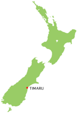
Timaru is a major port city in the southern Canterbury region of New Zealand, located 160 kilometres south of Christchurch and about 200 kilometres north of Dunedin on the eastern Pacific coast of the South Island. The Timaru District is a territorial authority of 42,867 people (2006 census) in and around the former Timaru City (27,200) includes a prosperous agricultural hinterland with links to smaller rural communities such as Pleasant Point (1,170), Temuka (4,044), and Geraldine (2,244). The town of Waimate is about 40 kilometres to the south on the road to Oamaru and Dunedin.
Caroline Bay beach is a popular recreational area located close to Timaru's city centre, just to the north of the substantial port facilities. Beyond Caroline Bay, the industrial suburb of Washdyke is at a major junction with State Highway 8, the main route into the Mackenzie Country. This provides a road link to Fairlie, Twizel, Lake Tekapo, Aoraki/Mount Cook and Queenstown.
Timaru has been constructed on rolling hills created from the lava flows of the extinct Mt Horrible volcano, which last erupted many thousands of years ago. The result is that most of the main streets are undulating, a clear contrast with the flat landscape of the Canterbury Plains to the north. This volcanic rock is used for the construction of local "bluestone" buildings.
Timaru District Settlements
- Pleasant Point
- Temuka
- Waimate
- Geraldine
- Orari
- St Andrews
Local history
Early settlement
The origin of the name 'Timaru' is disputed . Some believe that it derives from Māori Te Maru, which can mean a 'place of shelter'. However, other authorities allege that Timaru originates from a literal translation of the combination of ti, a cabbage tree and maru, meaning 'shady'.
Māori canoes seem to have employed the site of Timaru as a place to rest on long journeys up and down the eastern coastline for many years before the arrival of the first Europeans in the 19th century. The area includes over 500 sites with traces of Māori rock art, particularly in the rock overhangs and caves of the Opuha and Opihi river valleys, to the west of modern day Timaru. Archaeologists have suggested that Māori tribes were permanently settled in the district before 1400 AD. During the 17th or 18th century the resident Ngāti Mamoe were driven southwards into Fiordland by an invasion of the Ngāi Tahu, who came from the North Island.
19th century European settlement
European settlement began with the construction of a whaling station in 1839 by the Weller brothers of Otago at Patiti Point, close to the present town centre. A supply ship, The Caroline, provided the name for a local bay. Later a sheep station, known as The Levels, was created on land purchased by the Rhodes brothers. Few lived in Timaru until 1859 when the ship SS Strathallan arrived from England, carrying a party of 120 immigrants. Persistent land disputes arose between the brothers and local government officials with the result that two townships were established in the port area, Government Town and Rhodestown. These eventually merged into a single community in 1868. Given this division, until recently none of the main north-south streets lined up. Stafford Street, which became the main thoroughfare, was formed along the early bullock wagon trail.
Following the loss of a number of vessels of the coast, work started on the redevelopment of the artificial port in 1877, which eventually caused sand washed south down the Pacific shoreline to build up against the northern mole. This was the beginning of the extensive land reclamation around the Caroline Bay district, an area which is still growing today.
20th century development
Timaru continued to expand during the 20th century, with much of the development taking the form of wooden colonial style bungalows set in individual sections of land.
Geography
Climate
| Month | Jan | Feb | Mar | Apr | May | Jun | Jul | Aug | Sep | Oct | Nov | Dec | Year |
|---|---|---|---|---|---|---|---|---|---|---|---|---|---|
| Average high °C (°F) | 21.1 (70) |
20.9 (70) |
19.3 (67) |
16.6 (62) |
13.3 (56) |
10.6 (51) |
10.1 (50) |
11.4 (53) |
14.2 (58) |
16 (61) |
18.3 (65) |
19.9 (68) |
16 (61) |
| Average low °C (°F) | 11.3 (52) |
11.1 (52) |
10 (50) |
7.1 (45) |
3.9 (39) |
1.3 (34) |
1.2 (34) |
2.3 (36) |
4.5 (40) |
6.4 (44) |
8.4 (47) |
10.4 (51) |
6.5 (44) |
| Precipitation mm (inches) | 46 (1.81) |
38 (1.5) |
52 (2.05) |
66 (2.6) |
42 (1.65) |
41 (1.61) |
43 (1.69) |
45 (1.77) |
35 (1.38) |
55 (2.17) |
48 (1.89) |
53 (2.09) |
573 (22.56) |
| Source: NIWA Climate Data[1] 1971 – 2000 | |||||||||||||
Government and politics

The mayor of Timaru is Janie Annear.
Economy
Timaru is one of the major cargo ports of the South Island, with a number of light manufacturing plants associated with the export and import trade. Many of these producers are concerned with processing, packing, and distributing meat, dairy and other agricultural produce.
Timaru is the second largest fishing port in New Zealand.
Transport
Timaru is located on State Highway One (SH1), the main road route down the eastern coast of the South Island.
There are regular coach and minibus services to Christchurch, Dunedin, Invercargill, Queenstown and the Mackenzie Country, leaving from outside the Visitor Information Centre, which provides booking facilities and other travel services.
The Main South Line section of the South Island Main Trunk Railway runs through Timaru and is a significant freight corridor. Passenger rail services were discontinued after the cancellation of the Southerner in February 2002. Between 1949 and 1970, Timaru was serviced by the South Island Limited, one of the former New Zealand Railways Department's most prestigious trains.
Richard Pearse Airport is located to the north of the city. It is equipped to handle light aircraft and short haul domestic flights, with regular services to Wellington.
A number of bus services connect Timaru's suburbs to the town centre.
Education
Further information: List of schools in Canterbury, New Zealand
- Pre-school
- Primary Schools
- Barton Rural
- Beaconsfield
- Bluestone
- Gleniti
- Grantlea Downs
- Highfield
- Oceanview Heights (Previously Marchwiel School)
- Sacred Heart Primary
- St. Josephs School
- Timaru Christian
- Timaru South School
- Waimataitai
- Secondary Schools
- Timaru Boys' High School
- Timaru Girls' High School
- Roncalli College
- Craighead Diocesan School
- Mountainview High School
- Higher Education
- Aoraki Polytechnic
There are a number of primary schools including Timaru South School which has two campuses, one in Timaru and the other in Pareora 12 km away. Timaru also has many nurseries and Plunket rooms.
Shopping
Retailing is concentrated around the Stafford Street area. In addition there are a number of local shopping malls distributed around the town, with extensive parking facilities.
Timaru has a branch of The Warehouse, a major national retailer. Ballantynes is a large department store in the city centre.
Tourist attractions
In recent years attempts have been made to promote local tourism and provide services for recreational visitors. The Visitor Information Centre, centrally located in the old Landing Services Building, next to the Railway Station, offers high quality advice and guidance about the South Canterbury district. the knowledgeable staff provide an efficient booking service for transport and visitor accommodation.

The South Canterbury Museum is the main museum for the region, containing exhibits relating to physical geography and the environment, fossil remains, Māori rock art, the early settlement of the district, local maritime history, scrimshaw, the E P Seally natural history collection, and information about Richard Pearse, a local inventor and his attempts at manned flight in the first years of the 20th century.
The Aigantighe (a Scots Gaelic word pronounced "egg and tie") Art Gallery in Wai-iti Road is the South Island’s third largest art museum and one of the best art galleries in the country. It holds a collection of New Zealand, Pacific, Asian and European art works from the sixteenth century to the present day and includes a sculpture garden. The gallery was founded in 1956 and is housed in a homestead built in 1908.
Timaru is graced with a number of open spaces, public gardens and parks. The Trevor Griffiths Rose Garden at Caroline Bay Park is an attractive new feature of the Timaru Piazza development. The parkland of the Bay Area contains a mini golf course, a roller skating rink, a maze and staging for musical events. It is home to the annual Summer Carnival that takes place over the Christmas and New Year holiday period. In addition, to the south of the city centre there is the extensive Timaru Botanic Gardens, first laid out in 1864, with a notable collection of roses and native tree ferns. To the west is the well maintained Centennial Park Reserve, opened in 1940, that includes a tranquil 3.5 km walkway following the wooded valley of the Otipua Creek.
The DB Mainland Brewery in Sheffield Street offers tours and tasting sessions.
Timaru has a number of high-quality cafes, wine bars and restaurants, mostly located in the Bay Area and around Stafford Street.
During the times of Boxing Day through to mid-January the Caroline Bay Park is taken over by the Caroline Bay Carnival, which features live performances, games, and side shows.
Media
The Timaru Herald is the local daily newspaper for the district and has been published since the mid nineteenth century. Papers are printed in Ashburton and then distributed throughout the Otago and South Canterbury region.
The region also supports a weekly community newspaper, The Timaru Courier, which has a circulation of over 24,000 copies and is delivered free every Thursday to local households.
Timaru has 2 local FM radio stations, Classic Hits FM which was originally called Radio Caroline New Zealand and Port FM. There are also many networked FM radio stations.
Notable People From Timaru
Academics
- Hugh D. Wilson, Botanist
Politics & Business
- Jim Sutton, Politician
- Basil Arthur, Politician
Film & Television
- Kevin Smith, Actor
- Neil Gudsell, Actor/Singer
Journalism
- Allen Curnow, Poet & Journalist
- Russell Brown, Journalist & Media Commentator
Music
- Peter Dawkins, Record producer and musician
- Michael Houstoun, Concert Pianist
Religious Leaders
- Reginald Cardinal Delargey, Roman Catholic Bishop
Aviation
- Richard Pearse, farmer, inventor & pioneering aviator
Rugby Union
- Brendan Laney, professional rugby player
Boxing
- Bob Fitzsimmons, World Heavyweight Champion from March 17, 1897 until June 9, 1899
Swimming
- Danyon Loader, Men's swimming Olympic Champion, born in Timaru
Field Hockey
- Ross Gillespie New Zealand Olympic Field Hockey Representative
Athletics
- Jack Lovelock, was a New Zealand athlete, and a 1936 Olympic 1500m Champion
Cricket
- Murray Parker, NZ Cricketer
- Mark Moreton Parker, NZ Cricketer
- Haidee Tiffen, NZ Women's Cricketer
- John Ward, NZ Cricketer
- Craig Cumming, NZ Cricketer
Motor Sport
- Ernie Sprague, Ford Zephyr racer
Recreation & Leisure
Drama and performing arts
The Theatre Royal at 118 Stafford Street is home of much of Timaru's live entertainment.
Public libraries
The Timaru District Library has branches situated in Timaru, Temuka and Geraldine.
The first Reading Room was opened in the Scholl House, Barnard Street in 1862. It was open daily from 5.00pm - 10.00pm and on Saturdays 10.00am - 8.00pm. English and Colonial Newspapers were provided and a selection of Library Books for the use by members. In 1870 the Mechanics Institute was created by an addition on an existing building and aimed to provide a Library, Reading Room and News Room.
Timaru Public Library was officially opened in 1909 on the present Timaru District Council site. The Library was built with a 3,000 pound grant from Andrew Carnegie of New York - the condition under which the money was given was that the reading rooms should be open to everyone and that the lending Library should be free to ratepayers of the borough. The current library was opened on Sophia Street in 1979. It was designed by Miles, Warren and Mahoney.
Sport
Sporting venues
Timaru has a comprehensive range of community sporting facilities designed to international standards for rugby, tennis, yachting, swimming, netball, cricket, golf, hockey, croquet and bowls. Aorangi Park is Timaru's major sporting venue. The Council also operates two swimming pools.
Football
Timaru's main football ground is Sir Basil Arthur Park. It has 4 senior pitches and 5 junior pitches.
Rugby
- South Canterbury Rugby Football Union is based in Timaru. Alpine Energy Stadium is the home of local rugby.
Golf
Timaru has many Golf Clubs and well maintained Golf courses. Most have green fees of around $15 NZD. Clubs include:
- Highfield Golf Club ($20) NZ Golf - Highfield Golf Club
- Gleniti Golf Club ($20) NZ Golf - Gleniti Golf Club
- Timaru Golf Club ($25-35) NZ Golf - Timaru Golf Club
and in close proximity to these (15 minute drive)
- Pleasant Point Golf Club ($15) NZ Golf - Pleasant Point Golf Club
- St.Andrews Golf Club ($15-$25) NZ Golf - St.Andrews Golf Club
- Maungati Golf Club (9 holes) ($5) NZ Golf - Maungati Golf Club
- Temuka Golf Club ($15) NZ Golf - Temuka
Surfing
Timaru has some great surfing.
- -Patiti Point, near Timaru city, has a left-hand reef break, which operates very consistently in any swell from the east or south.
- Jack’s Point (3 km south of Timaru) has both left and right-hand reef breaks at high tide, as does Lighthouse Reef, a short walk to the south. Southerly swells produce super-heavyweight monster breakers along the Timaru coast, which are only suitable for top-gun surfers.
About 1 hr and 20 minutes drive south is Kakanui, which has some very large surf.
Trivia
- Racehorse Phar Lap was born just to the north of Washdyke, and pioneer aviator Richard Pearse lived at Waitohi, 15 kilometres north of Timaru.
- Bob Fitzsimmons a champion boxer lived and worked as a blacksmith in Timaru. There is a life sized statue of him in the city centre. Fitzsimmons was born in Helston, Cornwall, UK and emigrated to New Zealand when he was nine years of age.
- During 1978, The ocean liner, SS Australis (SS American Star, SS America) was for months laid up in storage at the port of Timaru.
- Timaru crater on Mars is named after the city.
- In 2004, a single was released about Timaru by Auckland band Deja Voodoo, entitled "Today, Tomorrow, Timaru". This was meant as a tribute to Jordan Luck, lead singer of The Exponents
- The 1986 Dance Exponents song, "Caroline Skies" references Timaru.
- 1936 Olympic 1500m gold medalist Jack Lovelock attended Timaru Boys High School, and donated the oak tree which he received as part of his prize to the school, where it remains to this day. There is a statue of him at the school, made by the same sculptor who created the Bob Fitzsimmons statue on Strathallan Corner. Lovelock was born in Crushington near Reefton on the South Island's West Coast.
- An MTV Production's short documentary entitled, "True Life: I'm the New Kid in Town", was partially filmed in Timaru. The documentary featured a 15 year old American school girl and her family adapting to their new home in Timaru.
Sister Cities
 Eniwa City, Hokkaido, Japan
 Orange, Australia
 Weihai, China
 Orange, USA
Further reading
- James Bellich, Russell Brown, and Martin Robinson (2004) New Zealand, Lonely Planet Series
- Darroch Donald (2003) New Zealand, 2nd Edition, Footprint Guide Series.
- Laura Harper, Tony Mudd and Paul Whitfield (2000) The Rough Guide to New Zealand, Rough Guide Series
References
- ↑ "Climate Data". NIWA. Retrieved on November 2, 2007.
External links
- Timaru District Council
- Tourist information
- Timaru District Library
- Historic images of Timaru from the collection of the Museum of New Zealand Te Papa Tongarewa
|
|||||||||||||||||
|
||||||||||||||||||||||||||