Tagaytay City
| City of Tagaytay Lungsod ng Tagaytay |
|||
 |
|||
|
|||
| Nickname(s): The Philippines' 2nd Summer Capital | |||
 |
|||
| Country | Philippines | ||
|---|---|---|---|
| Region | CALABARZON (Region IV-A) | ||
| Province | Cavite | ||
| Districts | 3rd District of Cavite | ||
| Barangays | 34 | ||
| Incorporated (town) | February 3, 1945 | ||
| Incorporated (city) | June 21, 1938 | ||
| Government | |||
| - Mayor | Abraham "Bambol" Tolentino (Kampi/Liberal) (2007-2010) | ||
| - Vice Mayor | Virgilio T. Ambion (Kampi/Liberal) (2007-2010) | ||
| Area | |||
| - Total | 66.1 km² (25.5 sq mi) | ||
| Elevation | 634 m (2,080 ft) | ||
| Population (2007) | |||
| - Total | 61,623 | ||
| - Density | 932/km² (2,413.9/sq mi) | ||
| Time zone | PST (UTC+8) | ||
| Area code(s) | 46 | ||
| Website: www.tagaytay.gov.ph | |||

The City of Tagaytay (Filipino: Lungsod ng Tagaytay) is a third class city in the province of Cavite, Philippines. Only 55 km (34 mi) away from Manila via Aguinaldo Highway, it is one of the country's most popular tourist destinations. Tagaytay City provides a good view of the Taal Volcano. The city is a popular summer tourist destination because of its cool climate due to its high altitude.
Contents |
Geography
Tagaytay City lies on top of the Tagaytay Ridge, which, at 640 m (2,100 ft) above sea level, is the highest point in Cavite. The ridge provides a spectacular view of Taal Lake and Taal Volcano in Batangas. This view supports Tagaytay's main industry, which is tourism.
Location
Tagaytay City is located in the Province of Cavite, on the island of Luzon, approximately 56 km (35 mi) south of Manila. It lies within 120° 56' longitude and 14° 6' latitude and overlooks Manila Bay on the North, Taal volcano and Taal lake on the south and Laguna Bay on the east.
The City is linked by the national highway to the Metropolitan Manila Area and to the Province of Batangas. It is also connected by the roads to the adjoining municipalities of Amadeo, Mendez, Indang, Silang and Alfonso in Cavite towards the northwest, to the cities of Calamba and Sta. Rosa in Laguna in the northeast and to the town of Talisay in Batangas in the south.
Land area
Tagaytay City has a total land area of 66.1 km2 (26 sq mi) which represent about 5.14% of the total area of the Province of Cavite. There are 34 barangays, 6 of which are urban and the rests are classified as rural.
Topography
Tagaytay City is characterized by mixed topography, the southern and eastern portions are covered by hills and mountains which is generally forests and open grasslands. These are the ridge with slope ranging from 10.0 to over 25 percent. On the other hand the portions adjoining the municipalities of Mendez, Indang, Amadeo and Silang are level to nearly level areas interspersed with very gently sloping surface. The built-up areas including the urban center is situated in these relatively level portions of the city.
Tourism
The city of Tagaytay is a tourist attraction for local and foreign visitors. It is a vantage point of Taal Lake and Volcano. Tagaytay also offers a view of Taal Lake - a lake within an island within a lake.

Route
Tagaytay is an hour and 15 minute drive from Manila via the South Luzon Expressway or using the Coastal Road Expressway and the Aguinaldo Highway. If going through the South Luzon Expressway, take the Carmona Exit and drive down through the Governor's Drive and Silang up to the entrance of Tagaytay City. Or through South Luzon Expressway, take Sta. Rosa exit going straight to Tagaytay City. There are two possible ways to get to Tagaytay via the Coastal Road: Taking the Coastal Road to the Aguinaldo Highway and continuing south, and using the Indang and Mendez Roads in the Trece Martires City and Amadeo areas. If coming from the neighboring town of Ternate, Cavite take the Naic Road and drive straight to Indang and Trece Martires City. From Batangas, the best way to reach Tagaytay is through the new circumferential road. From Laguna, you may enter Tagaytay through the Carmona exit. There are buses that ply to Tagaytay from Manila on a daily basis. Several bus companies have their terminals in EDSA, Pasay City, and at Baclaran, below LRT, Manila.
Climate
Temperature and precipitation
Tagaytay City's climate is characterized by relatively low temperature, low humidity and abundant rainfall. The City is endowed with a cool and invigorating climate with an average temperature of 22.7 °C. Situated approximately 600 meters above sea level, the city is misty and is relatively cooler during the months of December, January and February. Like most areas in the Province of Cavite, the city has two pronounced seasons: dry from November to April and wet during the rest of the year. The climate has made the city very ideal for sports, picnics, conferences, honeymoons, country homes, and spiritual retreats.
Humidity
Tagaytay has an average humidity of 78% which makes the city cooler than Metro Manila where relatively humidity exceeds 81%. Northeasterly winds prevail in the City from October to April. Winds come from southwest from May to September. The cool Tagaytay breeze has made the city ideal for leisurely kite flying and competitions.
Barangays
Tagaytay City is politically subdivided into 34 barangays.
|
|
|
History
Legend has it that the word Tagaytay came from "taga" meaning to cut and "itay" which means father. A father and son were said to be on a wild boar hunt when the animal they were chasing turned and attacked them. As the boar charged towards the old man, the son cried "taga itay!". The boy's repeated shout reverberated in the alleys of the ridge. Heard by the residents, hunters and wood gatherers, the cries became subject of conversation for several days in the countryside. In time, the place where the shouts came from became known as TAGAYTAY.
During the Philippine revolution of 1896, the ridges and forests of Tagaytay became the sanctuary for revolutionaries including those from nearby provinces. The passage to and from towns via Tagaytay added the word "mananagaytay" to the native's vocabulary. It means "to traverse ridges."
On February 3, 1945, the 11th Airborne Division of Lt. Gen. William Krueger's 8th Army performed a combat jump of the 511th Parachute Infantry Regiment and associated elements on the ridge, with a drop zone around the Manila Hotel Annex, which had been cleared of Japanese forces by Filipino soldiers and local guerillas. To commemorate this event, a marker was installed in 1951 at the junction of Silang, Canlubang-Nasugbu roads by the city officials in coordination with the Philippine Historical Institute.
Timeline
- 1749 - destroyed the entire Volcano Island and the towns of Taal, old Sala and part of old Tanauan.
- 1754 - destroyed towns of Sala, Lipa, Tanauan and Talisay.
- 1911 - devastated Volcano Island; killed 1334 people; ashes reached Manila.
- 1965 - affected the entire Volcano Island; ashfall covered an area of 60km² killed 200 people.
- 1937- Construction ensues on Tagaytay ridge. Taal Vista Lodge is built, to be run by the Manila Hotel Corporation. Cavite prisoners construct the long highway stretching from Silang up to the ridge. This is the continuation of the Aguinaldo Highway, named after the First President of the Republic of the Philippines, Emilio Aguinaldo.
- 1979 - First Lady Imelda Marcos brings a major change to the landscape: The Palace in the Sky is erected as a guesthouse for American President Ronald Reagan - who never arrives. Palace in the sky is now better known as People Park in the Sky.
- 1992 - Mayor Ben Erni builds cement roads to the smaller barangays and erects the fruit arch on the city boundary to welcome investors.
Places of interest
Tagaytay Picnic Grove
Tagaytay's playground is the popular Picnic Grove. It features thatch huts line along the gentle slopes of the Tagaytay Ridge. It is a prime location, providing the finest view of the volcano far below. It is in Barangay Sungay East. For the image, please see the infobox at the top.
People's Park In The Sky
An artful blending of natural and man-made attractions, poised on the highest point of Tagaytay City. It stands on a 4,516 sq, meters solid ground and overlooks four bodies of water – Taal Lake, Balayan Bay, Laguna de Bay and Manila Bay. It is located at Dapdap West and Dapdap East, approximately 6 to 7 km away from Silang Crossing.
Tagaytay Highlands

Tagaytay Highlands is a world-class recreational and residential complex nestled amid the natural splendor and cool, unpolluted atmosphere of the Tagaytay Ridge. With tons of exciting activities, plush facilities, fine dining & drinking, and Asia's most exciting golf course, it serves as a getaway haven from the hustle and bustle of Metro Manila. It is also considered as the country's premier destination for luxury living.
Divine Word Seminary
Divine Word Seminary, one of biggest schools of theology in the Philippines in terms of population and land area, is also one of the oldest religious institutions in the city. It is run by Divine Word Missionaries also known as SVD.
41st Division USAFFE Marker
Tagaytay played a significant role in Philippine history. During World War 2, Filipino revolutionaries found refuge on its vast forests and ridges. It was used as landing site and sanctuary for paratroopers on their way to liberate Manila. The 41st USAFFE marker is a one place where you will know more about Tagaytay’s rich political history. It is located beside the Metro Tagaytay College of Business and Arts, Kaybagal South, Tagaytay City.
11th Airborne Division Marker
On February 3, 1945, the 11th Airbourne Division of Lt. Gen. William Krueger’s 8th Army airdropped military supplies and personnel together with the Philippine Commonwealth troops on the Tagaytay Ridge amidst enemy groundfire. Their mission: to secure Tagaytay City and guarantee the easy flow of troops and supplies to Manila, an action later proved as significant to the Manila Liberation. A marker was made at the Silang Crossing to honor the event.
Filipino-Japanese Friendship Garden
This 1,200 sq. meters garden was constructed to inculcate the value of freedom, peace and international unity into the hearts and minds of the people. It is located in front of Development Academy of the Philippines Conference Center, Sungay East, Tagaytay City.
Sister cities
 Amman, Jordan
 Bacolod City, Philippines
 Cuernavaca, Mexico
- Daraga, Albay, Philippines
 Fukuoka, Japan
 Goulbourn, Ontario, Canada
- Iriga City, Camarines Sur, Philippines
 Las Vegas, NV, U.S.A.
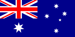 Manningham, Victoria, Australia
- Palayan City, Nueva Ecija, Philippines
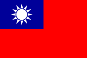 Tainan City, Taiwan
External links
- Official Website - City of Tagaytay
- Official Website of the Provincial Government of Cavite
- Tagaytay Wiki Map
|
||||||||
|
|||||||||||