Swiss Alps

The Swiss Alps (German: Schweizer Alpen, French: Alpes suisses, Italian: Alpi svizzere, Romansh: Alps svizras) are the central portion of the Alps mountain range that lies within Switzerland. Because of their central position they are also known as the Central Alps.
The highest summit in the Swiss Alps is the Dufourspitze, at 4,634 metres (15,202 ft) near the Swiss-Italian border. The highest mountain which lies entirely on Swiss territory is the Dom, at 4,545 metres (14,911 ft). Other main summits can be found in the list of mountains in Switzerland.
Contents |
Introduction
The Alps cover 61% of Switzerland's surface area (41,285 km²) thus making her the second most alpine country after Austria. Despite the fact that Switzerland covers only 13.2% of the Alps total area (190,600 km²), many alpine four-thousanders (48 of 82) are located in the Swiss Alps and almost the totality of the other are within 20 km of the country's border. The glaciers in the Swiss Alps cover an area of 1230 km² (3% of the Swiss territory), this represent 44% of the total glaciated area in the Alps (2800 km²).
Geography
- See also: Geography of Switzerland and Valleys of the Alps
The Swiss Alps are situated south of the Swiss plateau and north of the national border. The countries with which Switzerland shares mountain ranges of the Alps are (from west to east): France, Italy, Austria and Liechtenstein.
Subdivision
Like the Alps the Swiss Alps can be divided into two main parts, the Western Alps and Eastern Alps, whose division is along the Rhine from the lake Bodensee to the Splügen Pass (in Graubünden).
Western Alps

From west to east, south of Rhône and Rhine:
- Chablais Alps*: Canton of Valais, separated from the Mont Blanc Massif by the Arve, the Dents du Midi are the highest summits.
- Graian Alps (Mont Blanc Massif): Canton of Valais, separated from the Pennine Alps by the Col Ferret. The Aiguille d'Argentière is the highest summit on the Swiss side.
- Pennine Alps (Valais Alps): Canton of Valais, separated from the Lepontine Alps by the Simplon Pass, contains the highest Swiss mountains, the Dufourspitze in the Monte Rosa Massif, the Dom, the Weisshorn and the Matterhorn (38 summits over 4000 m).
- Lepontine Alps: Cantons of Valais, Ticino, Graubünden, separated from the Oberhalbstein Range by the Splügen Pass, contains the St. Gotthard Pass.
From west to east, north of Rhône and Rhine:
- Bernese Alps*: Cantons of Bern,Valais, Vaud, Fribourg, separated from the Urner Alps by the Grimsel Pass, contains the Jungfrau and the north face of Eiger (9 summits over 4000 m).
- Urner Alps*: Cantons of Uri, Bern, Valais, Lucerne, Obwalden, Nidwalden, separated from the Glarus Alps by the Reuss River.
- Glarus Alps*: Cantons of Uri, Glarus, Graubünden, separated from the Appenzell Alps by the Seeztal.
- Appenzell Alps*: Cantons of Appenzell Innerrhoden, Appenzell Ausserrhoden, St. Gallen.
Eastern Alps

All following mountain ranges are situated in Graubünden, they are part of the Central Eastern Alps except the Ortler Alps which belong to the Southern Limestone Alps.
From west to east, north of Mera and Inn river:
- Oberhalbstein Range
- Plessur Range*
- Albula Range
- Rätikon*
- Silvretta*
- Samnaun Alps*
From west to east, south of Mera and Inn river:
- Bregaglia Range
- Bernina Range (contains the easternmost summit over 4000 m: the Piz Bernina)
- Livigno Range (Piz Paradisin highest on the Swiss side)
- Ortler Alps* (Piz Murtaröl highest on the Swiss side)
- Sesvenna Range
(*) situated out of the main chain
Hydrography
Lakes
- See also: List of lakes in Switzerland
Since the highest dams are located in Alpine regions, many large mountains lakes are artificial and are used as hydroelectric reservoirs. As some large artificial lakes can be found at above 2,300 m, natural lakes larger than 1 km² are generally below 1,000 m (with the exceptions of Lake Sils and Oeschinen). The melting of low altitude glaciers can generate new lakes, such as the 0.25 km² large Triftsee which formed between 2002-2003.
Rivers
- See also: List of rivers in Switzerland
The waters flowing in the Swiss Alps can end up in the North Sea, the western Mediterranean Sea, the Adriatic Sea or in the Black Sea. Switzerland owns 6% of Europe's fresh water, this is why it is sometimes referred as the "water tower of Europe".
Triple watersheds:
- Witenwasserenstock, Lepontine Alps: Rhone (Mediterranean Sea), Po (Adriatic Sea) and Rhine (North Sea).
Geology
- See also: List of glaciers in Switzerland
With a few exceptions, the Alps north of Rhone and Rhine river are part of the Helvetic Zone and those on the south side are part of the Penninic nappes. As the first ones are generally composed of hard crystalline rocks , the second ones contains mainly metamorphic rocks.
The last glaciations deeply transformed Switzerland’s landscape, many valleys of the Swiss Alps are characteristically U-shaped due to the erosion of ice. During the maximum extension of the Würm glaciation (18,000 years ago) the glaciers completely covered the Swiss Plateau, before retreating to remain only in high mountain areas. Nowadays the Aletsch Glacier in the western Bernese Alps is the largest and longest in the Alps, having a length of 23 km and a maximum depth of 900 metres (2953 ft) at Konkordia. Along with the Fiescher and Aar Glaciers the region became a UNESCO World Heritage Site in 2001.
Climate and flora
- See also: Climate of the Alps
As the temperature decreases with altitude (0,56°C per 100 metres on yearly average), three different regions, each having distinct climate, are to be found in the Swiss Alps:
Subalpine zone
The Subalpine zone is the region which lies below the tree line. It is the most important region as it is the larger of the three and contains almost all human settlements as well as the productive areas. The forests are mainly composed by conifers above 1,200-1,400 metres as the deciduous tree forest are confined to lower areas. The upper limit of the Subalpine zone is located at about 1,800 metres on the north side of the Alps and at about 2,000 metres on the south side. It can however differ in some regions such as the Appenzell Alps (1,600 metres) or the Engadine valley (2,300 metres).
Alpine zone
The Alpine zone (Tundra) is situated above the tree line and is exempt of tree because of low average temperatures. It contains mostly grass and small plants along with mountain flowers. Below the permafrost limit (at about 2,600 metres), the alpine meadows are often used as pastures. Some villages can still be found on the lowest altitudes such as Riederalp (1,940 m) or Juf (2,130 m). The extend of Alpine zone is limited by the first permanent snow, its altitude greatly vary depending on the location (and orientation), it is comprised between 2,800 and 3,200 metres.
Glacial region
The glacial region is the area where the melting of snow in summer does not compensate the snow falls in winter. It is the last region and thus has no upper limit. When the stepness of the slope is not too high, this results in an accumulation and compaction of snow, which transform into ice. The glacier formed then flows down the valley and can reach far location on very low altitudes (1,500 metres for the Upper Grindelwald Glacier). Where the slopes are too step, the snow accumulates to form seracs until it fall. The Bernese Alps, Pennine Alps and Mont Blanc Massif contain most of the glaciated areas in the Alps. Except research stations such as the Sphinx Observatory no settlements are to be found in those regions.
Travel and tourism

Tourism in the Swiss Alps began with the first ascents of the main peaks of the Alps (Jungfrau in 1811, Piz Bernina in 1850, Dufourspitze in 1855, Matterhorn in 1856, Dom in 1858, Weisshorn in 1861) mostly by British mountain climbers accompanied by the local guides. The construction of facilities for tourists started in the mid nineteenth century with the building of hotels and mountain huts (creation of the Swiss Alpine Club in 1863) and the opening of mountain train lines (Mount Rigi in 1873, Mount Pilatus in 1889, Gornergrat in 1898). 1912 was the year of inauguration of the Jungfraubahn which leads to the highest train station in Europe, the Jungfraujoch.
Summer tourism
Switzerland enjoys a network of 62,000 km well-maintained trails among which 23,000 are located in mountainous areas. Many mountains attract a large number of alpinists from around the world, especially the 4000 metres summits and the great north faces. The large winter resorts are also the most appreciated destinations in summer as most of aerial tramways operate through the year, enabling hikers and mountaineers to reach high altitudes without much effort. The Klein Matterhorn is the highest summit of the European continent to be served by cable car.
Winter tourism
The major destinations for skiing and other winter sports are located in Valais, Bernese Oberland and Graubünden, some are accessible only with public transports. The most visited places are:
- Davos
- Grindelwald
- St. Moritz
- Zermatt (all year round ski resort, car-free village)
Other important winter resorts are:
- Adelboden
- Crans Montana
- Engelberg
- Flims
- Gstaad
- Klosters
- Riederalp-Bettmeralp (car-free villages)
- Saas Fee (all year round ski resort, car-free village)
- Verbier
- Wengen (car-free village)
Transportation
- See also: List of mountain passes in Switzerland

The Swiss Alps and Switzerland enjoy an extensive transportation network. Every mountain village can be reached by public transport, the main companies are:
- Federal Railway
- Rhaetian Railway
- Matterhorn Gotthard Bahn
- Golden Pass
- PostBus
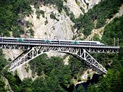
Most of mountain regions are within 3 hours of travel from Switzerland’s main cities and their respective airport. The Engadin Valley in Graubünden is usually 4 to 6 hours away from the large cities but the train travel itself with the panoramic Glacier Express or Bernina Express is considered as an attraction. The Engadin Airport near St. Moritz at an altitude of 1,707 metres (5,600 ft) is the highest in Europe.
The crossing of the Alps is a key issue at national and international levels, as the European continent is sharply divided by them. Since the beginnings of industrialization, Switzerland constantly had to improve its transalpine network. It began in 1882, by the Gotthard Rail Tunnel and was followed in 1906 by the Simplon Tunnel and more recently, in 2007, by the Lötschberg Base Tunnel. The 57 km long Gotthard Base Tunnel is slated to be open in 2016, it will finally provide a direct flat rail link through the Alps.
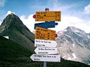
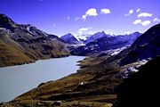
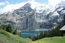
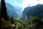
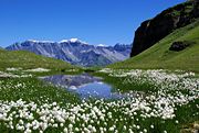
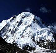
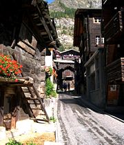
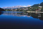
Gallery
Beyond the Alps
A large number of peaks outside the Alps were named or nicknamed after Swiss mountains, as the Wetterhorn Peak in Colorado or the Matterhorn Peak in California (see the Matterhorn article for a list of Matterhorns in the world).
The confluence of the Baltoro Glacier and the Godwin-Austen Glacier south of K2 in the Karakoram range was named Concordia by European explorers.
See also
- Natural Parks
- Swiss National Park
- Ela Park
- Glarus thrust
- Entlebuch Biosphere
- Tourism
- Swiss Alpine Club
- Haute Route
- Tour du Mont Blanc
- Monte Rosa tour
- Alpine Pass Route
- Trans-Swiss Trail
- Sport
- Patrouille des Glaciers
- Lauberhorn Ski Race
- Other
- The Alps (film)
- History of the Alps
- Transhumance in the Alps
- AlpTransit
- Exploration of the High Alps
- List of highest points of the cantons of Switzerland
References
- Alpine Convention
- Federal Department of Foreign Affairs informations
- Glaciers of the Alps, USGS
- Encyclopedia Britannica, Alps
- Swiss hiking federation (german, french)
External links
- Tourism
- General timetable of all public transport
- MySwitzerland.com
- SuisseMobile.com
- Scenic PostBus lines in the Swiss Alps
- MySwissAlps.com
- WalkingSwitzerland.com
- Maps
- Other
|
||||||||||||||||||||||
|
|||||||
