Sussex County, Delaware
| Sussex County, Delaware | |
| Map | |
 Location in the state of Delaware |
|
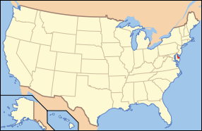 Delaware's location in the U.S. |
|
| Statistics | |
| Founded | 1683 |
|---|---|
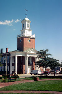
| Seat | Georgetown |
| Largest city | Milford (partial) Seaford (whole) |
| Area - Total - Land - Water |
1,196 sq mi (3,098 km²) 938 sq mi (2,429 km²) 258 sq mi (668 km²), 21.58% |
| Population - (2000) - Density |
156,638 167/sq mi (64.4/km²) |
| Congressional district | At-large |
| Website: www.sussexcountyde.gov | |
 |
|
Sussex County is a county located in the southern part of the U.S. state of Delaware. As of 2000 the population was 156,638. The county seat is Georgetown. In 2005, the population of the county was estimated to be 176,548, an increase of 12.7%. The Seaford Micropolitan Statistical Area includes all of Sussex County.
Sussex County is Delaware's largest county by land area, with 938 square miles (2,429 km2). The first European settlement in the state of Delaware was founded in 1631 near the present-day town of Lewes. However, Sussex County was not organized until 1683.
Contents |
History
Beginnings
Between 10,000 and 14,000 years ago, archaeologists estimate that the first inhabitants of Sussex County, the southernmost county in Delaware, arrived. Native Americans in Sussex County called themselves by the various tribal names of the Algonquin Nation. The most prominent tribes in the area were the Leni Lenape and Nanticoke tribes. The people settled along the numerous bodies of water in the area where they were able to harvest fish, oysters, and other shellfish in the fall and winter. In the warmer months they planted crops, and hunted deer and other small mammals as larger game was not present in the area.
European Discovery
There is no universally agreed upon group known to be the first to settle in Sussex County. In the early years of exploration, from 1593 to 1630, many feel the Spanish or Portuguese were probably the first to see the Delaware River and the lands of present day Sussex County.
Henry Hudson, on his expedition for the Dutch West India Company, discovered the Delaware River in 1609. Attempting to following him, Samuel Argall, an English explorer, was blown off course in 1610 and landed in a strange bay that he named after the Governor of Virginia, Thomas West, Lord De La Warr.
In the first half of 1613, Cornelius Jacobsen Mey, a Dutch navigator, discovered and named both Cape May, New Jersey and Cape Henlopen, (originally Hindlopen) in the Delaware Bay. Later it was found that what May had named Henlopen, was actually Fenwick Island protruding into the Atlantic Ocean, and the name of the cape was moved to its present location just east of Lewes.
European Settlement
Sussex County, was the site of the first European settlement in Delaware, a trading post named Zwaanendael at the present site of Lewes in June 3, 1631. Dutch captain David Pietersen De Vries landed along the shores of the Delaware to establish a whaling colony in the mid-Atlantic of the New World. The colony only lasted until 1632, when De Vries left. Upon returning to Zwaanendael that December, he found the Indian tribes had killed his men and burned the colony. The Dutch then set about settling the area once again.
The original boundaries were undefined with boundary disputes between the family of William Penn, who claimed the county extended to Fenwick Island, and Charles Calvert, 5th Baron Baltimore, who claimed the county ended at Lewes with all the land south of that belonging to Somerset County[1]. Maryland and Pennsylvania both claimed the land between the 39th and 40th parallels according to the charters granted to each colony. The 'Three Lower Counties' (Delaware) along Delaware Bay moved into the Penn sphere of settlement, and later became the Delaware Colony, a satellite of Pennsylvania.
In 1732 the proprietary governor of Maryland, Charles Calvert, signed an agreement with William Penn's sons which drew a line somewhere in between, and also renounced the Calvert claim to Delaware. But later Lord Baltimore claimed that the document he signed did not contain the terms he had agreed to, and refused to put the agreement into effect. Beginning in the mid-1730s, violence erupted between settlers claiming various loyalties to Maryland and Pennsylvania. The border conflict between Pennsylvania and Maryland would be known as Cresap's War.
The issue was unresolved until the Crown intervened in 1760, ordering Frederick Calvert, 6th Baron Baltimore to accept the 1732 agreement. As part of the settlement, the Penns and Calverts commissioned the English team of Charles Mason and Jeremiah Dixon to survey the newly established boundaries between the Province of Pennsylvania, the Province of Maryland, Delaware Colony and parts of Colony and Old Dominion of Virginia.
Between 1763 and 1767, Charles Mason and Jeremiah Dixon surveyed the Mason-Dixon line settling Sussex County's western and southern borders. After Pennsylvania abolished slavery in 1781, the western part of this line and the Ohio River became a border between free and slave states, although Delaware remained a slave state.
In 1769 there was a movement started to move the county seat from Lewes to the area then known as Cross Roads, the present day site of Milton. The current county seat of Georgetown was settled upon on January 27, 1791 after residents in western Sussex County successfully petitioned the Delaware General Assembly to move the county seat to a central location as roads at the time made it too difficult to reach the county seat in Lewes[2]. Georgetown was not a previously established town and on May 9, 1791, the 10 commissioners headed by President of the State Senate George Mitchell negotiated the purchase of 76 acres and Commissioner Rhodes Shankland began the survey by laying out "a spacious square of 100 yards each way." Eventually the Town was laid out in a circle one mile across, centered on the original square surveyed by Shankland and now listed on the National Register of Historic Places. Georgetown was named after Senate President George Mitchell[3].
Sussex County has been known by several names over the years including Susan County, Hoorenkill or Whorekill County as named by the Dutch prior to 1680 when Kent County broke off, Deale County from 1680 to 1682 after being taken over by the British under James Stuart, Duke of York prior to signing over to William Penn, and Durham County when claimed by the Lord's Baltimore during the boundary dispute with the Penn family[4].
Law and Government
Sussex county's government is composed of an elected legislature and various elective executive heads of departments.
The county council is has five members; all are elected in and for specific geographic subdivisions for four years. This forms the legislative authority of the county, which then chooses a "County Administrator" or executive.
The current county council members are George Cole, Dales Dukes, Finley Jones, Vance Phillips, and Lynn Rogers.
The additional offices of Clerk of the Peace, Register of Deeds, Register of Chancery and Sheriff are elected at large.[5]. These positions are held by George Parish, John Brady, David Wilson Sr., and Eric Swanson, respectively.
Education
Public Schools
- See also: List of school districts in Delaware
Sussex County is served by seven public school districts (K-12 grade levels).[6] Kent is served by six districts and New Castle is served by seven districts.[6]
- Cape Henlopen School District
- Delmar School District
- Indian River School District
- Laurel School District
- Milford School District (also serves Kent County)
- Seaford School District
- Woodbridge School District
The county also contains six of Delaware's seventeen charter schools:[6]
- Georgetown Charter School
- Southern Delaware School of the Arts
- Sussex Academy of Arts & Sciences
- Sussex Technical High School
- Delmarva Christian High School
- Western Sussex Academy
Those state funded public high schools which participate in sporting events are members of the Henlopen Conference.
Private Schools
There are several private schools in Sussex County. The schools include Christian Tabernacle Academy located in Lincoln City, Greenwood Mennonite School in Greenwood, Bible Center Christian Academy in Laurel, Epworth Christian School in Laurel, Jesus Is Lord Christian Academy in Georgetown, Lighthouse Christian School in Dagsboro, The Jefferson School in Georgetown, Children Craft CO in Seaford, Eagle's Nest Christian School in Milton, Lighted Pathway Christian Academy in Seaford, Milford Christian School in Milford, and Seaford Christian Academy in Seaford.[7]
Secondary Schools
There are also several secondary schools in Sussex County. Delaware Technical & Community College has the largest presence in the county, but students can also attend Delaware State University, Goldey-Beacom College, University of Delaware, Wesley College all in Georgetown, the Philadelphia Bible College in Ellendale, and the Beebe Hospital School of Nursing in Lewes.
Geography
According to the U.S. Census Bureau, the county has a total area of 1,196 square miles (3,097 km²), of which, 938 square miles (2,428 km²) of it is land and 258 square miles (668 km²) of it (21.58%) is water.
The eastern portion of the county is home to most of Delaware's beaches and many seaside resorts. The western side of the county is center of Delaware's agriculture industry with more acres of arable land under cultivation than anywhere else in the state.
Adjacent Counties
- Kent County, Delaware - north
- Cape May County, New Jersey - northeast¹
- Worcester County, Maryland - south
- Dorchester County, Maryland - southwest
- Wicomico County, Maryland - southwest
- Caroline County, Maryland - northwest
¹ across Delaware Bay; no land border
Major highways
There are three major north-south highways in Sussex County:
- US Route 13 in the west,
- US Route 113 in the middle, and
- State Route 1 along the coast
In addition, Sussex has a number of east-west thoroughfares, the primary being U.S. Route 9. State Routes 16, 18, 20, 24, 30, 54 and 404 also service the area, providing alternatives east-west routes to most municipalities in the county.
National protected area
- Prime Hook National Wildlife Refuge
Economy
The average home and property price in Sussex County increased 250% in the ten years between 1995 and 2005. Local increases within Sussex County for this period include a 381% increase for Millsboro and a 609% increase for Millville. Sussex County is served by the Delaware Coast Line Railway, the Maryland & Delaware Railway and the Norfolk Southern Railroad.[8]
Demographics
As of the census[9] of 2000, there were 156,638 people, 62,577 households, and 43,866 families residing in the county. The population density was 167 people per square mile (64/km²). There were 93,070 housing units at an average density of 99 per square mile (38/km²). The racial makeup of the county was 80.35% White, 14.89% Black or African American, 0.60% Native American, 0.75% Asian, 0.04% Pacific Islander, 2.02% from other races, and 1.35% from two or more races. 4.41% of the population were Hispanic or Latino of any race. 14.9% were of English, 14.3% United States or American, 12.9% Irish, 12.5% German and 5.6% Italian ancestry according to Census 2000. 93.3% spoke English and 4.3% Spanish as their first language.
There were 62,577 households out of which 27.10% had children under the age of 18 living with them, 54.90% were married couples living together, 11.30% had a female householder with no husband present, and 29.90% were non-families. 24.30% of all households were made up of individuals and 11.10% had someone living alone who was 65 years of age or older. The average household size was 2.45 and the average family size was 2.88.
In the county the population was spread out with 22.50% under the age of 18, 7.00% from 18 to 24, 26.30% from 25 to 44, 25.60% from 45 to 64, and 18.50% who were 65 years of age or older. The median age was 41 years. For every 100 females there were 95.50 males. For every 100 females age 18 and over, there were 92.80 males.
The median income for a household in the county was $39,208, and the median income for a family was $45,203. Males had a median income of $30,811 versus $23,625 for females. The per capita income for the county was $20,328. About 7.70% of families and 10.50% of the population were below the poverty line, including 15.00% of those under age 18 and 8.40% of those age 65 or over.
Cities and towns
- Bethany Beach
- Bethel
- Blades
- Bridgeville
- Dagsboro
- Delmar (part of Delmar is in Maryland)
- Dewey Beach
- Ellendale
- Fenwick Island
- Frankford
- Georgetown
- Greenwood
- Henlopen Acres
- Laurel
- Lewes
- Milford (part of Milford is in Kent County)
- Millsboro
- Millville
- Milton
- Ocean View
- Rehoboth Beach
- Seaford
- Selbyville
- Slaughter Beach
- South Bethany
Non-Incorporated Communities
- Gumboro
- Lincoln
- Long Neck
- Oak Orchard
Festivals, Fairs, and Events
Sussex County, Delaware is home to several festivals, fairs, and events. Some of the more notable festivals are the Riverfest held in Seaford, the World Championship Punkin Chunkin held at various locations throughout the county since 1986, the Rehoboth Beach Chocolate Festival, the Bethany Beach Jazz Funeral to mark the end of summer, the Apple Scrapple Festival held in Bridgeville, the Rehoboth Beach Jazz Festival, the Sea Witch Halloween Festival and Parade in Rehoboth Beach, the Rehoboth Beach Independent Film Festival the Nanticoke Indian Pow Wow in Oak Orchard, and the Return Day Parade held after every election in Georgetown.
Media outlets
Newspapers
- Cape Gazette, Lewes
- Coastal Point, Ocean View
- Delaware Coast Press, Rehoboth Beach
- Delaware Wave, Bethany Beach
- Hoy en Delaware, Georgetown
- Laurel Star, Laurel
- Leader & State Register, Seaford
- Milford Beacon, Milford
- Milford Chronicle, Milford
- Seaford Star, Seaford
- Sussex Countian, Georgetown
- Sussex Post, Georgetown
- The Script, Georgetown (published at various times throughout the school year, stories by DelTech students majoring in communications)
Radio Stations
| Call sign | Frequency | City of License [10][11] | Owner [12] | Format [13][14] |
|---|---|---|---|---|
| WAFL | 97.7 FM | Milford | Delmarva Broadcasting Company | Hot Adult Contemporary |
| WGBG | 98.5 FM | Seaford | Great Scott Broadcasting | Classic Rock |
| WGMD | 92.7 FM | Rehoboth Beach | Resort Broadcasting Co., LLC | News Talk Information |
| WJKI | 103.5 FM | Bethany Beach | Great Scott Broadcasting | Classic Rock |
| WJWK | 1280 AM | Seaford | Great Scott Broadcasting | Spanish Variety |
| WJWL | 900 AM | Georgetown | Great Scott Broadcasting | Spanish Variety |
| WKDB | 95.3 FM | Laurel | Great Scott Broadcasting | Contemporary Hit Radio |
| WLBW | 92.1 FM | Fenwick Island | Clear Channel Communications | Oldies |
| WNCL | 101.3 FM | Milford | Delmarva Broadcasting Company | Oldies |
| WOCM | 98.1 FM | Selbyville | Irie Radio, Inc. | Album Adult Alternative |
| WOSC | 95.9 FM | Bethany Beach | Clear Channel Communications | Active Rock |
| WRBG-LP | 107.9 FM | Millsboro | Rhythm and Blues Group Harmonty Association, Inc. | |
| WXJN | 105.9 FM | Lewes | Delmarva Broadcasting Company | Country |
| WYUS | 930 AM | Milford | Delmarva Broadcasting Company | Spanish Contemporary |
| WZBH | 93.5 FM | Georgetown | Great Scott Broadcasting | Active Rock |
| WZEB | 101.7 FM | Ocean View | Great Scott Broadcasting | Contemporary Hit Radio |
Television Stations
- WBOC TV-16, Milton, CBS & Fox
- WPBD, Seaford, PBS
- WRDE-LP, Rehoboth Beach, Independent (Low-power broadcasting channel)
WEWE TV 24 OCEAN60 BROADCASTING DAGSBORO,DE.
- ↑ Sussex County, Delaware: USGenWeb Project
- ↑ Sussex County - History
- ↑ At The Beach-Georgetown, Delaware History
- ↑ Sussex County, Delaware Genealogical Records Information
- ↑ "Sussex County - Government Structure". Sussex County Council. Retrieved on December 16, 2006.
- ↑ 6.0 6.1 6.2 "Delaware Public School Districts for K-12 Education". Delaware Educational Directory. Delaware Department of Education. Retrieved on 2008-03-11.
- ↑ Sussex County, Delaware Private Schools
- ↑ Mike Chalmers (May 22, 2006). "Looking to live in Sussex? Good luck", The News Journal, pp. A1, A6. Retrieved on March 22.
- ↑ "American FactFinder". United States Census Bureau. Retrieved on 2008-01-31.
- ↑ FM Query - FM Radio Technical Information - Audio Division (FCC) USA
- ↑ AM Query - AM Radio Technical Information - Audio Division (FCC) USA
- ↑ Inside Radio/M Street
- ↑ Station Information Profile
- ↑ Inside Radio/M Street
External links
|
||||||||||||||||||||||||||
|