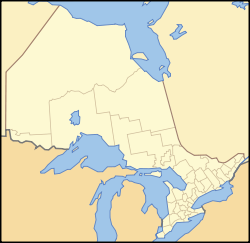
Sault Ste. Marie, Ontario
| City of Sault Ste. Marie, Ontario | |||
|
|||
| Nickname(s): The Soo, The Sault | |||
| Motto: “Naturally Gifted” | |||
 |
|||
| Coordinates: | |||
| Country | |||
|---|---|---|---|
| Province | |||
| District | Algoma District | ||
| Incorporated(town) | 1887 | ||
| Incorporated(city) | 1912 | ||
| Government | |||
| - Type | Corporation | ||
| - Mayor | John Rowswell | ||
| - MP | Tony Martin | ||
| - MPP | David Orazietti | ||
| Area | |||
| - City | 715 km² (276.1 sq mi) | ||
| Elevation | 192 m (630 ft) | ||
| Population (2006)[1] | |||
| - City | 74,948 | ||
| - Density | 110.3/km² (285.7/sq mi) | ||
| - Metro | 80,098 | ||
| Time zone | Eastern Standard Time (EST) (UTC-5) | ||
| - Summer (DST) | Eastern Daylight Time (EDT) (UTC-4) | ||
| Postal code span | P6(A-C) | ||
| Area code(s) | 705 | ||
| CA rank: 46th in Canada Municipal rank: 66th in Canada |
|||
| Website: http://www.city.sault-ste-marie.on.ca | |||
Sault Ste. Marie (nicknamed "the Sault" or "the Soo") is a city on the St. Marys River in Ontario, Canada. It is the third largest city in Northern Ontario, after Sudbury and Thunder Bay, with a population of 74,948.[1] The name is pronounced /ˈsuː ˈseɪnt məˈriː/, where Sault is pronounced like sue. Residents of the city are called Saultites.
Sault Ste. Marie is bordered to the east by the Rankin Location and Garden River First Nation reserves, and to the west by Prince Township. To the north, the city is bordered by an unincorporated portion of the Algoma District, with Heyden as the nearest community. To the south, across the river, is the United States and the city of Sault Ste. Marie, Michigan. The city's census agglomeration, consisting of the townships of Laird, Prince and Macdonald, Meredith and Aberdeen Additional and the First Nations reserves of Garden River and Rankin, had a total population of 80,098 in 2006.
The two cities are joined by the International Bridge, which connects Interstate 75 in Sault Ste. Marie, Michigan and Huron Street in Sault Ste. Marie, Ontario. Shipping traffic in the Great Lakes system bypasses the Saint Mary's Rapids via the American Soo Locks, the world's busiest canal in terms of tonnage that passes through it, while smaller recreational and tour boats use the Canadian Sault Ste. Marie Canal.
The city's crest contains the words "Ojibwa Kitche Gumeeng Odena" (from Ojibwe gichi-gamiing oodena) which means "Town by the large body of water of the Ojibwe" (or simply "Town by Lake Superior") in the Ojibwe language.
The Ontario city is also served by the Sault Ste. Marie federal electoral district and the Sault Ste. Marie provincial electoral district, both having separate boundaries.
Sault Ste. Marie is the seat of the Algoma District.
Contents |
Meaning of the name
The city name originates from "Saults de Sainte-Marie," archaic French for "Saint Mary's Falls", a reference to the rapids of Saint Marys River. Etymologically, the word "sault" comes from an archaic spelling of "saut", the French word for "leap" or "jump" (similar to somersault), although there are citations dating back to 1600 for the use of the "sault" spelling to mean a waterfall or rapids.
In modern French, however, the words "chutes" or "rapides" are more usual, and "sault" survives almost exclusively in geographic names dating from the 17th century. (See also Long Sault, Ontario and Grand Falls/Grand-Sault, New Brunswick, two other place names where "sault" also carries this meaning.)
History
This area was originally called Baawitigong, meaning "place of the rapids," by the Ojibwa, who used the site as a regional meeting place during whitefish season in the St. Mary's Rapids. (The anglicized form of this name, Bawating, continues to be used in institutional and geographic names in the area.)
After the visit of Étienne Brûlé in 1623, the French called it "Sault de Gaston" in honour of Gaston, Duke of Orléans , the brother of King Louis XIII of France. In 1668, French Jesuit missionaries renamed it Sault Sainte Marie, and established a settlement that is now Sault Ste. Marie, Michigan, on the river's south bank. Sault Ste. Marie was incorporated as a town in 1887 and a city in 1912. The town gained some brief international notoriety in 1911, during the media frenzy sparked by the case of Angelina Napolitano, the first person in Canada to use the battered woman defence for murder.[2]
During World War II, and particularly after the US was attacked at Pearl Harbor in 1941, concern turned to the locks and shipping channel at Sault Ste. Marie. A substantial military presence was established to protect the locks from a possible attack by Nazi German aircraft from the north. The new development of long-range bombers created fears of a sudden air raid from the north. Military strategists studied polar projection maps which indicate that the air distance from occupied Norway to the town is about the same as the distance from Norway to New York. That direct route of about 3000 miles is over terrain where there were few observers and long winter nights.
A joint Canadian and US committee called the "Permanent Joint Board on Defence" drove the installation of anti-aircraft defence and associated units of the United States Army Air Forces and Royal Canadian Air Force to defend the locks.
An anti-aircraft training facility was established 100 kilometres (62 miles) north of Sault Ste. Marie on the shores of Lake Superior. Barrage balloons were installed, and early warning radar bases were established at 5 locations in northern Ontario to watch for incoming aircraft. Military personnel were established to guard sensitive parts of the transportation infrastructure.
A little over one year later, in January 1943, most of these facilities and defences were deemed excessive and removed, save a reduced military base at Sault Ste. Marie.
On January 29, 1990, Sault Ste. Marie became a flashpoint in the Meech Lake Accord debate when council passed a resolution declaring English the city's official language[3] and the sole language of municipal services.[4] The Sault Ste. Marie language resolution was not the first of its kind in Ontario, but Sault Ste. Marie was the largest municipality to have passed such a resolution and the first with a sizable Franco-Ontarian population,[5] and bore the brunt of the controversy.
Economy
The city has made a name for itself in steel-making, and Essar Steel Algoma (formerly Algoma Steel) is the largest single employer with 3500 employees at the main plant and approximately 554 at an adjacent tube mill operated by Tenaris. During the 1940s, the steel and chromium operations were of substantial importance to the war effort in Canada and the United States. Algoma Steel and the Chromium Mining and Smelting Corporation were key producers for transportation and military machines.
In the early 1960s and 1970s, Sault Ste. Marie was a booming town. However, as time passed and foreign imports became a vital reality of business success, the demand for the town's steel industry diminished. Within the past eight years, Essar Steel Algoma has declared bankruptcy twice and laid off large numbers of workers. Most recently, Essar Steel Algoma was bailed out by the Ontario government, which promised interest-free loans.
Essar Steel Algoma is currently the most profitable steel company per unit on a global scale. The company experienced a swift turnaround in 2004 from its earlier financial troubles in the 1990s, largely due to the rising costs of steel and the high demand for steel in China. Denis Turcotte, CEO, was named Canadian CEO of the year in 2006 for his efforts. An offer to purchase ASI by the Essar Group (India) had been recommended by the ASI Board of Directors and was approved. The company was officially sold to the Essar Group in June 2007 for $1.6 billion.
Forestry is also a major local industry, especially at St. Mary's Paper which has been reopened as of June 2007 under new ownership. Also related to wood products is Flakeboard Ltd., which employs over 110 people in the community along with an adjacent melamine factory which manufactures products with Flakeboard's materials. Such examples of this are furniture and cupboards where a finish is added to the product. Together both of Flakeboard's factories employ about 150 people.
Furthermore, the business process outsourcing industry, with four call centres located within city limits employ about 1800 people. The largest employer of the four call centres is the Sutherland Group. The call centre industry has become a large employer in Sault Ste. Marie which contributed to the economic turn around of the city in the late 1990's.
Another very large employer in the community is the Ontario Lottery and Gaming Corporation (OLG). The OLG has a corporate office located within the city on the waterfront and employs about 900 people in Sault Ste. Marie between the corporate office and Casino Sault Ste. Marie. The prize centre used to reside within the city but was moved back to Toronto (York Mills) in 2000. Its role in Sault Ste. Marie has diminished, although only slightly; however, it is still the fourth largest employer next only to Essar Steel Algoma, Sault Area Hospital and the call centre industry.
Transportation

Sault Ste. Marie is served by Highway 17, which is a segment of the Trans-Canada Highway in the region. The highway connects the city to Thunder Bay to the northwest and Sudbury to the east. The International Bridge also directs traffic from downtown to the beginning of the Interstate 75 freeway in Sault Ste. Marie, Michigan, which runs through Saginaw, Flint and Detroit before the Michigan/Ohio border (and eventually to Miami, Florida).
The International Bridge also directs traffic from the American side of the border via Sault Ste. Marie's new transport route that runs from the bridge to Second Line. This new limited-access roadway, known as "Carmen's Way" after the late MP Carmen Provenzano, will make it much easier for transport trucks to gain access to main roads. Planning is underway to eventually connect Second Line East to the new four-lane section of Highway 17 that recently opened east of the city.
The city also plays an inherited role in marine transportation, with the locks in Michigan being an integral component of the St. Lawrence Seaway. However, the city also holds a small-scale lock which is used by small boats and other pleasure craft in the summer. Currently under construction is a multi-modal terminal designed to take advantage of the Sault as a rail, road, and water transportation hub.
Sault Ste. Marie is also served by Sault Ste. Marie Airport and Sault Transit Services.[6] The city is no longer linked to any other major cities by passenger rail, but is part of the Algoma Central Railway network, which runs north from the city to the small town of Hearst. In 2006 the city's Member of Parliament, Tony Martin, called for passenger rail service to be reinstated between Sault Ste. Marie and Sudbury.[7]
Tourism

Area tourist attractions include the Canadian Bushplane Heritage Centre, the Sault Ste. Marie Canal National Historic Site, boat tours of the Sault locks (which connect Lake Superior with the lower Great Lakes), Whitefish Island, the Ermatinger-Clergue National Historic Site, Casino Sault Ste. Marie, the Art Gallery of Algoma and the Algoma Central Railway's popular Agawa Canyon Tour Train. Nearby parks include Pancake Bay Provincial Park and Batchawana Bay Provincial Park and Lake Superior Provincial Park. Winter activities are also an asset to Sault Ste Marie's tourism industry with the annual Bon Soo Winter Carnival, Searchmont Resort as a great ski and snowboard destination, Stokely Creek Lodge (cross country ski resort) and Hiawatha a nearby cross country ski trails. The city also hosts a large snowmobile trail system that criss-crosses the province of Ontario.
A new non-motorized HUB trail is being created around the city (20 km) so that walkers, rollerbladers and cyclists (snowshoeing and cross country skiing in winter) can enjoy the beautiful and convenient circle tour around town. The Voyageur Hiking Trail, a long-distance trail that will eventually span from Manitoulin Island to Thunder Bay, originated in Sault Ste. Marie in 1974.
The city is also home to the Station Mall, one of the largest shopping malls in Northern Ontario.
Demographics
Similar to many other Northern Ontario municipalities, Sault Ste. Marie's population has declined sharply in the 1990s and early 2000s, with many individuals migrating to larger cities in southern Ontario. Since the early 1990s, the city had dropped from 84,000 to 74,566 residents, but in the 2006 census the city's population grew very slightly to 74,948. The city's census agglomeration, consisting of the townships of Laird, Prince and Macdonald, Meredith and Aberdeen Additional and the First Nations reserves of Garden River and Rankin, had a total population of 80,098, up from 78,908 in 2001.
The population has now increased with the improving economic climate. Some employers are currently reporting labour shortages in several job categories.
The population under 14 still continues to be greater than those over 65 years of age.
Ethnicity
Sault Ste. Marie was at one time a haven for Italian immigrants. The city has a large concentration of Italians for a community its size, and they play a predominant role in the city's businesses.[8]. The city also has a significant First Nations population, with three reserves nearby.
Those who are of European origin constitute 91.6% of the population, including those who are of Italian, Franco-Ontarian, English and Nordic. Aboriginals or Native Canadians, constitute 7.8%, and those who are Chinese, Asian, Black, and Filipino make up the remainder of the population.
Religion
| Religion statistics for Sault Ste. Marie (city) | ||
| Religion | Population | % |
|---|---|---|
| 63 190 | 86.00% | |
| Catholic 1 | 33 975 | 46.24% |
| Protestant | 27 960 | 38.05% |
| Christian Orthodox | 205 | 0.28% |
| Christian, n.i.e. 2 | 1050 | 1.43% |
| 55 | 0.07% | |
| 55 | 0.07% | |
| 125 | 0.17% | |
| 80 | 0.11% | |
| 10 | 0.01% | |
| Eastern religions 3 | 15 | 0.02% |
| Other religions 4 | 170 | 0.23% |
| No religious affiliation 5 | 9770 | 13.30% |
| Statistics Canada 2001. | ||
|
1 Includes Roman Catholic, Eastern Catholic, |
||
Christianity is the largest faith in the city with Roman Catholicism being the strongest denomination, which can be attributed to the large number of citizens with a traditional Catholic-Italian heritage. The largest non-Christian religion is Buddhism numbering 126 members, with small communities of Jews, Muslims, Hindus, and Sikhs.
Government
The Corporation of the City of Sault Ste. Marie is run by a city council of 12 councillors (representing 6 wards) and a mayor. The most recent municipal election was held on 13 November, 2006.
The current mayor is John Rowswell, first elected in 2000 and re-elected in 2003 and 2006.
See also Neighbourhoods in Sault Ste. Marie, Ontario.
Education
The city is home to Sault College, a college of applied arts and technology, and to Algoma University. While the vast majority of programs at Algoma University and Sault College are delivered on the respective campuses, both institutions also offer joint programs with Lake Superior State University in Sault Ste. Marie, Michigan. On June 18, 2008, Algoma University became an independent university, breaking their long time affiliation with Laurentian University in Sudbury. A new school, Shingwauk Kinoomaage Gamig (University), is poised to launch as a federated school of Algoma University. It will offer courses in Anishinaabe culture and language.
Sault Ste. Marie is home to both the Algoma District School Board and the Huron-Superior Catholic District School Board, and is part of the Conseil scolaire de district du Grand Nord de l'Ontario and the Conseil scolaire de district catholique du Nouvel-Ontario. It is also home to the following high schools:
- Alexander Henry High School (English, public, trade and adult education)
- Bawating Collegiate & Vocational School (English, public)
- Korah Collegiate & Vocational School (English, public, offers the International Baccalaureate Programme)
- École secondaire Notre-Dame-des-Grands-Lacs (French, Catholic)
- St. Basil Secondary (English with some Ojibwe, Catholic)
- St. Mary's College (English with French Immersion Program, Catholic)
- Sir James Dunn Collegiate & Vocational School (English and French Immersion, public)
- White Pines Collegiate & Vocational School (English with some Ojibwe, public)
Sports
The Sault Ste. Marie Greyhounds are the city's most recognized sports team having existed since the formation of the Northern Ontario Hockey Association in 1919. The Hounds won national championships twice including the 1993 Memorial Cup and the 1924 Allan Cup.
The current Hounds have retired four jerseys since joining the Ontario Hockey League in 1972. #1 John Vanbiesbrouck, #4 Craig Hartsburg, #10 Ron Francis and #99 Wayne Gretzky.
The Greyhounds play in the Essar Centre, a state-of-the-art downtown arena that replaced the Sault Memorial Gardens in 2006.
Sault Ste. Marie also had a team in hockey's first professional league. The Sault Ste. Marie Marlboros or 'Canadian Soo' team played in the International Professional Hockey League from 1904 to 1907.
Sault Ste. Marie teams boast a number of Hockey Hall of Fame members including Sault natives Phil, Tony Esposito and Ron Francis, as well as Sault team members Paul Coffey, Bill Cook, Bun Cook, Wayne Gretzky, Newsy Lalonde and George McNamara.
Recent National Hockey League All-Stars Joe Thornton and Marty Turco are either from the Sault or have played for a Sault team.
Former Greyhound player and coach Ted Nolan won the Jack Adams Trophy as the NHL Coach of the Year in 1998.
The Sault has been host to many national and international sporting events including the 2003 Eco-Challenge North American Championship, an expedition-length (350-500 km) adventure race through unmarked wilderness by biking, trekking, paddling and using ropes.
Sault Ste. Marie was the host of the 1990 Brier, the Canadian Men's Curling Championship. The local curling clubs are the Soo Curlers Association and the Tarentorus Curling Club.
The 2007 Sault Steelers captured the Canadian Senior Football Championship.
Walk of Fame
The Walk of Fame was created in 2006 as a joint project between the city of Sault Ste. Marie and its Downtown Association, and honours those from the city or the Algoma District who have made outstanding contributions to the community or significant contributions in their chosen field of work. Inductees are added on an annual basis.
Culture
Sault Ste. Marie is home to the Bon Soo winter carnival, held every February. The city also hosts the annual Algoma Fall Festival which draws local and international performing artists. The Kiwanis Community Theatre and the landmark Central United Church are used for the performances. Both venues hold approximately 1,000 people. The Art Gallery of Algoma features an extensive collection of local and international artist's work and presents regular exhibitions. Residents celebrate Community Day on the third weekend of July. The local Rotary International club organizes a three-day event called Rotaryfest.
It is also the birthplace of the first youth police cadet group in Canada: the Sault Squires Police Cadet Corps. The rock band Treble Charger was originally from Sault Ste. Marie.
Media
Climate
Climate information is taken from the Sault Ste. Marie Airport (YAM)
| Average climate for Sault Ste. Marie, Ontario | |||||||||||||
| Month | Jan | Feb | Mar | Apr | May | Jun | Jul | Aug | Sep | Oct | Nov | Dec | Year |
| Maximum daily temp. (°C) | -5.5 | -4.2 | 0.9 | 8.4 | 16.5 | 21.1 | 24.0 | 23.0 | 18.0 | 11.5 | 4.1 | -2.2 | 9.6 |
| Minimum daily temp. (°C) | -15.5 | -15.2 | -9.7 | -2.2 | 3.5 | 7.9 | 11.3 | 11.3 | 7.5 | 2.5 | -3.1 | -10.3 | -1.0 |
| Precipitation (mm) | 71.3 | 41.1 | 60.1 | 68.5 | 63.1 | 78.4 | 76.8 | 84.7 | 96.5 | 86.7 | 85.7 | 75.9 | 888.7 |
| Rainfall (mm) | 7.8 | 4.7 | 28.0 | 50.5 | 62.5 | 78.4 | 76.8 | 84.7 | 96.2 | 80.3 | 50.7 | 13.7 | 634.3 |
| Snowfall (cm) | 81.7 | 42.8 | 34.8 | 17.4 | 0.5 | 0.2 | 6.2 | 38.6 | 80.8 | 302.9 | |||
| Snow depth (cm) | 35 | 40 | 28 | 4 | 2 | 15 | 10 | ||||||
| Wind speed (km/h) | 14.3 | 12.6 | 14.1 | 14.5 | 13.4 | 12.0 | 11.0 | 10.7 | 12.5 | 14.2 | 15.6 | 13.3 | 13.3 |
| Extreme climate for Sault Ste. Marie, Ontario | |||||||||||||
| Month | Jan | Feb | Mar | Apr | May | Jun | Jul | Aug | Sep | Oct | Nov | Dec | |
| Extreme humidex (°C) | 31.6 | 37.3 | 40.9 | 42.9 | 42.7 | 39.5 | 33.2 | ||||||
| Extreme maximum temp. (°C) | 8.4 | 10.8 | 21.1 | 27.8 | 31.8 | 34.0 | 36.8 | 36.1 | 32.8 | 26.7 | 19.4 | 15.4 | |
| Extreme minimum temp. (°C) | -38.9 | -38.7 | -35.6 | -20.6 | -8.9 | -5.6 | 0.0 | -3.3 | -8.3 | -10.0 | -21.7 | -36.7 | |
| Extreme windchill (°C) | -44.8 | -42.3 | -38.4 | -27.8 | -10.0 | -13.9 | -29.2 | -42.8 | |||||
| Extreme daily precipitation (mm/d) | 32.5 | 61.0 | 37.8 | 41.1 | 116.6 | 77.2 | 43.9 | 89.8 | 71.2 | 44.0 | 50.4 | 37.6 | |
| Extreme daily rainfall (mm/d) | 32.5 | 39.1 | 30.2 | 38.2 | 116.6 | 77.2 | 43.9 | 89.8 | 71.2 | 44.0 | 50.4 | 37.6 | |
| Extreme daily snowfall (cm/d) | 30.2 | 61.0 | 27.7 | 27.0 | 10.2 | 21.1 | 2.1 | 12.6 | 37.0 | 48.1 | |||
| Extreme snow depth (cm) | 111 | 117 | 137 | 58 | 4 | 3 | 8 | 36 | 140 | ||||
| Extreme wind speed (km/h) | 80 | 64 | 74 | 74 | 65 | 64 | 63 | 74 | 65 | 72 | 89 | 80 | |
| Extreme wind gusts (km/h) | 107 | 100 | 100 | 102 | 89 | 100 | 109 | 98 | 94 | 105 | 119 | 98 | |
Image gallery
See also
- Twin cities
References
- ↑ Stats Canada 2006 Community Profile
- ↑ Dictionary of Canadian Biography Online: Angelina Napolitano. By Franca Iacovetta. University of Toronto/Université Laval, 2004. page accessed June 2008
- ↑ Canadian Annual Review of Politics and Public Affairs, 1990, David Leyton-Brown (ed.), p.135. "On the language front, a major headache for the government began when the Sault Ste Marie City Council, under pressure from the Alliance for the Preservation of English in Canada, declared English as its official language."
- ↑ Crosswords: Language, Education and Ethnicity in French Ontario, Monica Heller, p. 79
- ↑ Crosswords: Language, Education and Ethnicity in French Ontario, Monica Heller, p. 80
- ↑ Sault Ste. Marie Transit
- ↑ Passenger rail service to Sudbury needed: Sault MP
- ↑ [1]
External links
- City of Sault Ste. Marie
- Economic Development Corporation
- Sault Ste. Marie Chamber of Commerce
- Soo Guide: Pictoral Guide to Sault Ste. Marie
- Environment Canada's Weather Report for Sault Ste. Marie, Ontario
- Climate info from Environment Canada
- SooWeather.com
|
|||||||||||||||||||||||
| North-West: Algoma Unorganized, North Part |
North: Algoma Unorganized, North Part |
North-East: Algoma Unorganized, North Part |
| West: Whitefish Bay (Lake Superior), Prince Township |
Sault Ste. Marie | East: Garden River First Nation, Rankin First Nation |
| South-West: St. Marys River |
South: Whitefish Island, St. Marys River, Sault Ste. Marie (Michigan) |
South-East: St. Marys River, Sugar Island (Michigan) |