Sarangani
| Province of Sarangani | |
Provincial seal of Sarangani |
|
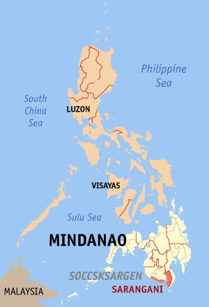 Map of the Philippines with Sarangani highlighted |
|
| Region | SOCCSKSARGEN (Region XII) |
| Capital | Alabel |
| Divisions | |
| - Highly urbanized cities | 0 |
| - Component cities | 0 |
| - Municipalities | 7 |
| - Barangays | 140 |
| - Congressional districts | 1 |
| Population | 58th largest |
| - Total (2007) | 410,622 |
| - Density | 138 /km² (357 /sq mi) (23rd lowest) |
| Area | 47th largest |
| - Total | 2,980.0 km2 (1,151 sq mi) |
| Founded | March 10, 1917 |
| Spoken languages | Cebuano |
| Governor | Miguel Rene A. Dominguez |
Sarangani is a province of the Philippines located in the SOCCSKSARGEN region in Mindanao. Its capital is Alabel and borders South Cotabato to the north and Davao del Sur to the east. To the south lies the Celebes Sea. The province is divided into two parts, separated by the Sarangani Bay, and it used to be part of South Cotabato until it was made an independent province in 1992.[1]
Contents |
Government
Elected Officials 2007-present
-
- Rep. Erwin Chiongbian
- Gov. Miguel Dominguez
- Vice Gov. Steve Solon
Elected Officials 2004-2007
-
- Rep. Erwin Chiongbian
- Gov. Miguel Dominguez
- Vice Gov. Bridget Chiongbian-Huang
Economy
Geography
Political
Sarangani is subdivided into 7 municipalities grouped into two parts, separated by the Sarangani Bay. The western part consists of Kiamba, Maasim, and Maitum, while the eastern part is composed of Alabel, Glan, Malapatan, and Malungon.
Municipalities
|
|
Physical
History
The early inhabitants who first inhabited Sarangani were the indigenous natives, called "MunaTo," a native term for "first people."[2]
In 1942, the Japanese troops occupied Sarangani.
| Invasion of Sarangani | |||||||
|---|---|---|---|---|---|---|---|
| Part of World War II | |||||||
|
|||||||
| Belligerents | |||||||
In 1945, the liberated to the Philippine Commonwealth troops entered in Sarangani by the attacked from the Japanese soldiers in the Invasion of Sarangani during World War II.
Before its inception in 1992, Sarangani was part of South Cotabato and held its title as the Lone Third District of South Cotabato. Created by Republic Act No. 7228 on March 16, 1992 it was one of the newest districts of the time penned by the late Congressman, James L. Chiongbian. His wife, Priscilla L. Chiongbian is the retired Governor of Sarangani.
Sarangani celebrates its 16th foundation anniversary with its theme "Ang Galing Mo, Sarangan," with the November 27 to 29, 2008 6th "MunaTo Festival."
It's landmark "Isla Parilla" resort is now an "AA" world-class resort, built within a man-made island..[3][4]
Sarangani also has, as treasure, its ancient burial jars, discovered by archaeologists from the National Museum in Ayub Cave, Maitum, in 1991 and in 2008, at Sagel Cave, Maitum (now declared by National Historical Institute as a national historical sites). Amid Mindanao's armed conflicts, artifacts found thereat prove settlements of pre-historic civilization in Maitum.[5][6]
External links
- Official Website of the Province of Sarangani
- Official Website of the Provincial Government of Sarangani
- gmanews.tv, Born to be Wild: Sarangani, 06/12/2008
References
- ↑ gmanews.tv, Born to be Wild: Sarangani, 06/12/2008
- ↑ balita.ph/2008, Man-made island resort now a Sarangani landmark
- ↑ pia.gov.ph, Island resort now Sarangani landmark
- ↑ balita.ph/2008/11, Sarangani gears for foundation anniversary festival
- ↑ pia.gov.ph, Island resort now Sarangani landmark
- ↑ balita.ph/2008/11, Sarangani gears for foundation anniversary festival
|
|||||