Rothenburg ob der Tauber
| Rothenburg ob der Tauber | |
 |
|
| Coat of arms | Location |
 |
 |
| Administration | |
| Country | Germany |
|---|---|
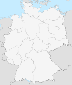
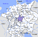
| State | Bavaria |
| Admin. region | Middle Franconia |
| District | Ansbach |
| Mayor | Walter Hartl (Für Rothenburg) |
| Basic statistics | |
| Area | 41.45 km² (16 sq mi) |
| Elevation | 430 m (1411 ft) |
| Population | 11,226 (30/12/2006) |
| - Density | 271 /km² (701 /sq mi) |
| Other information | |
| Time zone | CET/CEST (UTC+1/+2) |
| Licence plate | AN |
| Postal code | 91541 |
| Area code | 09861 |
| Website | www.rothenburg.de |


Rothenburg ob der Tauber is a town in the district of Ansbach of Mittelfranken (Middle Franconia), the Franconia region of Bavaria, Germany, well known for its well-preserved medieval old town, a destination for tourists from around the world. In the Middle Ages, it was an Imperial Free City. A significant fraction of Rothenburg is carfree.
Contents |
Name
The name "Rothenburg ob der Tauber" is actually a shortened version of "Rothenburg oberhalb der Tauber", which in German means "Rothenburg above the Tauber". This is so because the town is located on a plateau overlooking the Tauber river. As to the name "Rothenburg", some say it comes from the German words Rot (Red) and Burg (burg, medieval fortified town), referring to the red colour of the roofs of the houses which overlook the river. The name may also refer to the process of retting ("rotten" in German) flax for linen production.
Since German does not have the th-sound (as in thin), the proper pronunciation of the first syllable of the name is more or less like English rote, while -burg is similar to "burk". In IPA (International Phonetic Alphabet): [ro:tənbʊag ɔp dєr taʊba].
History
~ 950, Weir system in today’s castle garden – Earl of Comburg-Rothenburg. ~ 1070, The Earls of Comburg-Rothenburg, who also own the village „Gebsattel“, built Rothenburg castle on the mountain top high above the river Tauber.
In 1116, The Earls of Comburg-Rothenburg dynasty dies out. Earl Heinrich wills all his belongings, including Gebsattel and Rothenburg to the Comburg convent. But Emperor Heinrich V. appoints his nephew Konrad von Hohenstaufen to be the successor.
In 1142, Konrad von Hohenstaufen, who became Konrad III (1138-52) the Roman-German King, trades a part of the monastery Neumünster in Würzburg above the village Detwang and builds the Stauffer-Castle Rothenburg on this cheaper land. He holds court there and appoints reeves as caretaker.
~ 1170, The city of Rothenburg is founded at the time of the building of Staufer castle. The centre is the market place and the Jakobs-Church. The development of the oldest fortification can be seen: Old cellar / old moat and the milk market. Walls and towers were built in the 13th century. Preserved are the “White Tower” and the Markus-Tower with the Röder-Arch.
1194 - 1254, The representatives of the Staufer dynasty govern the area around Rothenburg. The St. John order and other orders are founded near the Jakobs-Church and the monastery of the Dominikan order.
in 1241/42, The Staufer Empire Tax statistics names the Jews in Rothenburg. Rabbi Meir Ben Baruch of Rothenburg (died 1293, buried 1307 in Worms) had a great reputation as a jurist in Europe.
In 1274, Rothenburg is accorded privileges by King Rudolf of Habsburg as an imperial city. Three famous fairs are established in the city. In the following centuries the city expands. The citizens of the city and the knights of the hinterland build the Franziskaner-Monastery and the Holy-Ghost-Hospital (1376/78 incorporated into the city walls). The German Order begins the building of the Jakobs-Church, which the citizens have used since 1336. The Heilig-Blut-pilgrimage attracts many pilgrims to Rothenburg. At the time one of the 20 largest cities of the Holy Roman Empire. The population was around 5,500 people within the city walls and another 14,000 in the 150 square miles (390 km2) of surrounding territory.
In October 1631 during the Thirty Years' War, Catholic Count Tilly wanted to quarter his 40,000 troops in Protestant Lutheran Rothenburg. Rather than allow entrance, the town defended itself and intended to withstand a siege. However, Tilly's troops quickly defeated Rothenburg, losing only 300 soldiers. After the winter they left the town poor and nearly empty, and in 1634, the Black Plague killed many more. Without any money or power, Rothenburg stopped growing and preserved its 17th century state.
Since 1803 the town has been a part of Bavaria. Romanticism artists of the 1880s rediscovered Rothenburg, bringing tourism to the town. Laws were created to prevent major changes to the town.
In March 1945 in World War II, Nazi soldiers were stationed in Rothenburg defending it. On March 31, bombs were dropped over Rothenburg by 16 planes killing 39 people and destroying 306 houses, six public buildings, nine watchtowers, and over 2,000 feet (610 m) of the wall. The U.S Assistant Secretary of War John J. McCloy knew about the historic importance and beauty of Rothenburg, so he ordered US Army General Jacob L. Devers not use artillery in taking Rothenburg. The local military commander Major Thömmes ignored the order of Adolf Hitler for all towns to fight to the end and gave up the town, thereby saving it from total destruction by artillery. American troops occupied the town on April 17, 1945, and in November 1948 McCloy was named Honorable Protectorate of Rothenburg. After the war, the residents of the city quickly repaired the bombing damage. Donations for the rebuilding were received from all over the world. The rebuilt walls feature commemorative bricks with donor names.
Town


The building on the town square is the Ratstrinkstube and contains a clock which re-enacts the historic meistertrunk daily. According to legend, the meistertrunk commemorates the event in 1631 when the walled town was under siege by the Imperial forces of Count Tilly. On a lark, Count Tilly told the city that he would spare them if anyone could drink a tankard containing about one gallon of wine in one draught. Mayor Nusch took the challenge and was successful, and the city was saved. The clock re-enacts the event hourly from 11:00 to 15:00 and 8:00 to 22:00. Rothenburg celebrates this rescue each year on Whitsun with a festival performance, a grand army march, and a field camp.
To the left of the picture forming the west side of the town hall square is the Rathaus or town hall. The rear Gothic part of the building dates from 1250, and the attached front Renaissance building was started in 1572. This building served as the seat of government for the city-state during the medieval ages and for the city of Rothenburg since the formation of the federalist government. The town hall tower is open for ascent to view the city from high above. Underneath the tower is the entrance to a museum celebrating the Thirty Years War and also the Imperial Entrance into the Rathaus.
Rothenburg ob der Tauber is one of the cities on the Romantische Straße (Romantic Road) that has preserved vestiges of its medieval importance into the 21st century. A series of walls and towers defended the city over the ages, and the most recent still stands and surrounds most of the older part of the city. The inner wall (built prior to the 13th century) still remains. Stairwells ascend to the top of the wall at intervals, and the entire wall can be walked. In addition, the Roedertor tower at the east end of the city is open daily to allow a climb up the stairs to the vista from it.
While buildings within the walled city reflect the city's medieval history, this part of the city is in many ways a normal, modern German town with some concession to the tourist trade. In addition to many stores and hotels aimed at tourists, residences and shops also reflect the daily life of modern Germany. Most of the tourist shops cluster around the Town Hall Square and along several major thoroughfares (Herrngasse, Schmiedgasse). Also in the town is a criminal museum, containing various punishment and torture devices as used during the Middle Ages.
Along the Tauber River below the west town walls and the castle gardens lies the original settlement of Detwang, dating from the year 960. Its St. Peter and Paul church was built in 968 and is the only Romanesque church in the region.
The mayor of Rothenburg was Herbert Hachtel (SPD) from 1988 until March 2006, he was followed by Walter Hartl.(no party)
Cultural references
Rothenburg has appeared in several films, notably fantasies. It was the inspiration for the village in the 1940 Walt Disney movie Pinocchio. It was also the location for the Vulgarian village scenes in the 1968 family movie, Chitty Chitty Bang Bang. It is sometimes mistaken as the town at the end of Willy Wonka & the Chocolate Factory (1971). That town was Nördlingen.
Rothenburg is the primary location for Elizabeth Peters' mystery novel, "Borrower of the Night" (1973) which involves the search for a missing Tilman Riemenschneider sculpture. The town also featured as the location in the Belgian comic book La Frontière de la vie (The Frontier of Life, 1977) and it inspired the look of the town in the Japanese manga and anime series A Little Snow Fairy Sugar (2001). Rothenburg's famous street Koboldzellersteig and Spitalgasse is depicted on the cover of two Blackmore's Night albums, 1999's Under a Violet Moon and their 2006 festive album Winter Carols.
Image Gallery
See also
- Rintfleisch-Pogrom
External links
- Rothenburg o.d.T. Tourist Office website
- Tourist informations
- Rothenburg Pictures & information
- Criminalistics museum
|
||||||||||||||||
|
||||||||||||||||||||||||
|
|||||||