Roswell, New Mexico
| The City of Roswell | |||
|
|||
| Nickname(s): All America City | |||
 |
|||
| Coordinates: | |||
| Country | United States | ||
|---|---|---|---|
| State | |||
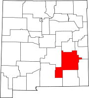
| County | Chaves | ||
| Government | |||
| - Mayor | Sam LaGrone | ||
| Area | |||
| - Total | 29.0 sq mi (75.0 km²) | ||
| - Land | 28.9 sq mi (75.0 km²) | ||
| - Water | 0.04 sq mi (0.1 km²) | ||
| Elevation | 3,573 ft (1,089 m) | ||
| Population (2000) | |||
| - Total | 45,293 | ||
| Time zone | Mountain (UTC-7) | ||
| - Summer (DST) | DST (UTC-6) | ||
| ZIP codes | 88201-88203 | ||
| Area code(s) | 575 | ||
| FIPS code | 35-64930 | ||
| GNIS feature ID | 0894171 | ||
| Website: City of Roswell | |||
Roswell is a city in and the county seat of Chaves County in the southeastern quarter of the state of New Mexico, United States.[1] The population was 45,293 at the 2000 census. It is a center for irrigation farming, dairying, ranching, manufacturing, distribution, and petroleum production. It is also the home of New Mexico Military Institute (NMMI), founded in 1891. Bitter Lake National Wildlife Refuge is located a few miles northeast of the city on the Pecos River.
Roswell is most popularly known for having its name attached to what is now called the 1947 Roswell UFO incident, even though the actual crash site was some seventy-five miles from Roswell and closer to Corona. However, the investigation and debris recovery was handled by the local Roswell Army Air Field.


Contents |
History

The first non-indigenous settlers of the area around Roswell were a group of pioneers from Missouri, who attempted to start a settlement 15 miles southwest of what is now Roswell in 1865 but were forced to abandon the site because of a lack of water.
Van C. Smith, a businessman from Omaha, Nebraska, and his partner, Aaron Wilburn, constructed two adobe buildings in 1869 that began what is now Roswell. The two buildings became the settlement's general store, post office, and sleeping quarters for paying guests. In 1871, Smith filed a claim with the federal government for the land around the buildings, and on August 20, 1873, he became the town's first postmaster. Van C. Smith was the son of Roswell Smith, a prominent lawyer in Lafayette, Indiana, and Annie Ellsworth, daughter of U.S. Patent Commissioner Henry Leavitt Ellsworth. He called the town Roswell, after his father's first name.
Roswell was originally a part of Lincoln County that included all of southeastern New Mexico, but in 1889 Chaves County was carved out of the larger county, and Roswell became its county seat. The Roswell, NM Post Office uses ZIP codes 88201, 88202, and 88203.
In 1877, Captain Joseph Calloway Lea and his family bought out Smith and Wilburn's claim and became the owners of most of the land of Roswell and the area surrounding it. The town was relatively quiet during the Lincoln County War (1877-1879). A major aquifer was discovered when merchant Nathan Jaffa had a well drilled in his back yard on Richardson Avenue in 1890, resulting in the area's first major growth and development spurt. The growth continued when a railroad was built through town in 1893.
During World War II, a prisoner of war camp was located in nearby Orchard Park. The German prisoners of war were used to do major infrastructure work in Roswell, such as paving the banks of the North Spring River. Some POWs used rocks of different sizes to create the outline of an iron cross among the stones covering the north bank. Later, the iron cross was covered with a thin layer of concrete. In the 1980s, a crew cleaning the river bed cleared off the concrete and revealed the outline once more. The small park just south of the cross was then known as Iron Cross Park. On November 11, 1996 the park was renamed POW/MIA park. The park displays a piece of the Berlin Wall, presented to the City of Roswell by the German Air Force.
In the 1930s, Roswell was a site for much of Robert Goddard's early rocketry work. It is also the birthplace of actress Demi Moore, musician John Denver, and Hall of Fame jockey Mike E. Smith. A Golf Hall of Famer, Nancy Lopez, was reared in Roswell (though born in California). A Hall of Famer astronaut, sixth man on the moon Edgar Mitchell, attended school in Roswell. Roger Staubach (later of the Dallas Cowboys) played football at NMMI, and Lewis Lloyd (later of the Houston Rockets) played basketball there. The professional baseball record for home runs in a season, 72, was set in 1954 by Joe Bauman of the Roswell Rockets, who took up permanent residence there (the record was broken in 2001 by Barry Bonds).
Roswell was a location of military importance from 1941 to 1967, at which time Walker Air Force Base was decommissioned. After the closure of the base, Roswell capitalized on its pleasant climate and reinvented itself as a retirement community. Roswell has benefited from interest in the alleged UFO incident, and in more recent times the business community has deliberately sought out tourists interested in UFOs.
In the early 1980s, a major manufacturer, Transportation Manufacturing Corporation, which produced buses opened a factory in Roswell. The factory has opened and closed repeatedly, resulting in cyclical swings of unemployment. TMC stopped building buses. NovaBus used the same buildings to manufacture buses but has also closed. The plant was reopened by Millennium Transit Services in 2003.
In 2002, Roswell was named one of the All-American cities.
Geography
==
Headline text
==;\zdjkfbn;zjdnfbndgjvbjiodgjhjrgokh;nv;osjfghn;9ya;fgn;oaiheriog'erhyoisrtonaoiherotjp][qregkadfb/mzndfqqqqqqqqqqqqqqqqqqqqq;josfzdnfijgjaekfghgbedfjtierthefkjns;zdfoigijndb;
Roswell is located at (33.387160, -104.528116).[2] (75.0 km²) of it is land and 0.04 square miles (0.1 km²) of it (0.07%) is water.
| Monthly Normal and Record High and Low Temperatures | ||||||||||||
| Month | Jan | Feb | Mar | Apr | May | Jun | Jul | Aug | Sep | Oct | Nov | Dec |
|---|---|---|---|---|---|---|---|---|---|---|---|---|
| Rec High °F | 82 | 85 | 93 | 99 | 107 | 114 | 111 | 107 | 103 | 99 | 88 | 81 |
| Norm High °F | 55.6 | 62 | 70 | 77.7 | 86 | 94 | 94.8 | 92.3 | 85.7 | 76.5 | 64.5 | 56.3 |
| Norm Low °F | 24.4 | 29.3 | 35.7 | 43.3 | 53.2 | 62 | 66.7 | 65.5 | 58.3 | 46.3 | 33.3 | 25.1 |
| Rec Low °F | -9 | 3 | 9 | 23 | 34 | 47 | 56 | 54 | 40 | 14 | 4 | -8 |
| Precip (in) | 0.39 | 0.41 | 0.35 | 0.58 | 1.3 | 1.62 | 1.99 | 2.31 | 1.98 | 1.29 | 0.53 | 0.59 |
| Source: USTravelWeather.com [1] | ||||||||||||
==Demographics==roawr As of the census[3] of 2000, there were 45,293 people, 17,068 households, and 11,742 families residing in the city. The population density was 1,565.2 people per square mile (604.3/km²). There were 19,327 housing units at an average density of 667.9/sq mi (257.9/km²). The racial makeup of the city was 70.96% White, 2.47% African American, 1.28% Native American, 0.65% Asian, 21.29% from other races, and 3.31% from two or more races. Hispanic or Latino of any race were 44.34% of the population.
There were 17,068 households out of which 34.5% had children under the age of 18 living with them, 49.1% were married couples living together, 14.9% had a female householder with no husband present, and 31.2% were non-families. 27.1% of all households were made up of individuals and 13.4% had someone living alone who was 65 years of age or older. The average household size was 2.58 and the average family size was 3.13.
In the city the population was spread out with 28.5% under the age of 18, 9.9% from 18 to 24, 24.9% from 25 to 44, 20.6% from 45 to 64, and 16.0% who were 65 years of age or older. The median age was 35 years. For every 100 females there were 93.1 males. For every 100 females age 18 and over, there were 88.7 males.
The median income for a household in the city was $27,252, and the median income for a family was $31,724. Males had a median income of $26,554 versus $21,408 for females. The per capita income for the city was $14,589. About 18.7% of families and 22.6% of the population were below the poverty line, including 31.1% of those under age 18 and 13.8% of those age 65 or over.
1947 Roswell UFO incident
- ufo ufo ufo cookies $5 foot long.
Education
Public schools
- Roswell Independent School District
Private schools
- New Mexico Military Institute, includes 4-year high school and 2-year associate college degree programs.
- Gateway Christian School, a pre-K through high school parochial school (statistics)
- Valley Christian Academy, a first grade through high school "interdenominational Christian school" (parochial)
Colleges
- Eastern New Mexico University-Roswell, a branch of Eastern New Mexico University that is located in Portales, New Mexico. The Roswell campus offers several certificate and associate programs. There are also bachelor's and master's programs via ENMU's Instructional Television System (ITV). http://www.roswell.enmu.edu/
Transportation
Airport
- Roswell International Air Center, which is served by American Airlines
Also served by Pecos Trails Transit.
Nearby cities
- Ruidoso, New Mexico
- Artesia, New Mexico
- Carlsbad, New Mexico
- Clovis, New Mexico
- Portales, New Mexico
- Hobbs, New Mexico
- Alamogordo, New Mexico
- Las Cruces, New Mexico
- El Paso, Texas
- Lubbock, Texas
- Littlefield, Texas
Major highways
- U.S. Route 70
- U.S. Route 285
- U.S. Route 380
In popular culture
- In the movie BASEketball there is a team called the Roswell Aliens.
- On the television series The X Files in the episode called "The Unnatural", an extraterrestrial passing as human plays minor league baseball for a team named the Roswell Grays.
- There is a level based on this city in Tony Hawk's Pro Skater.
- Roswell is mentioned at the turning point in the movie Independence Day.
- A hit teen drama, Roswell, aired in the late 1990s and early 2000s, centering around the existence of aliens living in Roswell, NM.
- The American band Splitsville sings about the alien incident in their song "Home" (from the album Ultrasound). The lyrics are sung from the point of view of the alien, who states, "I might as well...land in Roswell".
- An episode of Futurama takes place in Roswell, New Mexico when Fry accidentally gets the crew transported back to 1947, and the authorities mistake Bender's disassembled body for a UFO.
Local industry
- Roswell is home to Leprino Foods, one of the world's largest mozzarella factories.[4]
References
- ↑ "Find a County". National Association of Counties. Retrieved on 2008-01-31.
- ↑ "US Gazetteer files: 2000 and 1990". United States Census Bureau (2005-05-03). Retrieved on 2008-01-31.
- ↑ "American FactFinder". United States Census Bureau. Retrieved on 2008-01-31.
- ↑ "Lots a Mozzarella in Roswell - Leprino Foods". BNET.com.
2. City Map, Roswell, New Mexico. Map. Roswell: Roswell Printing. 1976.
See also
- Roswell UFO Incident
- Roswell alien autopsies
- Roswell (TV series)
- Roswell That Ends Well
- Little Green Men (DS9 episode)
- Walker Air Force Base
- UFO
External links
- Bitter Lake National Wildlife Refuge - Straddling the Pecos River, Bitter Lake NWR is truly a jewel, a wetland oasis inhabited by a diverse abundance of wildlife species. The Refuge protects and provides habitats for some of New Mexico's most rare and unusual creatures..
- Roswell Museum & Art Center - features Robert Goddard's rockets as well as art by Peter Hurd and Henriette Wyeth Hurd.
- Forbes article on Roswell
- Anderson Museum of Contemporary Art - permanent collection of the artwork done by the 170+ artists of the Roswell Artist-in-Residence Program
- Roswell Artist-in-Residence Program
- Roswell International UFO Museum & Research Center
- Spring River Zoo - Roswell's Spring River Zoo, New Mexico's only free zoo.
- Documentation on Roswell by Dr. Rodney Chang (Pygoya), Honolulu/HI
- Roswell Independent School District Homepage
- Eastern New Mexico University-Roswell Homepage
- The Unity CenterA music venue for teens
- Roswell, New Mexico is at coordinates
|
||||||||||||||
|