Rochdale
| Rochdale | |
|
|
|
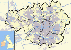 Rochdale shown within Greater Manchester |
|
| Population | 95,796 (2001 Census) |
|---|---|
| OS grid reference | |
| - London | 169 mi (272 km) SSE |
| Metropolitan borough | Rochdale |
| Metropolitan county | Greater Manchester |
| Region | North West |
| Constituent country | England |
| Sovereign state | United Kingdom |
| Post town | ROCHDALE |
| Postcode district | OL11, OL12, OL16 |
| Dialling code | 01706 |
| Police | Greater Manchester |
| Fire | Greater Manchester |
| Ambulance | North West |
| European Parliament | North West England |
| UK Parliament | Rochdale |
| List of places: UK • England • Greater Manchester | |

Rochdale is a large market town in Greater Manchester, England.[1] It lies amongst the foothills of the Pennines on the River Roch, 5.3 miles (8.5 km) north-northwest of Oldham, and 9.8 miles (15.8 km) north-northeast of the city of Manchester. Rochdale is surrounded by several smaller settlements which together form the Metropolitan Borough of Rochdale, of which Rochdale is the largest settlement and administrative centre. Rochdale has a total population of 95,796.
Historically a part of Lancashire, Rochdale's recorded history begins with an entry in the Domesday Book of 1086 under Recedham Manor. The ancient parish of Rochdale was a division of the hundred of Salford and one of the largest ecclesiastical parishes in England comprising several townships. By 1251, Rochdale had become important enough to have been granted a Royal charter. Subsequently, Rochdale flourished into a centre of northern England's woollen trade, and by the early 18th century was described as being "remarkable for many wealthy merchants".[2]
Rochdale rose to prominence during the 19th century as a major mill town and centre for textile manufacture during the Industrial Revolution. It was a boomtown of the Industrial Revolution, and amongst the first ever industrialised towns.[3] The Rochdale Canal—one of the major navigable broad canals of the United Kingdom—was a highway of commerce during this time used for the haulage of cotton, wool, coal to and from the area. The socioeconomic change brought by the success of Rochdale's textile industry in the 19th century led to its rise to borough status and it remained a dominant settlement in its region.[3] However, during the 20th century Rochdale's spinning capacity declined towards an eventual halt.[3]
Rochdale today is a predominantly residential town. Rochdale Town Hall—a Grade I listed building—dates from 1871 and is one of the United Kingdom's finest examples of Victorian Gothic revival architecture.[4] Rochdale is the birthplace of the Co-operative Movement.[5] The Rochdale Equitable Pioneers Society, founded in 1844, was the first modern cooperative; the Rochdale Principles are a set of ideals for cooperatives.
Contents |
History
Toponymy
Rochdale seems to be named for its position on the River Roch at the edge of the Pennines. But the Domesday Book records the name as Recedham, formed from Old English reced "hall", and ham "homestead". The name of the river is a back-formation from this Old English name. With time, the town's name changed to Rachedale and eventually Rochdale.[6] The name of the river Roch is pronounced /rəʊtʃ/, with a long o. The name of the town is pronounced /ˈrɒtʃdeɪl/.
Early history
A Roman road, leading from Mamucium (Manchester) to (Eboracum) York, traversed the outlying moors of Rochdale.[7]
During the Danelaw, Rochdale was frequented by incursions upon the Saxons by the Danes. Initially penetrating the area, the Saxons overthrew the Danes. A castle, from which Castleton has its name, but of which there are no traces, was one of the twelve Saxon forts probably destroyed in the frequent conflicts that occurred between the Saxons and Danes in the 10th and 11th centuries.[7]
Rochdale appears in the Domesday Book under the name of Recedham Manor, and was part of the hundred of Salfordshire. Ownership of the manor belonged to The Crown in 1399, and continued so until it was purchased by John Byron, 1st Baron Byron in 1638. It was eventually sold by the poet Lord Byron in 1823, when it passed to the Dearden family, who still hold the title. In earlier medieval times, Rochdale had been an important market town, with weekly markets held from the 13th century, and an annual fair. The market was held outside the parish church, and had a long-standing "Orator's Corner". The local reformer and Rochdale Member of Parliament, John Bright spoke in the town about Anti-Corn Law reform.
Industrial Revolution and cotton
Rochdale was among the world's most productive cotton spinning towns.[3]
Governance
Civic history
Lying within the historic county boundaries of Lancashire since the early 12th century, Rochdale was recorded in 1066 as held by Gamel, one of the twenty-one thegns of the Hundred of Salfordshire.[9]
The ancient eccelsiastical parish of Rochdale was originally divided in to four townships: Butterworth, Castleton, Hundersfield and Spotland.[9] Hundersfield was later divided into four townships: Blatchinworth, Calderbrook, Wardleworth and Wuerdle and Wardle.[9] Excluding the large chapelry of Saddleworth, which lay entirely in Yorkshire, the parish of Rochdale had an area of 65.4 square miles (169.4 km2).[9]
There is no certain evidence that the town of Rochdale became a borough during the Middle Ages.[1]
In 1825 commissioners for the social and economic improvement of the town of Rochdale were established.[1] The town was made part of a parliamentary borough, in 1832, though it was in 1856 when Rochdale was incorporated as a municipal borough, giving it borough status in the United Kingdom,[1] and in 1858 the borough council obtained the powers of the improvement commissioners.[1] In 1872 the remaining area of Wardleworth township and parts of Castleton, Wuerdle and Wardle, Spotland and Butterworth townships were added to the Borough of Rochdale.[1]
When the administrative county of Lancashire was created by the Local Government Act 1888, Rochdale was elevated to become the County Borough of Rochdale and was effectively a unitary authority area exempt from the administration of Lancashire County Council.[1] In 1900 most of Castleton Urban District was added to the borough; this urban district had included parts of Castleton, Hopwood and Thornham townships. In 1933 parts of Norden Urban District and Birtle with Bamford civil parish were added to the borough.[1] Since 1953 Rochdale has been twinned with Bielefeld in Germany and since 1956 with Tourcoing in France.[10] Under the Local Government Act 1972, the town's autonomous county borough status was abolished. The Municipal Boroughs of Middleton and Heywood, along with the Littleborough, Milnrow and Wardle Urban Districts; are now part of the Metropolitan Borough of Rochdale, one of the ten metropolitan boroughs belonging to the Metropolitan County of Greater Manchester.[1]
Parliamentary representation
Rochdale was one of the constituencies created by the Reform Act of 1832.
It was held for two decades of the 20th century by Cyril Smith, first of the Liberal Party and then of the Liberal Democrats.
Currently the town is represented in Parliament by Paul Rowen MP, a member of the Liberal Democrats.
Geography
- Further information: Geography of Greater Manchester

At (53.6136, -2.161), and 169 miles (272 km) north-northwest of London, Rochdale stands about 150 feet (46 m) above sea level, 9.8 miles (15.8 km) north-northeast of Manchester City Centre, in the valley of the River Roch. Blackstone Edge, Saddleworth Moor and the South Pennines are close to the east, whilst on all other sides, Rochdale is bound by smaller towns, including Whitworth, Littleborough, Milnrow, Royton, Heywood and Shaw and Crompton, with little or no green space between them. Rochdale experiences a temperate maritime climate, like much of the British Isles, with relatively cool summers and mild winters. There is regular but generally light precipitation throughout the year.
Rochdale's built environment consists of a mixture of infrastructure, housing types and commercial buildings from a number of periods. Rochdale's housing stock is mixed, but has a significant amount of stone or red-brick terraced houses from the late 19th and early 20th centuries. Rochdale's Town Hall, seven large tower blocks and a number of former cotton mills mark the town's skyline. The urban structure of Rochdale is regular when compared to most towns in England, its form restricted in places by its hilly upland terrain. Much of Rochdale's built environment is centred around a central business district in the town centre, which is the local centre of commerce.
|
There is a mixture of high-density urban areas, suburbs, semi-rural and rural locations in Rochdale, but overwhelmingly the land use in the town is urban. For purposes of the Office for National Statistics, forms the fifth largest settlement of the Greater Manchester Urban Area,[11] the United Kingdom's third largest conurbation. The M62 motorway passes to the south and southwest of Rochdale. Two heavy rail lines enter Rochdale from the east, joining at Rochdale railway station before continuing southwards to the city of Manchester.
Divisions and suburbs
|
|||||
Demography
Rochdale has large white and Asian communities.
Landmarks

Rochdale Town Hall
Rochdale Town Hall, designed by William Henry Crossland, was completed in 1871. The original clock tower, which rose to 240 feet (73 m), was destroyed by fire in 1883. The present shorter (and less flamboyant) tower was designed by Alfred Waterhouse in 1887.[12] One American academic has suggested that Adolf Hitler was so impressed with the town hall that he had plans to transport the building stone by stone to a new site in Germany if Britain lost the Second World War.[13]
The front of the building has gargoyles and gilded statues of lions which bear the traditional emblems of Rochdale, Lancashire and Yorkshire. These are said to be a commemoration of the peace, to which Rochdale contributed, between the two historic counties. Rochdale's own Gracie Fields received the Freedom of the Borough on the town hall's balcony, in front of a crowd of thousands who turned out to greet her in the pouring rain.
The River Roch flows in front of the town hall, under the widest bridge in Europe, at 1,460 feet (450 m).[14]
Parish church

From a hill, the Parish Church of St Chad directly overlooks the Town Hall. Some parts of the church date from Norman times. The town stocks (no longer in use) are in the churchyard.
War memorial
This monument, bearing four flags, is opposite the town hall (to the north). It commemorates those who died in conflicts since the First World War (1914–1918). The monument and surrounding gardens were designed by Sir Edwin Lutyens.[15][16]
Transport
Rail and Metrolink
Demand for cross-Pennine trade (e.g. to support the local cotton, wool and silk industries) led to the building of George Stephenson's Summit Railway Tunnel and the Rochdale Canal (from Manchester to Yorkshire - re-opened in 2003 after years of neglect, including its division by a motorway). The Manchester and Leeds Railway opened a station, but the line passed about a mile south of the town centre. The station remains open, but much reduced from its heyday. Trains run south (to Manchester Victoria), east (to Halifax, Bradford and Leeds) and to Manchester Victoria via the Manchester to Rochdale via Oldham Line, (also known as the Oldham Loop). Rochdale is to be served by an extension of the Manchester Metrolink tram system, which would see the Oldham Loop converted from heavy rail to light rail. This extension was deferred in 2004 on grounds of cost. In July 2006, however, ministers approved plans for extension from Manchester Victoria as far as the planned Rochdale Rail Station stop just outside the station. Approval for extension into Rochdale town centre, extended down Drake Street and terminating opposite Rochdale bus station, as well as into Oldham town centre, is expected in 2008.
Bus
Rochdale Bus Station is located next to the Wheatsheaf Shopping Centre under a multi-storey car park. There are plans to demolish the bus station and move it across the road, where it would eventually link up with the Metrolink to provide a transport interchange.
There are frequent journeys running from Rochdale to Manchester on First Manchester's 17 service, via Middleton, or on the 24, via Royton and Chadderton, to Oldham and Ashton-under-Lyne on the 409, and to Bury and Bolton on the 471. There are also cross-county services into Lancashire and West Yorkshire. Rossendale Transport's 464 service runs buses to Rawtenstall and Accrington. First Calderdale & Huddersfield run three services from Rochdale. The 528 runs to Halifax via Ripponden, the 589 runs to Burnley via Todmorden and the 590 runs to Halifax via Todmorden.
Road
The M62 motorway passes to the south of the town. The motorway is accessed via the A627(M), which starts at Sandbrook Park in Rochdale and runs to Elk Mill in Royton, Oldham. The A627(M) provides drivers a quick access to the M62 and to Oldham.
Sports
Rochdale's professional football team Rochdale A.F.C. play home games at Spotland Stadium, which they share with Rochdale Hornets Rugby League team. The town is also home to non-league side Rochdale Town. The town's main rugby union team is Rochdale R.U.F.C., who play in Bamford. There are two adult amateur football leagues: the Rochdale Online Alliance League and the Rochdale and District Sunday Football League.
There are a number of golf courses in the town, including Rochdale Golf Club, Marland Golf Club and Springfield Park Golf Club.[17] The town also has a substantial number of cricket clubs, most of which play in the Central Lancashire League.
Speedway racing was staged at the Athletic Grounds in the pioneer days of 1928 - 1930 and returned for a short spell at the start of the 1970s. The 1970s venture provided a home for the British League Division Two Belle Vue Aces juniors and the team was known as Rochdale Hornets. Peter Collins, who went on to win the 1976 World Championship and other honours, was the most famous Hornets rider.
Public services

Home Office policing in Rochdale is provided by the Greater Manchester Police. The force's "(P) Division" have their headquarters for policing the Metropolitan Borough of Rochdale at central Rochdale. Public transport is co-ordinated by the Greater Manchester Passenger Transport Executive. Statutory emergency fire and rescue service is provided by the Greater Manchester Fire and Rescue Service, which has one station in Rochdale on Maclure Road.[18]
The Rochdale Infirmary in north-central Rochdale and Birch Hill Hospital at the far northeast of Rochdale near the villages of Wardle and Littleborough, are NHS hospitals administrated by Pennine Acute Hospitals NHS Trust. Birch Hill occupies the former Rochdale Union Workhouse at Dearnley.[19] The North West Ambulance Service provides emergency patient transport. Other forms of health care are provided for locally by several small clinics and surgeries.
Waste management is co-ordinated by the local authority via the Greater Manchester Waste Disposal Authority.[20] Rochdale's Distribution Network Operator for electricity is United Utilities;[21] there are no power stations in the town, but a Wind farm exists on Scout Moor which consists of 26 turbines on the high moors between Rawtenstall and Rochdale. The wind farm generates 65MW of electricity.[22] United Utilities also manages Rochdale's drinking and waste water;[21] water supplies are sourced from several local reservoirs, including Watergrove, Blackstone Edge and Piethorne in Rochdale's outlying moorland.[21]
Notable people
The 19th-century Lancashire dialect poet Edwin Waugh (1817–1890) was born and raised in the town. Amongst Rochdale's most notable historical residents are a number of musicians, including female singers Gracie Fields, Lisa Stansfield (born in Heywood) and Barb Jungr, and bands Autechre, Tractor, The Chameleons and The Mock Turtles. Good Charlotte drummer Dean Butterworth also hails from Rochdale. Broadcasters John Peel, Mark Chapman, Liz and Andy Kershaw also have links with the town, Peel having lived there for a period of time and the latter three having been born there. Rochdale can also boast a number of actors and actresses; Colin Baker, Anna Friel, Bill Oddie and the aforementioned Gracie Fields all were either born or bred in Rochdale. Don Estelle, who was born and raised in Crumpsall, Manchester, lived for much of his life in Rochdale and was buried there in August 2003.[23] The bestselling poet John Siddique was brought up in Rochdale and has referenced the town in several poems.
Rochdale also has a proud liberal political heritage, as shown by such people as John Bright, Samuel Bamford, Rev. Joseph Cooke and perhaps the town's most colourful export Cyril Smith.
Other notable residents of Rochdale include Nicholas Blincoe, a novelist, George Gordon Byron, Lord Byron of Rochdale, Monica Coghlan, a prostitute caught up in the Lord Archer scandal, Stefan Kiszko, a local man infamously convicted wrongly of sexual assault.
References
Notes
- ↑ 1.0 1.1 1.2 1.3 1.4 1.5 1.6 1.7 1.8 "A select gazetteer of local government areas, Greater Manchester County". Greater Manchester County Record Office (2003-07-31). Retrieved on 2007-07-09.
- ↑ Godman, Pam (1996). Images of England: Rochdale. ISBN 1-84588-173-7.
- ↑ 3.0 3.1 3.2 3.3 McNeil, R. & Nevell, M (2000). A Guide to the Industrial Archaeology of Greater Manchester. Association for Industrial Archaeology. ISBN 0-9528930-3-7.
- ↑ Cunningham, C (1981). Victorian & Edwardian Town Halls. London: Routeledge.
- ↑ Rochdale - The Birthplace of Co-operation. URL accessed 1 January 2006.
- ↑ Mills, A.D.: A Dictionary of English Place Names, 2nd Edition, page 289, s.n. Rochdale. Oxford University Press, 1998
- ↑ 7.0 7.1 Lewis, Samuel (1848). A Topographical Dictionary of England; 'Rixton - Rochford'. Institute of Historical Research. pp. 679–686. ISBN 978-0806315089.
- ↑ R.D.W. Young (1998-2007). "Civic Heraldry of England and Wales - Greater Manchester". civicheraldry.co.uk. Retrieved on 2007-09-14.
- ↑ 9.0 9.1 9.2 9.3 Brownbill, J; William Farrer (1911). A History of the County of Lancaster: Volume 5. Victoria County History. pp. 187-201. ISBN 978-0712910552.
- ↑ "Town twinning". rochdale.gov.uk. Retrieved on 2008-03-01.
- ↑ Office for National Statistics (2001). "Census 2001:Key Statistics for urban areas in the North; Map 3" (PDF). statistics.gov.uk. Retrieved on 2007-09-13.
- ↑ Victorian & Edwardian Town Halls; C Cunningham; Routeledge; London; 1981
- ↑ Anon (2006-10-7). "Amazing windows always a glass act", Rochdale Observer, M.E.N. Media. Retrieved on 2008-04-25.
- ↑ Nicholls (2004), p. 147.
- ↑ Rochdale Official Guide (3rd edition); Pyramid Press; London; 1952
- ↑ Hartwell, C., (2004), Buildings of South Lancashire, p. 595.
- ↑ Anon. "Rochdale Online Golf Directory". Retrieved on 2007-12-24.
- ↑ Greater Manchester Fire and Rescue Service. "My area: Rochdale". manchesterfire.gov.uk. Retrieved on 2008-03-07.
- ↑ Higginbotham, Peter (2007-05-07). "Rochdale". workhouses.org.uk. Retrieved on 2008-03-07.
- ↑ Greater Manchester Waste Disposal Authority (2008). "Greater Manchester Waste Disposal Authority (GMWDA)". gmwda.gov.uk. Retrieved on 2008-02-08.
- ↑ 21.0 21.1 21.2 United Utilities (2007-04-06). "Rochdale". unitedutilities.com. Retrieved on 2008-02-08.
- ↑ "Scout Moor Wind Farm". scoutmoorwindfarm.co.uk. Retrieved on 2008-03-02.
- ↑ Farewell to screen star 'Lofty' Don - News - Rochdale Observer
Bibliography
- Nicholls, Robert (2004). Curiosities of Greater Manchester. Sutton Publishing. ISBN 0750936614.
External links
- www.rochdale.gov.uk Rochdale Metropolitan Borough Council website.
- www.link4life.org, Rochdale Boroughwide Cultural Trust.
|
|||||||||||||||||