Plaquemines Parish, Louisiana
| Plaquemines Parish, Louisiana | |
| Map | |
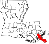 Location in the state of Louisiana |
|
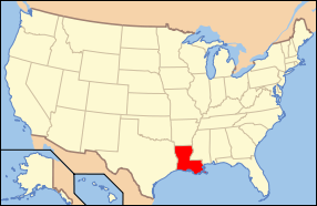 Louisiana's location in the U.S. |
|
| Statistics | |
| Founded | 1807 |
|---|---|
| Seat | Pointe à la Hache |
| Largest city | Belle Chasse |
| Area - Total - Land - Water |
2,429 sq mi (6,290 km²) 845 sq mi (2,187 km²) 1,584 sq mi (4,102 km²), 65.22% |
| Population - (2000) - Density |
26,757 32/sq mi (12/km²) |
| Time zone | Central: UTC-6/-5 |
| Website: www.plaqueminesparish.com/ | |
| Named for: Louisiana French word for persimmons | |
Plaquemines Parish (Cajun French: Paroisse Plaquemine) is the parish with the most combined land and water area in the U.S. state of Louisiana. The parish seat is Pointe à la Hache. As of 2000, the parish's population was 26,757.
The name is pronounced /ˈplɑːkəmɪnz/.
Plaquemines Parish is part of the New Orleans–Metairie–Kenner Metropolitan Statistical Area as well as the New Orleans–Metairie–Bogalusa Combined Statistical Area.
Contents |
History
The name "Plaquemines" comes from a Native American word, piakimin, meaning persimmon. It was first used to name an old military post on the banks of the Mississippi which was surrounded by a large number of persimmon trees. Eventually the name was applied to the entire parish.
The oldest European settlement in the parish was La Balize, where the French built and inhabited a rude fort by 1699 near the mouth of the Mississippi River. The name in French meant "seamark", a tall structure of wood built as a guide for ships. The French built one 62 feet (19 m) high by 1721.[1] A surviving map from about 1720 shows the island and fort, and the mouth of the river.[2]
As traffic and trade on the river increased, so did the importance of river pilots who were knowledgeable about the complicated, ever-changing currents and sandbars in the river. They lived at La Balize with their families. The village was destroyed and rebuilt numerous times, but it was abandoned for good after the destruction of a September 1860 hurricane. The pilots moved upriver and built the settlement they named Pilottown, which reached its peak of population in the 19th century.[3] The river pilots' expertise continues to be critical, but now they generally live with their families in more populated areas, and stay at Pilottown temporarily for work.
One of the remaining historical treasures of Plaquemines Parish is Fort Jackson, built in 1822 under the recommendation of General Andrew Jackson, hero of the Battle of New Orleans. In 1861, Fort Jackson served as an important defense for the city of New Orleans during the Civil War because it was at the mouth of the Mississippi River. It was also used as a training base during World War I - 1917-1918.
Because Plaquemines Parish encompasses the first 70 miles (110 km) of the Mississippi River, it plays host to several oil refineries which make use of the shipping lanes. The Mississippi River Delta of Plaquemines also provides assistance to offshore oil rigs. Plaquemines Parish was also the first place where a container was first used to ship cargo in foreign trade.
In the early 1900s Plaquemines was an exporter of citrus, and used the train and the river to move its large annual harvest. The parish has also been a big commercial fisheries haven, especially for oysters.
From 1919 to 1969, Plaquemines Parish (together with neighbouring St. Bernard Parish), was effectively the domain of political boss Leander Perez, who established a virtual dictatorship in the area. He was notorious for fixing elections and mandating strict racial segregation.
During the Great Mississippi Flood of 1927, city and state leaders used dynamite to breech a levee at Caernarvon, thirteen miles (19 km) below Canal Street, in order to save the city of New Orleans from flooding. However, this action resulted in the flooding of much of St. Bernard and the east bank of Plaquemines parish, causing widespread destruction.
Historic sites
The parish includes three U.S. National Historic Landmarks:
- Fort De La Boulaye Site,
- Fort Jackson, and
- Fort St. Philip.
It includes 5 other sites listed on the National Register of Historic Places, including Woodland Plantation, the plantation depicted on the label of Southern Comfort since the 1930s. Woodland Plantation, an antebellum mansion in West Pointe à la Hache, a small town on the West Bank of Plaquemines, is now operated as a bed and breakfast.
Hurricane Katrina
One of the worst natural disasters in United States history struck Louisiana on August 29 2005. Hurricane Katrina struck and did severe damage to all of Southeast Louisiana. Martial law was not declared in Plaquemines, contrary to many media reports, as no such term exists in Louisiana state law [1]. No place escaped without some damage, while most of the rest of Plaquemines, Orleans and neighbouring St. Bernard Parish were severely hit; Pointe à la Hache, Port Sulphur, Buras-Triumph, Empire, Boothville-Venice, Phoenix, and Venice, Louisiana suffered tremendous damage. Amidst heavy rains accompanied by hurricane force winds in excess of 120 mph (190 km/h) at initial landfall (with a Category 3 storm surge), the levees failed and broke, and the storm surge that flowed in was more than 20 feet (6.1 m) high. Although a good majority of the populace did heed mandatory evacuation orders, some did not. At least three residents died.
Geography
The parish has a total area of 2,429 square miles (6,290 km²), of which, 845 square miles (2,187 km²) of it is land and 1,584 square miles (4,102 km²) of it (65.22%) is water.
Major highways
 Louisiana Highway 23 - West Bank
 Louisiana Highway 39 - East Bank
Adjacent parishes and features
- Orleans Parish (north)
- St. Bernard Parish (northeast)
- Jefferson Parish (west)
Plaquemines Parish is bordered to the south and southeast by the Gulf of Mexico.
National protected area
- Delta National Wildlife Refuge
Economy
Plaquemines has a significant seafood industry. The parish exports millions of pounds of shrimp, crab, oysters, and fish annually. Plaquemines also has a vibrant citrus industry.
The seafood and citrus industries have suffered somewhat in the wake of Hurricane Katrina in August 2005. About half the shrimping and shellfish fleet were lost. In January 2007, thousands of citrus trees went unpicked.
Demographics
| Historical populations | |||
|---|---|---|---|
| Census | Pop. | %± | |
| 1900 | 13,039 |
|
|
| 1910 | 12,524 | −3.9% | |
| 1920 | 10,194 | −18.6% | |
| 1930 | 9,608 | −5.7% | |
| 1940 | 12,318 | 28.2% | |
| 1950 | 14,239 | 15.6% | |
| 1960 | 22,545 | 58.3% | |
| 1970 | 25,225 | 11.9% | |
| 1980 | 26,049 | 3.3% | |
| 1990 | 25,575 | −1.8% | |
| 2000 | 26,757 | 4.6% | |
| Est. 2006 | 22,512 | [4] | −15.9% |
| Plaquemines Parish Census Data[5] | |||
As of the census[6] of 2000, there were 26,757 people, 9,021 households, and 7,000 families residing in the parish. The population density was 32 people per square mile (12/km²). There were 10,481 housing units at an average density of 12 per square mile (5/km²). The racial makeup of the parish was 69.77% White, 23.39% Black or African American, 2.07% Native American, 2.62% Asian, 0.01% Pacific Islander, 0.73% from other races, and 1.42% from two or more races. 1.62% of the population were Hispanic or Latino of any race.
There were 9,021 households out of which 39.50% had children under the age of 18 living with them, 57.50% were married couples living together, 14.60% had a female householder with no husband present, and 22.40% were non-families. 18.60% of all households were made up of individuals and 7.10% had someone living alone who was 65 years of age or older. The average household size was 2.89 and the average family size was 3.30.
In the parish the population was spread out with 29.20% under the age of 18, 9.20% from 18 to 24, 30.50% from 25 to 44, 21.40% from 45 to 64, and 9.80% who were 65 years of age or older. The median age was 34 years. For every 100 females there were 99.40 males. For every 100 females age 18 and over, there were 97.30 males.
The median income for a household in the parish was $38,173, and the median income for a family was $42,610. Males had a median income of $37,245 versus $21,691 for females. The per capita income for the parish was $15,937. About 15.40% of families and 18.00% of the population were below the poverty line, including 20.70% of those under age 18 and 18.40% of those age 65 or over.
Communities

There are no incorporated areas within Plaquemines Parish.
- Belle Chasse
- Bohemia
- Boothville-Venice
- Braithwaite
- Buras-Triumph
- Burrwood (no longer inhabited)
- Davant
- Empire
- Homeplace
- Ironton
- Jesuit Bend
- Oakville
- Olga
- Pilottown
- Pointe à la Hache
- Port Eads
- Port Sulphur
- Venice
Education
Plaquemines Parish School Board operates the public schools of the parish.
See also
References
- ↑ David Roth, "Louisiana Hurricane History: 18th Century (1722-1800)", Tropical Weather - National Weather Service - Lake Charles, LA; 24 Jun 2003, accessed 7 May 2008
- ↑ "Carte du Fleuve Saint Louis ou Mississippy dix lieues au dessous de la Novelle Orleans Jusqu'a son Embouchoure", Louisiana State Museum Map Database, accessed 6 May 2008
- ↑ David Roth, "Louisiana Hurricane History: Late 19th Century (1851-1900)", Tropical Weather - National Weather Service - Lake Charles, LA; Jun 2003, accessed 6 May 2008
- ↑ United States Census Bureau. "Plaquemines Parish Quickfacts". Retrieved on 2007-06-12.
- ↑ United States Census Bureau. "Louisiana Population of Counties by Decennial Census: 1900 to 1990". Retrieved on 2007-06-12.
- ↑ "American FactFinder". United States Census Bureau. Retrieved on 2008-01-31.
External links
- Official website
- Images of destruction caused by Hurricane Katrina in the parish (Photos taken August 31 2005)
|
||||||||||||||
|