Pennines


The Pennines are a low-rising mountain range in northern England and southern Scotland. They separate the North West of England from Yorkshire and the North East.
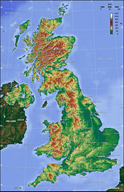
Often said to be the "backbone of England",[1][2][3] they form an unbroken range stretching from the Peak District in Derbyshire, through the Yorkshire Dales, around the northern and eastern edges of Greater Manchester, the West Pennine Moors of Lancashire and Cumbrian Fells to the Cheviot Hills on the Anglo-Scottish border. North of the Aire Gap the Pennines give out a western spur into Lancashire, the Forest of Bowland and south of the gap is a similar spur, the Rossendale Fells.[4]
It is an important water catchment area with numerous reservoirs in the head streams of the major river valleys. The region is widely considered to be one of the most scenic areas of the United Kingdom.[5] The North Pennines have been declared an Area of Outstanding Natural Beauty (AONB) as has Nidderdale, while portions of the Pennines are incorporated into the Peak District National Park, the Yorkshire Dales National Park and the Northumberland National Park.[6] Britain's first long distance footpath, the Pennine Way, runs the full length of the Pennine chain and is 429 kilometres (268 mi) long.[7]
Contents |
Etymology
The earliest written reference to the name is in the 18th century forgery De Situ Britanniae. The name was arguably influenced by the name of the Apennine Mountains of Italy, whose acquaintance many English gentry made on the Grand Tour at the same period and whose name is attributed to the same Celtic linguistic root.
Toponomy
The names of towns and geographical features retain some evidence of the Celts who were here before, and after, the Romans: for example the town Penrith, the fell Pen-y-ghent, the river Eden, or the name Cumbria. More commonly the local names result from the later Anglo-Saxon and Norse settlements. And in both Yorkshire and Cumbria many Norse words not commonly used in standard English are part of everyday speech: for example, gill (narrow steep valley), beck (brook or stream), fell (hill), dale (valley).[8]
Geology and landscape
The Pennines form an anticline which extends in a north-south direction, consisting of Millstone Grit and the underlying Carboniferous Limestone. The limestone is exposed at the surface to the north of the range in the North Pennines AONB and to the South in the Derbyshire Peak District. In the Yorkshire Dales this limestone exposure has led to the formation of large underground cave systems and watercourses, known as "gills" and "pots" in the Yorkshire dialect. These potholes are more prevalent on the eastern side and are amongst the largest in England; notable examples are the chasms of Gaping Gill, which is over 350 ft (107 m) deep and Rowten Pot, which is 365 ft (111 m) deep. The presence of limestone has also led to some unusual geological formations in the region, such as the limestone pavements of the Yorkshire Pennines. Between the Northern and Southern areas of exposed limestone, between Skipton and the Peak, lies a narrow belt of gritstone country. Here the shales and sandstones of the Millstone Grit form high hills occupied by moors and peat-mosses with the higher ground being uncultivable and barely fit for pastures.
The landscape of the Pennines is generally upland areas of high moorland indented by the more fertile valleys of the region's various rivers.
Drainage
The Pennines constitute the main watershed in northern England, dividing the eastern and western parts of the country. The rivers Eden, Ribble, and Mersey all rise in the Pennines and flow westwards towards the Irish Sea. On the other side of the watershed, the rivers Tyne, Tees, Wear, Swale, Ure, Nidd, Calder, Wharfe, Aire, Don, and Trent also rise in the region but flow eastwards to the North Sea.
Reservoirs
Kielder Water
Ladybower Reservoir
Altitude
The mountains are not very high and are often referred to as fells. The highest is Cross Fell in eastern Cumbria, at 2,930 feet (893 m) while other principal peaks include Mickle Fell 2,585 ft (788 m), Whernside 2,415 ft (736 m), Ingleborough 2,372 ft (723 m), High Seat 2,328 ft (710 m) and Wild Boar Fell 2,324 ft (708 m), both in Mallerstang, Pen-y-ghent 2,274 ft (693 m), and Kinder Scout 2,087 ft (636 m).
Character Areas of the Pennines

England has been divided into areas with similar landscape character. These have been called Joint Character Areas (JCAs). The JCAs are a widely recognised national spatial framework but the boundaries of the JCAs are not precise and many of the boundaries should be considered as broad zones of transition.[9]
The Pennines have ten Joint Character Areas. These are: -
- Border Moors and Forests[10]
- Tyne Gap and Hadrian's Wall[11]
- North Pennines[12]
- Howgill Fells[13]
- Yorkshire Dales[14]
- Bowland Fells[15]
- Southern Pennines[16], including the West Pennine Moors
- Dark Peak[17]
- White Peak[18]
- South West Peak[19]

The Bowland area of the Pennines is dominated by a central upland landform of deeply incised gritstone fells. There are vast tracts of heather covered peat moorland and blanket bog on these fells. The lower slopes of the fells are dotted with stone built farms and small villages and are criss crossed by drystone walls enclosing reclaimed moorland pasture. Cloughs, steep sided wooded valleys, link the upland and lowland landscapes. To the south-east of the area are extensive coniferous plantations and the eastern limestone areas support high quality species rich meadows.[20]
Dales
- Airedale
- Dovedale
- Nidderdale
- Ribblesdale
- Swaledale
- Teesdale
- Weardale
- Wensleydale
- Wharfedale
Demography
It is a relatively sparsely populated region by English standards.
Economy
The main economic activities include sheep farming, quarrying and tourism.
Main Settlements
- Hawes
- Keld
- Muker
- Reeth
- Stanhope
- Thwaite
Transport
The three main gaps in the Pennines have always afforded communications links between the areas to the east and west. These gaps are the Tyne Gap between Carlisle and Newcastle upon Tyne followed by the A69 road, the Stainmoor Gap and the Aire Gap linking Lancashire and Yorkshire via the valleys of the rivers Aire and Ribble. The Pennines are also traversed by the Leeds and Liverpool Canal and the M62 motorway. Elsewhere, the Pennines remain a formidable barrier to be crossed by tunnel or roads which may be blocked by snow for several days in winter.
Rail services are operated along the Huddersfield line between Huddersfield railway station and Victoria and Piccadilly stations in Manchester. The name of the train-operating company First TransPennine Express comes from such journeys - its trains connect the North West with the North East.
History

Early inhabitants
The area contains many examples of Bronze Age settlements, and evidence of Neolithic settlement (including many stone circles or henges, such as Long Meg and Her Daughters.)[21]
Celtic and Roman times
The Pennines would have come under the tribal federation of the Brigantes. This tribal federation was made up of mainly small tribes who inhabited the Pennines and cooperated on defence and external affairs. The Brigantes later evolved into an early form of kingdom.
During Roman times, the Brigantes came under Roman domination. The Romans exploited the Pennines for the natural resources and wild animals found there.
Early Middle Ages
The Pennines were a major obstacle for Anglo-Saxon expansion west. Even when they were conquered they still retained a distinct Semi-Celtic identity, which they still hold today. During the Dark Ages the Pennines came under a number of Celtic and Anglo-Saxon kingdoms. It is believed that the north of the area first came under the kingdom of Rheged. There were later three kingdoms which were solely based in the Pennines though. These were: The Kingdom of the Pennines and later the Kingdom of the Pennines broke up and was succeeded by Dunoting/Kingdom of the North Pennines and The Peak/Kingdom of the South Pennines.
During Norse times the Pennines were lightly settled by Viking Danes in the east and Norwegian Vikings in the west. The Vikings left a lot of influence on placenames, even though they did not settle in great numbers. When England was unified the Pennines were incorporated into England.
Other history
The Pennines were the major route for the Jacobite attack on England. They also became highly exploited in the Victorian age.
Language
The language used in pre-Roman and Roman times was British. During the Early Middle Ages, the Cumbric language developed. However, little evidence of Cumbric remains, so it is difficult to ascertain whether or not it was a language in its own right or simply a dialect of Old Welsh. It is also uncertain as to the extent of the region in which Cumbric was spoken.
During Anglo-Saxon times (the area was settled by Anglian peoples of Mercia and Northumbria, rather than the Saxon peoples of southern England) Celtic speech remained in most areas of the Pennines longer than it did in the surrounding areas of England. Eventually, the Celtic tongue of the Pennines was replaced by early Middle English in the 12th Century.
In Norse times, Viking settlers brought their languages of Old Norse, Old Danish (mainly in the Yorkshire Dales and parts of the Peak District) and Old Norwegian (mainly in the western Pennines). With the eventual consolidation of England by the Saxon kingdom of Wessex, the pure Norse speech died out in England, though it survived in the Pennines longer than in most areas. However, the fusion of Norse and Old English was an important part of the formation of Middle (and hence, Modern)English, and many individual words of Norse descent remain in use in local dialects, such as that of Yorkshire, and in local place names.
Norman French had little effect on the language of the Pennines though. All of the above languages have had an influence, either large or small on the modern placenames of the Pennines. The modern language of the Pennines is English.
Folklore and customs
The folklore and customs are mostly based on Celtic and Viking customs and folklore. Many customs and stories have their origin in Christianised pagan traditions.
See also
- Yorkshire three peaks
- Geology of the United Kingdom
- Geology of Yorkshire
References
- ↑ Poucher, W.A. (1946), The Backbone of England. A photographic and descriptive guide to the Pennine range from Derbyshire to Durham., Guildford and Esher: Billing and Sons Limited.
- ↑ Edwards, W.; Trotter, F.M. (1954), The Pennines and Adjacent Areas, Handbooks on the Geology of Great Britain (Third Edition ed.), London: HMSO, p. 1, ISBN 0 11 880720 X.
- ↑ "Pennines -- Britannica Online Encyclopedia". Retrieved on 2008-02-28.
- ↑ Dudley Stamp, L (1946), Britain’s Structure and Scenery, The Fontana New Naturalist Series (1960 ed.), London and Glasgow: Collins.
- ↑ "Writer inspired by beauty of Pennines celebrates its views - Yorkshire Post". www.yorkshirepost.co.uk. Retrieved on 2008-10-13.
- ↑ "Designated Landscapes Index". Natural England. Retrieved on 2007-12-02.
- ↑ "Trail stats, Pennine Way". National Trails Homepage. The Countryside Agency. Retrieved on 2007-08-03.
- ↑ Gunn, Peter, The Yorkshire Dales. Landscape with Figures, London: Century Publishing Co Ltd (published 1984), ISBN 0 7126 0370 0
- ↑ Mills, Rachael. "> Joint Character Areas". Natural England. Retrieved on 2007-12-02.
- ↑ 52150 Vol 2
- ↑ 52150 Vol 2
- ↑ http://www.countryside.gov.uk/Images/JCA10_tcm2-21072.pdf
- ↑ 52150 Vol 2
- ↑ http://www.countryside.gov.uk/Images/JCA21_tcm2-21079.pdf
- ↑ http://www.countryside.gov.uk/Images/JCA34_tcm2-21084.pdf
- ↑ http://www.countryside.gov.uk/Images/JCA36_tcm2-21086.pdf
- ↑ http://www.countryside.gov.uk/Images/JCA51_tcm2-21087.pdf
- ↑ http://www.countryside.gov.uk/Images/JCA52_tcm2-21149.pdf
- ↑ http://www.countryside.gov.uk/Images/JCA53_tcm2-27913.pdf
- ↑ "> The Landscape of The Forest of Bowland Area Of Outstanding Natural Beauty (AONB)". Page managed by the Information Management Team in the Strategic Planning & Transport Section, Environment Directorate, Lancashire County Council (06 June 2007 16:35:58.). Retrieved on 2007-12-07.
- ↑ Out of Oblivion: A landscape through time
- Arthur Raistrick, 'The Pennine Dales', Eyre Methuen Ltd 1968, ISBN 041326760