Pasadena, Texas
| City of Pasadena | |
 |
|
| Nickname(s): "Strawberry Capitol", "Stinkadena" "Pasa get down dena" | |
| Motto: "Enriched by our Heritage. Inspired by our Future." | |
 |
|
| Coordinates: | |
| Country | United States |
|---|---|
| State | Texas |
| County | Harris |
| Government | |
| - Type | Mayor-Council |
| - Mayor | Johnny Isbell
District A: Ralph Riggs |
| - City Council | {{{leader_name1}}} |
| Area | |
| - City | 44.5 sq mi (115.3 km²) |
| - Land | 44.2 sq mi (114.4 km²) |
| - Water | 0.4 sq mi (0.9 km²) |
| Elevation | 30 ft (9.1 m) |
| Population (2004) | |
| - City | 152,968 |
| - Density | 3,208.2/sq mi (1,238.7/km²) |
| - Metro | 5,628,101 |
| Time zone | CST (UTC-6) |
| - Summer (DST) | CDT (UTC-5) |
| ZIP codes | 77501-77506 |
| Area code(s) | Area code 713, 281, 832 |
| FIPS code | 48-56000[1] |
| GNIS feature ID | 1343631[2] |
| Website: http://www.ci.pasadena.tx.us/ | |
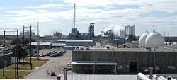
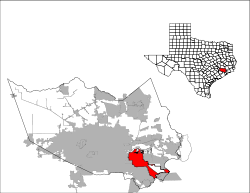
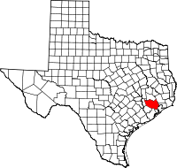
Pasadena (pronounced /ˌpæsəˈdiːnə/) is a city south of Houston in Harris County, Texas within the Houston–Sugar Land–Baytown metropolitan area. It is the second largest city in the county, 15th largest in the state and 159th largest in the United States, next to its namesake city, Pasadena, California, the 160th largest. The area was founded in 1893 by John H. Burnett of Galveston. At the time of its founding, the land's lush, flowering vegetation inspired Burnett to name the city after Pasadena, California.
As of the 2000 U.S. Census, the city's population was 141,674, but as of 2007, it is estimated to be at 152,968.[3] It claims largest all volunteer municipal fire department in the United States, the Pasadena Volunteer Fire Department. The city's economy is closely linked to the nearby Houston Ship Channel and its related industrial districts, as well as the National Aeronautics and Space Administration's Lyndon B. Johnson Space Center in the bordering Clear Lake area.
Contents |
History
The first inhabitants of the area are believed to have been the Karankawa Indians, who lived throughout the Gulf coast region.
Birthplace of Texas
Pasadena is near the location of the final battle of the Texas Revolution, which occurred on April 21, 1836. The Mexican General Antonio López de Santa Anna was captured at Vince's Bayou. A monument to that battle, known as the San Jacinto Monument, is located in the city of La Porte on the Houston ship channel. Because this was the last conflict that led to the Mexican surrender, Pasadena and neighboring Deer Park are known as the "Birthplace of Texas." Washington County, Texas shares the claim to that title, since that is where the Texas Declaration of Independence was signed.
The Allen Ranch
A large ranch occupied what is now western Pasadena all the way to Harrisburg, Texas. That ranch was known as the Allen Ranch. By 1888, the Allen Ranch contained 15,000 acres (60 km²) in Harris County, 10,000 acres (40 km²) in Brazoria County, Texas with grazing lands in Galveston and Fort Bend Counties. Sam Allen had started the ranch 45 years earlier with 350 acres (1.4 km²). When he was 62, he suffered a sunstroke and was buried in nearby Harrisburg in 1888.
The 19 mile (31 km) fence
The Galveston, Harrisburg & Houston Railroad ran through the Allen ranch. There was a problem of cattle being regularly killed on the tracks and in 1875, Sam Allen built a 19 mile (31 km) fence along the east side of the railway right of way to keep the cattle off the tracks. The fence ran from Harrisburg to League City and had four rails and a top rail wide enough to walk on. A gate was placed in the fence at the Harrisburg-Lynchburg Road with a large sign above instructing that it should be closed at all times. The area east of this railroad fence running from Buffalo Bayou to the tracks on Sims Bayou ran all the way to Galveston Bay. It contained 100,000 acres (400 km²) of grazing land for cattle.
First settlements

In the area were small post along Buffalo Bayou such as Lynchburg, Clinton, Morgans Point, La Porte and the larger towns of Harrisburg and Houston. Many other "proposed" towns in or near present day Pasadena were set up but short lived and either abandoned or never even got off the ground. Some of these included, Germantown, later known as Frostown, Hamilton, which tried to steer away residents of Harrisburg, San Jacinto a town across from the Lynchburg Ferry, Louisville just down stream. A huge development called Buffaloe at the mouth of Vince Bayou was proposed by Merriweather Woodson Smith on July 8, 1837. He had purchased 2,222 acres (8.99 km²) from the William Vince survey, but no lots were ever sold.
In 1892 Colonel John H. Burnett of Galveston established an unnamed townsite on the Vince Survey just east of the Allen Ranch. Burnett was involved in both construction and promotion of railroads and knew their impact on the value of property. The land was sold in 10 acre lots. He had also established the nearby towns of Deepwater and Genoa, later to be incorporated into Pasadena and Houston.
Late 20th century
From the 1980 Census to the 1990 Census, Hispanics began to move into parts of Pasadena.[4]
Geography
Pasadena is located at (29.676196, -95.173845)[5]. According to the United States Census Bureau, the city has a total area of 44.5 square miles (115.3 km²), of which, 44.2 square miles (114.4 km²) of it is land and 0.4 square miles (0.9 km²) of it (0.81%) is water. The city is bordered by the Houston Ship Channel (Buffalo Bayou / San Jacinto River) to the north. The southeastern most part of the city fronts Galveston Bay.
Climate
The climate of Pasadena is that of neighboring Houston. Hot and humid summers with mild winters typical of the Southern United States.
| Month | Jan | Feb | Mar | Apr | May | Jun | Jul | Aug | Sep | Oct | Nov | Dec | Year |
|---|---|---|---|---|---|---|---|---|---|---|---|---|---|
| Record high °F (°C) | 85 (29) |
87 (31) |
96 (36) |
94 (34) |
98 (37) |
101 (38) |
104 (40) |
106 (41) |
101 (38) |
96 (36) |
90 (32) |
84 (29) |
106 (41) |
| Average high °F (°C) | 63 (17) |
67 (19) |
74 (23) |
79 (26) |
86 (30) |
91 (33) |
94 (34) |
93 (34) |
89 (32) |
82 (28) |
73 (23) |
65 (18) |
80 (27) |
| Average low °F (°C) | 45 (7) |
48 (9) |
55 (13) |
61 (16) |
68 (20) |
74 (23) |
75 (24) |
75 (24) |
72 (22) |
62 (17) |
53 (12) |
47 (8) |
61 (16) |
| Record low °F (°C) | 10 (-12) |
14 (-10) |
22 (-6) |
22 (-6) |
44 (7) |
56 (13) |
45 (7) |
64 (18) |
50 (10) |
33 (1) |
25 (-4) |
9 (-13) |
9 (-13) |
| Precipitation inches (mm) | 4.3 (109.2) |
3.0 (76.2) |
3.2 (81.3) |
3.5 (88.9) |
5.1 (129.5) |
6.8 (172.7) |
4.4 (111.8) |
4.5 (114.3) |
5.6 (142.2) |
5.3 (134.6) |
4.5 (114.3) |
3.8 (96.5) |
54.0 (1,371.6) |
| Source: weather.com[6] Aug 2007 | |||||||||||||
Etymology
It is claimed by some sources that the word "Pasadena" is Spanish for "land of flowers." [7] After Pasadena, California was established Burnett had visited the area and decided that area near the Vince Bayou looked very similar to Pasadena, and named the new Texas town after it. [8]
Transportation
Pasadena is served by three freeway systems. Interstate 45 is the closest interstate to the Pasadena city limits. The main freeway artery is the Pasadena Freeway (State Highway 225). The east side of the Sam Houston Tollway (Beltway 8) runs through the eastern portion of the city.
Demographics
As of the census[1] of 2000, there were 141,674 people, 47,031 households, and 35,179 families residing in the city. The population density was 3,208.1 people per square mile (1,238.7/km²). There were 50,367 housing units at an average density of 1,140.5/sq mi (440.4/km²). The racial makeup of the city was 71.45% White, 1.63% African American, 0.68% Native American, 1.83% Asian, 0.04% Pacific Islander, 21.30% from other races, and 3.08% from two or more races. Hispanic or Latino of any race were 48.24% of the population.
There were 47,031 households out of which 43.1% had children under the age of 18 living with them, 55.8% were married couples living together, 13.1% had a female householder with no husband present, and 25.2% were non-families. 20.4% of all households were made up of individuals and 6.2% had someone living alone who was 65 years of age or older. The average household size was 2.99 and the average family size was 3.48.
In the city the population was spread out with 31.6% under the age of 18, 11.4% from 18 to 24, 31.2% from 25 to 44, 17.9% from 45 to 64, and 7.9% who were 65 years of age or older. The median age was 29 years. For every 100 females there were 99.8 males. For every 100 females age 18 and over, there were 97.6 males.
The median income for a household in the city was $38,522, and the median income for a family was $42,541. Males had a median income of $34,330 versus $25,869 for females. The per capita income for the city was $16,301. About 13.2% of families and 16.0% of the population were below the poverty line, including 20.8% of those under age 18 and 10.5% of those age 65 or over.
Culture
The city has several museums, including the Pasadena Historical Museum, the Bay Area Museum and Armand Bayou Nature Center. Pasadena also has a community theater (Pasadena Little Theatre), a large rodeo each year (Pasadena Livestock Show & Rodeo) and orchestra (the Pasadena Philharmonic). The city's newspaper is the Pasadena Citizen.
Because of its location near the enormous amount of refineries that dot the ship channel (which help to make Houston's petrochemical complex the largest in the nation), Pasadena has been dubbed by locals with the nickname "Stinkadena." Another reason for the name may be the large sewage treatment plant located along State Highway 225 that links Houston to Pasadena. Another nickname, "Pasa-get-down-dena", was coined in the mid-1980s by a Houston morning radio DJ named Moby on his show Moby in the Morning on the long gone station, 97 Rock. At least two country music songs have been recorded with "Pasa-get-down-dena" as the title: one by Kenefick on their album "Hard Road," and John Evans on his album "Biggest Fool in Town."
Gilley's and Urban Cowboy
Pasadena was enshrined in film history when John Travolta, Debra Winger and others descended on the city to film the 1980 hit movie Urban Cowboy, which depicted life and young love in Pasadena. The film centered around the city's enormous honky-tonk bar Gilley's, which was co-owned by country music star Mickey Gilley. In 1989 Gilley's suffered an arson fire that gutted the interior, but the building's shell was still standing until 2006 when it was demolished by the Pasadena Independent School District, its current owner. Only the old sound recording studio remains. Gilley still makes his home in Pasadena.
Strawberry Festival
The Galveston Hurricane of 1900 caused many people to resettle in Pasadena, TX. Clara Barton of the American Red Cross purchased 1.5 million strawberry plants and sent them to Pasadena to help victims of the flood get back on their feet. By the 1930s those crops had flourished so much that Pasadena was claiming the moniker of Strawberry Capital of the World. At its height, the city's strawberry growers shipped as many as 28 train carloads of strawberries each day. To honor that history, the city still holds an annual Pasadena Strawberry Festivaland today Strawberry Road stretches through much of the city near where the old strawberry crops grew.
Education
Colleges and universities
Institutions of higher education include:
- University of Houston–Clear Lake (partially in Pasadena, partially in Houston)
- San Jacinto College (Central Campus and System Headquarters) a community college system which serves all of Pasadena as well as all and portions of several other school districts.
- Texas Chiropractic College Founded in 1908, Texas Chiropractic College is the fourth oldest chiropractic college in the nation and recognized as one of the very best. TCC is accredited as a Level V doctoral degree granting institution by the Southern Association of Colleges and Schools. TCC has maintained continuous accreditation since 1971 and enjoys a stable and secure financial condition as well, annually generating an operational surplus. Its first-of-its-kind Hospital Rotations Program is a pioneer in the integrated health care field. The program provides interns the opportunity to rotate in nearly 30 hospitals and clinics throughout the Houston metropolitan area, including the Texas Medical Center.
Primary and secondary schools
Most of city of Pasadena is served by the Pasadena Independent School District. Some of the eastern part is served by Deer Park Independent School District, some of the southern part is served by Clear Creek Independent School District and La Porte Independent School District.
Public libraries
Pasadena owns the Pasadena Public Library with the Main Library at 1201 Jeff Ginn Memorial Drive and the Fairmont Library, a branch, at 4330 Fairmont Parkway between Panama Street and Watters Road.[9][10]
Neighborhoods
Neighborhoods in Pasadena include:
- Vista Villas
- Allendale
- Bayport
- Clear Lake City (Pasadena)
- Deepwater
- El Jardin del Mar
- Golden Acres
- Old Downtown
- Parkview Manor
- Red Bluff Terrace
Parks
Harris County operates two community centers in Pasadena [2].
- East Harris County Activity Center
- Bay Area Community Center
- Armand Bayou Nature Center
- Clear Lake Water Front (Pasadena Section)
San Jacinto Branch YMCA is located in Pasadena.
Government
Local government
The Government of Pasadena operates under a Mayor-Council form of government with a mayor and eight council members who are responsible for enacting legislation, adopting budgets and setting policies.[11]
Elections
The last election was a special election held in December 2007.
Mayor
- John Manlove July 2001- October 2007
- Jack Douglass October 2007- January 2008
- Johnny Isbell January 2008 - present
County, state, and federal representation
Harris County Hospital District operates the Strawberry Health Center in Pasadena.[12]
The United States Postal Service operates four post offices in Pasadena.[13] [14],[15] [16]
References
- ↑ 1.0 1.1 "American FactFinder". United States Census Bureau. Retrieved on 2008-01-31.
- ↑ "US Board on Geographic Names". United States Geological Survey (2007-10-25). Retrieved on 2008-01-31.
- ↑ Bay Area Houston Economic Partnership
- ↑ Rodriguez, Lori. "Census tracks rapid growth of suburbia." Houston Chronicle. Sunday March 10, 1991. Section A, Page 1.
- ↑ "US Gazetteer files: 2000 and 1990". United States Census Bureau (2005-05-03). Retrieved on 2008-01-31.
- ↑ "Weather.com: Weather Channel Historical Weather for Houston, Texas, United States of America". Retrieved on Aug 3, 2007.
- ↑ Travel Texas, State Tourism Travel Guide
- ↑ Pasadena, The Early Years, by Pomeroy 2006
- ↑ "Hours & Location." Pasadena Public Library. Retrieved on December 6, 2008.
- ↑ "Fairmont Library." Pasadena Public Library. Retrieved on December 6, 2008.
- ↑ [1]
- ↑ "Strawberry Health Center." Harris County Hospital District. Retrieved on December 6, 2008.
- ↑ "Post Office™ Location - PASADENA." United States Postal Service. Retrieved on December 6, 2008.
- ↑ "Post Office™ Location - JOHN FOSTER." United States Postal Service. Retrieved on December 6, 2008.
- ↑ "Post Office™ Location - BOB HARRIS." United States Postal Service. Retrieved on December 6, 2008.
- ↑ "Post Office™ Location - DEBERT L. ATKINSON." United States Postal Service. Retrieved on December 6, 2008.
External links
- City of Pasadena
- Pasadena Texas Community Information
- Pasadena Chamber of Commerce
- Pasadena Citizen
- Pasadena Strawberry Festival
- Pasadena Livestock Show & Rodeo
- Pasadena Information
- Pasadena, Texas from the Handbook of Texas Online
- Pasadena, Texas is at coordinates
 |
Houston–Sugar Land–Baytown METROPOLITAN AREA |
|---|---|
| Counties | Austin | Brazoria | Chambers | Fort Bend | Galveston | Harris | Liberty | Montgomery | San Jacinto | Waller |
| "Principal" cities |
Houston | Sugar Land | Baytown | Galveston |
| Cities and towns |
Alvin | Angleton | Bellaire | Cleveland | Clute | Conroe | Dayton | Deer Park | Dickinson | Freeport | Friendswood | Galena Park | Hitchcock | Hempstead | Humble | Jacinto City | Jersey Village | Katy | Lake Jackson | La Marque | La Porte | League City | Liberty | Meadows Place | Missouri City | Pasadena | Pearland | Richmond | Rosenberg | Santa Fe | Seabrook | Sealy | South Houston | Stafford | Texas City | Tomball | Webster | West University Place |
| Unincorporated areas | Atascocita | Channelview | Cloverleaf | Cypress | Klein | Spring | The Woodlands |
|
||||||||||||||||||||
|
|
|||||||||||||
