Paris Métro
|
||||||||||||||||||||||||||||||||||||||||||||||||||||||||||||||||||||||||||||||||||||||||||||||||||||||||||||||||||
|
||||||||||||||||||||||||||||||||||||||||||||||||||||||||||||||||||||||||||||||||||||||||||||||||||||||||||||||||||
The Paris Métro or Métropolitain (French: Métro de Paris) is the rapid transit system in Paris. It is a symbol of the city, notable for its older stations architecture, influenced by Art Nouveau. It has 16 lines, each using exclusively their own tracks, mostly underground, and a total length of 214 km (133 mi). There are 300 stations. Since some are served by several lines, there are overall 384 stops, all having their own platforms. [1]
Paris has the most closely spaced subway stations in the world, with 245 stations within the 105 square kilometres (41 sq mi) City of Paris. Lines are numbered 1 to 14, with two minor lines, 3bis and 7bis. The minor lines were originally part of lines 3 and 7 but became independent.
Lines are identified on maps by number and colour. Direction of travel is shown by the terminus station.
Paris is the second busiest metro system in Europe after Moscow.[2] It carries 4.5 million passengers a day. It carried 1.365 billion in 2005. Châtelet-Les Halles is the world's largest underground station.[3]
Contents |
Brief history

The first line opened without ceremony on 19 July 1900, during the Exposition Universelle world's fair. The system expanded quickly until the First World War and the core was complete by the 1920s. Extensions into suburbs were built in the 1930s. Line 11 was also created during this period.
The network reached saturation after World War II. The Métro introduced newer trains to allow higher traffic. Further improvements are limited by the design of the network, such as short distances between stations. The solution was a second network, the RER, developed from the 1960s.
In the late 1990s, the Métro began the automated Line 14 to relieve RER Line A.
Naming
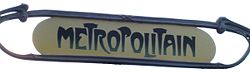
Métro is the abbreviated name of the company which originally operated most of the network: the Compagnie du chemin de fer métropolitain de Paris, shortened to "Métropolitain". That was quickly abbreviated to Métro. The Métro today is operated by the Régie autonome des transports parisiens (RATP), a public transport authority that also operates part of the RER network, bus services and light rail lines. The name métro proved very popular and was adopted in many languages, making it the most used word for a (generally underground) urban transit system. It is also possible that "Compagnie du chemin de fer métropolitain" was copied from the name of London's pioneering underground railway company, the Metropolitan Railway, which had already been in business for almost 40 years prior to the inauguration of Paris's first line.
General use
Opening hours

Trains run from approximately 0500 to 0100 on every station Sunday through Thursday. The last train, often called the "balai" (broom) because it sweeps up remaining passengers, arrives at the terminal station at 0115. The Metro stays open an hour later on Fridays (since 7 December 2007[4]), Saturdays and on nights before a holiday, when the service ends at 0215.
The network stays partially open all night for New Year's Eve, Fête de la Musique or Nuit Blanche and other events.
Using the trains
Tickets are sold at kiosks and at automated machines in the station foyer (see below for details). Entrance to platforms is by automated gate, opened by inserting a ticket. The gate returns the ticket for the passenger to keep.
In common with many metro systems of Europe, doors on the trains do not tend to open by themselves. These require the lifting of a latch/lever (all train series built between 1963 and mid-1970s) or pressing a button on the door (MF77 and MF88 stock).
The exception to this is the MP89 rolling stock on lines 1 and 14, and the MF2000 series being introduced on lines 2, 5 and 9. Very high (and rising) passenger numbers theoretically mean that passenger-operated doors are increasing dwell times, although Parisians are usually very prompt at opening the doors and the driver enables them just before the train has come to a halt.
Tickets
The standard ticket is ticket "t+". It is valid for 90 minutes and for one continuous journey. It can be used on the whole Métro network, on buses, trams and on zone 1 of the RER. The ticket allows unlimited transfers between the same transport (i.e. Métro to Métro, bus to bus and tram to tram), between bus and tram, and between metro and RER zone 1. It can be bought singly at €1.60 or in tens, a carnet, at €11.40.
Other passes:
- weekly or monthly (carte orange, weekly is called hebdomadaire "hebdo", monthly is called mensuel), one-day (Mobilis)
- yearly (intégrale, imagine R for students)
- one-day, two-day, three-day or five-day (Paris Visite)
Finally, the Navigo card is a pass which can be reloaded monthly or weekly. It is replacing the carte orange. Navigo is not magnetic but an RFID-based contactless smart card.
Technical summary
Overview
| Paris Métro | |
| Info | |
|---|---|
| Locale | Paris |
| Transit type | Rapid transit |
| Number of lines | 16 |
| Number of stations | 300 |
| Daily ridership | 4,500,000 |
| Operation | |
| Began operation | 19 July 1900 |
| Operator(s) | RATP |
| Technical | |
| System length | 214 km (133 mi) |
| Track gauge | 1,435 mm (4 ft 8½ in) (standard gauge) |
The Métro has 214 km (133 mi) of track and 300 stations (384 stops), 62 connecting between lines[1]. These figures do not include the RER network. The average distance between stations is 562 m (1,845 ft). Trains stop at all stations [5]. Lines do not share platforms, even at interchange (transfer) stations. This also applies to RER lines.
Trains average 35 km/h (22 mph) with a maximum of 70 km/h (44 mph) on all but the automated, driverless trains of line 14, where the limit is 80 km/h. Trains travel on the right. The track is standard gauge but the loading gauge is smaller than on the mainline SNCF network. Trains vary from three to six cars. Trains on the same line always have the same number of cars. Power is from a lateral third rail, 750V DC, except on the rubber-tyred lines where the 750 V DC is from guide bars. Lines 1, 4, 6, 11, and 14 are rubber-tyred.
The earliest lines, dug by hand, follow roads. Line 1 follows the Champs Élysées in a straight line. Engineers had to follow roads or encounter cellars. This explains why some stations (Commerce on line 8 and Liège on line 13) have platforms that do not align; the street above is too narrow to fit both platforms opposite each other.
With the average speed and the average distance between each station, a station-to-station trip takes 58 seconds on average.
Rolling stock

The rolling stock has steel-wheel ("MF" for matériel fer) and rubber-tyred trains ("MP", matériel pneu). The different versions of each kind are specified by year of design (not the year of first use).
- Rubber-tyred
- MP 59: lines 4 and 11 (To be phased out of Line 4 once transfer of MP 89 CC from Line 1 is complete.)
- MP 73: line 6
- MP 89 CA: Line 14
- MP 89 CC: Line 1 (To be transferred over to Line 4, beginning 2008/9)
- MP 05: planned to serve on line 1 by 2010 once the line is fully automated.
- Steel-wheel
- MF 67: lines 2, 3, 5, 9, 10, 12 and as a shortened three-car version on 3bis
- MF 77: lines 7, 8 and 13
- MF 88: line 7bis
- MF 2000: planned to serve on lines 2, 5 and 9 by 2007.
The lines
Paris Métro lines
| Line name | Opened | Last extension |
Stations served |
Length | Average interstation |
Journeys made (per annum) |
Termini | |
|---|---|---|---|---|---|---|---|---|
| Line 1 | 1900 | 1992 | 25 | 16.6 km / 10.3 miles | 692 m | 165,921,408 | La Défense Château de Vincennes |
|
| Line 2 | 1900 | 1903 | 25 | 12.3 km / 7.7 miles | 513 m | 95,945,503 | Porte Dauphine Nation |
|
| Line 3 | 1904 | 1971 | 25 | 11.7 km / 7.3 miles | 488 m | 91,655,659 | Pont de Levallois Gallieni |
|
| Line 3bis | 1971 | 1971 | 4 | 1.3 km / 0.8 miles | 433 m | Porte des Lilas Gambetta |
||
| Line 4 | 1908 | 1910 | 26 | 10.6 km / 6.6 miles | 424 m | 155,348,608 | Porte de Clignancourt Porte d'Orléans |
|
| Line 5 | 1906 | 1985 | 22 | 14.6 km / 9.1 miles | 695 m | 92,778,870 | Bobigny Place d'Italie |
|
| Line 6 | 1909 | 1942 | 28 | 13.6 km / 8.5 miles | 504 m | 104,102,370 | Charles de Gaulle - Étoile Nation |
|
| Line 7 | 1910 | 1987 | 38 | 22.4 km / 13.9 miles | 605 m | 121,341,833 | La Courneuve Villejuif Mairie d'Ivry |
|
| Line 7bis | 1967 | 1967 | 8 | 3.1 km / 1.9 miles | 443 m | Louis Blanc Pré Saint-Gervais |
||
| Line 8 | 1913 | 1974 | 37 | 22.1 km / 13.8 miles | 614 m | 92,041,135 | Balard Créteil |
|
| Line 9 | 1922 | 1937 | 37 | 19.6 km / 12.2 miles | 544 m | 119,885,878 | Pont de Sèvres Mairie de Montreuil |
|
| Line 10 | 1923 | 1981 | 23 | 11.7 km / 7.3 miles | 532 m | 40,411,341 | Boulogne Gare d'Austerlitz |
|
| Line 11 | 1935 | 1937 | 13 | 6.3 km / 3.9 miles | 525 m | 46,854,797 | Châtelet Mairie des Lilas |
|
| Line 12 | 1910[6] | 1934 | 28 | 13.9 km / 8.6 miles | 515 m | 81,409,421 | Porte de la Chapelle Mairie d'Issy |
|
| Line 13 | 1911[6] | 2008 | 32 | 24.3 km / 15.0 miles | 776 m | 114,821,166 | Châtillon - Montrouge Saint-Denis Les Courtilles |
|
| Line 14 | 1998 | 2007 | 9 | 9 km / 5.6 miles | 1,129 m | 62,469,502 | Saint-Lazare Olympiades |
|
The additional regional express network: the RER
| Line Name | Opened | Last extension |
Stations served |
Length | Average Interstation |
Journeys made (per annum) |
|
|---|---|---|---|---|---|---|---|
| Line A | 1977 | 1994 | 46 | 108.5 km / 67.5 miles | 2,411 m | 272,800,000 | |
| Line B | 1977 | 1981 | 47 | 80.0 km / 49.8 miles | 1,739 m | 165,100,000 | |
| Line C | 1979 | 2000 | 84 | 185.6 km / 115.5 miles | 2,184 m | 140,000,000 | |
| Line D | 1987 | 1995 | 59 | 160.0 km / 99.6 miles | 2,807 m | 145,000,000 | |
| Line E | 1999 | 2003 | 21 | 52.3 km / 32.5 miles | 2,615 m | 60,000,000 | |
History

Paris and the existing railway companies were already thinking by 1845 about an urban railway system to link inner districts of the city. The railway companies wanted to extend their existing lines to a new underground network, whereas the Paris favoured a new and independent network. The disagreement lasted from 1856 to 1890. Meanwhile, the population became more dense and traffic congestion massive. The deadlock put pressure on the authorities and gave the city the chance to enforce its vision.
Fulgence Bienvenüe project
On 20 April, 1896, Paris adopted the Fulgence Bienvenüe project, which was to serve only the city proper of Paris. Many Parisians worried that extending lines to industrial suburbs would reduce the safety of the city. Paris forbade lines to the inner suburbs and, as a guarantee, Métro trains were to run on the right, as opposed to existing suburban lines which ran on the left.
The first line, Maillot-Vincennes, was inaugurated on 19 July 1900 during the Paris World's Fair. Entrances to stations were designed in art nouveau style by Hector Guimard. Eighty-six of his entrances are still in existence.
Fulgence Bienvenüe's project consisted of 10 lines, which correspond to today's lines 1 to 9. Construction was so intense that by 1920, despite a few changes from schedule, most lines had been completed.
Lines 1 and 4 were conceived as central east-west and central north-south lines. Two circular lines, ligne 2 Nord (line 2 North) and ligne 2 Sud (line 2 South), were also planned but line 2 South was merged with line 5 in 1906.
Line 3 was an additional east-west line to the north of line 1 and line 5 an additional north-south line to the east of line 4. Line 6 would run from Nation to Place d'Italie. Lines 7, 8 and 9 would connect commercial and office districts around the Opéra to residential areas in the north-east and the south-west.
Bienvenüe also planned a circular line, the ligne circulaire intérieure, to connect the six mainline stations. A section opened in 1923 between Invalides and the Boulevard Saint-Germain before the plan was abandoned.
Nord-Sud: the competing network

On 31 January 1904, a second concession was granted to a company called the Société du chemin de fer électrique souterrain Nord-Sud de Paris (Paris North-South underground electrical railway company) and abbreviated to the Nord-Sud (North-South) company. It was responsible for building three proposed lines:
- line A would join Montmartre to Montparnasse as an additional north-south line to the west of line 4
- line B would serve the north-west of Paris only by connecting Saint-Lazare station to Porte de Clichy and Porte de Saint-Ouen
- line C would serve the south-west only by connecting Montparnasse station to Porte de Vanves.
Line A was finally inaugurated on 4 November 1910, after being postponed because of the flood Paris experienced in January of that year. Line B was inaugurated on 26 February 1911. Because of the high construction costs, the construction of line C was postponed. The Nord-Sud company and the C.M.P company used compatible trains which could be used on both networks. However, the Nord-Sud network distinguished itself from its competitor with the high-quality decoration of its stations.
Nord-Sud did not become profitable and bankruptcy became unavoidable. By the end of 1930, the C.M.P bought Nord-Sud. Line A became line 12 and line B line 13. Line C was never built.
1930–1950: The first inner suburbs are reached

Fulgence Bienvenüe's project was nearly completed during the 1920s. Paris planned three new lines and extensions of most lines to the inner suburbs, despite the reluctance of Parisians. Bienvenüe's inner circular line having been abandoned, the already built portion between Duroc and Odéon for the creation of a new east-west line which would become today's line 10 and it would be extended west to Porte de Saint-Cloud and the inner suburbs of Boulogne.
The line C planned by Nord-Sud between Montparnasse station and Porte de Vanves would be built as an initial line 14 (different from nowadays line 14). It would also extend north in encompassing the already built portion between Invalides and Duroc which was initially planned as part of the inner circular.
The over-busy funicular to Belleville would be replaced by a new line, line 11, which would be extended to Châtelet. Lines 10, 11 and 14 were thus the three new lines envisaged under this plan.
In addition, most existing lines would be extended to the inner suburbs. The first to leave the city proper was line 9, extended in 1934 to Boulogne-Billancourt; more would follow it in the 1930s. World War II forced authorities to abandon projects such as the extension of lines 4 or 12 to the northern suburbs. By 1949, eight lines had been extended: line 1 to Neuilly and Vincennes, line 3 to Levallois-Perret, line 5 to Pantin, line 7 to Ivry, line 8 to Charenton, line 9 to Boulogne-Billancourt, line 11 to Les Lilas and line 12 to Issy-les-Moulineaux.
World War II had a massive impact on the Métro. Services were limited and many stations closed. The risk of bombing meant the service between Place d'Italie and Étoile was transferred from line 5 to line 6, so that most of the elevated portions of the Métro would be on a single line: line 6. As a result, lines 2 and 6 together now form a circle.
It took a long time to recover after liberation in 1944. Many stations had not reopened by the 1960s and some closed for good. On March 23 1948, the C.M.P (the underground) and the STCRP (bus and tramways) merged to form the RATP, which still operates the Métro.
1960–1990: the development of the RER

The network grew saturated during the 1950s. Outdated technology limited the number of trains. That led the RATP to stop extending lines and to concentrate instead on modernisation. The MP 51 prototype was built, testing both rubber-tyred metro and basic automatic piloting on the voie navette. The first replacements of the older Sprague trains began with experimental articulated train units and then with mainstream rubber-tyred metro MP 55 and MP 59, some of the latter are still in service today (line 4 and 11). Thanks to newer trains and better signalling, trains ran more frequently.
The population of Paris boomed from 1950 to 1980. Cars became more popular and suburbs grew further from the city. Paris' main railway stations, ere the termini of the suburban rail lines, were overcrowded during rush hour. The short distance between metro stations slowed the network and made it unprofitable to build extensions.
The solution in the 1960s was to revive a project abandoned at the end of the 19th century: joining suburban lines to new underground portions in the city centre. The system would be known as the réseau express régional (regional express network) (RER).

The RER plan initially included one east-west line and two north-south lines. RATP bought two unprofitable SNCF lines—the Ligne de St-Germain (westbound) and the Ligne de Vincennes (eastbound) with the intention of joining them and to serve multiple districts of central Paris with new underground stations. The new line created by this merger became RER A. The Ligne de Sceaux, which served the southern suburbs and was bought by the CMP in the 1930s, would be extended north to merge with a line of the SNCF and reach the new Charles de Gaulle Airport. This line would become RER B. These new lines were inaugurated in 1977 and their wild success outperformed all the most optimistic forecasts to the extent that, today, RER A is the most used urban rail line in the world with nearly 300 million journeys a year.
Because of the enormous cost of these two lines, the third planned line was abandoned and the French authorities decided that later developments of the RER network would be more cheaply developed by the SNCF company, alongside its continued management of other suburban lines. However, the RER developed by the SNCF company would never match the success of the RATP's two RER lines. In 1979, SNCF developed RER C in joining the suburban lines of Gare d'Austerlitz and Gare d'Orsay, the latter being converted into a museum dedicated to impressionist paintings. During the 1980s, it would also develop RER D line, which was the second line planned by the initial RER schedule, but would serve Châtelet instead of République to reduce costs. A huge Métro-RER hub was created at the Châtelet-Les Halles station, the world's largest underground station.
The same project of the 1960s also decided to merge lines 13 and 14 to create a quick connection between Saint-Lazare and Montparnasse thanks to a new full north-south line. Distances between stations on the lengthened line 13 differ from that on other lines in order to make it more 'express' and hence to extend it farther in the suburbs. The new Line 13 was inaugurated on 9 November 1976.
1990–2010: Eole and Météor

In October 1998, the line 14 was inaugurated. It was the first fully new Métro (not RER) line in 63 years. The project, which was known during its conception as Météor (Métro Est-Ouest Rapide), is still the only fully automatic line within the network. It was also the first to feature platform screen doors to prevent suicides and accidents.
It was conceived with extensions to the suburbs in mind, similar to the extensions of the line 13 built during the 1970s. As a result, most of the stations are at least a kilometre apart. Like the RER lines designed by the RATP, nearly all stations of line 14 offer connections with multiple Métro lines. The line currently runs between Saint-Lazare and Olympiades. Lines 7 and 13 are the only two on the network to be split in branches. The RATP would like to get rid of those saturated branches in order to improve the network's efficiency. As such, a project consists in attributing to the line 14 one branch of each line, and to extend them further into the suburbs. This project has not yet been approved.
In 1999, the RER E was inaugurated as the latest extension of the network. Known during its conception as Eole (Est-Ouest Liaison Express), it is the fifth RER line serving Paris. Currently, the RER E terminates at Haussmann - Saint-Lazare, but a new project, financed by EPAD, the public authority managing the La Défense business district, should extend the line west into La Défense - Grande Arche and the suburbs beyond.
Accidents
- 10 August 1903: The Couronnes Disaster (fire), 84 killed.
- 30 August 2000: an MF 67 rolling stock derailled due to excessive speed and unavailable automatic cruising at the Notre-Dame-de-Lorette station, 24 slightly injured.
- 6 August 2005: fire broke out on a train at the Simplon station. The fire injured at least 19 people before it was extinguished. Early reports blamed an electrical short circuit as the cause.
- 29 July 2007: a fire started on a train between Varenne and Invalides stations. Fifteen people were injured.
See also
- List of stations of the Paris Métro
- List of rapid transit systems
- RER, the Paris regional express network
- Transport in Paris
- Transportation in France
- Rubber-tyred metro
References
- ↑ 1.0 1.1 Statistiques STIF rapport 2005 [1] + Olympiades + Les Courtilles
- ↑ Metro systems by annual passenger rides
- ↑ http://www.ratp.fr/common/ressources/concertation_p1.pdf
- ↑ Press statement from RATP 2 October 2007
- ↑ On January 1, 2006, a test was done with few lines opening at night on main stops only
- ↑ 6.0 6.1 Lines 12 and 13 has originally been inaugurated as part of the Nord-Sud network (respectively as lines A and B).
Bibliography
- Bindi, A. & Lefeuvre, D. (1990). Le Métro de Paris: Histoire d'hier à demain, Rennes: Ouest-France. ISBN 2737302048. (French)
- Descouturelle, Frédéric et. al. (2003). Le métropolitain d'Hector Guimard. Somogy. ISBN 2850568155. (French)
- Gaillard, M. (1991). Du Madeleine-Bastille à Météor: Histoire des transports Parisiens, Amiens: Martelle. ISBN 2878900138. (French)
- Hovey, Tamara. Paris Underground, New York: Orchard Books, 1991. ISBN 0531059316
- Lamming,C.(2001) Métro insolite, Paris: Parigramme, ISBN 2840961903
- Ovenden, Mark. Paris Metro Style in map and station design, London: Capital Transport, 2008. ISBN 978-1-85414-322-0
External links
English
- RATP English version. Contains routes, schedules, journey times, etc...
- Comprehensive map of the Paris Metro network
French
|
|||||||||||||||||||||||||||
|
|||||