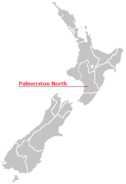
Palmerston North
| Palmerston North Te Papa-i-oea (Māori) |
|
| — Metropolitan Area — | |
 |
|
 |
|
| Coordinates: | |
| Country | |
|---|---|
| Region | Manawatu-Wanganui |
| Territorial authority | Palmerston North City |
| Settled by the UK | |
| Electorate | Palmerston North |
| Government | |
| - Mayor | Jono Naylor |
| Area | |
| - Territorial | 336 km² (129.7 sq mi) |
| Population (June 2008 estimate)[1] | |
| - Territorial | 79,300 |
| - Density | 236/km² (611.3/sq mi) |
| - Urban | 79,800 |
| Time zone | NZST (UTC+12) |
| - Summer (DST) | NZDT (UTC+13) |
| Area code(s) | 06 |
| Website: http://www.pncc.govt.nz http://www.horizons.govt.nz/ |
|
Palmerston North (Māori: Te Papa-i-oea) is the main city of the Manawatu-Wanganui region of the North Island of New Zealand. It is an inland city with a population of 79,800 (June 2008 estimate).[1] As of 2008 Palmerston North is the eleventh largest city in New Zealand, and the centre of the seventh largest urban area.[2] A large proportion of its population consists of students attending Massey University, Universal College of Learning (UCOL) or International Pacific College[1] during the student year. Over half of the city's population is under the age of twenty-five and as a result, the city has been marketed as 'Student City'.
Locals are known as Palmerstonians and affectionately refer to the city simply as "Palmy".
Contents |
Name
The city was first named "Palmerston" in honour of Viscount Palmerston, a former Prime Minister of Great Britain. The suffix "North” was then added in 1871 by the Postal Service in order to distinguish the settlement from Palmerston in the South Island.
Māori Name
The Māori transliteration of Palmerston North is "Pamutana", however, this is largely unused, with Papa-i-oea (more commonly contracted to Papaioea) being the preferred option, e.g. Te Kura Kōhine o Papaioea (Palmerston North Girls' High School) or Te Hohipera o Papaioea (Palmerston North Hospital). Papa-i-oea is believed to mean "How beautiful it is". [3]
Geography
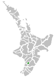
Palmerston North covers an area of 325.94 square kilometres (126 sq mi) and one million people live within a two hour (200 km/120 mi) radius. The city is situated about 140 km (87 mi) north of the capital, Wellington, in the eastern part of the Manawatu Plains, and close to the northern bank of the Manawatu River. It is 35 km (22 mi) from the river's mouth and 12 km (7 mi) from the end of the Manawatu Gorge.
The official limits of the city also take in rural areas to the south and northeast of the main urban area, extending to the Tararua Ranges and including the town of Ashhurst at the mouth of the Manawatu Gorge. This is a rich and fertile agricultural area.
- Physical environment
Land Area : 325.94 square kilometres (80,540 acres) [4]
Area In Public Reserves : 5.54 square kilometres (1,369 acres)
Highest Point (Elevation): 760 metres (2,493 ft) Above Sea Level (In The Ranges South East of Scotts Road)
Lowest Point (Elevation) : 10 metres (33 ft) Above Sea Level (Riverbank Near Te Puna Road)
Typical Urban Area Elevation : 20 – 40 metres (65–130 ft)
Length Of River (Within City Boundary) : 29.9 km/18.6 mi (Manawatu River) & 2.6 km/1.6 mi (Pohangina River)
- Climate
Palmerston North's climate is temperate with maximum daytime temperatures averaging 22 °C (72 °F) in summer and 12 °C (54 °F) in winter. On average temperatures rise above 25 °C (77 °F) on 20 days of the year. Annual rainfall is approximately 960 mm (37.8 in) with rain occurring approximately 5% of the time. There are on average 200 rain free days each year.
In the ranges that flank the city, there is often sustained wind, especially in spring. Much of this land is within the city boundaries and these ranges have the reputation of providing the most consistent wind in the country. As a result, Palmerston North is under increasing tensions between wind farm operators who want to build more renewable energy wind turbines and local residents who wish to continue to enjoy untouched scenery. Close to the city is the largest electricity-generating wind farm in the southern hemisphere, with 158 turbines on the nearby Tararua and Ruahine Ranges providing power for approximately 30,000 homes.
| Month | Jan | Feb | Mar | Apr | May | Jun | Jul | Aug | Sep | Oct | Nov | Dec | Year |
|---|---|---|---|---|---|---|---|---|---|---|---|---|---|
| Average high °C (°F) | 22.4 (72) |
22.9 (73) |
21.1 (70) |
18.4 (65) |
15.3 (60) |
13.1 (56) |
12.5 (55) |
13.3 (56) |
14.9 (59) |
16.7 (62) |
18.5 (65) |
20.7 (69) |
17.5 (64) |
| Average low °C (°F) | 13.4 (56) |
13.5 (56) |
12.1 (54) |
9.8 (50) |
7.4 (45) |
5.4 (42) |
4.7 (40) |
5.4 (42) |
7.2 (45) |
8.7 (48) |
10.2 (50) |
12 (54) |
9.1 (48) |
| Precipitation mm (inches) | 65 (2.56) |
62 (2.44) |
74 (2.91) |
76 (2.99) |
94 (3.7) |
87 (3.43) |
94 (3.7) |
82 (3.23) |
83 (3.27) |
90 (3.54) |
78 (3.07) |
83 (3.27) |
966 (38.03) |
| Source: NIWA Climate Data[5] 1971 – 2000 | |||||||||||||
Economy
The tertiary education sector provides NZ$1 billion dollars a year to the local economy and the Education sector accounts for 11.3% (as at February 2006) [6] of the total Palmerston North workforce. Palmerston North also has economic strengths in research, especially in the bio-industry, defence, distribution, and smart business sectors. The city is home to more than 70 major educational and research institutions, including New Zealand's fastest expanding university, Massey; the Massey University Sport and Recreation Institute (situated at Massey University campus, Turitea); UCOL - Universal College of Learning and Linton Military Camp.
A total of 44,870 employees worked in Palmerston North City as at February 2006. This represented 2.5% of total employees in New Zealand. The largest industry in terms of employees was the health and community services industry, which employed 14.9% of all employees in the city. The retail trade industry employed a further 13.3% of total employees in the city.[6]
The Square

The city's main streets are arranged in a grid around The Square, a seven hectare park of lawn, trees, lakes, fountains, and gardens in the centre of the city. This park contains the city's war memorial, a memorial to Te Peeti Te Awe Awe - the Rangitāne chief who was instrumental in the sale of Palmerston North district to the government in 1865 [7] - and a clock tower whose illuminated cross was damaged in a storm in the first half of 2006. The damage to the cross and its subsequent removal rekindled a discussion about the appropriateness of a Christian symbol in the centre of a city whose citizens are of many cultures and religious backgrounds. The Māori name for the Square is Te Marae o Hine. Te Peeti Te Awe Awe was one member of a Māori contingent consulted for the choice of a Māori name. The meaning of the name is The Meeting Place of the Daughter of Peace signalling the harmony of the meeting between Māori and Pākehā in Palmerston North.
The City's Parks
There are a number of parks in the city. The foremost is the Victoria Esplanade. Victoria Esplanade is located along the northern bank of the Manawatu River, to the right of Fitzherbert Avenue if heading south. The esplanade includes gardens, children's play areas, an aviary, a mini-train ride, walking tracks, and sports fields (Ongley-Manawaroa Park).
Palmerston North's Image
- Promotion
The city has used many descriptions in advertising and promotion including "Rose City" (referring to its international rose trial grounds) and "Knowledge City" or "Student City" (referring to the city's many academic institutions). The current slogan, "Young Heart, Easy Living", indicates that Palmerston North is a city of young people and people with a youthful attitute.[8]
History
Ngāti Rangitāne were the local Māori iwi (tangata whenua) living in the area known as Te Ahu-a-Turanga([2]:1), when a trader, Jack Duff, became the first known European person to explore the area in 1830. He came on a whaling ship, and explored as far inland as the site where Woodville stands today. He later reported his discovery on arrival back to Porirua. Colonel Wakefield heard of the potential the Manawatu had for development and visited in 1840. It was not until 1846, when Charles Hartley, another trader, heard from tangata whenua of a clearing in the forest and he proceeded through the dense bush and forest and discovered it. [3]
The Government surveyed the area in 1866-67. The original subdivision of Palmerston North was also made in 1866, in the natural clearing in the Papaioea Forest (as discovered by Hartley). A township was laid out by J.T. Stewart, an employee of the Wellington Provincial Government.[9]
Mr Stewart's plan consisted of a series of wide and straight streets, laid out in a rectangular pattern, with the focal point for the new settlement taking the form of an open space of 17 acres (7 ha), subsequently known as The Square. Mr Stewart is not completely forgotten as there are landmarks named for him, e.g. Stewart Crescent (Palmerston North), Mt Stewart (near Sanson).
The four original streets, which arrive at the Square from the different directions are now Fitzherbert Avenue (from the S), Main Street East, Main Street West and Rangitikei Street. As the settlement grew, the forest diminished to make way for farms, and today virtually no remnant of it survives.
By 1877, when the Borough Council came into existence, Palmerston North was an isolated village, set in the midst of a native forest which covered inland Manawatu. The population of the town was approximately 800 people and sawmilling was the main industry of the district. The arrival of the railway in 1886 saw an increase in the speed of growth, and by 1900 the population was 6,000.[10] By this time, the town was at the centre of a lucrative agricultural district.
In 1930, the population reached the 20,000 threshold and Palmerston North was officially proclaimed a city. Development was slow at this period in the city’s history, however, due to the great depression and World War II. An airport was established at Milson in 1936, which is now Palmerston North International Airport. After the war growth was rapid, with the population rising to over 50,000 by the mid 1970s. [11]
Sport
Sport in the Palmerston North area, in general, is predominantly provincial based. Unlike Auckland or Wellington, Palmerston North is more of a provincial city, therefore most sports teams draw their players from around the province, in this case, Manawatu. Most representative teams would have players from Feilding or other neighbouring towns.
The most famous team to have "Palmerston North" in its title was the Palmerston North Jets, but they changed their name to Manawatu earlier this decade.[12]
The city is the home of the Manawatu Turbos, who play in the Air New Zealand Cup, the main competition in New Zealand Rugby. The home ground is at FMG Stadium. The Ezibuy Manawatu Women's rugby team also plays at FMG Stadium.
FMG Stadium is also the home of the Robertson Holden International Speedway. Palmerston North is host to a Stock car racing team known as the Panthers.
YoungHeart Manawatu is one of 8 franchise teams competing in the New Zealand Football Championship which is the premier national competition. The team formerly played at FMG Stadium, however home games have since been moved to Memorial Park.
The Central Districts Stags serve the region as the premier cricket team and play in the national State Championship. The team includes of a number of players born and bred in Palmerston North. Games played in city take place at Fitzherbert Park.
Transport
Road
The city is a significant road and rail junction. State Highways 56 and 57 meet State Highway 3 close to the city, with these highways providing the main streets of the city. However, State Highway 1, New Zealand's main highway, passes about 25 km (16 mi) to the west of Palmerston North.
State Highway 3 enters the city from the northwest as Rangitikei Street before turning left into Grey Street, north of the Square.
On the opposite sides of The Square to these two roads are Main Street West (in the south-west) and Fitzherbert Avenue (to the south-east). These two roads connect with State Highways 56 and 57 respectively. Many of the city's main public buildings are located close to The Square and to Main Street East.

Fitzherbert Avenue extends south, crossing the Fitzherbert Bridge, the only bridge over the Manawatu River close to the city to reach. The other is Fitzherbert East Road in Ashhurst, 14 km (9 mi) away. Massey University and International Pacific College (IPC), as well as some of the newly developed residential areas (Summerhill, Aokautere).
Air
Palmerston North International Airport in the suburb of Milson is placing itself as a major secondary international airport in New Zealand. Domestic services operate to a number of destinations, Operated mostly by Air New Zealand. There have been no international services since Freedom Air ceased to operate in March 2008, and replacement carrier, OzJet, cancelled its plans to run a service out of Palmerston North only four days before they were due to commence.
Palmerston North International Airport is the operational base of the Massey University School af Aviation, and by night serves as a busy domestic freight hub.
Rail
At Palmerston North, the North Island Main Trunk railway is joined by the Palmerston North - Gisborne Line, which runs through the Manawatu Gorge to Woodville and Hawke's Bay, with a connection to the Wairarapa Line at Woodville. The railway was originally routed through the central Square of the town, but was diverted to the north in 1964 - 1966. There are very few passenger rail services to Palmerston North with only two services using the station: The daily Capital Connection service to and from Wellington, and the Overlander to Auckland or Wellington. This means that a maximum of four passenger trains arrive or leave the station per day.
Bus
There is an urban bus service in which 5 town buses and 1 campus bus set off from the main depot on Main Street East (in front of the Palmerston North Courthouse) at least every half hour. It is run in conjunction between Horizons Regional Council and Masterton-based bus company, Tranzit.
| Bus Route name | Services |
|---|---|
| Rangiora/Brightwater | southern portion of Roslyn, including Terrace End and Hokowhitu |
| Roslyn/Rhodes | northern portion of Roslyn and Kelvin Grove |
| Milson/Cloverlea | Milson, Cloverlea and parts of Takaro |
| Awapuni/Rugby | Awapuni South and Awapuni North |
| Highbury/Takaro | Highbury, Takaro and Westbrook |
| Fernlea/Heights | Kelvin Grove |
| 12,12A,12B,12C,(14), 15 | Massey services (14 also services IPC) |
Occasionally there are buses which service Linton, Ashhurst and Feilding. There are also frequent bus services from town to Massey (both Turitea and Hokowhitu Campuses) and IPC Campus.
There is a bus service which travel on specific days to Ashhurst, Feilding and Linton.
The main bus depot for travel between Palmerston North and other cities is located at the intersection of Main and Pitt Sts.
Education
The large number of students from Massey, UCOL and IPC bring a youth culture to the city, helping to support the many cafes and bars. Highbury is the home of the Papaioea Campus of Te Wānanga o Aotearoa.
- Tertiary Education Institutions
| School Name | Location |
|---|---|
| Massey University | Turitea |
| Massey University College of Education | Hokowhitu |
| Universal College of Learning | Palmerston North Central |
| International Pacific College | Aokautere |
| Te Wānanga o Aotearoa | Highbury |
- Secondary schools
| School Name | Location |
|---|---|
| St Peter's College | Milson |
| Palmerston North Boys' High School (PNBHS) | Palmerston North Hospital Area |
| Palmerston North Girls High School (PNGHS) | West End |
| Queen Elizabeth College (QEC) | Palmerston North Hospital Area |
| Freyberg High School (FHS) | Roslyn |
| Awatapu College | Awapuni South |
| Longburn Adventist College (LAC) | Longburn |
Palmerston North also has many primary and intermediate schools.
Governance
On 1 November, 1989, New Zealand local government authorities were reorganised. Palmerston North City boundaries were extended to include Ashhurst, Linton and Turitea, through amalgamation of parts of the former Kairanga County, Oroua County and Ashhurst Town Council.
The Council consists of a Mayor and 15 Councillors. The Council, its standing committees, and some sub-committees meet regularly for the purpose of decision-making. Its administrative functions are broken down into seven units; City Future, City Contact, City Corporate, City Enterprises, Community and Commercial Services, City Library and City Networks. Chief executive Paddy Clifford is responsible for ensuring the effective, efficient and economic management of all the Council’s activities. [13]
The current mayor is Jono Naylor, who himself was once a councillor representing Hokowhitu. Elections for Mayor and local government occur nationwide every three years, with the next election to take place in 2010.
The City Council is located in the Civic Administration Building and the Customer Service Centre building which are both on the Square.
For electoral purposes, Palmerston North City is divided into 5 wards since Ashhurst and Fitzherbert wards have now amalgamated. Four of these are urban and one rural.
| Wards of Palmerston North | |||
| Ward Name | Suburbs including | Number of Councillor(s) | Councillors [14] |
|---|---|---|---|
| Ashhurst-Fitzherbert Ward | Ashhurst, Whakarongo, Turitea, Linton, Massey University, Aokautere | Two | Cr B Wilson Cr Anne Podd |
| Awapuni Ward | Awapuni West, Awapuni North, Awapuni South | Three | Cr Annette Nixon Cr P J Wheeler Cr Pat Kelly |
| Hokowhitu Ward | Hokowhitu East, Hokowhitu West, Hokowhitu Lagoon, Terrace End, part of Papaioea | Three | Cr Gordon Cruden Cr Jim Jeffries Cr Chris Teo-Sherrell |
| Papaioea Ward | Milson, Roslyn, Kelvin Grove, Palmerston North Hospital Area, Papaioea | Four | Cr John Hornblow Cr Lew Findlay Cr Jan Barnett Cr Ross Linklater |
| Takaro Ward | Takaro, Highbury, Westbrook, Cloverlea | Three | Cr Michael Feyen Cr Vaughn Dennison Cr David Ireland |
|
|||||
Services
Palmerston North City Council provides services for rubbish collections, water management, environmental management (e.g. Parks and Reserves) and the general maintenance of the City. Recently the City Council has funded the upgrading of the Square and the Clocktower and has proposed new infrastructure for the city, such as a recreational lake in Aokautere, or a second bridge crossing to ease the traffic which travels over the Fitzherbert Bridge.
Sister cities
Palmerston North has two sister cities, as designated by Sister Cities NZ (SCI):
 Missoula, Montana, United States
 Guiyang, People's Republic of China
Musical Scene
Palmerston North has a thriving musical scene with many national and international acts touring through the town, as well as there being many local acts performing regularly.
Notable personalities
- Sport
- Charles Munro, founder of rugby union in New Zealand, lived for a time in an area now part of Palmerston North
- Craig Perks, International golfer
- Jacob Oram, New Zealand Black Cap (cricket)
- Steven Old, New Zealand All White (soccer)
- Jason Eaton, All Black
- David Kirk, All Black and CEO Fairfax Australia
- Ross Taylor, New Zealand Black Cap and Central Districts batsman (cricket)
- Moira Senior, Black Stick (Hockey)
- Kayla Sharland, Black Stick (Hockey)
- Emily Naylor, Black Stick (Hockey)
- Tim Wilkinson, International golfer
- Michael Mason, New Zealand Black Cap and Central Districts bowler
- Kris Gemmell, International triathlete
- Politics
- Simon Power, National MP
- Lynne Pillay, Labour MP
- Steve Maharey, Labour MP
- Ashraf Choudhary, Labour MP
- Jacqui Dean, National MP
- Jill White, former Labour MP and former Mayor of Palmerston North, now Horizons Regional Councillor
- Metiria Turei, Green MP
- Arts & Culture
- Anna Leese, operatic soprano
- Billy TK, guitarist
- John Clarke, famous as "Fred Dagg"
- Nigel Keay, composer
- Warwick Keay, bass player and songwriter
- PNC, rapper
- Other
- Judy Bailey, former newsreader, deemed "Mother of the Nation"
- Olaf Wiig, photojournalist
- Fred Hollows, ophthalmologist
References
- ↑ 1.0 1.1 "Subnational Population Estimates: At 30 June 2008". Statistics New Zealand (23 October 2008). Retrieved on 2008-10-28.
- ↑ See List of cities in New Zealand
- ↑ 3.0 3.1 PALMERSTON NORTH - 1966 Encyclopaedia of New Zealand
- ↑ "Introduction to Palmerston North". Palmerston North City Council. Retrieved on 2008-02-08.
- ↑ "Climate Data". NIWA. Retrieved on November 2, 2007.
- ↑ 6.0 6.1 http://www.stats.govt.nz/NR/rdonlyres/592B0521-E31C-45E9-9F14-E436E5A3319D/0/Sep07_PalmerstonNorthCity.pdf
- ↑ Dictionary Of New Zealand Biography
- ↑ "The Manawatu Community". Manawatu - Our Region. Retrieved on 2008-07-04.
- ↑ "Topic: John Tiffin Stewart". Kete Horowhenua. Retrieved on 2008-07-04.
- ↑ "1890s". Palmerston North City Council. Retrieved on 2008-07-04.
- ↑ "1970s". Palmerston North City Council. Retrieved on 2008-07-04.
- ↑ "NBL Handbook" (PDF) p 23 (2008).
- ↑ Palmerston North City Council website: About Council
- ↑ http://www.pncc.govt.nz/Council/Council/MayorAndCouncillors.htm Mayor and Councillors - Palmerston North City Council
- ↑ Creative Sounds Society Incorporated
- ↑ Student City - Swampfest 2007
External links
- Palmerston North City Council
- PalmerstonNorthNZ.com - Independent Media
- Wikitravel Palmerston North page
|
|||||||||||||||||
|
|||||
|
|||||