Nikkō, Tochigi
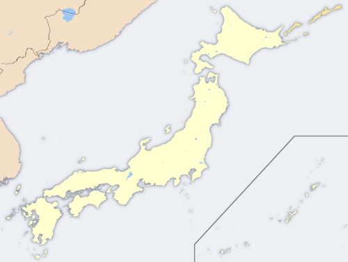
 Nikkō's location in Tochigi, Japan. |
|
 Nikkō's location in Japan. |
|
| Location | |
| Country | Japan |
| Region | Kantō |
| Prefecture | Tochigi |
| Physical characteristics | |
| Area | 1,449.87 km2 (559.80 sq mi) |
| Population (as of January 2008) | |
| Total | 92,181 |
| Density | 63.6 /km² (165 /sq mi) |
| Location | |
| Symbols | |
 Flag |
|
| Nikkō Government Office | |
| Mayor | Masakatsu Shingai |
| Address | 1 Imaichi Honchō, Nikkō-shi, Tochigi-ken 321-1292 |
| Phone number | 0288-22-1111 |
| Official website: Nikkō City | |
| Shrines and Temples of Nikko* | |
|---|---|
| UNESCO World Heritage Site | |
 |
|
| State Party | |
| Type | Cultural |
| Criteria | i, iv, vi |
| Reference | 913 |
| Region** | Asia-Pacific |
| Inscription history | |
| Inscription | 1999 (23rd Session) |
| * Name as inscribed on World Heritage List. ** Region as classified by UNESCO. |
|
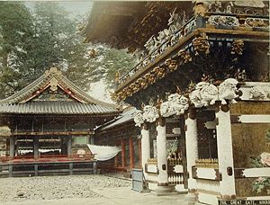
Nikkō (日光市 Nikkō-shi?, literally sunlight) is a city located in the mountains of Tochigi Prefecture, Japan. Located approximately 140 km north of Tokyo and approximately 35 km west of Utsunomiya, the capital of Tochigi, it is a popular destination for Japanese and international tourists, housing the mausoleum of shogun Tokugawa Ieyasu (Nikkō Tōshō-gū) and that of his grandson Iemitsu (Iemitsu-byō Taiyū-in), as well as the Futarasan Shrine, which dates to the year 767. There are also many famous hot springs (onsen) in the area. Elevations range from 200 to 2,000 m[1]. The mountains west of the main city are part of Nikkō National Park and contain some of the country's most spectacular waterfalls and scenic trails.
As of January 1, 2008, the city has an estimated population of 92,181.

Contents |
History
Shōdō Shōnin (勝道上人?) established the temple of Rinnō-ji in 766, followed by the temple of Chūzen-ji in 784. The village of Nikkō developed around these temples. The shrine of Nikkō Tōshō-gū was completed in 1617 and became a major draw of visitors to the area during the Edo period. A number of new roads were built during this time to provide easier access to Nikkō from surrounding regions. Nikkō Tōshō-gū, Futarasan Shrine and Rinnō-ji now form a UNESCO World Heritage Site.
During the Meiji period Nikkō developed as a mountain resort, and became particularly popular among foreign visitors to Japan. The Japanese National Railways began service to Nikkō in 1890 with the Nikkō Line, followed by Tobu Railway in 1929 with its Nikkō Line.
Nikkō was incorporated as a town in 1889, part of Kamitsuga District. It was upgraded to city status in 1954 after merging with the neighboring village of Okorogawa. On March 20, 2006, the city of Nikkō merged with the city of Imaichi and the municipalities of Ashio, Fujihara, and Kuriyama to create what is officially the new city of Nikkō. The new city hall is located at the former Imaichi City Hall: the former Nikkō City Hall is now known as Nikkō City Hall-Nikkō Satellite Office.
Historical sites and attractions
Central Nikkō
- Cedar Avenue of Nikko
- Nikko Botanical Garden
- The three shrine and temples
- Tōshō-gū
- The Three wise monkeys ("See no evil, hear no evil, speak no evil")
- Rinnō-ji
- Taiyū-in Mausoleum
- Futarasan Shrine
- Sacred bridge
- Lake Chūzenji
Geography
The post-merger city of Nikkō covers a large area (1,449.87 km²) of rural northwestern Tochigi. It is the third-largest city (by area) in Japan, behind Takayama and Hamamatsu.
Lake Chūzenji and the Kegon Falls lie in Nikkō, as does the Nikko Botanical Garden. The city's many mountains and waterfalls have made it an important source of hydroelectric power. The area has also been used for mining copper, aluminum and concrete.
The weather in Nikkō is fairly similar to that of Hokkaidō even though it is much closer to Tokyo than Hokkaidō. The elevation of Nikkō plays an important role in this fact. It will usually get cooler as one ascends the mountain. The average temperature of Nikkō is around 7°C (44°F) [2] with the warmest months reaching only about 22°C (72°F)[3] and the coldest reaching down to about -8°C (17°F) [4].

Sports
Nikkō is the home city to the Nikkō Ice Bucks in the Asia League Ice Hockey. Nikkō Arena hosted the Women's Ice Hockey World Championships (Division I) in April 2007.
Photo gallery
References
External links
- Nikko Tourist Association in Japanese
- Nikko Tourist Association in English
- Nikko City website in English
- Shrines and Temples of Nikko in English
- Early foreign tourist Isabella Bird's report
- Collaborative Collection of Creative Commons licensed images of Nikkō
|
|||
| Cities | |||
|---|---|---|---|
| Ashikaga | Kanuma | Mooka | Nasukarasuyama | Nasushiobara | Nikkō | Ōtawara | Oyama | Sakura | Sano | Shimotsuke | Tochigi | Utsunomiya (capital) | Yaita | |||
| Districts | |||
| Haga | Kamitsuga | Kawachi | Nasu | Shimotsuga | Shioya | |||
|
|
|||||||