Puncak Jaya
| Puncak Jaya | |
|---|---|
 Peak of Puncak Jaya |
|
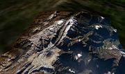
 Puncak Jaya
|
|
| Elevation | 4,884 metres (16,024 ft)[1] |
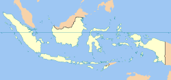
| Location | Papua Province, Indonesia |
| Range | Sudirman Range |
| Prominence | 4,884 m (highest point on New Guinea) Ranked 9th |
| Coordinates | |
| First ascent | 1962 by Heinrich Harrer and 3 others |
| Easiest route | rock/snow/ice climb |
| Listing | Seven summits Country high point Ultra |
Puncak Jaya (pronounced [ˈpʊntʃak ˈdʒaja]), sometimes called Mount Carstensz or the Carstensz Pyramid, is a mountain in the Sudirman Range, the western central highlands of Papua province, Indonesia. Other names include Nemangkawi in the Amungkal language, Carstensz Toppen and Gunung Sukarno.[2]
Puncak Jaya is the highest mountain in Indonesia, the highest on the island of New Guinea (which comprises the Indonesian Papua provinces plus Papua New Guinea), the highest on the Australia-New Guinea continent and the highest in Oceania. It is also the highest point between the Himalayas and the Andes and the highest island peak in the world.
Contents |
History
The highlands surrounding the peak were inhabited before European contact, and the peak was known as Nemangkawi in Amungkal. Puncak Jaya was named 'Carstensz Pyramid', after Dutch explorer Jan Carstensz who first sighted the glaciers on the peak of the mountain on a rare clear day in 1623 (Carstensz was ridiculed in Europe when he said he had seen snow near the equator). This name is still used among mountaineers. Although the snowfield of Puncak Jaya was reached as early as 1909 by a Dutch explorer, Hendrik Albert Lorentz with six of his indigenous Dayak Kenyah porters recruited from the Apo Kayan in Borneo[3], the peak was not climbed until 1962, by an expedition led by the Austrian mountaineer Heinrich Harrer (of Seven Years in Tibet fame) with three friends — Temple, Kippax and Huizenga.
When Indonesia took control of the province in the 1960s, the peak was renamed 'Puntjak Soekarno' (Simplified Indonesian: Puncak Sukarno) or Sukarno Peak, after the first President of Indonesia, later this was changed to Puncak Jaya. Puncak means peak or mountain and Jaya means 'victory', 'victorious' or 'glorious').
Access
Access to the peak requires a government permit. The mountain was closed to tourists and climbers between 1995 and 2005. As of 2006, access is possible through various adventure tourism agencies.[4]
Glaciers

While Puncak Jaya’s peak is free of ice, there are several glaciers on its slopes, including the Carstensz Glacier and the Northwall Firn. Being equatorial, there is little variation in the mean temperature during the year (around 0.5°C) and the glaciers fluctuate on a seasonal basis only slightly. However, analysis of the extent of these rare equatorial glaciers from historical records show significant retreat since the 1850s, indicating a regional warming of around 0.6°C per century between 1850 and 1972.
The glacier on Puncak Trikora in the Maoke Mountains disappeared completely some time between 1939 and 1962[5]. Since the 1970s, evidence from satellite imagery indicates the Puncak Jaya glaciers have been retreating rapidly. The Meren Glacier melted away sometime between 1994 and 2000[6].
Climbing
Puncak Jaya is one of the more demanding climbs in one version of the Seven Summits peak-bagging list. (It is replaced by Mount Kosciuszko in the other version.) It is held to have the highest technical rating, though not the greatest physical demands of that list's ascents. The standard route is up the north face and along the summit ridge, which is all hard rock surface. Despite the large mine, the area is highly inaccessible to hikers and the general public, requiring a 100-km hike from the nearest town with an airport, Timika, to the base camp, which usually takes about four or five days each way.
External links
References
- ↑ The elevation given here was determined by the 1971-73 Australian Universities' Expedition and is supported by the Seven Summits authorities and modern high resolution radar data. An older but still often quoted elevation of 5,030 metres (16,503 ft) is obsolete.
- ↑ Greater Atlas of the World, Mladinska knjiga, Ljubljana, Slovenia, 1986.
- ↑ Lorentz, H.A., 1910. Zwarte Menschen - Witte Bergen : Verhaal van den Tocht naar het Sneeuwgebergte van Nieuw-Guinea, Leiden: E.J. Brill.
- ↑ "Seven Summits Page". Retrieved on 2006-07-07.
- ↑ Ian Allison and James A. Peterson. "Glaciers of Irian Jaya, Indonesia and New Zealand". U.S. Geological Survey, U.S.Department of the Interior. Retrieved on April 28, 2000.
- ↑ Joni L. Kincaid and Andrew G. Klein. "Retreat of the Irian Jaya Glaciers from 2000 to 2002 as Measured from IKONOS Satellite Images" (pdf). 61st Eastern Snow Conference Portland, Maine, USA 2004. Retrieved on 2004.
|
|||||