Metro Vancouver
| Metro Vancouver Greater Vancouver Regional District |
|||
 |
|||
|
|||
| Motto: Building a sustainable region | |||
 |
|||
| Coordinates: | |||
| Country | |||
|---|---|---|---|
| Province | |||
| Region | Lower Mainland | ||
| Location of head office | Burnaby | ||
| Established | 1967 | ||
| Government [1] | |||
| - Board | Metro Vancouver Board of Directors | ||
| - Chair | Lois Jackson | ||
| - MPs |
List of MPs
|
||
| - MLAs |
List of MLAs
|
||
| Area [2] | |||
| - Total | 2,877.36 km² (1,111 sq mi) | ||
| Elevation | 60 m (197 ft) | ||
| Population (2006)[2] | |||
| - Total | 2,116,581 | ||
| - Density | 735.6/km² (1,905.2/sq mi) | ||
| Canadian CD rank: 2nd | |||
| Time zone | PST (UTC-8) | ||
|
Anmore
Belcarra
Bowen
Island Langley
Langley DM
Lions Bay
Maple
Ridge New
Westminster N.Vancouver
North
Vancouver DM Pitt
Meadows Port
Moody Electoral District A
A
 |
|||
| Website: Metro Vancouver | |||
Metro Vancouver, legally the Greater Vancouver Regional District, is the inter-municipal body, or regional district, charged with certain aspects of governance for the metropolitan area surrounding and including the city of Vancouver, British Columbia, Canada. The territory under Metro Vancouver's authority is essentially synonymous with what is usually meant by the colloquial term Greater Vancouver, and Statistics Canada defines the Vancouver CMA (Census Metropolitan Area) as having perfectly coterminal boundaries with Metro Vancouver. Although the region's principal city is Vancouver, its administrative offices are located in the City of Burnaby. Despite the equation of the regional district with the metropolitian area, Indian reserves and the University Endowment Lands are not part represented in the regional district.
The Greater Vancouver Regional District was formed in 1967[3], following the creation of Greater Vancouver Sewerage and Drainage District (GVSDD) in 1914 and Greater Vancouver Water District (GVWD) in 1926. In 2007, the GVRD board unanimously supported a proposal to the provincial government to change its official name to Metro Vancouver.[4], and the new name took effect in September 2007. The body's letters patent have yet to be amended.
Contents |
Geography
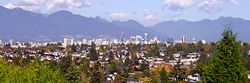
Metro Vancouver occupies the southwest corner of mainland British Columbia. It comprises the western half of the Lower Mainland.
Thirteen of the province's thirty most populous municipalities are located in Metro Vancouver.[5]. The official land area of the district is 2,877.36 square kilometres (1,111 sq mi). It is the most densely populated regional district in British Columbia.
Municipalities
The Regional District consists of 21 incorporated municipalities and one unincorporated area. The 21 municipalities are:
| Municipality | Type | Population | Year |
|---|---|---|---|
| Anmore | village | 1,992 | 2007 |
| Belcarra | village | 701 | 2007 |
| Bowen Island | island municipality | 3,551 | 2007 |
| Burnaby | city | 216,336 | 2007 |
| Coquitlam | city | 120,512 | 2007 |
| Delta | district municipality | 101,668 | 2007 |
| Langley | city | 25,134 | 2007 |
| Langley | district municipality | 100,049 | 2007 |
| Lions Bay | village | 1,394 | 2007 |
| Maple Ridge | district municipality | 73,248 | 2007 |
| New Westminster | city | 62,607 | 2007 |
| North Vancouver | city | 47,463 | 2007 |
| North Vancouver | district municipality | 86,954 | 2007 |
| Pitt Meadows | city | 16,757 | 2007 |
| Port Coquitlam | city | 55,735 | 2007 |
| Port Moody | city | 30,004 | 2007 |
| Richmond | city | 186,628 | 2007 |
| Surrey | city | 423,935 | 2007 |
| Vancouver | city | 611,869 | 2007 |
| West Vancouver | district municipality | 44,097 | 2007 |
| White Rock | city | 19,839 | 2007 |
| Electoral Area A | unincorporated area | 19,252 | 2007 |
| Greater Vancouver Regional District | Metropolitan Area | 2,249,725 | 2007 |
Greater Vancouver Regional District Electoral Area A comprises all unincorporated land within the Regional District boundaries, including the University Endowment Lands, Passage Island and Barnston Island in the Fraser River and are classified as Regional District Remainders[6].
There are also seventeen Indian reserves within the geographical area that are not subject to governance by the municipalities or the Regional District; they have a combined population of 7,550 (2006).
The cities of Abbotsford and Chilliwack and the district of Mission, located to the east, are part of the Fraser Valley Regional District.
Administrative role
The principal function of Metro Vancouver is to administer resources and services which are common across the metropolitan area. These include community planning, water, sewage, drainage, housing, transportation, air quality, and parks.
There are four legal entities of Metro Vancouver: the Greater Vancouver Water District (GVWD); the Greater Vancouver Sewerage and Drainage District (GVS&DD); the Greater Vancouver Housing Corporation (GVHC), and the Greater Vancouver Regional District (GVRD).
Metro Vancouver Regional Parks oversees the development and maintenance of nineteen regional parks, as well as various nature reserves and greenways. (The regional parks are distinct from municipal parks in that they are typically more "wild" and represent unique geographical zones within the region, such as bogs and mature rainforests.)
Although, the Greater Vancouver Water District comprises a system that covers more than 2,600 km², all the water for the district comes from three sources: the Capilano reservoir, the Seymour reservoir, and the Coquitlam reservoir. Metro Vancouver controls the Cleveland Dam on the Capilano reservoir, which supplies 40 percent of the district's water.[7]
Metro Vancouver also oversees South Coast British Columbia Transportation Authority (TransLink), which administers public transportation and major bridges and highways throughout the region. TransLink also runs the AirCare program, which primarily aims to improve air quality by reducing harmful emissions from automobiles. In the period 1992 to 2002, this program is credited with reducing the air emissions in the urban area by 35%.
One current initiative of Metro Vancouver is the Ashcroft, British Columbia, Ranch Mega-Landfill Proposal.
Demographics
According to the 2001 census, 1,986,965 people lived in the metropolitan area, about half of the population of British Columbia. The 2006 Census has placed the population at 2,116,581, representing 6.5% growth since the last census[8].
In 2006, Metro Vancouver had a population of 2,116,581 living in 870,992 dwellings. The regional district has a land area of 2,877.36 km² (1,111 sq mi) and a population density of 735.6/km² (1,905.2/sq mi).[2]
Notes
- ↑ Metro Vancouver. "Boards and committees". Retrieved on 2007-07-04.
- ↑ 2.0 2.1 2.2 Statistics Canada (Census 2006). "Greater Vancouver Regional District - Community Profile". Retrieved on 2007-07-04.
- ↑ Western Economic Diversification Canada. "The Greater Vancouver Regional District (GVRD)". Retrieved on 2007-07-04.
- ↑ Skeleton, Chad (2007-08-03). "Goodbye GVRD, hello Metro Vancouver", Vancouver Sun. Retrieved on 2007-08-03.
- ↑ Statistics Canada - BC municipalities - Population
- ↑ Greater Vancouver - BC Stats 2007 Population Estimates
- ↑ Metro Vancouver Water Sources & Supply
- ↑ Greater Vancouver Regional District - Population Growth
External links
- Metro Vancouver Official Site
- Metro Vancouver Regional Parks
- Census 2006 Population and Private Dwellings
|
|||||||||||||||||
|
||||||||||||||
|
|||||