Mato Grosso
|
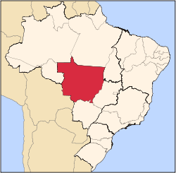
State of Mato Grosso
|
||||||
|---|---|---|---|---|---|---|
|
||||||
 |
||||||
| Capital (and largest city) |
Cuiabá | |||||
| Demonym | Mato-grossense | |||||
| Government | ||||||
| - | Governor | Blairo Borges Maggi | ||||
| - | Vice Governor | Silval da Cunha Barbosa | ||||
| Area | ||||||
| - | Total | 903,357 km² (3th) | ||||
| Population | ||||||
| - | 2006 estimate | 2,856,999 (19th) | ||||
| - | 2005 census | 2,807,482 | ||||
| - | Density | 3.2/km² (25th) | ||||
| GDP | 2005 estimate | |||||
| - | Total | R$ 37,466,000,000 (14th) | ||||
| - | Per capita | R$ 13,365 (6th) | ||||
| HDI (2005) | 0.796 (medium) (10th) | |||||
| Abbreviation | BR-MT | |||||
| Time zone | BRT (UTC-4) | |||||
| - | Summer (DST) | BRST (UTC-3) | ||||


Mato Grosso (pronounced ['ma.tu 'gɾo.su]) is one of the states of Brazil, the third largest in area, located in the western part of the country. Neighboring states are (from west clockwise) Rondônia, Amazonas, Pará, Tocantins, Goiás and Mato Grosso do Sul. It also borders Bolivia to the southwest. A state with a flat landscape, alternating great chapadas and plain areas, Mato Grosso presents three different ecosystems: Cerrado, Pantanal and the Amazon Rainforest. The vegetation of the open pasture covers 40% of the state and the National Park Chapada dos Guimarães, with its caves, grottos, tracks and waterfalls, is one of its great tourist attractions. In the north is the Amazonian forest, with a biodiversity covering half of the state. The Xingu National Park and the river Araguaia are in Mato Grosso. Further south, the Pantanal, the world's largest plain covered with water, is the habitat for almost a thousand species of animals, with many aquatic birds.
Contents |
Geography

There we can find the Chapada dos Guimarães, a scenery of unique beauty formed by sandy mountains that seem to have been cut, reminding of a city made of rocks. There are many cliffs, canyons and beautiful waterfalls.

And it is in Mato Grosso State where great part of one of the most intriguing places in the Country is located: the Pantanal, the biggest floodable region in the world, where the succession between floods and ebb tides gives origin to a unique feeding chain, populating the region with a varied fauna. Cutting across the Pantanal, the Transpantaneira - a mud road, full of small wooden bridges – allowing a parade among birds and mammals of the region along the path.
History

In 1977 the state was split into two halves, with Mato Grosso do Sul becoming a new state. The Bororo Indians live in the Mato Grosso area. As late as 1880, soldiers patrolled lands on the outskirts of Cuiaba, Mato Grosso's capital and largest city, to protect settlers from Bororo raids.
By the end of the nineteenth century, although severely reduced by disease and by warfare with explorers, slave traders, prospectors, settlers, and other indigenous groups, as many as five to ten thousand Bororo continued to occupy central and eastern Mato Grosso, as well as western Goias. [1]
The historic remoteness of this area led it to be the subject of exploration, most notably by Captain Percy Fawcett, in the quest for lost cities. It was also the rumored location of access to the interior of the earth in various Hollow Earth theories.
Demographics

According to the IBGE of 2007, there were 2,866,000 people residing in the state. The population density was 3.2 inh./km². The last PNAD (National Research for Sample of Domiciles) census revealed the following numbers: 1,599,228 Pardo (Brown) people (55.8%), 1,060,420 White people (37.0%), 174,000 Black people (6.1%), 31,000 Asian or Amerindian people (1.1%).[1]
Urbanization: 76.6% (2006); Population growth: 2.4% (1991–2000); Houses: 836,000 (2006).[2]
Many settlers started arriving in the 1970s, mainly from Southern and Southeast Regions of Brazil, attracted by the large quantity of free land in the state. Many of them are of German and Italian descent.
Economy
The agriculture is the largest component of GDP at 40.8%, followed by the service sector at 40.2%. Industrial sector represents 19%, of GDP (2004). Mato Grosso exports: soybean 83%, wood 5.6%, meats 4.8%, cotton 3.3% (2002).
Share of the Brazilian economy: 1.7% (2005).
Interesting facts
Vehicles: 745,810 (March/2007); Mobile phones: 1.6 million (April/2007); Telephones: 527 thousand (April/2007); Cities: 141 (2007).[3]
Education

Portuguese is the official national language, and thus the primary language taught in schools. But English and Spanish are part of the official high school curriculum.
Educational institutions
Cuiabá is home to the following universities:
- Federal University of Mato Grosso (UFMT);
- State University of mato Grosso (Unemat);
- Universidade de Cuiabá (Unic);
- and many others.
Culture

The Local culture is very rich, due to the multiple influences of many people, like the Portuguese, the Africans and the Indians. Two long periods of isolation also contributed to its differentiation, which has been a little diluted by recent immigration. Cuiabá has an interesting Indian-influenced cuisine, typical dances, craftwork and music.
Dance and music were traditionally connected to the worship of Catholic saints, like Saint Benedict (the city's patron) but has become lay lately.
Carnival
The four-day period before Lent leading up to Ash Wednesday is carnival time in Brazil. Rich and poor alike forget their cares as they party in the streets; not surprisingly, the former have an easier time of it.
Tourism and recreation
- Alta Floresta


Excursions by boat
The Cristalino Jungle Lodge is located along the banks of the Cristalino River in the middle of a Private Rainforest Reserve. The highlights are hiking along the large trail system, canoeing and observing wildlife. The lodge has a 50 meter observation tower that stands above the canopy.
Fishing
For those who love fishing, the Thaimaçu inn offers the opportunity to fish large bass and varieties of Amazon catfish. The Thaimaçu is located along the banks of the São Benedito River, which extends for 250 km through a natural state reserve. Prince-consort Henrik of Monpezat, of Denmark, has already been to this veritable fishing paradise that can only be reached by car or by plane.
Fishing in the São Benedito region is productive practically all year long. However, the period when it is permitted to catch certain species may vary. The best chance of landing large fish is when the waters are at their highest levels (February to May). Fly fishing is apparently most indicated when the waters are at their lowest levels (August, September and October). Fishing is prohibited during the period when the fish are hatching their eggs, from December 1st to February 1st.
In this region, rivers such as the Juruena, Teles Pires and their tributary streams, which are tributaries of the Tapajós River, are true sanctuaries of beauty and excellent fishing locations.
Bird Watching: with the more than 570 species of catalogued birds and new species being discovered every year, the region of Alta Floresta and the Cristalino River Basin receives constant visits from famous ornithologists and bird watchers.
- Chapada dos Guimarães


Waterfalls
Véu de Noiva, Independência, Andorinhas, 19 de Novembro, Pedra Furada, Sete de Setembro, Cachoeirinha, Salgadeira and dozens of other waterfalls wash the soul of all those seeking an escape from urban life. The transparent waters descend and form natural pools in creeks and small pebble-filled rivers, where lambaris (small fish) swim, indifferent to the company of bathers. It is recommended to hire a guide to accompany you on this outing.
Mount São Jerônimo
One of the highest points in Mato Grosso at 1020 meters, it provides a fabulous panoramic view. The difficult walk to the top passes by curious sandstone formation, such as the Jacaré de Pedra (Stone Alligator), the Pedra Furada (Hole in the Stone) and the Mesa do Sacrifício (Sacrificial Table). The trail finishes after a 30-minute steep, uphill climb – inaccessible on rainy days.
House of Stone
This is a 70-square meter cavern with a stream and a light trail from the Park's Visitor’s Center. It also has cave pictures on the inside.
City of Stone
It is possible to walk by rocky formations, sculptured by wind and water and that formed along the cliffs of the Chapada, 350 meters high. The location is reminiscent of a city made of stone, which gave it its name. Access is made along a road that connects the Chapada dos Guimarães to the district of Água Fria, 24 km (15 mile) away.
Aroe Jari Cavern (Morada das Almas) (Home of the Souls)
The largest sandstone cavern in Brazil, Aroe Jari extends nearly 1550 meters and several pre-historic inscriptions can be found on the inside. Access is achieved over a moderate trail – 4.5 km (2.8 miles) long, an average 1 hour and 20 minute walk.
Lagoa Azul Cavern
This is a 30 minute walk from the Aroe Jari Cavern and it includes a lagoon with crystal clear waters where bathing is prohibited. Only 50 people are allowed to visit per day, and it is obligatory to hire a guide.
Paredão do Eco (Echo Wall)
This is a natural outlook formed by a huge sandstone wall at the top of the Chapada. Access is made along the road that leads to Água Fria, and then a secondary road that enters the Park.
Portão do Inferno (Gateway to Hell)
This is an 85-meter deep canyon that can be seen from the road that connect Cuiabá to Chapada (MT-251). It is possible to see the Cidade de Pedra from there.
- North Pantanal

Paraguay River
The Pantanal's backbone is the Paraguay River, which cuts through the region from North to South. The Miranda, Aquidauna, Taquari and Cuiaba rivers flow into the Paraguay River. From October to April, the high waters reveal outsized lakes, bays, river branches and outlets. A boat trip through this natural beauty provides wonderful sights.
Transpantaneira Highway
It connects the town of Pocone to Jofre Port, along the Cuiaba River bank. It is a dirt road with 126 wooden bridges, and extends for 149 km. On the way, it is possible to observe wild animals, especially alligators, capybaras and birds, among other wild animals. The best time for fauna observation is the early morning or at the end of the day. Many tourists travel it in one day, leaving from Pocone, having lunch at one of the inns on the way and returning in the afternoon.
Sesc Pantanal
SESC's Private Natural Heritage Reserve (RPPN) increases by one third the total area of this preserved ecosystem in the State of Mato Grosso. It leaves a legacy for future generations, which includes a rich sample of biodiversity for studies in agriculture, cattle-raising, aquiculture, biomedicine and wild fauna management. A reserve with these features not only guarantees official protection of a considerable part of the Pantanal and attends to the requirements of sustainable management – including fiscal benefits – but it can also stimulate the same type of initiative in other areas of Brazil, contributing to the establishment of a national system of conservation units.

Ornithology or Bird Watching
One hundred and sixty one different species of birds have been observed in the Pantanal. There are still many species in the area which have not yet been identified during the bird watching season.
Ecotourism
Horseback riding and boat rides, hikes to observe animals, photographic safaris – in four-wheel drive vehicles, on horseback or in canoes – and piranha fishing are the main attractions for those who want explore the exuberant Pantanal fauna. Some old cattle farms were adapted to receive visitors and offer these kinds of activity and tours for those visitors who enjoy ecotourism.
Infrastructure
International Airport


The runway at Marechal Rondon International Airport was opened to traffic in 1956. In February 1975, Infraero took over the airport's administration and began various upgrades to meet the needs of the airport complex.
As of 1996, Marechal Rondon International Airport, located 10 km (6.21 mi) from the city center, started receiving international flights. Currently it serves more than 500.000 passengers a year.
Highways
- BR-070;
- BR-173;
- BR-174;
- BR-158;
- BR-163;
- BR-242;
- BR-252;
- BR-364;
- MT-100;
- MT-358.
Sports
Cuiabá is one of the 18 remaining candidates to host games of the 2014 FIFA World Cup, for which Brazil is the only South American bidder.
Flag
The flag has the same colors as the national flag, with blue symbolizing the sky, green the vegetation, and white standing for peace. The star is yellow to symbolize the gold which attracted the first settlers. The flag was adopted by Decree No. 2 of January 31, 1890, just few days after the adoption of the national flag. The Mato Grosso state flag was abolished by Law No. 1.046 of October 8, 1929, but reinstated by article 140 of the Constitution of the State of Mato Grosso on July 11, 1947.
References
- ↑ (in Portuguese) (PDF)Síntese de Indicadores Sociais 2007. Mato Grosso, Brazil: IBGE. 2007. ISBN 85-240-3919-1. ftp://ftp.ibge.gov.br/Indicadores_Sociais/Sintese_de_Indicadores_Sociais_2007/Tabelas. Retrieved on 2007-07-18.
- ↑ Source: PNAD.
- ↑ Source: IBGE.
See also
- (English) Brazil
- (Portuguese) Official Website
- (Portuguese) Federal University of Mato Grosso
- (Portuguese) Mato Grosso's location on a 3D globe (Java)
|
||||||||||||||||||||||||||
|
|||||||||||||||||||||||||||||
|
|||||||||||||||||||||||