Marinduque
| Province of Marinduque | |
Provincial seal of Marinduque |
|
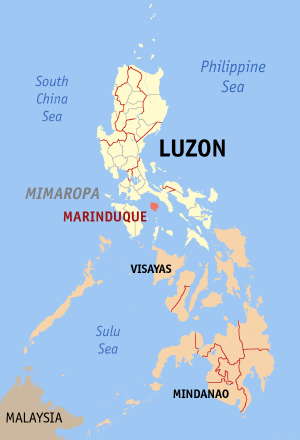 Map of the Philippines with Marinduque highlighted |
|
| Region | MIMAROPA (Region IV-B) |
| Capital | Boac |
| Divisions | |
| - Highly urbanized cities | 0 |
| - Component cities | 0 |
| - Municipalities | 6 |
| - Barangays | 218 |
| - Congressional districts | 1 |
| Population | 14th smallest |
| - Total (2007) | 217,392 |
| - Density | 227 /km² (588 /sq mi) (35th highest) |
| Area | 6th smallest |
| - Total | 959.3 km2 (370 sq mi) |
| Founded | February 21, 1920 |
| Spoken languages | Tagalog |
| Governor | Jose Antonio N. Carrion (PMP) |
Marinduque is an island province of the Philippines located in the MIMAROPA region in Luzon. Its capital is Boac. Marinduque lies between Tayabas Bay to the north and Sibuyan Sea to the south. It is located south and west of Quezon, east of Mindoro, and north of Romblon.
Marinduque is a heart-shaped island situated about eleven miles from the main island of Luzon. It is 370 square miles making it the thirteenth largest island in the Philippine archipelago.[1]
Marinduqueños are of Tagalog origin and speak Tagalog. However, because of the island's proximity to the Visayas region, the Marinduqueño variant of Tagalog has many words that are Visayan origin and are not comprehensible to other Tagalog speakers. Traces of Bicolano can also be found in this variant. Filipino and English are also well understood.
Marinduqueños are very hospitable in nature and are very welcoming. One such custom reflecting this is putong, which is a custom of welcoming and honoring friends and visitors. The honoree (or honorees) are seated and crowned with flowers while local women dance and sing for them. Other well-wishers throw coins and flower petals for long life.
The Moriones festival also plays a prominent role in Marinduque's culture. Marinduque is famous for this annual Moriones Festival. During the month of April, parades and celebrations can be seen on the streets. In Gasan, Boac, and Mogpog, a parade of people dressed as Moriones can be seen on the main road connecting the towns of the island. Boac and Sta. Cruz, the biggest town in the province, shows a reenactment in the evening of the actual event when Longinus, a blind soldier, punctures Jesus with his spear and blood droplets from the wound restores Longinus' sight.
Contents |
Economy
Marinduque is an agricultural province, primarily growing rice and coconuts. It is also a place for handicrafts that is now being exported to dıfferent parts of the world. Fishing is also an important part of the economy. Mining was once an important player in the economy until a mining accident (the Marcopper Mining Desaster) occurred, bringing the industry to a standstill on the island and causing countless amounts of damage to the people and the island. The provincial government has just recently sued Marcopper's parent company, Placer Dome, for $100 million in damages. Placer Dome was purchased in 2006 by Barrick, who has now been joined in the lawsuit.
Tourism also plays a major role in the economy especially during the lenten season. Whilst not a major source of economy for the island, it has shown great growth.
Geography
Political
Marinduque is subdivided into 6 municipalities.
Municipalities
|
|
Physical
Marinduque is a heart-shaped island between Tayabas Bay in the north and Sibuyan Sea to the south. It is separated from the Bondoc Peninsula in Quezon by the Mompog Pass. Some of the smaller islands to the northeast are Maniuayan Island, Santa Cruz Island, and Mompog Island. The highest peak in Marinduque is Mt. Malindig (formerly, Mt. Marlanga), a potentially active volcano with an elevation of 1157 meters.
The island has two major seasons--the dry season (November through February) and the rainy season (June through October), with a transitional period in between. [1]
History

Legend has it that the island of Marinduque was formed as a consequence of a tragic love affair between two people: Marina and Garduke. Marina's father, a local chieftain, did not approve of this affair and ordered the beheading of Garduke. Before this could be done, the couple sailed out to sea and drowned themselves, forming the island now called Marinduque. Other versions of the legend also claim that the island was named "Malindik", named after Marinduque's highest mountain, Mt. Malindig. When Spanish conquistadors arrived in the Philippines, they found the name hard to pronounce, which led to the renaming of the island as "Marinduc" and later the current "Marinduque" when spelled in its French from (e.g. Antique for Hantik, Cavite for Kawit).
During the Spanish and early American occupations, Marinduque was part of the province of Balayan (now Batangas) in the 16th century, Mindoro in the 17th century, and had a brief period as an independent province in 1901, when the Americans arrived.
During the Philippine-American War, Marinduque was the first island to have American concentration camps.[2] Marinduque is the site of the Battle of Pulang Lupa, where Filipino soldiers under Colonel Maximo Abad, defeated a larger better trained force of Americans.
In 1902, the US-Philippine Commission annexed the islands of Mindoro (now two separate provinces) and Lubang (now part of Occidental Mindoro) to the province.
Four months later, the province became part of the province of Tayabas (now Quezon).
On February 21, 1920, Act 2280 was passed by the Philippine Congress, reestablishing Marinduque as a separate province.
In 1942, the Japanese Imperial forces landed in Marinduque.
In 1945, landed from the American and Philippine Commonwealth troops attacked from the Japanese Troops liberated to the Battle of Marinduque in the Second World War.
Schools/Educational Institution
Tertiary
- Lighthouse Maritime Institute in Poblacion, Boac, Marinduque
- Marinduque Midwest College in Gasan, Marinduque
- Marinduque State College - Main Campus in Boac, Marinduque
- Marinduque State College - Fisheries in Gasan, Marinduque
- Marinduque State College - Sta. Cruz campus
- Marinduque State College - Torrijos campus
- St. Mary's College of Marinduque in Isok, Boac, Marinduque
- Quezon-Roxas High School(private school)-[Dulong Bayan, Mogpog, Marinduque
- If you're looking for some other educational institutions, kindly proceed to designated counties/municipalities for the direct statements of the secondary and primary schools.
External links
- Provincial Government of Marinduque
- Historical Informations about Marinduque
- Ang Kasaysayan ng Mahal na Birhen ng Biglang-awa - Boac, Marinduque
- The Roman Catholic Diocese of Boac, Marinduque, Philippines
- Global Pinoy Travel
- Marinduqueños helping Marinduqueños
- Total Population by Province, City, Municipality and Barangay as of August 1, 2007
Footnotes
- ↑ 1.0 1.1 Birtle, Andrew J. (April 1997). "The U.S. Army's Pacification of Marinduque, Philippine Islands, April 1900 – April 1901" (at JSTOR). The Journal of Military History 61: 255–282. doi:. http://www.jstor.org/stable/2953967.
Jessup, Philip Caryl (1938). Elihu Root. Dodd, Mead, & Co./Reprint Services Corp. ISBN 0-7812-4908-2. - ↑ Birtle, p. 272
|
|||||