Maricopa County, Arizona
| Maricopa County, Arizona | |
| Map | |
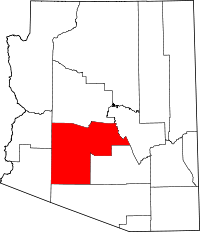 Location in the state of Arizona |
|
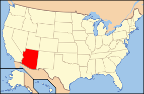 Arizona's location in the U.S. |
|
| Statistics | |
| Founded | February 14, 1871 |
|---|---|
| Seat | Phoenix |
| Area - Total - Land - Water |
9,224 sq mi (23,890 km²) 9,203 sq mi (23,836 km²) 21 sq mi (54 km²), 0.23% |
| Population - (2000) - Density |
3,072,149 396/sq mi (153/km²) |
| Website: www.maricopa.gov | |
Maricopa County (pronounced /ˌmɛɹɨˈkoʊ̪pə/) is located in the central part of the U.S. state of Arizona. As of July 2007, its population was 3,880,181, which ranks fourth among the nation's counties and is greater than the population of 24 states.[1] The county seat is Phoenix,[2] which is Arizona's largest city and capital. The center of population of Arizona is located in Maricopa County, in the town of Gilbert.[3] It is by far Arizona's most populous county, encompassing well more than half of the state's residents.
The population explosion is evident in a 2007 Forbes study which ranked four of Maricopa County's municipalities in the top ten fastest-growing cities in the nation. Those included Buckeye as the 2nd-fastest-growing city, Surprise and Goodyear as 3rd and 4th, respectively, and Avondale as 9th.[4] All four of these cities are located in the booming "West Valley" which is the area of Maricopa County to the west of the City of Phoenix.
There are 12 Indian reservations located in the county. The largest of these are the Salt River Pima Maricopa Indian Community (East of Scottsdale) and the Gila River Indian Community (South of Phoenix), both of which have casino gambling.
Contents |
Geography
According to the U.S. Census Bureau, the county has a total area of 9,224 square miles (23,891 km²), of which, 9,203 square miles (23,836 km²) of it is land and 21 square miles (55 km²) of it (0.23%) is water.
Major Highways
 Interstate 8
 Interstate 10
 Interstate 17
 U.S. Route 60
 Loop 101
 Loop 202
 Loop 303
 State Route 51
 State Route 71
 State Route 74
 State Route 85
 State Route 87
 State Route 143
 State Route 347
 State Route 587
Adjacent counties
- La Paz County, Arizona - west
- Yuma County, Arizona - west
- Pima County, Arizona - south
- Pinal County, Arizona - southeast
- Gila County, Arizona - east
- Yavapai County, Arizona - north
National protected areas
- Sonoran Desert National Monument (part)
- Tonto National Forest (part)
Demographics
| Historical populations | |||
|---|---|---|---|
| Census | Pop. | %± | |
| 1890 | 10,986 |
|
|
| 1900 | 20,457 | 86.2% | |
| 1910 | 34,488 | 68.6% | |
| 1920 | 89,576 | 159.7% | |
| 1930 | 150,970 | 68.5% | |
| 1940 | 186,193 | 23.3% | |
| 1950 | 331,770 | 78.2% | |
| 1960 | 663,510 | 100% | |
| 1970 | 971,228 | 46.4% | |
| 1980 | 1,509,175 | 55.4% | |
| 1990 | 2,122,101 | 40.6% | |
| 2000 | 3,072,149 | 44.8% | |
| Est. 2006 | 3,768,123 | 22.7% | |
| source:[5] | |||
As of the census[6] of 2000, there were 3,072,149 people, 1,132,886 households, and 763,565 families residing in the county. The population density was 334 people per square mile (129/km²). There were 1,250,231 housing units at an average density of 136/sq mi (52/km²). The racial makeup of the county was 77.35% White, 3.73% African American, 1.85% Native American, 2.16% Asian, 0.14% Pacific Islander, 11.86% from other races, and 2.91% from two or more races. 29.5% of the population were Hispanic or Latino of any race. 19.10% reported speaking Spanish at home.[7]
There were 1,132,886 households out of which 33.00% had children under the age of 18 living with them, 51.60% were married couples living together, 10.70% had a female householder with no husband present, and 32.60% were non-families. 24.50% of all households were made up of individuals and 7.90% had someone living alone who was 65 years of age or older. The average household size was 2.67 and the average family size was 3.21.
The population was spread out with 27.00% under the age of 18, 10.20% from 18 to 24, 31.40% from 25 to 44, 19.80% from 45 to 64, and 11.70% who were 65 years of age or older. The median age was 33 years. For every 100 females there were 100.10 males. For every 100 females age 18 and over, there were 98.10 males.
The median income for a household in the county was $45,358, and the median income for a family was $51,827. Males had a median income of $36,858 versus $28,703 for females. The per capita income for the county was $22,251. About 8.00% of families and 11.70% of the population were below the poverty line, including 15.40% of those under age 18 and 7.40% of those age 65 or over.
2005 estimate
Source: [8] *Non Hispanic (61.0%):
- White(Non-Hispanic): 61.5%
- Black: 4.3%
- Asian: 2.7%
- American Indian and Alaska Native persons, percent: 2.2%
- Native Hawaiian and Other Pacific Islander: 0.2%
- Persons of Two or more Races: 1.6%
*Hispanic (30.1%):
- As of July 1, 2005, Maricopa County had 3,635,528; an 18% change from 2000. Males accounted for 50.3% of the population, and females accounted for 49.7%.[8]
- As of July 1, 2005:
- 27.4% of the population was under 18 years of age.
- 61.5% of the population was between 19 and 64 years of age
- 11.1% of the population was over 65 years of age.
Politics
| Year | Republican | Democratic |
|---|---|---|
| 2008 | 54.6% 596,611 | 44.3% 483,358 |
| 2004 | 57.0% 679,455 | 42.3% 504,849 |
| 2000 | 53.2% 479,967 | 42.9% 386,683 |
| 1996 | 47.2% 386,015 | 44.5% 363,015 |
| 1992 | 41.4% 360,049 | 32.6% 285,457 |
| 1988 | 64.9% 442,337 | 33.9% 230,952 |
| 1984 | 72.0% 411,902 | 27.1% 154,833 |
| 1980 | 65.0% 316,287 | 34.5% 119,752 |
| 1976 | 61.7% 258,262 | 35.3% 144,613 |
| 1972 | 69.3% 244,593 | 27.0% 95,135 |
| 1968 | 59.1% 161,262 | 31.4% 86,204 |
| 1964 | 53.9% 143,114 | 46.0% 122,042 |
Maricopa County is a strongly Republican county. While the city of Phoenix leans Democratic along with some other limited pockets within the county, the rest of the county tends to vote heavily Republican. Every Republican Presidential candidate has won Maricopa County since 1948. This includes the 1964 presidential run of native son Barry Goldwater; who wouldn't have even carried his own state had it not been for a 21,000-vote margin in Maricopa County.
Despite its Republican lean, Maricopa County voted against Proposition 107 in the 2006 election. This referendum, designed to ban gay marriage and restrict domestic partner benefits, was rejected by a slim 51.6%-48.4% margin within the county. Maricopa County made the difference statewide, as Arizona became the first state to reject a gay marriage ban by a 51.8%-48.2% margin that year.
The County Board of Supervisors consists of five members chosen by popular vote within their own districts. Currently, the Board consists of four Republicans, each representing districts in the more affluent or conservative districts of the county, and one Democrat, representing the largest district. Each member serves for a period of four years, and may be continuously reelected. The Board of Supervisors acts in the capacity of executive authority for the county within the statutes and powers prescribed by Arizona state law. In this respect the Legislature of the State of Arizona is, in effect, the legislative body of the county, with limited discretion granted to the Board of Supervisors on minor ordinance and revenue collection issues. Chair of the Board is held by one member for a period of one year, and is selected by the Board members themselves through public hearing. Unlike cities and towns in Arizona, each county is not a chartered government and is considered both politically and legally a sub-division of the state.
The election of the County Sheriff, County Attorney, County Assessor, County Treasurer, Superintendent of Schools, County Recorder, Constables, Justices of the Peace, Clerk of the Superior Court, and retention of Superior Court Judges are also determined by popular vote.
The current sheriff is Joe Arpaio, labeled "America's Toughest Sheriff" due to his flamboyant and often controversial management of office.[9]
As Maricopa County is home to almost 60 percent of the state's population, it dominates Arizona's politics. Six of the state's eight congressional districts take in significant portions of the county, and most of the state's most prominent elected officials live there.
Transportation
The county is served by three interstates (Interstate 8, Interstate 10, and Interstate 17), one U.S. Highway (US 60), and several state highways (SR 51, SR 74, SR 85, SR 87, SR 143, Loop 101, Loop 202, Loop 303, and SR 387).
Communities

Cities
- Apache Junction (most of Apache Junction is in Pinal County)
- Avondale
- Chandler
- El Mirage
- Glendale
- Goodyear
- Litchfield Park
- Mesa
- Peoria (part of Peoria is in Yavapai County)
- Phoenix
- Scottsdale
- Surprise
- Tempe
- Tolleson
Towns
- Buckeye
- Carefree
- Cave Creek
- Fountain Hills
- Gila Bend
- Gilbert
- Guadalupe
- Paradise Valley
- Queen Creek (part of Queen Creek is in Pinal County)
- Wickenburg
- Youngtown
Census-designated places
- New River
- Rio Verde
- Sun City
- Sun City West
- Sun Lakes
Other communities
- Aguila
- Anthem
- Arlington
- Circle City
- Higley
- Komatke
- Laveen
- Liberty
- Mobile
- Morristown
- Palo Verde
- Tonopah
- Tortilla Flat
- Waddell
- Wintersburg
- Wittmann
See also
- USS Maricopa County (LST-938)
- Maricopa County Sheriff's Office
- White Tank Mountain Regional Park
- 2myArizona.com
References
- ↑ US county census
- ↑ "Find a County". National Association of Counties. Retrieved on 2008-01-31.
- ↑ Arizona Center of Population Ceremony, Arizona Geographic Information Council, 2005-06-15. Accessed 2007-12-17.
- ↑ Woolsey, Matt. - "America's Fastest-Growing Suburbs". - Forbes. - July 16, 2007.
- ↑ Gibson, Campbell. "Population of the 100 Largest Cities and Other Urban Places in the United States: 1790 to 1990." United States Census Bureau. June, 1998. Retrieved on October 7, 2006.
- ↑ "American FactFinder". United States Census Bureau. Retrieved on 2008-01-31.
- ↑ mla.org
- ↑ 8.0 8.1 census.gov
- ↑ Joseph M. Arpaio, Maricopa County Sheriff's Office, 2005. Accessed 2007-12-12.
|
|||||||||||||||||||||||
|
||||||||||||||
|