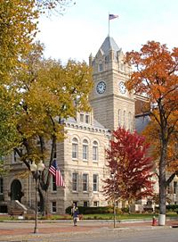
Manhattan, Kansas
| City of Manhattan | |
 |
|
| Nickname(s): The Little Apple | |
 |
|
| Coordinates: | |
| Country | United States |
|---|---|
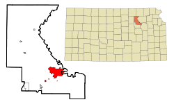
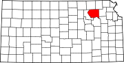
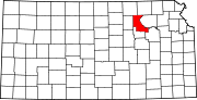
| State | Kansas |
| Counties | Riley, Pottawatomie |
| Settled | 1855 |
| Incorporated | May 30, 1857 |
| Government | |
| - Type | Commission-Manager |
| - Mayor | Mark Hatesohl |
| - Commissioner | Tom Phillips |
| - Commissioner | Bob Strawn |
| - Commissioner | Bruce Snead |
| - Commissioner | Jim Sherow |
| Area | |
| - Total | 15.0 sq mi (38.9 km²) |
| - Land | 15.0 sq mi (38.9 km²) |
| - Water | 0.0 sq mi (0.0 km²) |
| Elevation | 1,020 ft (311 m) |
| Population (2007)[1] | |
| - Total | 51,707 |
| Time zone | CST (UTC-6) |
| - Summer (DST) | CDT (UTC-5) |
| ZIP codes | 66502–66503, 66505-66506 |
| Area code(s) | 785 |
| FIPS code | 20-44250[2] |
| GNIS feature ID | 0476378[3] |
| Website: www.ci.manhattan.ks.us | |
Manhattan is a city in Pottawatomie and Riley counties in the northeastern part of the U.S. state of Kansas. Located at the junction of the Big Blue and Kansas rivers, the city is the county seat of Riley County.[4] As of the July 2007 census estimate, its population was 51,707, making it the eighth-largest city in Kansas.[1] It is the principal city of the Manhattan, Kansas Micropolitan Statistical Area.
Nicknamed The Little Apple in 1977 as a play on New York City's "Big Apple," it is best known for being the home of Kansas State University. Eight miles (13 km) west of the city is Fort Riley, a United States Army post. In 2007, CNN and Money magazine rated Manhattan as one of the ten best places in America to retire young.[5]
Contents |
History
Polistra and Canton
The Kansas-Nebraska Act opened the territory to settlement in 1854. That fall, George S. Park founded the first Euro-American settlement within the borders of the current Manhattan. Park named it Polistra (some historians refer to it as Poliska or Poleska).[6]
Later that same year, Samuel D. Houston and four other pioneers founded a neighboring community near the mouth of the Big Blue River that they named Canton.[7] Neither Canton nor Polistra ever grew to include anyone beyond their original founders.
Free-Staters
In March 1855, a group of Free-Staters traveled to Kansas Territory under the auspices of the New England Emigrant Aid Company to found a Free-State town. Led by Isaac Goodnow, the first members of the group selected (in conjunction with Samuel C. Pomeroy) the location of the Polistra and Canton claims for the Aid Company's new settlement. After the New Englanders arrived at the site, in April 1855 the various settlers agreed to join their three groups into one settlement named Boston.[6]

In June 1855, the steamboat Hartford, carrying 75 settlers from Ohio, ran aground in the Kansas River near the settlement. The Hartford passengers accepted an invitation to join the new town, but insisted that it be renamed Manhattan, which was done on June 29, 1855. Manhattan was incorporated on May 30, 1857.[6]
Early events
Early Manhattan settlers found themselves in conflict with Native Americans and the town itself was threatened by pro-slavery Southerners, but the proximity of Fort Riley protected the settlement from the major violence visited upon other Free-State towns during the "Bleeding Kansas" era.
The young city received an early boost when gold was discovered in the Rocky Mountains in 1859 and Fifty-Niners began to stream through Manhattan on their way to prospect in the mountains. Manhattan was one of the last significant settlements on the route west, and the village's merchants did a brisk business selling supplies to miners.
At the same time, Manhattan was fast becoming a center of education. In 1858, the Territorial Legislature chartered the private Methodist Bluemont Central College in Manhattan. In 1861, when the State of Kansas entered the Union, Isaac Goodnow, who had been a teacher in Rhode Island, began lobbying the legislature to establish a university in Manhattan. As an inducement, the Manhattanites offered to the state the physical plant of Bluemont Central College. The culmination of these efforts came on February 16 1863, when the Kansas legislature established Kansas State Agricultural College (now Kansas State University) in Manhattan.
By the time the Kansas Pacific Railroad laid its tracks west through Manhattan in 1866, the 11-year-old settlement was already permanently ensconced in the tallgrass prairie. Manhattan has increased in population every decade since its founding.
Geography

Manhattan is located at (39.190142, -96.586818),[8] or about 50 miles (80 km) west of Topeka on the Kansas River.
According to the United States Census Bureau, the city has a total area of 15.0 square miles (39 km2), almost all land.
Geographic features
Manhattan is located in the Flint Hills region of Kansas, which consists of continuous rolling hills covered in tall grasses. However, the current downtown area – the original site of Manhattan – was built on a broad, flat floodplain at the junction of the Kansas and Big Blue rivers.
Tuttle Creek Reservoir is located 5 miles (8 km) north of Manhattan. The lake was formed when the Big Blue River was dammed for flood control in the 1960s, and it is now a state park that offers many recreational opportunities. South of the city is the Konza Prairie, a tallgrass prairie preserve jointly owned by The Nature Conservancy and Kansas State University.
Climate
Over the course of a year, temperatures range from an average low of almost 15 °F (−9 °C) in January to an average high of nearly 93 °F (34 °C) in July. The maximum temperature reaches 90 °F (32 °C) an average of 56 days per year and reaches 100 °F (38 °C) an average of 9 days per year. The minimum temperature falls below the freezing point (32°F) an average of 118 days per year. Typically the first fall freeze occurs between the last week of September and the end of October, and the last spring freeze occurs between the first week of April and early May.
The area receives nearly 35 inches (890 mm) of precipitation during an average year with the largest share being received in May and June—the April–June period averages 33 days of measurable precipitation. During a typical year the total amount of precipitation may be anywhere from 24 to 46 inches (1,200 mm). There are on average 97 days of measurable precipitation per year. Winter snowfall averages almost 16 inches, but the median is less than 10 inches (250 mm). Measurable snowfall occurs an average of 10 days per year with at least an inch of snow being received on six of those days. Snow depth of at least an inch occurs an average of 20 days per year.
| Month | Jan | Feb | Mar | Apr | May | Jun | Jul | Aug | Sep | Oct | Nov | Dec | Year |
|---|---|---|---|---|---|---|---|---|---|---|---|---|---|
| Temperatures (°F) | |||||||||||||
| Mean high | 39.5 | 46.8 | 57.5 | 67.9 | 77.5 | 87.1 | 92.5 | 90.8 | 82.1 | 70.7 | 54.5 | 42.9 | 67.5 |
| Mean low | 16.1 | 21.5 | 31.4 | 42.2 | 52.5 | 62.3 | 67.3 | 65.1 | 55.5 | 43.2 | 30.2 | 19.9 | 42.3 |
| Highest recorded | 74 (1939) |
84 (1972) |
95 (1907) |
99 (1910) |
103 (1934) |
112 (1911) |
115 (1936) |
116 (1936) |
112 (1947) |
98 (1947) |
87 (1909) |
77 (1939) |
116 (1936) |
| Lowest recorded | −31 (1947) |
−26 (1905) |
−12 (1948) |
5 (1920) |
23 (1907) |
39 (1946) |
38 (1902) |
40 (1916) |
26 (1995) |
13 (1993) |
−9 (1952) |
−22 (1989) |
−31 (1947) |
| Precipitation (inches) | |||||||||||||
| Median | 0.79 | 0.92 | 2.11 | 2.22 | 4.53 | 4.62 | 3.20 | 2.93 | 3.28 | 2.38 | 1.51 | 0.85 | 34.34 |
| Mean number of days | 5.4 | 5.2 | 7.9 | 10.0 | 12.0 | 10.9 | 8.6 | 9.2 | 8.1 | 7.7 | 7.0 | 5.2 | 97.2 |
| Highest monthly | 3.16 (1979) |
2.48 (1997) |
7.40 (1973) |
9.52 (1999) |
14.73 (1995) |
11.55 (1977) |
17.56 (1993) |
7.25 (1977) |
9.89 (1973) |
6.49 (1973) |
5.79 (1998) |
3.40 (1973) |
|
| Snowfall (inches) | |||||||||||||
| Median | 3.7 | 3.2 | 0.8 | 0.0 | 0.0 | 0.0 | 0.0 | 0.0 | 0.0 | 0.0 | 0.1 | 1.7 | 9.5 |
| Mean number of days | 4.5 | 3.2 | 1.7 | 0.6 | 0.0 | 0.0 | 0.0 | 0.0 | 0.0 | 0.0 | 1.5 | 3.5 | 15.0 |
| Highest monthly | 16.2 (1985) |
18.5 (1978) |
9.0 (1998) |
4.8 (1975) |
0.0 | 0.0 | 0.0 | 0.0 | 0.0 | 1.1 (1991) |
8.8 (1975) |
14.6 (1983) |
|
| Notes: Temperatures are in degrees Fahrenheit. Precipitation includes rain and melted snow or sleet in inches; median values are provided for precipitation and snowfall because mean averages may be misleading. Mean and median values are for the 30-year period 1971–2000; temperature extremes are for the station's period of record (1900–2001). The station is located in Manhattan at 39°13′N 96°36′W, elevation 1,065 feet (325 m). | |||||||||||||
June 2008 Tornado
A tornado touched down in Manhattan at approximately 10:30 PM on June 11, 2008. Thirty-one homes and several businesses were destroyed by the EF4 tornado. Additionally, Kansas State University's campus incurred about $20 million in damage – a number of university buildings sustained significant damage and the Wind Erosion Laboratory was destroyed by the tornado's winds.[9] No one was killed.[10]
Previously, the most destructive tornado to hit Manhattan was on June 8, 1966. The 1966 tornado caused $5 million in damage and injured at least 65 people in Manhattan.[11][12]
Flooding
Becuase Manhattan was built on a floodplain at the junction of the Kansas and Big Blue rivers, it has faced recurring problems with flooding. The largest floods in the town's history were the 1903 flood, the Great Flood of 1951 and the Great Flood of 1993.[13][14]
Demographics
| Historical populations | |||
|---|---|---|---|
| Census | Pop. | %± | |
| 1870 | 1,173 |
|
|
| 1880 | 2,105 | 79.5% | |
| 1890 | 3,004 | 42.7% | |
| 1900 | 3,438 | 14.4% | |
| 1910 | 5,722 | 66.4% | |
| 1920 | 7,989 | 39.6% | |
| 1930 | 10,136 | 26.9% | |
| 1940 | 11,659 | 15% | |
| 1950 | 19,056 | 63.4% | |
| 1960 | 22,993 | 20.7% | |
| 1970 | 27,575 | 19.9% | |
| 1980 | 32,644 | 18.4% | |
| 1990 | 37,712 | 15.5% | |
| 2000 | 44,831 | 18.9% | |
As of the census[2] of 2000, there were 44,831 people, 16,949 households, and 8,254 families residing in the city. The population density was 2,983.9 people per square mile (1,152.4/km²). There were 17,690 housing units at an average density of 1,177.4/sq mi (454.7/km²). The racial makeup of the city was 87.28% White, 4.86% African American, 0.48% Native American, 3.93% Asian, 0.07% Pacific Islander, 1.30% from other races, and 2.07% from two or more races. Hispanic or Latino of any race were 3.49% of the population.
There were 16,949 households out of which 22.7% had children under the age of 18 living with them, 39.6% were married couples living together, 6.6% had a female householder with no husband present, and 51.3% were non-families. 30.5% of all households were made up of individuals and 6.3% had someone living alone who was 65 years of age or older. The average household size was 2.30 and the average family size was 2.89.
The age distribution is 15.8% under the age of 18, 39.2% from 18 to 24, 24.0% from 25 to 44, 13.2% from 45 to 64, and 7.8% who were 65 years of age or older. The median age was 24 years. For every 100 females there were 106.4 males. For every 100 females age 18 and over, there were 105.4 males.
The median income for a household in the city was $30,463, and the median income for a family was $48,289. Males had a median income of $31,396 versus $24,611 for females. The per capita income for the city was $16,566. About 8.7% of families and 24.2% of the population were below the poverty line, including 10.1% of those under age 18 and 7.8% of those age 65 or over.
Sites of interest
Manhattan is the site of Kansas State University sporting events, performing arts, lecture series and the annual Country Stampede Music Festival – the largest music festival in Kansas.
The Marianna Kistler Beach Museum of Art and the Kansas State University Gardens are located on the campus of Kansas State University. Next to campus is Aggieville, a shopping and retail center with enough bars to satisfy the college crowd. Aggieville is also home to the longest continuously-operating Pizza Hut in the world.
Manhattan's Sunset Zoo is accredited by the Association of Zoos and Aquariums (AZA). Colbert Hills Golf Course, which is annually ranked by Golf Digest among the best in the state, is home to the Earl Woods National Youth Golf Academy and a host site for the First Tee program. Manhattan is also the birthplace of Damon Runyon, the "Inventor of Broadway," and his Manhattan house is listed on the National Register of Historic Places.

The buildings which house The Flint Hills Job Corps Training Center west of the city were once used as a nursing home and orphanage operated by the Fraternal Order of Odd Fellows.
The first capitol of the Kansas Territory is preserved nearby, on Fort Riley grounds.
Education
Manhattan is home to Kansas State University, Manhattan Christian College, Manhattan Area Technical College, the American Institute of Baking and The Flint Hills Job Corps Training Center. The city is also headquarters for the International Association for Jazz Education.
Manhattan has one public high school with two campuses (Manhattan High School), two junior high schools (Susan B. Anthony and Dwight D. Eisenhower), and eight elementary schools (Amanda Arnold, Frank V. Bergman, Lee, Marlatt, Northview, Theodore Roosevelt, Bluemont and Woodrow Wilson). The city also has two private school systems: Flint Hills Christian School and the Manhattan Catholic Schools.
Transportation
Manhattan Regional Airport is located 4 kilometres (2 mi) west of Manhattan on K-18. The airport is served by Great Lakes Airlines which offers flights to both Kansas City and Denver. Domestic bus and train service to and from the city has been discontinued over the past several years.
Mass transit
Manhattan is served by Riley County's subsidized paratransit service, ATA Bus. ATA Bus recently started its first, set-route bus route in Manhattan connecting an apartment complex and an office campus, and is currently working with the city to develop a feasible mass transit system. ATA uses four small buses and a number of minivans in its fleet.
Highways
Manhattan is served by several state highways:
Interstate 70 runs about 9 miles (14 km) south of Manhattan. Three exits have a direct connection to Manhattan.
- Exit 313 - K-177
- Exit 307 - McDowell Creek Rd
- Exit 303 - K-18
U.S. Route 24 runs through Manhattan. East on 24 is Wamego, West is Clay Center. US-24 comes in from Clay Center, runs north of the city, turns into a four-lane highway near Tuttle Creek State Park and travels downtown as Tuttle Creek Boulevard until an intersection with E. Poyntz Ave. and turns northeast to Wamego.
K-177 runs north from I-70 as Bill Snyder Highway until the Kansas River viaduct. A half-leaf interchange with K-18 (Tuttle Creek Blvd. and Ft. Riley Blvd.) and travels North as US-24. It officially ends at the intersection with U.S. Route 77 near Randolph.
K-18 is a major connector in Manhattan. It begins about 18 miles (29 km) east of Manhattan, at K-99. It runs through Wabunsee and Zeandale to K-177, crosses to Kansas River, and runs West toward the Manhattan Regional Airport and Ogden. It then travels south to I-70 as a major gateway to Manhattan.
K-113 (Seth Child Road) runs North-South from K-18 to US-24 north of Manhattan.
Notable residents
- Bob Anderson – founder of Runner's World
- Louis Chaudet – film director, writer
- Del Close – comedian
- Bobby Douglass – NFL quarterback
- David Fairchild – botanist, explorer
- Philip Fox – astronomer
- James Harbord – military officer, businessman
- Jonathan Holden – former Poet Laureate of Kansas
- Lee Killough – author
- Benjamin Franklin Mudge – geologist
- Brian Doyle-Murray – actor and scriptwriter, brother of Bill Murray[15]
- Mitsugi Ohno – glassblower
- Cassandra Peterson – actress (Elvira)
- Merrill D. Peterson – historian
- Deb Richard – professional golfer
- Damon Runyon – author
- Fred Andrew Seaton – politician
- Bill Snyder – football coach
- Gary Spani – hall-of-fame football player
- Walter J. Stoessel – diplomat
- Tal Streeter – sculptor, writer[16]
- Samuel Wendell Williston – scientist
- Robert A. Woodruff – space instrumentation scientist
- Earl Woods – father of Tiger Woods
- See also List of Kansas State University people
- See also Johnny Kaw, fictional Kansas settler
Twin or partner cities
 Dobřichovice, Czech Republic (since 2004)
Manhattan in popular culture
- In 1972, Glen Campbell recorded a #6 hit on the Country Music Charts with his song entitled "Manhattan, Kansas."
- The 1975 documentary Banjoman captures a legendary concert held in Manhattan on January 23, 1973, to honor Earl Scruggs. The concert included performances by Joan Baez, David Bromberg, The Byrds, Ramblin' Jack Elliott, The Nitty Gritty Dirt Band, and Doc and Merle Watson.[17]
- The city features in Vernor Vinge's science-fiction novella The Ungoverned.
- The plot of the failed 1993 CBS television pilot The Elvira Show revolves around two witches, played by Elvira and Katherine Helmond, moving to Manhattan with their talking cat.[18]
- Manhattanite Brandon Bellinger was a contestant on the television show Survivor: Guatemala in 2005.
- Manhattanite Dave Spiker was a contestant on the television show The Amazing Race 9 in 2006.
- Manhattan is a principal setting for the novel Was, by Geoff Ryman, a contemporary examination of The Wonderful Wizard of Oz by L. Frank Baum.
- The eponymous character in The Little Sister, by Raymond Chandler, is from Manhattan.
- Jon Stewart jokingly referred to it as "the Manhattan with values" on the Daily Show, while reporting on a speech by President George W. Bush at Kansas State University in 2006.[19]
- The opening scene for the trailer to the film Friday Night Lights is Poyntz Avenue in downtown Manhattan; this was stock footage purchased for the trailer.[20][21]
- The city was featured on a Strong Bad Email segment on Homestar Runner.[22]
- W.E.B. Griffin mentioned Manhattan, Kansas, as the hometown of a main character in his Brotherhood of War (novel series), mentioning its two primary influences, Fort Riley and Kansas State University.
References
- ↑ 1.0 1.1 "2007 Census Estimate". Retrieved on 2008-08-08.
- ↑ 2.0 2.1 "American FactFinder". United States Census Bureau. Retrieved on 2008-01-31.
- ↑ "US Board on Geographic Names". United States Geological Survey (2007-10-25). Retrieved on 2008-01-31.
- ↑ "Find a County". National Association of Counties. Retrieved on 2008-01-31.
- ↑ "Best Places to Retire Young". Retrieved on 2007-10-02.
- ↑ 6.0 6.1 6.2 Parrish, Donald (2004). This Land is Our Land: The Public Domain in the Vicinity of Riley County and Manhattan, Kansas. Riley County Historical Society. ISBN 0-9677686-2-4. OCLC 54769277.
- ↑ Streeter, Floyd Benjamin (1975). The Kaw: The Heart of a Nation. New York: Arno Press. ISBN 9780405068898. OCLC 2180188. http://books.google.com/books?id=MZEJR647HyIC.
- ↑ "US Gazetteer files: 2000 and 1990". United States Census Bureau (2005-05-03). Retrieved on 2008-01-31.
- ↑ Wichita Eagle-Beacon Tornadoes rip Manhattan, KSU damage more than $20 million
- ↑ Hanna, John (2008-06-13). "Kansas residents assess damage after deadly twisters", Associated Press. Retrieved on 2008-06-13.
- ↑ "City Officials set Damage at $5 Million", Topeka Capital-Journal (1966-06-10). Retrieved on 2008-08-13.
- ↑ NOAA's National Weather Service, The Topeka Tornado - June 8, 1966, http://www.crh.noaa.gov/top/events/66tornado.php, retrieved on 2008-08-13
- ↑ U.S. Geological Survey, The 1903 and 1993 Floods in Kansas, http://ks.water.usgs.gov/pubs/fact-sheets/fs.019-03.pdf, retrieved on 2008-12-06
- ↑ Davis, Kenneth (1953). River on the Rampage. Doubleday.
- ↑ "Bill Murray Coming to Manhattan (Kansas)". Retrieved on 2008-10-21.
- ↑ "Tal Streeter Artist Page". Retrieved on 2008-10-21.
- ↑ "Country Music Hall of Fame site". Retrieved on 2007-01-22.
- ↑ "The Elvira Show on tv.com". Retrieved on 2007-01-22.
- ↑ Jon Stewart. The Daily Show: The Manhattan Project. Comedy Central.
- ↑ "IMDb "Friday Night Lights" filming locations". Retrieved on 2007-01-22.
- ↑ The Trailer
- ↑ "English Paper on the Strong Bad Emails". Retrieved on 2007-09-18.
External links
- City of Manhattan websites
- Manhattan newspapers
- Other sites
- Manhattan, Kansas is at coordinates
|
||||||||||||||
|
||||||||||||||||||||
|