Maguindanao
| Province of Maguindanao | |
Provincial seal of Maguindanao |
|
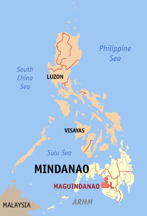 Map of the Philippines with Maguindanao highlighted |
|
| Region | Autonomous Region in Muslim Mindanao (ARMM) |
| Capital | Shariff Aguak |
| Divisions | |
| - Highly urbanized cities | 0 |
| - Component cities | 1 |
| - Municipalities | 33 |
| - Barangays | 488 |
| - Congressional districts | 2 |
| Population | 28th largest |
| - Total (2007) | 1,532,868 (including Cotabato City) |
| - Density | 163 /km² (422 /sq mi) (30th highest) |
| Area | 21st largest |
| - Total | 4,900.1 km2 (1,892 sq mi) |
| Founded | November 22, 1973 |
| Spoken languages | Maguindanaoan |
| Governor | Datu Andal S. Ampatuan |
Maguindanao is a province of the Philippines located in the Autonomous Region in Muslim Mindanao (ARMM). Its capital is Shariff Aguak. It borders Lanao del Sur to the north, Cotabato to the east, and Sultan Kudarat to the south.
Contents |
Geography
Maguindanao is composed of 33 municipalities, which are further subdivided into 279 barangays. Cotabato City is an independent component city of Maguindanao.
The province is divided into two congressional districts. In October 2006, the first congressional district was split off into a new province, Shariff Kabunsuan. However, the act of creating the province was nullified by the Supreme Court in July 2008, and it was restored as part of Maguindanao.
| Municipality | No. of Barangays |
Population (2007) |
Area (km²) |
Pop. density (per km²) |
|---|---|---|---|---|
| Ampatuan |
|
|
||
| Barira |
|
|
|
|
| Buldon |
|
|
|
|
| Buluan |
|
|
||
| Datu Abdullah Sangki |
|
|
||
| Datu Anggal Midtimbang |
|
|
||
| Datu Blah T. Sinsuat |
|
|
||
| Datu Odin Sinsuat (Dinaig) |
|
|
|
|
| Datu Paglas |
|
|
||
| Datu Piang |
|
|
||
| Datu Saudi-Ampatuan |
|
|
||
| Datu Unsay |
|
|
||
| Gen. S. K. Pendatun |
|
|
||
| Guindulungan |
|
|
||
| Kabuntalan (Tumbao) |
|
|
|
|
| Mamasapano |
|
|
||
| Mangudadatu |
|
|
||
| Matanog |
|
|
|
|
| Northern Kabuntalan |
|
|
||
| Pagagawan |
|
|
||
| Pagalungan |
|
|
||
| Paglat |
|
|
||
| Pandag |
|
|
||
| Parang |
|
|
|
|
| Rajah Buayan |
|
|
||
| Shariff Aguak (Maganoy) |
|
|
||
| South Upi |
|
|
||
| Sultan Kudarat (Nuling) |
|
|
|
|
| Sultan Mastura |
|
|
|
|
| Sultan sa Barongis (Lambayong) |
|
|
||
| Talayan |
|
|
||
| Talitay |
|
|
||
| Upi |
|
|
|
|
Government
Maguindanao is divided into two provincial districts[1] for purposes of electing members to the Sangguniang Panlalawigan or the Provincial Board which serves as its legislature. The Sangguniang Panlalawigan of Maguindanao is composed ten elected members,[2] five from each of the provincial districts the province is divided into. On the other hand, Cotabato City does not elect any provincial official being an independent component city.[3]
- District I: Ampatuan, Datu Abdullah Sangki, Datu Anggal Midtimbang, Datu Piang, Datu Saudi Ampatuan, Datu Unsay, Guindulungan, Mamasapano, Shariff Aguak, South Upi, Talayan, Talitay.
- District II: Buluan, Datu Paglas, Gen. S. K. Pendatun, Mangundadatu, Pagagawan, Pagalungan, Paglat, Pandag, Rajah Buayan, Sultan sa Barongis.
History
Shariff Mohammed Kabungsuwan of Johore introduced Islam in the area at the end of the 15th century. He subsequently married a local princess and established the Sultanate of Maguindanao. The Cotabato Valley formed the sultanate's heartland but its influence extended from the Zamboanga Peninsula to Sarangani Bay and Davao.
The Spaniards launched expeditions to subdue the area throughout the colonial era but they never gained control of the region until the middle of the 19th century.
During the American period, Cotabato became a district of the Moro Province created in 1903 and a province of the Department of Mindanao and Sulu in 1914.
In 1942, the Japanese Imperial forces enter in Maguindanao Province.
In 1945, liberated in Maguindanao from the Filipino soldiers and Maguindanaoan guerillas used the weapons and Maguindanaoan Kampilan and Kris swords by the attacked from the Japanese Imperial forces defeated beginning the Battle of Maguindanao during the Second World War.
The old province of Cotabato was divided in 1966 into Cotabato and South Cotabato. In 1973, the successor province of Cotabato was split into the provinces of Maguindanao, (North) Cotabato and Sultan Kudarat.
Maguindanao is the only Muslim-majority province of the four created out of the original Cotabato Province. In 1989, the it opted to join the Autonomous Region in Muslim Mindanao but Cotabato City did not, which, ironically, has since served as the capital of the Autonomous Region in Muslim Mindanao (ARMM).
On October 31, 2006, Maguindanao voters approved the creation of a new province to be composed of 10 towns from the province. Of with more than 500,000 voters registered, 285,372 favored the creation of the province, and 8,802 voted against it. The new province, Shariff Kabunsuan, became the country's 80th province and the 6th in the ARMM. It was composed of the towns of Datu Odin Sinsuat, Kabuntalan, Upi, Sultan Kudarat, Datu Blah T. Sinsuat, Sultan Mastura, Parang, Buldon, Matanog and Barira. However, in July 2008, the Supreme Court nullified the province's creation, restoring its municipalities to Maguindanao.
Musical Heritage
The native Maguindanaon have a fascinating culture that revolves around kulintang music, a specific type of gong music, found among both Muslim and non-Muslim groups of the Southern Philippines.
References
- ↑ COMELEC Resolution No. 7845. Accessed on May 13, 2008.
- ↑ COMELEC Resolution No. 7801 - Annex B. Accessed on May 13, 2008.
- ↑ COMELEC Resolution No. 7801 - Annex C. Accessed on May 13, 2008.
|
||||||||
|
|||||