Luhansk Oblast
| Luhansk Oblast Луганська область Luhans’ka oblast’ |
|||||
|
|||||
| Nickname: Eastern gate of Ukraine[1][2], dawn of Ukraine[3][4][5], Luhanshchyna, Luhan' | |||||
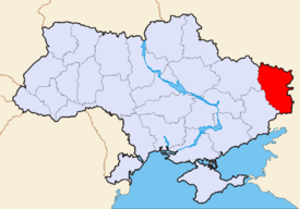 Location of Luhansk Oblast (red) on the map of Ukraine (blue). |
|||||
| Official language(s) | Ukrainian | ||||
| Administrative center | Luhansk | ||||
| Largest cities | |||||
| Governor | Oleksandr Antipov (?) | ||||
| Oblast council | |||||
| – Chairman | Valeriy Mykolayovych Holenko (Party of Regions) | ||||
| – № of seats | ? | ||||
| Established | June 3, 1938 | ||||
| Subdivisions | |||||
| – Raions | 18 | ||||
| – Cities of oblast subordinance | 4 | ||||
| – Cities (total) | 37 | ||||
| – Towns | 109 | ||||
| – Villages | 792 | ||||
| Area | Ranked | ||||
| – Total | 26,684 km² | ||||
| – Land | ? km² | ||||
| – Water | ? (?%) | ||||
| Population | Ranked 5 | ||||
| – Total (2006) | 2,409,000 | ||||
| – Density | 90,28 p/ km² | ||||
| – Average salary | UAH ? (?%) | ||||
| Time zone | EET +2 | ||||
| – Summer (DST) | EEST +3 | ||||
| Abbreviations | |||||
| – Postal code | ? | ||||
| – ISO 3166-2 | UA-09 | ||||
| – FIPS 10-4 | UP14 | ||||
| – Telephone code | +380-64 | ||||
| – Licence plate | BB | ||||
| Official website | www.loga.gov.ua | ||||
| Verkhovna Rada site | |||||


Luhansk Oblast (Ukrainian: Луганська область, translit. Luhans’ka oblast’, Russian: Луганская область, translit. Luganskaya oblast; also referred to as Luhanshchyna - Ukrainian: Луганщина or locally as Luhan' (Лугань)) is the easternmost oblast (province) of Ukraine. Its administrative center is Luhansk.
Important cities within the oblast include: Alchevsk, Antratsyt, Bryanka, Kirovsk, Krasnyi Luch, Krasnodon, Lysychansk, Luhansk, Pervomaisk, Rovenky, Rubizhne, Sverdlovsk, Syeverodonetsk, Stakhanov.
Contents |
Geography
The Luhansk Oblast is located in eastern Ukraine. The area of the oblast' (26,700 km²), comprises about 4.42% of the total area of the country.
Its longitude from north to south is 250 km, from east to west – 190 km. The oblast' borders the Belgorod and Voronezh Oblast's of Russia on the north, the Rostov Oblast of Russia on the east, the Rostov Oblast on the south, and the Kharkiv and Donetsk Oblast's on the west.
Administrative subdivisions

The following data incorporates the number of each type of administrative divisions of the Luhansk Oblast:
- Administrative Center - 1 (Luhansk)
- Raions — 18;
- City raions — 4;
- Settlements — 975, including:
- Villages — 787;
- Cities/Towns — 146, including:
- Urban-type settlement — 109;
- Cities — 37, including:
- Cities of oblast' subordinance — 14;
- Cities of raion subordinance — 23;
- Selsovets — 206.
The local administration of the oblast' is controlled by the Luhansk Oblast Rada. The governor of the oblast' is the Luhansk Oblast Rada speaker, appointed by the President of Ukraine.
Demographics
The population is largely Russian-speaking although ethnic Ukrainians constitute a majority. More than 69% of the population consider themselves native Russian speakers.
Its population (as of 2004) is 2,461,506 million constitutes 5.13% of the overall Ukrainian population. The Luhansk Oblast rates fifth in Ukraine by the number of its inhabitants, having an average population density of 90.28 /km². About 87% of the population lives in urban areas, and the rest - 13%, reside in agricultural areas. According to the national census, 54.0% of the population are Ukrainians and 42% are Russians.

Politics
On April 25, 2006 the Oblast's council voted to recognize Russian as a co-official language in the territory of Luhansk Oblast. However, such a decision may have no legal effect according to Ukraine's legislation.
History
The oblast belongs to the historical region of Donbas as well as to Sloboda Ukraine (Slobozhanshchina). Between 1753 and 1764, a territory of Imperial Russia named Slavo-Serbia existed in this area with administrative seat in Slovianoserbsk.
Points of Interest
The following historic-cultural sites were nominated for the Seven Wonders of Ukraine.
- The house of Dal's birth (Luhansk)
- Fighters for the Revolution monument
- Derkul horse factory
References
- ↑ http://www.oda.lg.ua/oda/documents/official/official_2087.html?template=33
- ↑ http://www.umoloda.kiev.ua/number/689/219/25032/
- ↑ http://www.oda.lg.ua/oda/documents/official/official_1930.html?template=33
- ↑ http://www.oda.lg.ua/oda/about/depart/media/calendar/70years/territory/2008/03/14/territory_1977.html
- ↑ http://www.oda.lg.ua/oda/about/depart/media/calendar/70years/news/2008/04/11/news_2401.html
External links
- Official site of Luhansk Oblast Administration (Ukrainian)
- Information Card of the Region - official site of the Cabinet of Ministers of Ukraine
|
||||||||||||||||||||
|
|||||||||||||||||