Llanfairpwllgwyngyll
| Llanfairpwllgwyngyll | |
| Welsh: Llanfairpwllgwyngyll | |
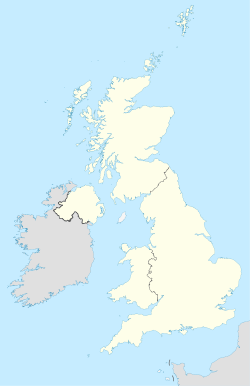 Llanfairpwllgwyngyll shown within the United Kingdom |
|
| Population | 3,040 (2001 UK census) |
|---|---|
| Principal area | Anglesey |
| Ceremonial county | Gwynedd |
| Constituent country | Wales |
| Sovereign state | United Kingdom |
| Post town | LLANFAIRPWLLGWYNGYLL |
| Postcode district | LL61 |
| Dialling code | 01248 |
| Police | North Wales |
| Fire | North Wales |
| Ambulance | Welsh |
| European Parliament | Wales |
| UK Parliament | Ynys Môn |
| List of places: UK • Wales • Anglesey | |
Llanfairpwllgwyngyllgogerychwyrndrobwllllantysiliogogogoch (short form Llanfairpwllgwyngyll), also spelled Llanfair Pwllgwyngyll and commonly known as Llanfair PG or Llanfairpwll, is a village and community on the island of Anglesey in Wales, situated on the Menai Strait next to the Britannia Bridge and across the strait from Bangor.
According to the 2001 census, the population of the community is 3,040,[1] 76% of whom speak Welsh fluently; the highest percentage of speakers is in the 10–14 age group, where 97.1% are able to speak Welsh. It is the fifth largest settlement on the island by population.
Visitors stop at the railway station to be photographed next to the station sign, visit the nearby Visitors' Centre, or have 'passports' stamped at a local shop. Another tourist attraction is the nearby Marquess of Anglesey's Column, which at a height of 27 metres offers views over Anglesey and the Menai Strait. Designed by Thomas Harrison, the monument celebrates the heroism of Henry Paget, 1st Marquess of Anglesey at the Battle of Waterloo.
Contents |
Name
The long form of the name is the longest officially recognised place name in the United Kingdom and one of the longest in the world, being 58 letters in length (51 letters in the Welsh alphabet, where "ch" and "ll" count as single letters). The name is Welsh for "St Mary's church in the hollow of the white hazel near to the rapid whirlpool and the church of St Tysilio of the red cave".
This village was originally known as Llanfair Pwllgwyngyll (and is sometimes still referred to as Llanfairpwllgwyngyll) and was given its long name in the 19th century in an attempt to develop the village as a commercial and tourist centre (see Significance of the name below). Today the village is still signposted as Llanfairpwllgwyngyll, marked on Ordnance Survey maps as Llanfair Pwllgwyngyll and is known to locals as Llanfairpwll or simply Llanfair.
The name is also seen shortened to Llanfair PG, which is sufficient to distinguish it from the many other Welsh villages with Llanfair in their names. Other variant forms use the full name but with tysilio mutated to dysilio, and/or with a hyphen between drobwll and llan. In Welsh, the initial Ll may be mutated to a single L in some contexts.
Significance of the name

The village's long name cannot be considered an authentic Welsh-language toponym. It was artificially contrived in the 1860s to bestow upon the station the honour of having the longest name of any railway station in the United Kingdom: an early example of a publicity stunt. The village's own web site credits the name to a cobbler from the local village of Menai Bridge. According to Sir John Morris-Jones the name was created by a local tailor, whose name he did not confide, letting the secret die with him.

The village was originally known as 'Llanfair Pwllgwyngyll' "St Mary's church in the hollow of the white hazel." 'Pwllgwyngyll' was the name of the original medieval township where the village stands today.[2] Although when written and read in English, the name has 58 letters, in Welsh it has only 51 because ll and ch are each regarded as a single letter.
The name is celebrated in the song "Red Cave" by the American band Yeasayer, which features the band repeating the lines "Mary's house in the hollow of the white hazel rapid whirlpool and the church of the red cave."
The name was also used in the movie Barbarella as the password for the headquarters of Dildano, the comical revolutionary.
The village is split into two smaller villages, Llanfairpwllgwyngyll-uchaf (Upper Llanfairpwllgwyngyll) the original part of the village and Llanfairpwllgwyngyll-isaf (Lower Llanfairpwllgwyngyll) the newer area nearer the railway station.
Pronunciation

The full name of the village is pronounced IPA: [ˌɬan.vair.puɬ.ˌɡwɪ̈n.ɡɪ̈ɬ.ɡo.ˌɡɛr.ə.ˌχwərn.ˌdro.buɬ.ˌɬan.tɪ̈.ˌsil.jo.ˌɡo.ɡo.ˈɡoːχ], or with [ɪ] for [ɪ̈], [pʊɬ, bʊɬ] for [puɬ, buɬ], depending on the speaker's accent.
The approximate pronunciation in English orthography is given at the station as: Llan-vire-pooll-guin-gill-go-ger-u-queern-drob-ooll-llandus-ilio-gogo-goch, although "chwurn" would be a far better representation of the middle syllable than "queern", and "llantus" would be more accurate than "llandus". The ch is a voiceless uvular fricative [χ] or voiceless velar fricative as in "Bach" ([bax]: see ach-laut) in most varieties of German.
The ll is a voiceless lateral fricative [ɬ], a sound that does not occur in English and is sometimes approximated as [θl] (thl as in athlete) or even [xl] by English speakers.

Rival names
There have been several attempts to steal the village's record. The Carmarthenshire village of Llanfynydd unofficially adopted the name Llanhyfryddawelllehynafolybarcudprindanfygythiadtrienusyrhafnauole in 2004 in protest at plans to erect a wind farm nearby (the name means "a quiet beautiful village; a historic place with rare kite under threat from wretched blades" in English). A station on the Fairbourne Railway was named Gorsafawddacha'idraigodanheddogleddollônpenrhynareurdraethceredigion (translated as "the Mawddach station and its dragon teeth at the Northern Penrhyn Road on the golden beach of Cardigan Bay") for promotional purposes. No such attempts have gained widespread recognition amongst official bodies or transport authorities.
History

A settlement has existed on the site of the village since the Neolithic era, with subsistence agriculture and fishing the most common occupations for much of the village's early history. The island of Anglesey was at that point only reachable by boat across the Menai Strait. The area was briefly invaded and captured by the Romans under Gaius Suetonius Paulinus, temporarily abandoned in order to consolidate forces against Boudicca, then held With the withdrawal of the Roman forces, the area fell under the control of the Kingdom of Gwynedd, an early Medieval kingdom. Under this feudal system, the residents worked small farms for the king. The rural nature of the settlement meant that the village had a population of only around 80.
However, with the introduction of estates in the 16th century, much of the land was absorbed into the Earldom of Uxbridge, currently under the Marquess of Anglesey, and the population forced to work as tenants on enclosures. The population of the village boomed, with a population of 385 in the 1801 census.
In 1826 the village was connected to the rest of Wales by the construction of the Menai Suspension Bridge by Thomas Telford, and connected with London in 1850 with the building of the Britannia Bridge and the busy North Wales Coast railway line, which connected London to the ferry port of Holyhead. The village decentralised, splitting into Upper Village (Pentre Uchaf), which was made up mainly of the older houses and farms, and the new Lower Village (Pentre Isaf), built around the railway station and consisting mostly of shops and workshops. The village became a hub of commerce, as the railways and road network brought traders and customers from across north Wales.
The first ever meeting of the Women's Institute took place in Llanfairpwll in 1915 and the movement (which began in Canada) then spread through the rest of the British Isles.
In recent years Llanfairpwllgwyngyll has spread and has become less like a village and more like a northern suburb of Bangor, Gwynedd.
See also
- Lake Chargoggagoggmanchauggagoggchaubunagungamaugg
- Llanfairpwll F.C., the Town's Football Club
- Longest word in English
- Taumatawhakatangihangakoauauotamateapokaiwhenuakitanatahu, a hill in New Zealand
References
- ↑ Neighbourhood Statistics
- ↑ Melville Richards, 'Enwau Lleoedd', in Atlas Môn (Llangefni, 1972). The late Professor Melville was one of Wales' leading authorities on place names.
External links
- Village website, listed in the 2002 Guinness Book of Records as the world's longest valid Internet domain name
- BBC Article at H2G2
- Flickr photos
- photos of Llanfair PG and surrounding area on geograph
|
|||||