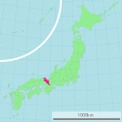
Kyoto Prefecture
| Kyoto Prefecture | |||||||||
|
|||||||||
 |
|||||||||
| Capital | Kyoto (city) | ||||||||
| Region | Kinki | ||||||||
| Island | Honshū | ||||||||
| Governor | Keiji Yamada | ||||||||
| Area (rank) | 4,612.71 km² (31st) | ||||||||
| - % water | 1.0% | ||||||||
| Population (2000) | |||||||||
| - Population | 2,644,331 (13th) | ||||||||
| - Density | 573 /km² | ||||||||
| Districts | 6 | ||||||||
| Municipalities | 26 | ||||||||
| ISO 3166-2 | JP-26 | ||||||||
| Website | www.pref.kyoto.jp/ index_e.html |
||||||||
| Prefectural Symbols | |||||||||
| - Flower | Weeping cherry blossom (Prunus spachiana) | ||||||||
| - Tree | Kitayama Sugi (Cryptomeria japonica) | ||||||||
| - Bird | Streaked shearwater (Calonectris leucomelas) | ||||||||
Symbol of Kyoto Prefecture |
|||||||||
| Template ■ Discussion ■ Parameter ■ WikiProject Japan | |||||||||
Kyoto Prefecture (京都府 Kyōto-fu?) is a prefecture of Japan located in the Kinki region of the island of Honshū. The capital is the city of Kyoto.
Contents |
History
For most of its history, the city of Kyoto was the Imperial capital of Japan. The history of the city itself can be traced back as far as the 6th century. In 544, the Aoi Matsuri was held in Kyoto to pray for good harvest and good weather.
Kyoto did not start out as the capital of Japan. A noteworthy earlier capital was Nara. In 741, Emperor Shōmu moved the capital briefly to a place called Kuni-kyo, between the cities of Nara and Kyoto, in present-day Kyoto Prefecture. In 784, the capital was moved to Nagaokakyo, also in present-day Kyoto Prefecture. In 794, Emperor Kammu moved the capital to Heian-kyo, and this was the beginning of the current-day city of Kyoto. Even today, almost all of the streets, houses, stores, temples and shrines in the city of Kyoto exist where they were placed in this year.
Although in 1192 real political power shifted to Kamakura, where a samurai clan established the shogunate, Kyoto still remained the imperial capital as the powerless emperors and their court continued to be seated in the city. Imperial rule was briefly restored in 1333, but another samurai clan established a new shogunate in Kyoto three years later.
In 1467, a great civil war, the Ōnin no Ran, took place inside Kyoto, and most of the town was burned down. Japan plunged into the age of warring feudal lords. A new strong man, Tokugawa Ieyasu, established the shogunate at Edo (today's Tokyo) in 1603.
The Meiji Restoration returned Japan to imperial rule in 1868. Emperor Meiji, who was now the absolute sovereign, went to stay in Tokyo during the next year. The imperial court has not returned to Kyoto since then. The subsequent reorganization of the old provincial system merged the former Tango Province, Yamashiro Province and the eastern part of Tanba Province into today's Kyoto Prefecture.
Although many Japanese major cities were heavily bombed by U.S. bombers during World War II, the old capital was protected from devastating bombing. This was partly due to a study of Japanese culture by the anthropologist Ruth Benedict (author of The Chrysanthemum and the Sword). During the occupation, the U.S. Sixth Army was headquartered in Kyoto.
Geography

Kyoto Prefecture is located almost in the center of Honshū and of Japan. It covers an area of 4612.71 km², which is 1.2% of Japan. Kyoto is 31st by size. To the north, it faces the Sea of Japan and Fukui Prefecture. To the south, it faces Osaka and Nara Prefectures. To the east, it faces Mie and Shiga Prefectures. To the west, it faces Hyōgo Prefecture. The prefecture is separated in the middle by the Tanba Mountains. This makes its climate very different in the north and south.
Cities
Fifteen cities are located in Kyoto Prefecture.
|
|
Towns and villages
These are the towns and villages in each district:
|
|
|
Mergers
Economy
The city of Kyoto is largely dependent on tourism. Northern Kyoto on the Tango Peninsula has fishing and water transportation, and midland Kyoto has agriculture and forestry. Nintendo is headquartered in the city of Kyoto.
Culture
Kyoto has been and still remains to this day, the cultural center of Japan. For over 1000 years it was Japan's capital. When the capital was changed to Tokyo, Kyoto remained Japan's cultural capital .
Sports
The sports teams listed below are based in Kyoto.
Football (soccer)
- Kyoto Purple Sanga (in the city of Kyoto)
- Sagawa Printing S.C. (Muko)
Tourism
The city of Kyoto is one of the most popular tourist spots in Japan, and many people from far and wide visit there. Along with Nara, Kyoto is a favorite location for the graduation trip of Elementary and Junior High schools.
Some of the festivals held in Kyoto are Aoi Matsuri from 544, Gion Matsuri from 869, Ine Matsuri from the Edo-era, Daimonji Gozan Okuribi from 1662, and Jidai Matsuri from 1895. Every shrine and temple holds some sort of event, and many of them are open for public viewing.
Prefectural symbols
The prefectural flower of Kyoto is the weeping cherry. The Kitayama Sugi is the official tree, and the streaked shearwater the bird that symbolizes the prefecture.
Sister areas
Kyoto Prefecture has sister relationships with these places:[1]
 Shaanxi Province in the People's Republic of China
 Yogyakarta Special Region in Indonesia
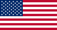 The state of Oklahoma in the United States
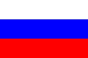 Leningrad Oblast in Russia
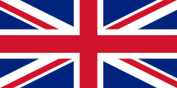 Edinburgh in Scotland, United Kingdom
 Tuscany in Italy
These relationships are distinct from those of cities in Kyoto Prefecture with other cities.
References
- ↑ International Exchange: Regions with Friendly Ties to Kyoto Prefecture Retrieved August 16, 2008
External links
- Official Kyoto Prefecture homepage (in English)
- Kyoto Prefectural International Center
- Kyoto Prefecture Daily Living Guide
- Kyoto Tourism Federation
- Kyoto Visitors Guide
|
|||
| Cities | |||
|---|---|---|---|
| Ayabe | Fukuchiyama | Jōyō | Kameoka | Kizugawa | Kyōtanabe | Kyōtango | Kyoto | Maizuru | Miyazu | Mukō | Nagaokakyō | Nantan | Uji | Yawata | |||
| Districts | |||
| Funai | Kuse | Otokuni | Sōraku | Tsuzuki | Yosa | |||
|
|
|||||||||||