Kent County, Maryland
| Kent County, Maryland | |
| Map | |
 Location in the state of Maryland |
|
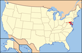
 Maryland's location in the U.S. |
|
| Statistics | |
| Founded | 1642 |
|---|---|
| Seat | Chestertown |
| Area - Total - Land - Water |
414 sq mi (1,072 km²) 279 sq mi (723 km²) 135 sq mi (350 km²), 32.55% |
| Population - (2000) - Density |
19,197 70/sq mi (27/km²) |
| Website: www.kentcounty.com | |
Kent County is a county located in the U.S. state of Maryland, on its Eastern Shore. It was named for the county of Kent in England. Its county seat is Chestertown. In 2000, the county's population was 19,197. It is the least populous of Maryland's 23 counties.
Contents |
History
In 1642, the Governor and Council appointed commissioners for the Isle and County of Kent. This act appears to have led to the establishment of Kent County.
Government and Politcs
Kent County was granted home rule in 1970 under a state code. Kent County is the most competitive county on Maryland's eastern shore. In 2004, Republican George W. Bush won it with 52% of the vote to Democrat John Kerry's 46%. In the 2008 United States Presidential Election, Barack Obama edged John McCain by 48 votes.[1]
Geography
According to the U.S. Census Bureau, the county has a total area of 414 square miles (1,073 km²), of which, 279 square miles (724 km²) of it is land and 135 square miles (349 km²) of it (32.55%) is water.
Adjacent counties
- Cecil County (north)
- New Castle County, Delaware (northeast)
- Kent County, Delaware (southeast)
- Queen Anne's County (south)
National protected area
- Eastern Neck National Wildlife Refuge
Demographics

As of the census[2] of 2000, there were 19,197 people, 7,666 households, and 5,136 families residing in the county. The population density was 69 people per square mile (27/km²). There were 9,410 housing units at an average density of 34 per square mile (13/km²). The racial makeup of the county was 79.64% White, 17.41% Black or African American, 0.15% Native American, 0.54% Asian, 0.05% Pacific Islander, 1.04% from other races, and 1.18% from two or more races. 2.84% of the population were Hispanic or Latino of any race. 15.7% were of English, 14.2% German, 12.4% Irish and 11.3% American ancestry according to Census 2000.
There were 7,666 households out of which 26.30% had children under the age of 18 living with them, 51.70% were married couples living together, 11.10% had a female householder with no husband present, and 33.00% were non-families. 27.80% of all households were made up of individuals and 13.70% had someone living alone who was 65 years of age or older. The average household size was 2.33 and the average family size was 2.81.
In the county the population was spread out with 20.80% under the age of 18, 10.90% from 18 to 24, 23.70% from 25 to 44, 25.30% from 45 to 64, and 19.30% who were 65 years of age or older. The median age was 41 years. For every 100 females there were 91.90 males. For every 100 females age 18 and over, there were 88.90 males.
The median income for a household in the county was $39,869, and the median income for a family was $46,708. Males had a median income of $31,899 versus $24,513 for females. The per capita income for the county was $21,573. About 9.30% of families and 13.00% of the population were below the poverty line, including 17.00% of those under age 18 and 8.50% of those age 65 or over.
Schools
- Kent County High School
- Chestertown Middle School
- Galena Middle School
- Rock Hall Middle School
- Henry Highland Garnett Elementary School
- Millington Elementary School
- Rock Hall Elementary School
- Worton Elementary School
- Kent School
- Chestertown Christian Academy
- Echo Hill Outdoor School
- Radcliffe Creek School
Cities and towns
This county contains the following incorporated municipalities:
- Betterton (incorporated 1906)
- Chestertown (incorporated 1805)
- Galena (incorporated 1858)
- Millington (incorporated 1890) (This town is partly in Kent County and partly in Queen Anne's County.)
- Rock Hall (incorporated 1908)
All five are classified as towns under Maryland law.
The United States Census Bureau recognizes no Census-Designated Places in Kent County, which is unusual for Maryland counties, which usually have many unincorporated population centers.
Other unincorporated places not listed as Census-Designated Places but known in the area include:
- Fairlee
- Lynch
- Kennedyville
- Massey
- Still Pond
- Tolchester Beach
- Worton
Miscellaneous
- The newspaper of record is The Kent County News.
- Kent County Public Schools were some of the last in the country to integrate, but this was because of construction delays in opening the desegregated high school.
- Kent County, Maryland, is one of the few counties in the United States to border its namesake in another state--in this case, Kent County, Delaware.
References
- ↑ "CNN Maryland Results 2008 election". http://www.cnn.com/ELECTION/2008/.
- ↑ "American FactFinder". United States Census Bureau. Retrieved on 2008-01-31.
External links
|
|||||||||||||||||
|
