Kane County, Illinois
| Kane County, Illinois | |
| Map | |
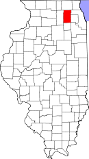 Location in the state of Illinois |
|
 Illinois's location in the U.S. |
|
| Statistics | |
| Founded | January 16, 1836 |
|---|---|
| Seat | Geneva |
| Area - Total - Land - Water |
524 sq mi (1,357 km²) 520 sq mi (1,347 km²) 4 sq mi (10 km²), 0.69% |
| Population - (2000) - Density |
404,119 777/sq mi (300/km²) |
| Website: www.co.kane.il.us | |
Kane County is located in the U.S. state of Illinois. In 2000, the population of the county was 404,119. In 2007, its population was estimated at 501,021. Its county seat is Geneva, Illinois,[1] and its largest city is Aurora.
Contents |
Geography
According to the U.S. Census Bureau, the county has a total area of 524 square miles (1,357 km²), of which, 520 square miles (1,348 km²) of it is land and 4 square miles (9 km²) of it (0.69%) is water. Its largest cities are situated along the Fox River.
Adjacent counties
- McHenry County (north)
- Cook County and DuPage County (east)
- Will County (southeast)
- Kendall County (south)
- DeKalb County (west)
History
Kane County was formed out of LaSalle County in 1836. The County was named in honor of Elias Kane, United States Senator from Illinois, and the first Secretary of State of Illinois.
Demographics
| Kane County Population by year |
|
|
2000 - 404,119 |
|

As of the census[2] of 2000, there were 404,119 people, 133,901 households, and 101,496 families residing in the county. The population density was 776 people per square mile (300/km²). There were 138,998 housing units at an average density of 267 per square mile (103/km²). The racial makeup of the county was 79.27% White, 5.76% Black or African American, 0.31% Native American, 1.81% Asian, 0.04% Pacific Islander, 10.61% from other races, and 2.21% from two or more races. 23.74% of the population were Hispanic or Latino of any race. 20.1% were of German, 8.7% Irish, 5.5% Polish, 5.5% Italian and 5.2% English ancestry according to Census 2000. 75.1% spoke English and 21.1% Spanish as their first language.
There were 133,901 households out of which 41.60% had children under the age of 18 living with them, 61.20% were married couples living together, 10.00% had a female householder with no husband present, and 24.20% were non-families. 19.60% of all households were made up of individuals and 6.70% had someone living alone who was 65 years of age or older. The average household size was 2.97 and the average family size was 3.43.
In the county the population was spread out with 30.30% under the age of 18, 9.10% from 18 to 24, 31.90% from 25 to 44, 20.40% from 45 to 64, and 8.40% who were 65 years of age or older. The median age was 32 years. For every 100 females there were 101.20 males. For every 100 females age 18 and over, there were 98.80 males.
The median income for a household in the county was $59,351, and the median income for a family was $66,558. Males had a median income of $45,787 versus $30,013 for females. The per capita income for the county was $24,315. About 4.90% of families and 6.70% of the population were below the poverty line, including 8.80% of those under age 18 and 5.00% of those age 65 or over.
Townships
- Aurora Township
- Batavia Township
- Big Rock Township
- Blackberry Township
- Burlington Township
- Campton Township
- Dundee Township
- Elgin Township
- Geneva Township
- Hampshire Township
- Kaneville Township
- Plato Township
- Rutland Township
- St. Charles Township
- Sugar Grove Township
- Virgil Township
Cities and towns
- Algonquin - partly in McHenry County
- Aurora - partly in DuPage County, Kendall County and Will County
- Barrington Hills
- Bartlett - mostly in DuPage and Cook counties, very small part in Kane County
- Batavia - very small section in DuPage County
- Big Rock
- Burlington
- Campton Hills
- Carpentersville
- East Dundee - very small parcel on eastern boundary in Cook County
- Elburn
- Elgin - partly in Cook County
- Geneva
- Gilberts
- Hampshire
- Hoffman Estates - primarily in Cook County, very small parcel in Kane County
- Huntley - partly in McHenry County
- Kaneville
- Lily Lake
- Maple Park -- partly in DeKalb County, Illinois
- Montgomery - partly in Kendall County
- North Aurora
- Pingree Grove
- St. Charles - very small section in DuPage County
- Sleepy Hollow
- South Elgin
- Sugar Grove
- Virgil
- Wayne - partly in DuPage County
- West Dundee
See also
|
References
- Forstall, Richard L. (editor) (1996). Population of states and counties of the United States: 1790 to 1990 : from the twenty-one decennial censuses. United States Department of Commerce, Bureau of the Census, Population Division. ISBN 0-934213-48-8.
- ↑ "Find a County". National Association of Counties. Retrieved on 2008-01-31.
- ↑ "American FactFinder". United States Census Bureau. Retrieved on 2008-01-31.
External links
|
|||||||||||||||||||||||
|
|||||||||||||||||||

|