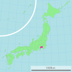
Kanagawa Prefecture
| Kanagawa Prefecture | |||||||||
|
|||||||||
 |
|||||||||
| Capital | Yokohama | ||||||||
| Region | Kantō | ||||||||
| Island | Honshū | ||||||||
| Governor | Shigefumi Matsuzawa | ||||||||
| Area (rank) | 2,415.42 km² (43rd) | ||||||||
| - % water | 2.3% | ||||||||
| Population (September 1, 2007) | |||||||||
| - Population | 8,898,195 (2nd) | ||||||||
| - Density | 3,683 /km² | ||||||||
| Districts | 6 | ||||||||
| Municipalities | 34 | ||||||||
| ISO 3166-2 | JP-14 | ||||||||
| Website | www.pref.kanagawa.jp/ menu/english.htm |
||||||||
| Prefectural Symbols | |||||||||
| - Flower | Golden-rayed lily (Lilium auratum) | ||||||||
| - Tree | Ginkgo (Ginkgo biloba) | ||||||||
| - Bird | Common gull (Larus canus) | ||||||||
Symbol of Kanagawa Prefecture |
|||||||||
| Template ■ Discussion ■ Parameter ■ WikiProject Japan | |||||||||

Kanagawa Prefecture (神奈川県 Kanagawa-ken?) is a prefecture located in the southern Kantō region of Honshū, Japan. The capital is Yokohama. Kanagawa is part of the Greater Tokyo Area.
Contents |
History
In medieval Japan, Kanagawa was part of the provinces of Sagami and Musashi.
There are some archaeological sites of Jōmon period (around 400 BC). About 3000 years ago, Mount Hakone made volcanic explosion and Lake Ashi on the western area of this prefecture.
It's estimated, Yamato Dynasty ruled this area from 5th century. In the ancient era, plains and damps were widely spread with few inhabitants.
Kamakura in central Sagami was the capital of Japan during the Kamakura period (1185-1333).
During the Edo period, the western part of Sagami Province was governed by the daimyo of Odawara Castle, while the eastern part was directly governed by the Tokugawa Shogunate in Edo (Tokyo).
Commodore Matthew Perry landed in Kanagawa in 1853 and 1854, and signed the Convention of Kanagawa to force open Japanese ports to the United States. Yokohama, the largest deep-water port in Tokyo Bay, was opened to foreign traders in 1859 after several more years of foreign pressure, and eventually developed into the largest trading port in Japan. Nearby Yokosuka, closer to the mouth of Tokyo Bay, developed as a naval port and now serves as headquarters for the U.S. 7th Fleet and the fleet operations of the Japan Maritime Self-Defense Force. After Meiji Period, many foreigners visited lived in Yokohama City, and visited Hakone. Meiji Government developed the first railways in Japan, from Shinbashi (in Tokyo) to Yokohama in 1872.
The epicenter of the Great Kantō earthquake in 1923 was deep beneath Izu Ōshima Island in Sagami Bay. It devastated Tokyo, the port city of Yokohama, surrounding prefectures of Chiba, Kanagawa, and Shizuoka, and caused widespread damage throughout the Kantō region.[1] The sea receded as much a quarter of a mile from the shore at Manazaru Point, and then rushed back towards the shore in a great wall of water which swamped Mitsuishi-shima.[2] At Kamakura, the total death toll from earthquake, tsunami, and fire exceeded 2,000 victims.[3] At Odawara, ninety percent of the buildings collapsed immediately, and subsequent fires burned the rubble along with anything else left standing.[4]
Yokohama, Kawasaki and other major cities were heavily damaged by the U.S. bombing in 1945. The number of casualties was more than several thousand. After the War, landed in this prefecture, before moving to other areas, many U.S. troops and the general Douglas MacArthur, the chief commander of Supreme Commander of the Allied Powers for the Occupation of Japan. Because of this history, U.S. military bases still remain in Kanagawa - Camp Zama (Army), Yokosuka Naval Base, Naval Air Station Atsugi (Navy).
After the War, Kanagawa Prefecture faced rapid urbanization and increasing populations, as a part of Tokyo Greater Zone. 8,944 thousand peoples live here in 2008 [7], and Kanagawa becomes the second largest inhabited prefecture in Japan from 2006 (at 1945, it was only 1,865 thousand, and the rank was 15th.).
Geography
Kanagawa Prefecture is a relatively small prefecture located at the southeastern corner of the Kantō Plain[5] wedged between Tokyo on the north, the foothills of Mount Fuji on the northwest, and the Sagami Bay[6] and Tokyo Bay on the south and east. The eastern side of the prefecture is relatively flat and heavily urbanized, including the large port cities of Yokohama and Kawasaki, but becomes more relaxed to the southeast, near the Miura Peninsula, where the ancient city of Kamakura draws tourists to its temples and shrines. The western part, bordered by Yamanashi Prefecture and Shizuoka Prefecture on the west,[7] is more mountainous and includes resort areas like Odawara and Hakone. The area, stretching 80 km from west to east and 60 km from north to south, contains a 2,400 sq km of land, accounting for 0.64 % of the total land area of Japan.[8]
Topography
Topographically, the prefecture consists of three distinct areas. The mountainous western region features the Tanzawa Mountain Range and Hakone Volcano; the hilly western region is characterized by the Tama Hills and Miura Peninsula; and the central region, which surrounds the Tama Hills and Miura Peninsula, is comprised by flat stream terraces and lowlands around major rivers including the Sagami River, Sakai River, Tsurumi River, and Tama River.[9]
The Tama River forms much of the boundary between Kanagawa and Tokyo. The Sagami River flows through the middle of the prefecture. In the western region, the Sakawa River runs through a small lowland, the Sakawa Lowland, between Hakone Volcano to the west and the Ōiso Hills to the east and flows into Sagami Bay.[10]
The Tanzawa Mountain Range, part of the Kantō Mountain Range, contains Mount Hiru (1,673 m), the highest peak in the prefecture. Other mountains measure similar mid-range heights: Mount Hinokiboramaru (1,601 m), Mount Tanzawa, (1567 m), Mount Ōmuro (1588 m), Mount Himetsugi (1,433 m), and Mount Usu (1,460 m). The mountain range lowers its height southward leading to Hadano Basin to the Ōiso Hills. At the eastern foothills of the mountain range lies the Isehara Plateau and across the Sagami River the Sagami Plateau. [11]

Cities
Nineteen cities are located in Kanagawa Prefecture:
|
|
Towns and villages
|
|
|

Mergers
Transportation
Kanagawa's transport network is heavily intertwined with that of Tokyo (see: Transportation in Greater Tokyo). Most air travel to Kanagawa goes through Tokyo International Airport or Narita International Airport. Shin-Yokohama and Odawara stations on the Tōkaidō Shinkansen are located in the prefecture, providing high-speed rail service to Tokyo, Nagoya, Osaka and other major cities.
Railway
- East Japan Railway Company
- Tōkaidō Main Line
- Nambu Line
- Tsurumi Line
- Yokohama Line
- Negishi Line
- Yokosuka Line
- Sagami Line
- Chūō Main Line
- Central Japan Railway Company
- Tōkaidō Shinkansen
- Gotemba Line
Education
The Kanagawa Prefectural Board of Education manages and oversees individual municipal school districts. The board of education also directly operates most of the public high schools in the prefecture.
Culture

- One of the most famous Ukiyo-e paintings is The Great Wave off Kanagawa by Hokusai.
- Kamakura city, known for its historical buildings, is a favored location used in many manga (comic) or anime (animation).
Sports
The sports teams listed below are based in Kanagawa.
Facilities
Football (mainly Soccer) and Athletics
- Nissan Stadium (International Stadium of Yokohama) - in Yokohama, the final venue of 2002 FIFA World Cup and FIFA Club World Cup in 2005-2007
- Nippatsu Mitsuzawa Stadium (Mitsuzawa Stadium) - in Yokohama, only for football
- Todoroki Athletics Stadium - in Kawasaki, the final venue of 2007 IFAF World Cup (American football).
- Hiratsuka Athletics Stadium
Baseball
- Yokohama Stadium - for baseball and American football
- Kawasaki Stadium - former homeground of Taiyo Whales (now Yokohama BayStars) and Lotte Orions (now Chiba Lotte Marines).
- Yokosuka Stadium
Indoor
- Yokohama Arena - also for music concert
- Yokohama Cultural Gymnasium - a volleyball venue of 1964 Summer Olympics in Tokyo
- Todoroki Arena - in Kawasaki
- Odawara Arena
Others
- Enoshima Yacht Course - used for 1964 Summer Olympics.
- Hakone Ekiden Course - from Tokyo to Hakone, 108.0km, mostly on Japan National Route 1 and Route 15. Runners run on the divided route for ten parts on January 2 (to Hakone) and January 3 (to Tokyo) every year.
- Lake Sagami - hosted canoeing and rowing for the 1964 Summer Olympics.
Teams
Soccer (football)
- Kawasaki Frontale (Kawasaki) - Todoroki Athletics
- Yokohama F. Marinos (Yokohama, Yokosuka) - Nissan Stadium
- Yokohama F.C. (Yokohama) - Mitsuzawa Ballpark
- Shonan Bellmare (Hiratsuka, Odawara and some cities and towns in central and western area of Kanagawa) - Hiratsuka Athletic Stadium (football) and Odawara Arena (futsal)
Baseball
- Yokohama BayStars (Yokohama) - Yokohama Stadium, and Yokosuka Stadium (for its farm team, "Shonan Searex").
Volleyball
- NEC Red Rockets (Kawasaki) - Todoroki Arena
Tourism
The city of Kamakura is famous as the location of many Buddhist temples and Shinto shrines.
Yokohama Chinatown is the largest Chinatown in Japan (larger than Chinatowns in both Kobe and Nagasaki) and it is one of the largest in the world.
Notes
- ↑ Hammer, Joshua. (2006). Yokohama Burning: the Deadly 1923 Earthquake and Fire that Helped Forge the Path to World War II, p. 278.
- ↑ Hammer, pp. 114-115.
- ↑ Hammer, pp. 115-116.
- ↑ Hammer, p. 113.
- ↑ [1]
- ↑ [2]
- ↑ [3]
- ↑ [4]
- ↑ [5]
- ↑ [6]
- ↑ [ http://www.jiban.co.jp/jibankaisetu/todohuken/kanagawa/jiban_kanagawa.htm]
References
- Hammer, Joshua. (2006). Yokohama Burning: The Deadly 1923 Earthquake and Fire that Helped Forge the Path to World War II. New York: Simon & Schuster. 10-ISBN 0-743-26465-7; 13-ISBN 978-0-743-26465-5 (cloth)
External links
- Official Kanagawa Prefecture homepage
- Official Kanagawa Living homepage
- KANAGAWA NOW JAPAN Kanagawa Prefectural Tourist Association website (English)
|
|||
| Cities | |||
|---|---|---|---|
| Atsugi | Ayase | Chigasaki | Ebina | Fujisawa | Hadano | Hiratsuka | Isehara | Kamakura | Kawasaki | Minamiashigara | Miura | Odawara | Sagamihara | Yamato | Yokohama (capital) | Yokosuka | Zama | Zushi | |||
| Districts | |||
| Aiko | Ashigarakami | Ashigarashimo | Koza | Miura | Naka | |||
|
|
|||||||||||