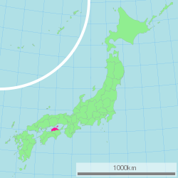
Kagawa Prefecture
| Kagawa Prefecture | |||||||||
|
|||||||||
 |
|||||||||
| Capital | Takamatsu | ||||||||
| Region | Shikoku | ||||||||
| Island | Shikoku | ||||||||
| Governor | Takeki Manabe | ||||||||
| Area (rank) | 1,861.70 km² (47th) | ||||||||
| - % water | 2.8% | ||||||||
| Population (2000) | |||||||||
| - Population | 1,022,843 (40th) | ||||||||
| - Density | 549 /km² | ||||||||
| Districts | 5 | ||||||||
| Municipalities | 17 | ||||||||
| ISO 3166-2 | JP-37 | ||||||||
| Website | www.pref.kagawa.jp/foreigner.shtml | ||||||||
| Prefectural Symbols | |||||||||
| - Flower | Olive (Olea europaea) | ||||||||
| - Tree | Olive (Olea europaea) | ||||||||
| - Bird | Oriental cuckoo (Cuculus poliocephalus) | ||||||||
 Symbol of Kagawa Prefecture |
|||||||||
| Template ■ Discussion ■ Parameter ■ WikiProject Japan | |||||||||
Kagawa Prefecture (香川県 Kagawa-ken?) is a prefecture of Japan located on Shikoku island. The capital is Takamatsu.
Contents |
History
Kagawa was formerly known as Sanuki Province.
For the brief period between August 1876 and December 1888, Kagawa was made a part of Ehime Prefecture.[1]
Battle of Yashima
Located in Kagawa's capital city, Takamatsu, the mountain of Yashima was the battlefield for one of the best-known battles between the Heike and the Genji clans. The name Yashima means literally 'roof island'. Yashima, so called because of its shape like the roof of a traditional Japanese farm house, is a mesa headland jutting out into the Seto Inland Sea. But at the time when the Genpei War was fought, it was, as is implied by the name, an island separated from the mainland by the Aibikigawa River.The military forces of the Heikes, defeated at Ichinotani, retreated to Yashima with Emperor Antoku and set up his temporary court and their headquarters at Dannoura Inlet of Yashima. Yashima retains many names related to the historic battle. According to the stories, the main battlefield was the whole Dannoura area, where now stands Yashima-higashi Primary School. Visitors now find the old court site of Emperor Antoku, Tombs of Sato Tsugunobu and Kikuomaru, Rock on which Nasuno Yoichi prayed for success of his feat, Rock on which the bestriding Yoichi shot his arrow at the fan. The place names of Genjigamine Peak, Funakakushi, Chinoike Pond and others are reminiscent of the past.
Geography

Kagawa comprises the northeast corner of Shikoku, bordering Ehime Prefecture on the west and Tokushima Prefecture on the south, with a coastline on the Seto Inland Sea facing Okayama Prefecture and the Kansai. The Sanuki Mountains run along the southern border.
Kagawa is currently the smallest prefecture, by area, in Japan. Osaka Prefecture held that title until Kansai International Airport was reclaimed from the ocean in the early 1990s, pushing its land area slightly above Kagawa's. Kagawa is a relatively narrow prefecture located between the mountains of Shikoku and the sea.
Cities
Eight cities are located in Kagawa Prefecture:
|
|
|
Towns
Towns and villages in each district:
|
|
|
Mergers
Economy
Demographics
Culture
Sports
The sports teams listed below are based in Kagawa.
Baseball
- Kagawa Olive Guyners
Basketball
- Takamatsu Five Arrows (Takamatsu)
Football (Soccer)
- Kamatamare Sanuki (Takamatsu)
Volleyball
- Eighty8 queen
Tourism
- Kotohira Shrine
- Shodo Island
- Takamatsu Castle
- Marugame Castle
- Yashima, the island on which the Battle of Yashima was fought.
- Ritsurin Park
- Tamamo Park
- Megijima (Onigashima) & Ogijima
- Goshikidai
Based on its ancient name, Sanuki, Kagawa is famous for its Sanuki Udon (wheat noodles). Recent years has seen a great interest in Sanuki Udon across Japan, and many Japanese now take day trips to taste the many Sanuki Udon restaurants in Kagawa.
Prefectural symbols
Miscellaneous topics
The novel Battle Royale by Koushun Takami was set in the fictional town of Shiroiwa ('Castle Rock') in the Kagawa Prefecture. Okishima, the fictional island on which much of the novel takes place is placed in the Seto Inland Sea. The manga also places Shiroiwa in the Kagawa Prefecture, while the film moves Shiroiwa to the Kanagawa Prefecture.
References
- ↑ Ikatachōshi Editing Committee, ed. (March 31, 1987) (in Japanese). Ikata Town History (伊方町誌 Ikatachōshi?). Town of Ikata, printed by DAI-ICHI HOKI Publishing.
External links
- Kagawa Prefecture English homepage
- (Japanese) Official Kagawa Prefecture Japanese homepage
- National Archives of Japan ... Kagawa map (1891)
- Notes from Shikoku in English
|
|||
| Cities | |||
|---|---|---|---|
| Higashikagawa | Kan'onji | Marugame | Mitoyo | Sakaide | Sanuki | Takamatsu (capital) | Zentsūji | |||
| Districts and towns | |||
| Ayauta District: Ayagawa - Utazu | Kagawa District: Naoshima | Kita District: Miki | Nakatado District: Kotohira - Mannō - Tadotsu | Shōzu District: Shōdoshima - Tonoshō | |||
|
|
|||||||||||
References
- ↑ Ikatachōshi Editing Committee, ed. (March 31, 1987) (in Japanese). Ikata Town History (伊方町誌 Ikatachōshi?). Town of Ikata, printed by DAI-ICHI HOKI Publishing.